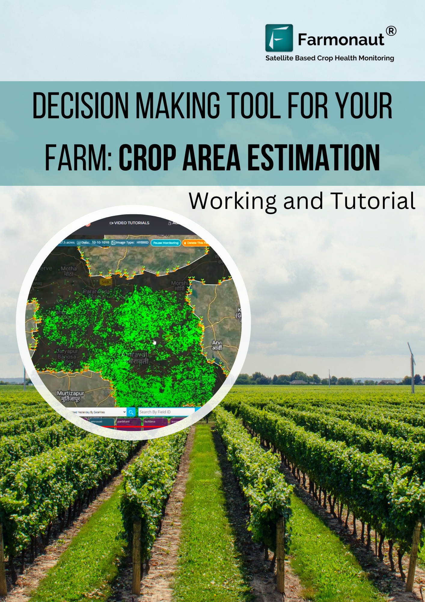
Crop classification helps to know which crops are grown in which areas. The estimation of agricultural production is necessary for decisions to be made. The crop area estimation allows the farmers to predict or calculate the tonnage of the particular crop. Identifying the specific crop grown at different village level, taluka level, district level and state level can be done. The estimation and identification of the crops could be useful in many ways:
- Deciding agricultural policies.
- Planning supply chain management.
- Making decisions on procurement, storage and distribution.
- Adjusting effective food prices.
- Allocation of resources.
- Identify the purpose of the vegetation such as food, feed and fiber.
- Can help in controlling water usage.
How does it work?
In order to identify a particular crop or vegetation the model requires few sample images to train the model for classification. How the classification model works can be explained as follows with an example.
# Training data and classes are needed: For example, if an area is sown with paddy the model must know the crop that has to be classified. The class must be paddy in this case.
# Sample data: In order to train the model few sample locations are needed. The sample location helps the satellite to create wavelength and identify the crop. Hence helps to know the crop cycle and the changes taking place during every satellite visit. Marking locations is known as Ground Truthing.
# Study images of location: In order to predict, the unknown study area location must be added which identifies whether the class mentioned is expected in which area. For example, which locations are expected to have rice and which areas do not expect rice.
Problematic area
The working of the crop area estimation manually creates many problem in the process such as
- Requires more time.
- Resources are required in a high amount such as labor.
- Cost increases.
- Accuracy gets compromised.
What does Farmonaut provide?
Farmonaut is providing Crop Area Estimation to deal with the problem caused due to the manual estimation. It helps to predict accurately and precisely the crop classification.
How to access data?
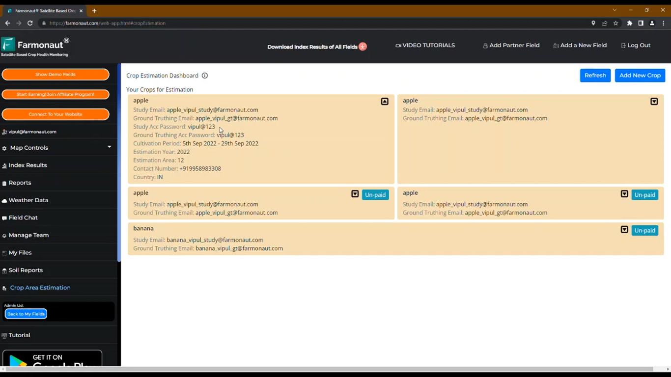
Once you login to your Farmonaut account. On the Farmonaut platform the Crop Area Estimation panel is added by which you can access it. By clicking on the “Crop Area Estimation”, DashBoard opens. Dashboard contains all the paid and unpaid area Estimations which are added by you as shown in the image.
- To add new crop:
The Dashboard has a button on the top right corner, “Add New Crop”. Click on it. A dialog box opens where you have to enter information as
- Crop Name: Select crop you want the data for.
- Study Year: Select year for which you want to have classification for. Can be done for past years.
- Sowing Date: The date the crop was sown as it can be different in different states and countries.
- Harvest Date: The Expected harvest date of the crop.
- Total Area: the area in which the crop is sown.
- Country: The country in which the farm is located.
- Contact Number: Your contact number for future useful deeds.
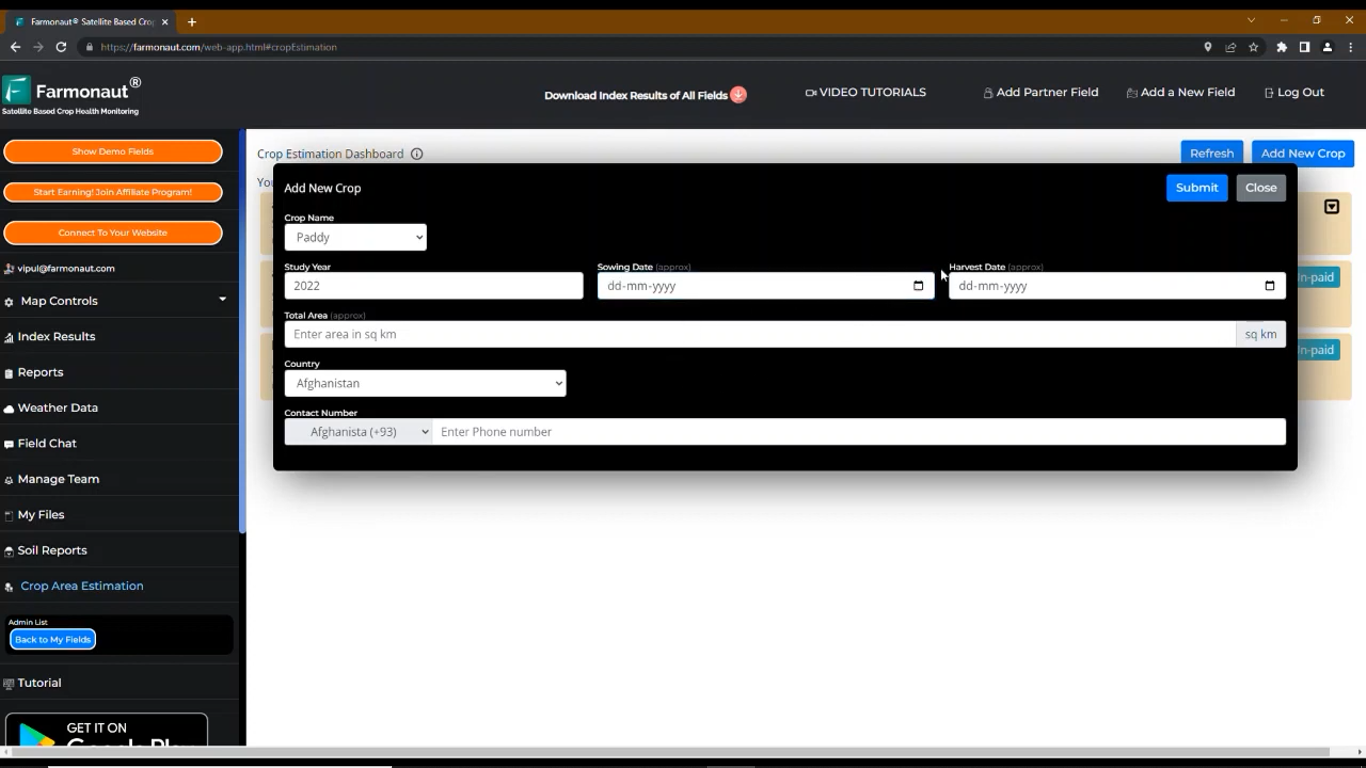
After the information is entered. Click on “Submit”.
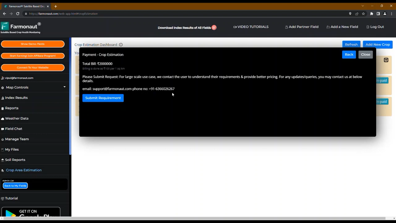
A dialog box will appear for the Payment stating the amount to be paid. Click on the “Pay” button to complete the payment.
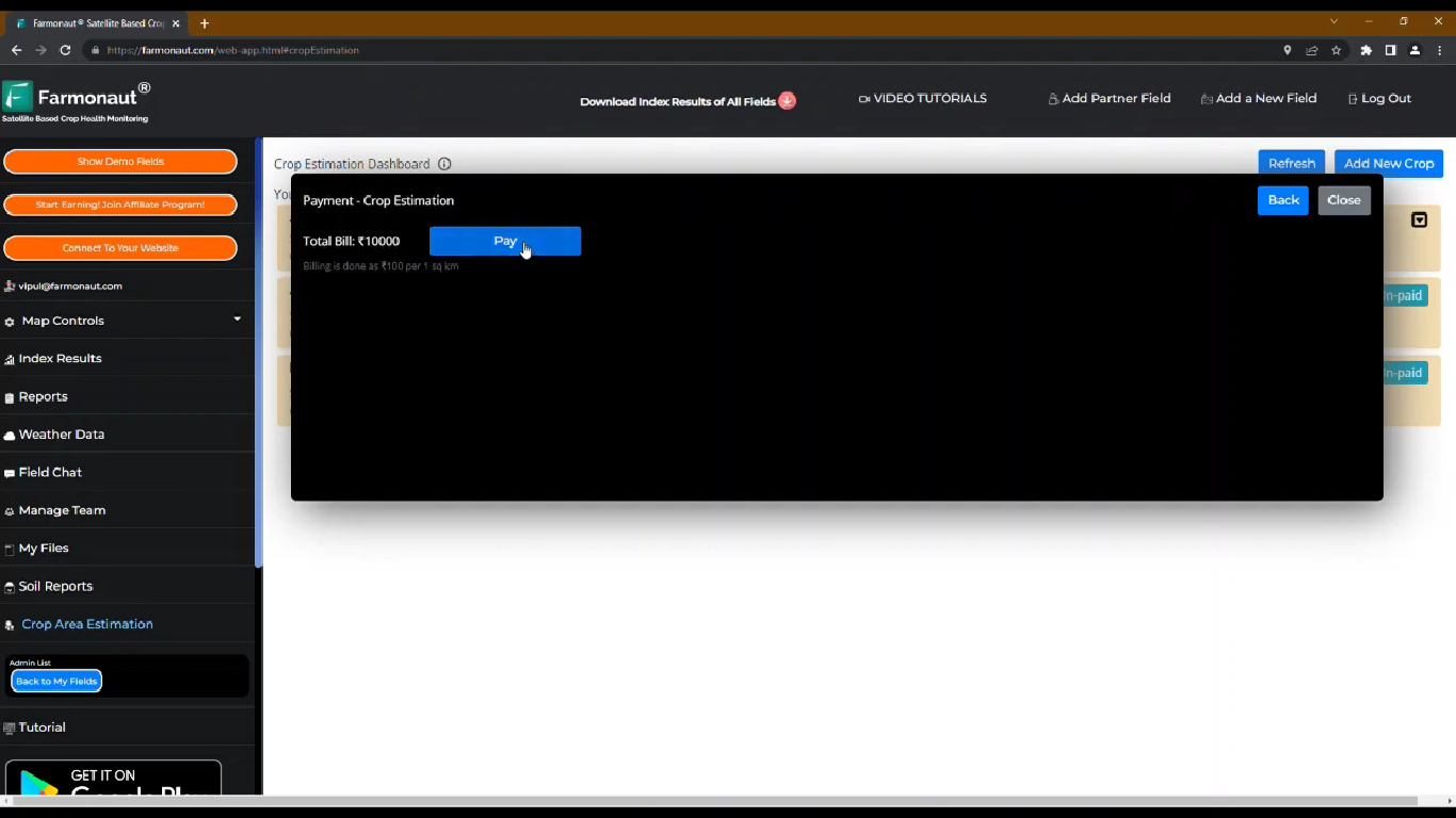
In case of large areas, it suggests a request and hence the Farmonaut team will contact you. Also email and contact number are provided in case you want to contact our team. And then click on the “Submit Requirement” button.
- Ground Truthing
In order to classify the crop, the system needs few locations on which the crop is shown, known as ground truthing. It can be done through web or mobile applications.
How to do Ground truthing?
Step 1: Login with the ground truthing email and ground truthing password provided on the dashboard for a particular crop request on Farmonaut platform.
Step 2: Select atleast 20 locations on the field to train the model.
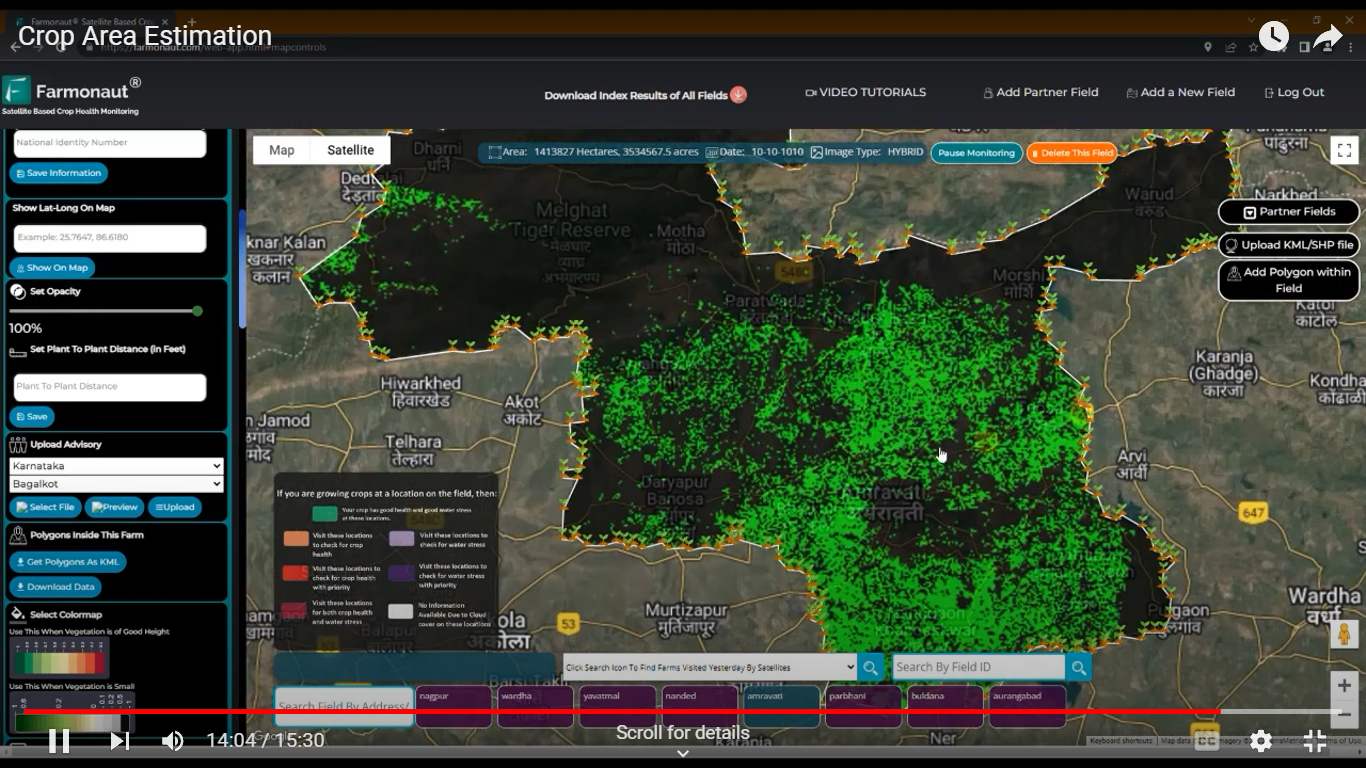
- Study Location:
Locations for which you want the classification are to be given. For which following steps are to be followed:
Step 1: Login on the Farmonaut platform using Study Email and Study Password provided on the Dashboard.
Step 2: Select the study area by adding a new field.
Step 3: Submit location for which you want classification done.
On submitting all the information, the Farmonaut system will study the information and process it for the crop classification. The results will be then sent to the farmers on Email. Also, you can check the data on the study email account.