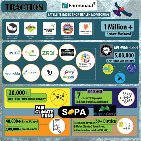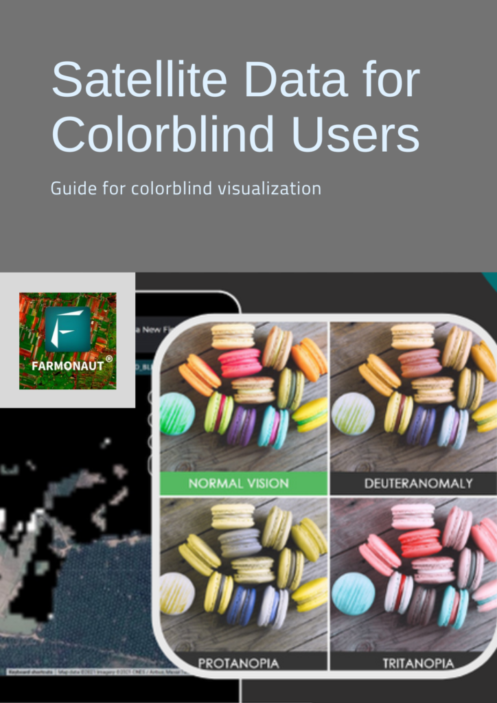
Farmonaut | Satellite Data For Colorblind Users
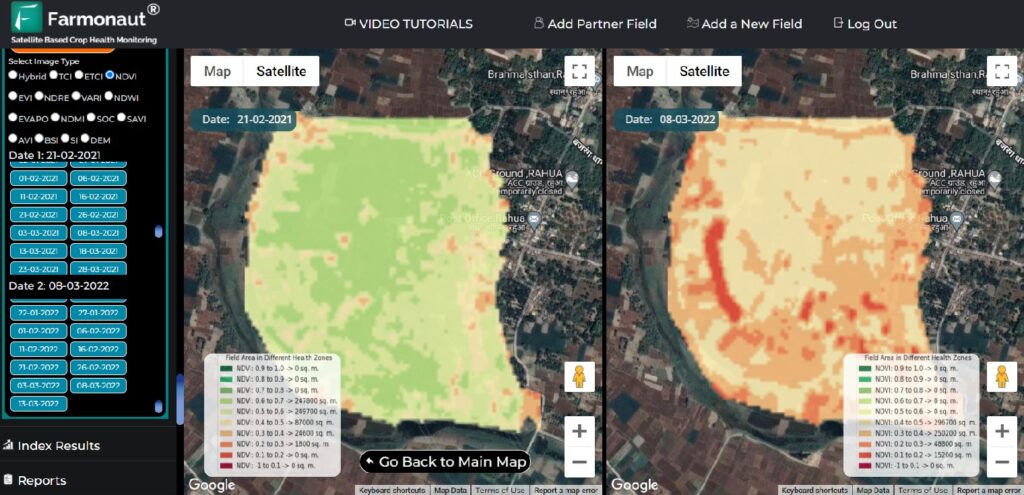
There are less number of people having color blindness who deal with identification of colors on a daily basis. There are multiple kinds of color blindness like Red-Green Colorblindness, Blue-Yellow Colorblindness, Complete color blindness, etc. Where they have issues in differentiating colors such as red and green or in some cases even all the colors. …