Empowering Farmers with Comprehensive GIS Resources for Modern Agriculture
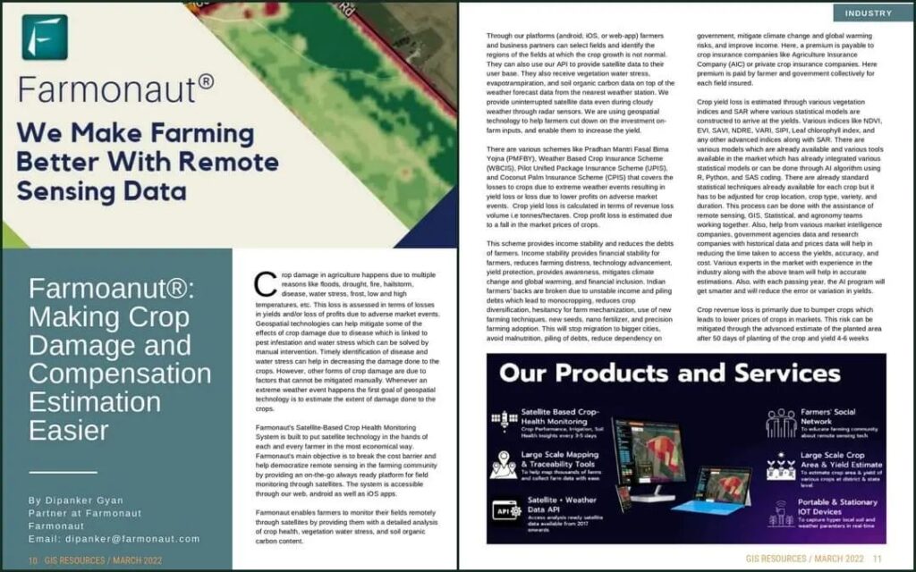
The GIS Resources magazine has recently published an article on Farmonaut , taking into account its immense role in bringing sophisticated solutions to existing problems in agriculture. The edition is named “Geospatial Technologies for Crop Damage and Compensation Estimation”, which outlines that the conventional approach to crop damage and compensation estimation is a time-consuming and labor-intensive process.

Introduction
In today’s rapidly evolving world, the agriculture industry faces numerous challenges that require innovative solutions. The advent of Geographic Information System (GIS) technology has significantly transformed the way farmers manage their operations. Among the leading players in this field is Farmonaut, a groundbreaking platform that harnesses the power of GIS to revolutionize agriculture. In this article, we explore the remarkable features and benefits of Farmonaut, as highlighted in a recent edition of GIS Resources magazine.
"Farmonaut®: Making Crop Damage and Compensation Estimation Easier"
The GIS Magazine covered the article on Farmonaut under the concept of managing crop damage with Satellite induced technological solutions. The feature highlighted the approaches adopted by Farmonaut to ensure a seamless management of their farms and agriculture related businesses via the application of Satellite based monitoring systems and an advanced as well as a user-friendly mobile application.
What can be done eradicate the occurance of lesser yields?
Extreme weather events, such as fluctuations in temperatures, can result in crop damage and subsequent losses in yields and profits. Geospatial technologies play a crucial role in mitigating some of the adverse effects caused by diseases, pest infestations, and water stress through manual intervention. By promptly identifying and addressing these issues, the extent of crop damage can be minimized. However, certain forms of crop damage are unavoidable and cannot be mitigated manually. In such cases, geospatial technology serves the primary purpose of estimating the magnitude of the damage inflicted on the crops.
Understanding Farmonaut: The Ultimate Farming Companion
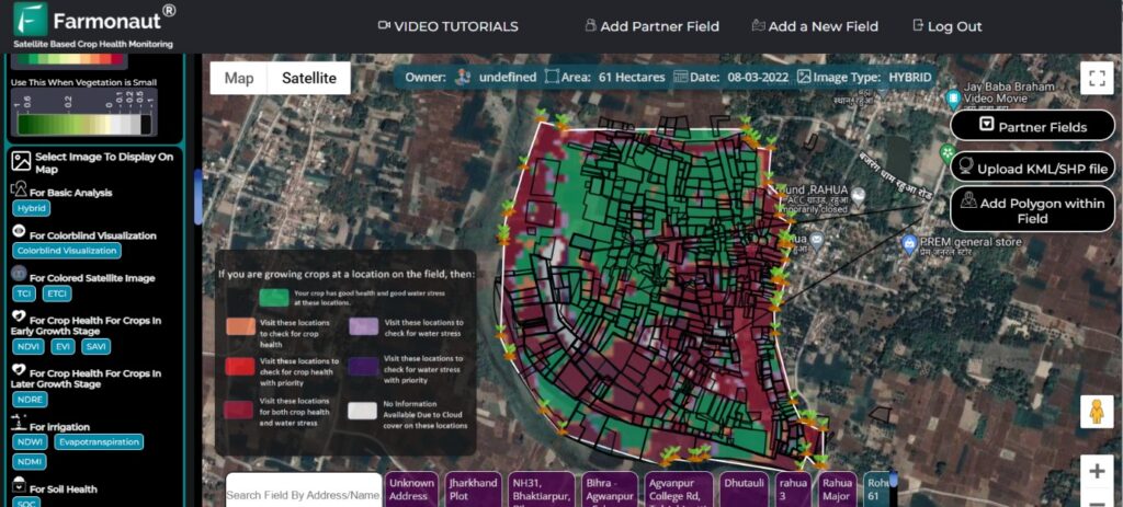
Farmonaut’s satellite-based crop health monitoring system aims to make satellite technology accessible and affordable for all farmers. The primary goal of Farmonaut is to eliminate cost barriers and democratize remote sensing within the farming community. It achieves this by offering a user-friendly platform that enables field monitoring through satellites, which can be accessed via web, Android, and iOS apps. Through Farmonaut, farmers have the capability to remotely monitor their fields using satellite data, receiving comprehensive insights into crop health, vegetation water stress, and soil organic carbon content.
Our platforms, including the Android, iOS, and web applications, empower farmers and business partners to select fields and identify specific regions where crop growth is abnormal. Additionally, they have the option to utilize our API to provide satellite data to their own users. In addition to weather forecast data from the nearest weather station, our platform delivers essential information such as vegetation water stress, evapotranspiration, and soil organic carbon data.

How does Farmonaut helps in reducing the crop Yield losses?
Crop yield loss estimation by Farmonaut involves the utilization of various vegetation indices and synthetic aperture radar (SAR) data. Statistical models are constructed to calculate the yields based on these indices. Commonly used indices include NDVI, EVI, SAVI, NDRE, VARI, SIPI, leaf chlorophyll index, and advanced indices, along with SAR data.
Although standard statistical techniques are available for each crop, adjustments must be made based on factors such as crop location, type, variety, and duration. This process requires collaboration between remote sensing, GIS, statistical, and agronomy teams. Market intelligence companies, government agencies, research companies, and historical data on prices can also contribute to reducing the time, improving accuracy, and minimizing costs associated with yield estimation.
Accurate estimations rely on the expertise of industry professionals, along with the collaborative efforts mentioned above. Over time, as AI programs advance, the margin of error or variation in yield estimations is expected to decrease
By delving into the features showcased in the GIS Resources magazine, this comprehensive article provides an in-depth overview of Farmonaut and its contribution to the agricultural sector. With its advanced capabilities in real-time crop monitoring, precision farming, efficient irrigation management, weather integration, and seamless data analysis, Farmonaut empowers farmers to make data-driven decisions, optimize productivity, and ensure sustainable farming practices. Additionally, it addresses the importance of organic carbon in soil for sustainable agriculture, provides insights on how to become a farmer in India, and highlights the agritech imagery companies in Delhi NCR that are leveraging GIS technology for agricultural advancements. As the agriculture industry continues to evolve, Farmonaut stands at the forefront, bridging the gap between technology and farming, and ushering in a new era of smart agriculture.
