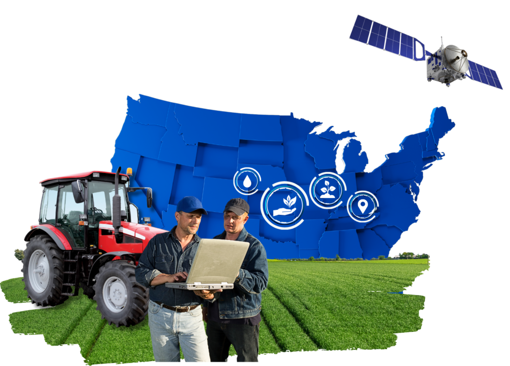
We utilize advanced satellite technology to give you detailed crop insights. Our monitoring services provide essential data on crop health, irrigation, soil quality, and more.
We aim to equip you with tools for informed decision-making and sustainable farming practices. With regular crop assessments every 4-5 days, our monitoring ensures timely information to effectively manage crops and farms.
What you will receive
Crop Health Monitoring
Crop Area & Yield Estimation
Water loss Management
Forecast Weather
Water Stress Managment
Soil Organic Carbon
Radar Data Provided
Land Use and Classification
Soil Moisture Management
Real-Time Weather
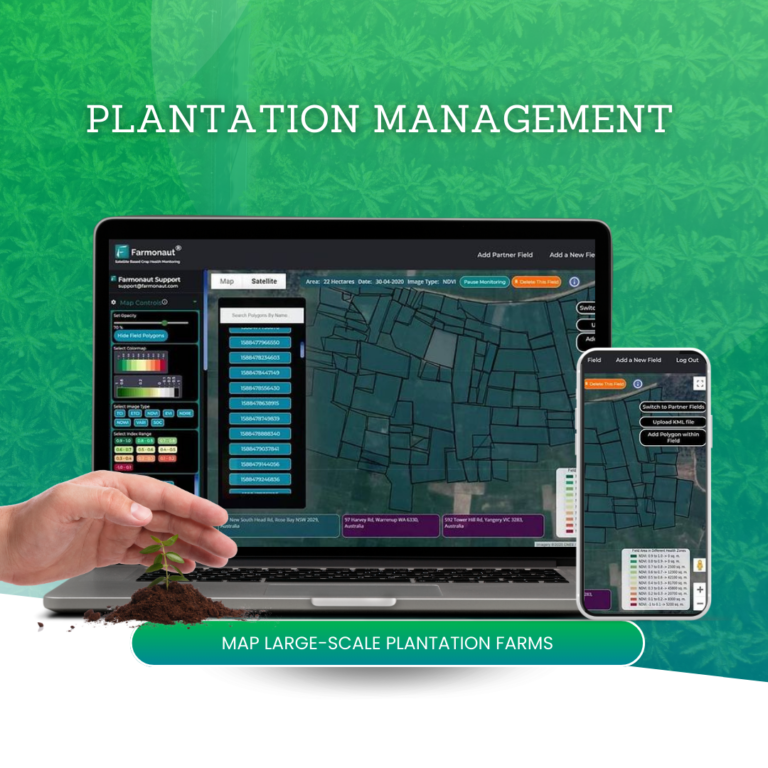
Plantation Management
Digital Elevation Model
Discover
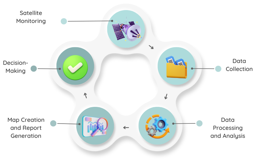
How we process
Data Collection: Raw Satellite data is collected from space agencies.
Data Processing and Analysis: Advanced software solutions process and analyze the collected data using various AI/ML algorithms.
Map Creation and Report Generation: Detailed maps and reports are generated, providing insights into various agricultural parameters.
Decision-Making: Farmers utilize the generated maps and reports to optimize their farming practices.
Learn About
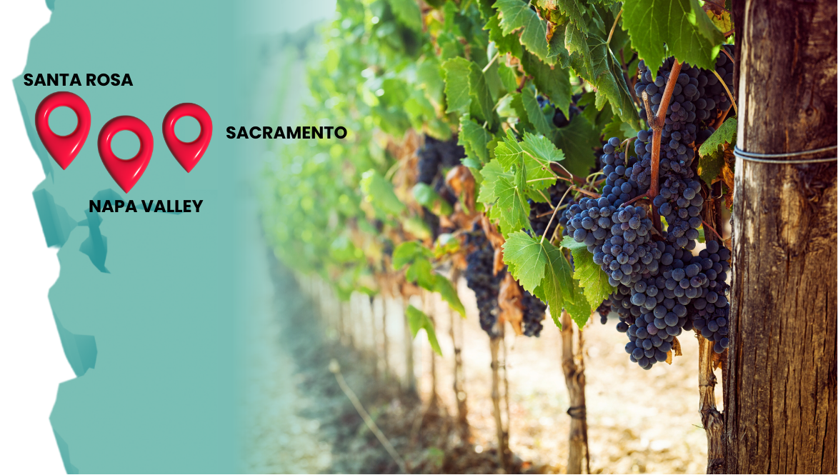
Ongoing Project
Currently we are working in Vineyards present across Santa Rosa, Napa Valley and Sacramento region of California
Vineyard Health Monitoring
Vineyard Irrigation Monitoring
Farm Input Mangement
Pest And Disease Detection
Learn About
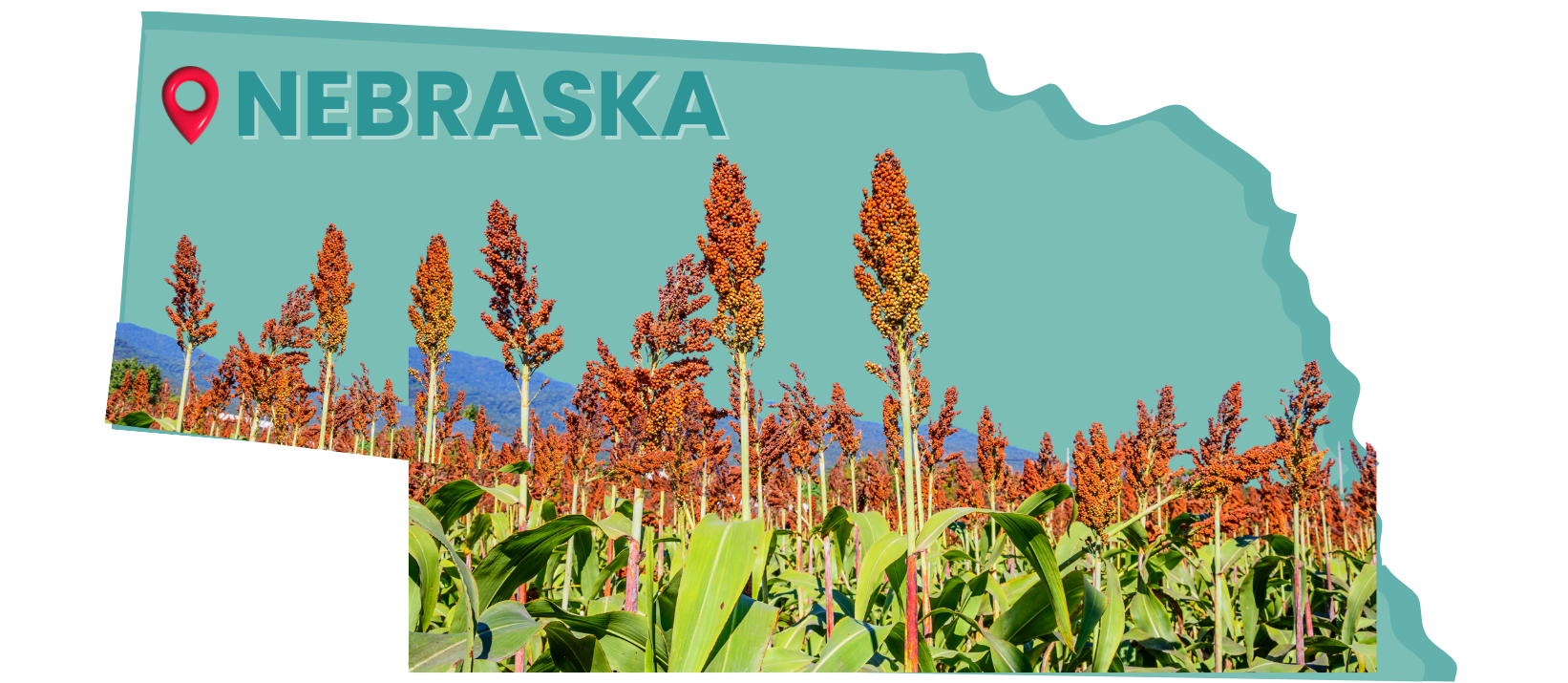
Coming Project
Within few months we will start our work in Nebraska region for providing the Sorghum Crop Monitoring and We will also provide the complete traceability.
Sorghum Health Monitoring
Sorghum Irrigation Monitoring
Sorghum Traceability
Weather Forecast
Read Our latest
News
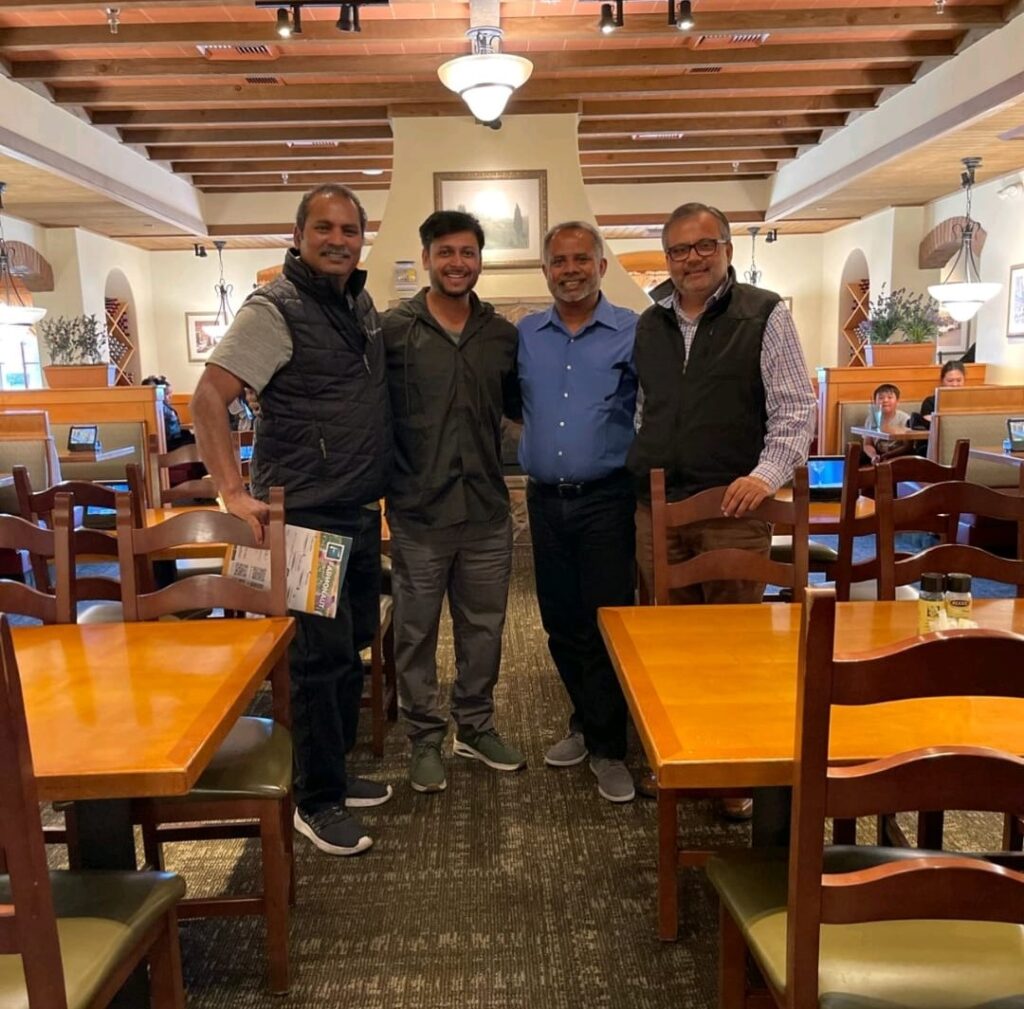
9 April 2024
Meeting at Tech Veterans
We recently attended a meeting at Tech Veterans in the Bay Area. Experienced tech veterans who have witnessed the region’s transformation since the dot-com era gathered over lunch to discuss our expansion into the American market.
As a successful startup from India, our aims to bring its innovative solutions to farmers across the United States. The meeting discussed how our technology can make farming operations more efficient, sustainable, and productive.
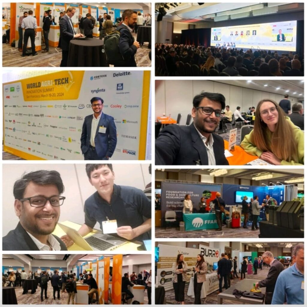
12 March 2024
World Agri-Tech Summit
We’ve been invited to the World Agri-Tech Innovation Summit, a key event where agri-food companies, tech providers, and investors meet to discuss new trends and innovations.
This is our chance to showcase our agricultural technology, network with industry leaders, and explore new business partnerships. The invitation is a significant acknowledgment of our role in advancing agricultural technology and our commitment to shaping the future of farming.
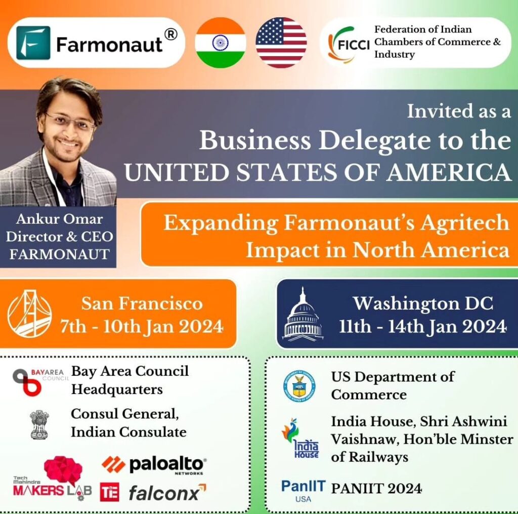
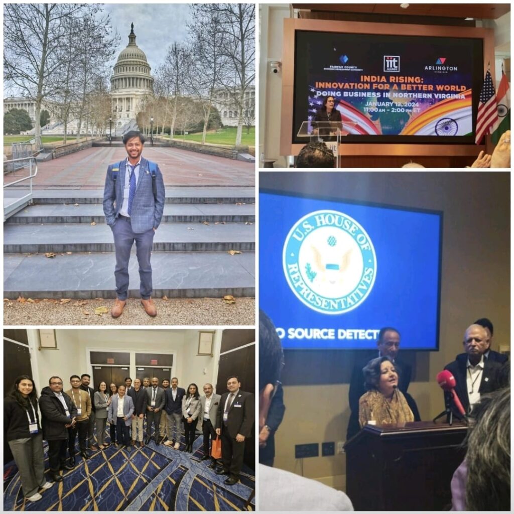
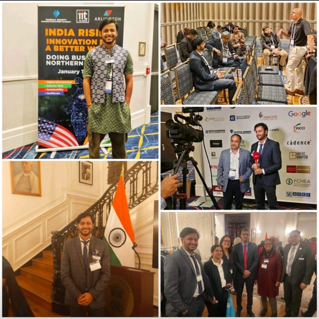
13 December 2023
FICCI USA Visit
We were part of FICCI’s business delegation to the USA from January 7th to 14th, 2024. The delegation traveled to San Francisco and Washington D.C. to strengthen business ties between India and the United States.
During the visit, we had the opportunity to demonstrate our agricultural technology and meet with US industry leaders and policymakers. This trip could lead to future partnerships and support our growth in the global agricultural technology sector.
Your Field’s Full Potential,
All in One Solution.
Offers
Complete Farming Solutions
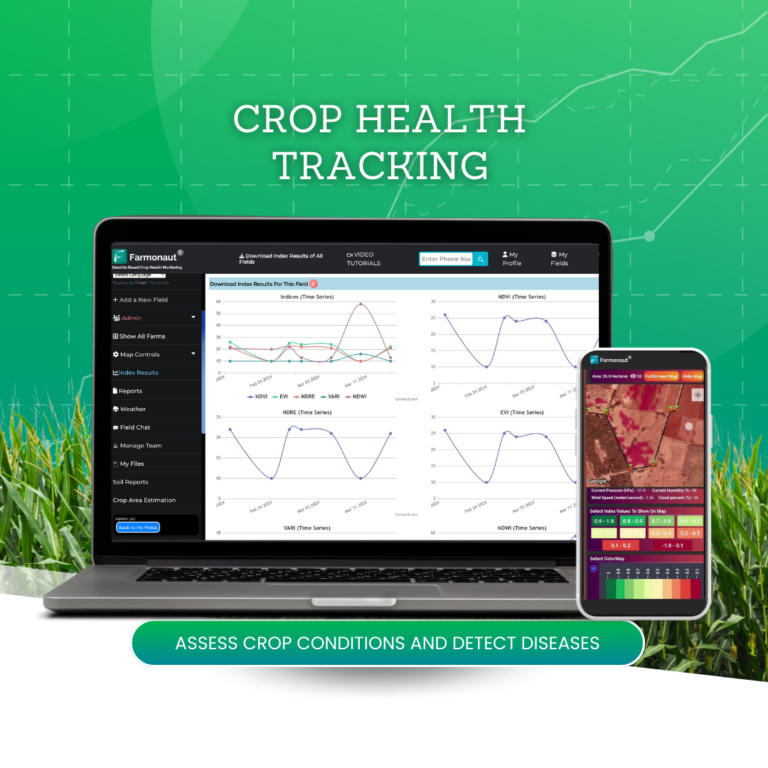
Crop Health Tracking
Satellite monitoring lets you spot areas where crops are stressed or diseased early on, so you can take quick action to protect your crops and maximize your harvest.
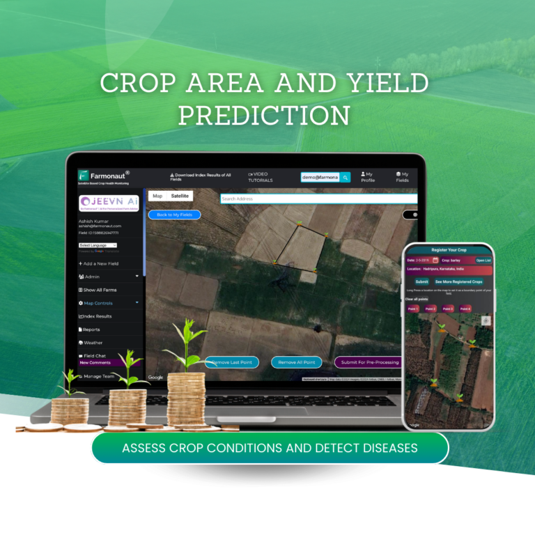
Crop Area and Yield Prediction
Delivers vital crop yield insights, aiding in strategic planning of planting, watering, and fertilizing methods for optimal productivity.
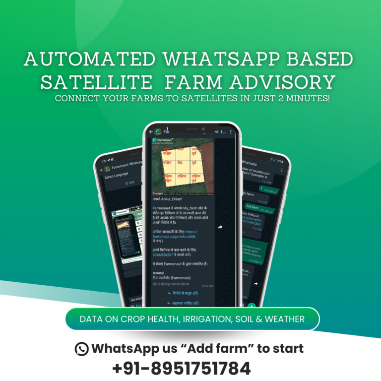
WhatsApp Advisory
Access detailed reports instantly via WhatsApp for seamless monitoring of farm performance, offering direct updates without requiring any technical expertise.
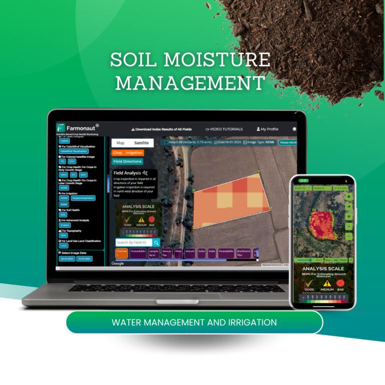
Soil Moisture Management
Accurately assess soil moisture levels to inform irrigation decisions, ensuring optimal water distribution across your entire land.
Plantation Management
Offers seamless mapping of large farms and providing analyses, including tree age, area, count, and uprooting assessment.