Month: July 2019

MoU Signed With STEI Foundation Africa

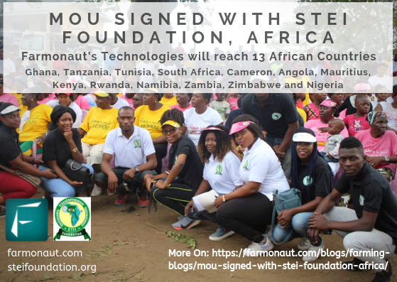
We are delighted to announce that we have signed a two-year MoU with STEI Foundation, Africa.

STEi Foundation ( Sustainable TransEnvironment International Foundation) was established in 2017 to contribute to greening the environment and empowering the women and young people in rural Africa and currently has a representation in Thirteen (13) African Countries, namely: Ghana, Tanzania, Tunisia, South Africa, Cameron, Angola, Mauritius, Kenya, Rwanda, Namibia, Zambia, Zimbabwe and Nigeria.  Nigeria is the seat of STEi Foundation’s Corporate Governance.

The objective of this MoU is:

Promotion of Remote Sensing technologies for farming amongst the farmers in Nigeria and the countries in Africa in which the STEI Foundation is present.

Through this program, Farmonaut in collaboration with the STEI Foundation will:

1. Create awareness amongst the farmers about the importance of remote sensing technology in agriculture. 


2. Educate farmers about the scientific background of the working of the remote sensing technology and the ways it can increase crop yield, reduce irrigation water loss and reduce fertilizers/chemical usage. 


3. Assist farmers with understanding the remote sensing technologies provided by Farmonaut and encourage them in using the remote sensing system provide by Farmonaut. 

Farmonaut will provide the technological support to the STEI foundation and the STEI foundation will be conducting the on-field engagement support to make this program a success. 


Remote Sensing Technologies Provided By Farmonaut

1. Crop Health Monitoring 


Farmers can select their field and identify the regions of the field at which the crop growth is not normal. Upon identifying that region of their fields, they can simply pay a visit to that part of the field and identify if the problem has already started. If it has not, the farmer can take preventive remedies by applying more fertilizers, plant growth regulators etc. If the problem has already started, they can simply explain their problem to Farmonaut’s crop issue identification system and get real-time govt. approved remedies. For the same, our system provides two different sets of images. One set of images provide crop health status if your crop is in the early stage of growth and the second set of images provided crop health status if your crop is in the later stage of growth.


Read More in Detail on these links.


Early Stage Crop Health: https://farmonaut.com/blogs/remote-sensing/normalized-difference-vegetation-index-ndvi/


Later Stage Crop Health: https://farmonaut.com/blogs/remote-sensing/ndvi-vs-ndre-and-their-applications-in-agriculture/


2. Vegetation Water Level Monitoring 

Vegetation cover on the earth’s surface undergoes severe stress during a drought. If affected areas are not identified in time, entire crops may be damaged. Hence, the early detection of water stress can prevent many of the negative impacts on crops. Vegetation Water Level Imagery provided by Farmonaut can help control irrigation, significantly improving agriculture, especially in areas where meeting the need for water is difficult.

Read more in detail on this link: https://farmonaut.com/blogs/remote-sensing/normalized-difference-water-index-ndwi/

Using automated crop monitoring service, farmers will automatically receive a. crop health report and b. vegetation water level report from latest satellite imagery every 5-10 days. They will also be updated with near real-time weather report of their field from the nearest weather station. They can put multiple fields for monitoring from their profile as well.The satellite imagery is updated every 5- 10 days and has a resolution of 10 meters.

The app is available on the following link:

 https://play.google.com/store/apps/details?id=com.farmonaut.android

We will keep posting about any such informative information on to our blogs, to help as many people as possible. Farmonaut is built upon a vision to bridge the technological gap between farmers and strives to bring state-of-the-art technologies in the hands of each and every farmer. For any queries/suggestions, please contact us at [email protected]

We have some more interesting articles coming up soon. Stay tuned!

Wait!!

Before that…

Follow us at:

Snow Cover Analysis Using NDSI

INTRODUCTION

Soil organic carbon is the carbon that remains in the soil after partial decomposition of any material produced by living organisms. Soil organic carbon is present as a main component of soil organic matter. Soil organic carbon is
believed to play crucial role for many soil functions and ecological properties. The amount of organic carbon present in a soil depends upon the local geology, climatic conditions, land use and management. Organic carbon is
mainly present in the top soil (2500 pg of c to 2-m depth).The amount of carbon that is present in the soil is twice larger the amount present in atmosphere hence soil act as an important reservoir of carbon. 

IMPACT ON AGRICULTURE

Soil organic carbon is the basis of sustainable agriculture. Farmers are interested in retaining and increasing soil organic carbon for individual fields in order to improve soil health and yield. One of the main reasons behind this is the ability of soil organic carbon in maintaining the soil fertility. SOC improves soil aeration, water retention capacity, drainage, and enhances microbial growth. As carbon stored in the soil is increased carbon i “sequestered” (long -term storage) and risk of loss of nutrients through leaching and erosion is reduced. When the amount of carbon in the soil is increased it reduces the amount of carbon dioxide present in the atmosphere which provides a better climatic condition for plant growth. An increase in soil organic carbon results in more stable carbon cycle and enhanced overall agricultural productivity. 


DEPLETION OF SOIL ORGANIC CARBON

According to the study conducted in Sweden, nationwide the 270 TG c stocks in agriculture surface soil is rapidly decreasing at a rate of 1 TG per year. One of the reasons behind this according to the study of GUO and GIFFORD is change in land use pattern. There is a chance of reduction of 10% of c stock when there is change in land use from forest to crop land. Unsustainable management practices like excessive irrigation, over grazing, deforestation, excessive tillage, practice of burning agricultural fields also causes soc losses. A large amount of carbon in the soil is reduced due to plant harvesting processes. The process of decomposition done by micro-organisms present in the soil where half of the organic carbon is released in the form of carbon dioxide is a major reason behind soil organic carbon depletion. Greater root bio-mass also result in carbon loss due to increased rate of respiration that take place through these roots. The amount of organic carbon present in the soil is affected by factors like climate, texture, hydrology (water content), land use and vegetation. When the amount of carbon in soil is reduced it affects the ability of soil to supply nutrients to the plant which in turn leads to low yield and affect food security. It also reduces the soil bio-diversity since it effects the growth of microbes. Global warming also contributes in depletion of organic matter present in the soil.

PRACTICES TO PROMOTE SOIL CARBON STORAGE 

Soil carbon storage is a vital ecosystem service. In an agricultural land soil carbon loss take place as a result of improper methods of soil managements such as excessive tillage, increased rate of irrigation, increased use of chemical fertilizers etc. One of the most effective methods for leaving the soil undisturbed is the practice of zero-tillage. Soil fertility can be maintained by introducing proper management strategy for grazing and by reducing the use of chemical fertilizers. Replacing chemical fertilizers with organic fertilizers and manures will help to restore the soil health. Erosion of top soil which bring the down the amount of carbon present in soil can be controlled by maintaining the ground cover. Growing cover crops like eucalyptus can reduce the wash away of top soil. Excessive irrigation can deteriorate soil health. So the amount of water supplied to the plants should be according to its needs, not more, not less. Another method of increasing carbon storage is by growing high yield, high biomass crops. The amount of carbon present in the soil will increase if the crop frequency of a place is maxi-mum. 


HOW TO ACHIEVE THIS 

Monitoring the field to assess whether the change in management is restoring or depleting the carbon resource is an important step towards protecting the soil organic carbon content. This can be done using the technology of remote sensing. Quantitative and qualitative estimation of soil using the conventional method is difficult since soil show variability form site to site even within the same field. The method of remote sensing is cost-effective and rapid. FARMONAUT app uses remote sensing technology to create a SOC image that provides color map of percentage of organic matter present in the selected field. If the content of SOC is more than 5% the area appears dark green in the color map and it appears red if the SOC content is less than 1%.Change in SOC content with time is also  noted with the help of remote sensing in FARMONAUT. This provides precise information to the farmers which help them to take the right measures, in the right time, and in the right place hence ensuring productivity and soil health.


NDVI vs NDRE And Their Applications In Agriculture

NDVI (Normalized Difference Vegetation Index) and NDRE (Normalized Difference Red Edge) are known as “index products” which are primarily used to estimate crop health in an agricultural field. Both of these indexes are constructed from a combination of two distinct frequencies of light. NDVI is built with a combination of visual red light and near-infrared (NIR) light. NDVI is discussed in detail in a separate article. You can read the detailed article on this link below:

https://farmonaut.com/blogs/remote-sensing/normalized-difference-vegetation-index-ndvi/


NDRE uses a combination of near-infrared light and a frequency band that is in the transition region between visual red and NIR light.

One of the most common question being asked is NDVI or NDRE, which one should I use?  And what we say to this is that it depends upon the growth stage of your crops in the farming field.


NDVI is a more commonly used index to estimate crop health of a given field. In simple words, NDVI correlates with chlorophyll, which then in turn correlates with plant health. Having NDVI information of a particular field can help us identify crop health in their earlier growth stages.

However, it isn’t perfect and accurate for all crops and for all stages of crop growth. The visual-band red content is absorbed quite strongly by the top of the plant canopy, which means that the NDVI measurements do not have contribution from the lower levels of the canopy. Hence, leaf area index (LAI) and its correlation with NDVI is partially impaired. If the plants have more layers of leaves (for example, tree canopies), this impairment of correlation of LAI with NDVI increases.

Furthermore, in grasses, cereal crops, permanent crops and in certain row crops which are in their later growth stages, chlorophyll content reaches a point at which NDVI reaches a maximum value of 1.0 and hence saturates. Hence, any crop health issue is hard to detect with NDVI until any such problem becomes strong enough to reduce the NDVI value below 1.0. This may happen at a point at which damage has already occurred.

NDRE

NDRE OFFERS A SOLUTION

By substituting NDVI’s red band with NDRE’s red edge band we can mitigate this issue of saturation discussed abovev. NDRE’s red edge band provides a measurement that is not as strongly absorbed by just the topmost layers of leaves. By using NDRE, one can get better insight into crops in their later stage because it is able to observe further down into the canopy as well.

NDRE = (NIR – RE)/(NIR + RE)

NDRE is also less prone to saturation in the presence of dense vegetation. This will help us get much accurate results in pasture biomass estimation measurements. Thus, in situations like these, NDRE can provide a much accurate and better measurement of variability in an area in which the NDVI measurement would come simply as 1.0

So, in conclusion, if the crops of observation are permanent or dense, you should use NDRE right away. Ofcourse, using both the indices together is often the most ideal solution. A lot of farmers with crops that transition from seed to thick canopies in a single season make use of both NDVI and NDRE.

Farmonaut’s Automated Satellite Based Crop Health Monitoring System provides a farmer with both NDVI and NDRE results for crop health status measurements everytime the satellite crosses the farmer’s field.

We will keep posting about any such informative information on to our blogs, to help as many people as possible. Farmonaut is built upon a vision to bridge the technological gap between farmers and strives to bring state-of-the-art technologies in the hands of each and every farmer. For any queries/suggestions, please contact us at [email protected]

We have some more interesting articles coming up soon. Stay tuned!

Wait!!

Before that…

Follow us at: