Revolutionizing Oil Palm Plantations: Farmonaut’s Collaboration with Masoom Group
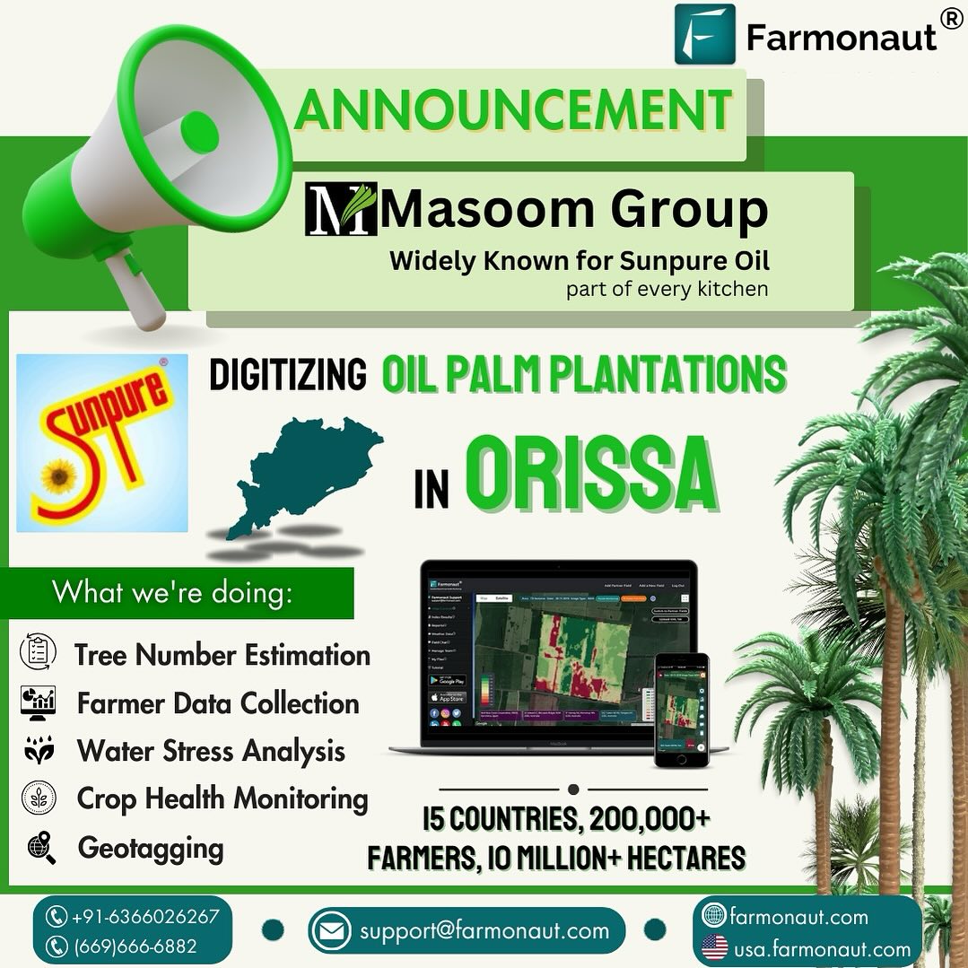
We at Farmonaut are thrilled to announce our latest collaboration with the esteemed Masoom Group, renowned for their Sunpure Oil which has become a staple in kitchens across India. This partnership marks a significant step forward in our mission to revolutionize agricultural practices and bring precision farming to the forefront of the industry.
Digitizing Oil Palm Plantations: A Game-Changing Initiative
Our collaboration with Masoom Group focuses on digitizing Oil Palm plantations in Orissa, a project that promises to transform traditional cultivation methods. By leveraging Farmonaut’s cutting-edge technologies, we aim to optimize resource utilization, boost productivity, and provide farmers with invaluable insights for sustainable growth.
The Power of Advanced Technologies in Agriculture
At the heart of this initiative lies a suite of advanced technologies that Farmonaut brings to the table:
- Satellite-based crop health monitoring
- Tree number estimation
- Water stress analysis
- Geotagging
- Comprehensive farmer data collection
Let’s delve deeper into how each of these technologies contributes to the transformation of oil palm cultivation.
Satellite-Based Crop Health Monitoring: A Bird’s Eye View of Plantation Health
One of the cornerstones of our approach is the use of
satellite-based crop health monitoring. This technology allows us to observe vast stretches of oil palm plantations from space, providing a comprehensive and real-time view of crop health.
How It Works:
- Multispectral Imaging: Satellites capture images of plantations using different spectral bands, including visible light and near-infrared.
- Vegetation Indices: We analyze these images using vegetation indices like NDVI (Normalized Difference Vegetation Index) to assess plant health and vigor.
- Data Interpretation: Our AI algorithms interpret this data to identify areas of stress, disease, or nutrient deficiency.
- Actionable Insights: Farmers receive easy-to-understand reports and recommendations based on this analysis.
By employing satellite-based monitoring, we can cover vast areas quickly and efficiently, providing insights that would be impossible to gather through traditional ground-based methods alone.
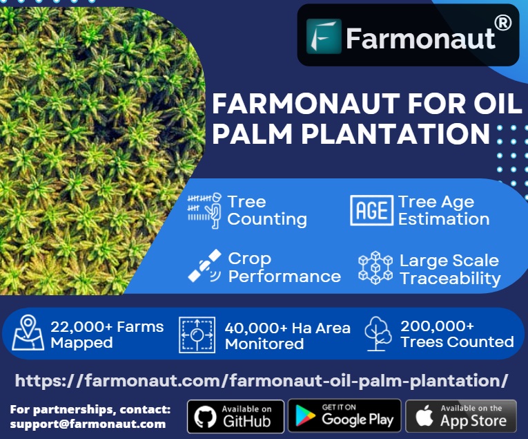
Tree Number Estimation: Precision in Plantation Management
Accurate tree count is crucial for efficient plantation management. Our tree number estimation technology uses high-resolution satellite imagery and advanced image processing algorithms to provide precise counts of oil palm trees across large plantations.
Benefits of Tree Number Estimation:
- Improved inventory management
- Better yield estimation
- Efficient resource allocation
- Early detection of gaps or areas needing replanting
This technology enables plantation managers to make data-driven decisions about resource allocation, replanting strategies, and yield forecasting.
Water Stress Analysis: Optimizing Irrigation for Oil Palm
Water management is critical in oil palm cultivation. Our water stress analysis technology helps identify areas of the plantation that are experiencing water stress, allowing for targeted and efficient irrigation.
How We Analyze Water Stress:
- Thermal Imaging: Satellites capture thermal data to detect temperature variations across the plantation.
- Spectral Analysis: We analyze the spectral signature of plants to identify signs of water stress.
- AI-Powered Interpretation: Our algorithms process this data to create water stress maps.
- Actionable Recommendations: Farmers receive specific irrigation recommendations for different zones of their plantation.
By optimizing water usage, we not only improve plant health and yield but also contribute to more sustainable farming practices.
Geotagging: Precision Mapping for Enhanced Management
Geotagging is a powerful tool that allows us to associate precise geographical information with every tree and section of the plantation. This technology enables highly targeted management practices.
Applications of Geotagging in Oil Palm Plantations:
- Individual tree monitoring and management
- Precise application of fertilizers and pesticides
- Efficient planning of harvesting routes
- Accurate record-keeping for each section of the plantation
By integrating geotagging into our system, we provide plantation managers with unprecedented control and insight into their operations.
Comprehensive Farmer Data Collection: Empowering Decision-Making
At Farmonaut, we believe that data is power. Our comprehensive farmer data collection system gathers a wide range of information to provide a holistic view of plantation operations.
Types of Data Collected:
- Planting dates and tree ages
- Fertilizer and pesticide application records
- Yield data
- Labor inputs
- Weather patterns
- Soil health indicators
This wealth of data, when analyzed using our advanced AI systems, provides farmers and plantation managers with actionable insights to optimize their operations.
The Farmonaut Advantage: Satellite vs. Drone and IoT-Based Monitoring
While drones and IoT devices have their place in agriculture, our satellite-based system offers unique advantages for large-scale plantations like those managed by Masoom Group.
| Feature |
Farmonaut Satellite System |
Drone-Based Monitoring |
IoT-Based Monitoring |
| Coverage Area |
Vast (Entire plantations at once) |
Limited (Requires multiple flights) |
Limited (Depends on sensor placement) |
| Frequency of Data Collection |
Regular (Every few days) |
As needed (Labor intensive) |
Continuous (But localized) |
| Initial Setup Cost |
Low |
High (Drone purchase, training) |
High (Numerous sensors required) |
| Maintenance |
Minimal (Satellite maintained by providers) |
Regular (Drone maintenance, repairs) |
Frequent (Sensor calibration, replacement) |
| Data Processing |
Automated (AI-powered analysis) |
Semi-automated (Requires expert interpretation) |
Automated (But limited in scope) |
| Scalability |
Highly scalable (No additional equipment needed) |
Limited (More drones needed for larger areas) |
Moderate (More sensors for larger areas) |
Empowering Farmers with Digital Solutions
Our collaboration with Masoom Group is not just about technology; it’s about empowering farmers with the tools and knowledge they need to thrive in an increasingly challenging agricultural landscape.
Key Benefits for Farmers:
- Increased Productivity: By optimizing resource use and identifying issues early, farmers can significantly boost their yields.
- Cost Reduction: Precise application of inputs like water and fertilizers leads to reduced waste and lower operational costs.
- Sustainability: Our technologies promote more sustainable farming practices, helping preserve the environment for future generations.
- Risk Mitigation: Early detection of issues like pests, diseases, or water stress allows for proactive management, reducing crop loss risks.
- Data-Driven Decision Making: Farmers have access to comprehensive data and insights, enabling them to make informed decisions about their plantations.
The Future of Oil Palm Cultivation
As we embark on this journey with Masoom Group, we envision a future where oil palm cultivation is not only more productive but also more sustainable and environmentally friendly. Our technologies are paving the way for:
- Precision Agriculture: Tailored management practices for each section of the plantation.
- Sustainable Intensification: Increasing yields without expanding cultivated areas.
- Climate-Smart Farming: Adapting cultivation practices to changing climate conditions.
- Traceability: Ensuring transparency in the supply chain from plantation to consumer.
Join the Agricultural Revolution
Are you ready to transform your agricultural practices? Farmonaut’s solutions are not limited to oil palm plantations. We offer a range of services tailored to various crops and farming scales.
Get Started with Farmonaut:
Frequently Asked Questions (FAQ)
1. What is satellite-based crop health monitoring?
Satellite-based crop health monitoring uses images captured by satellites to assess the health and condition of crops over large areas. It employs various spectral bands and vegetation indices to provide insights into plant vigor, stress, and potential issues.
2. How accurate is tree number estimation using satellite imagery?
Our tree number estimation technology is highly accurate, typically achieving over 95% accuracy in mature plantations. Factors like plantation age, tree spacing, and image resolution can affect accuracy.
3. Can Farmonaut’s technology be used for crops other than oil palm?
Yes, Farmonaut’s technologies are adaptable to a wide range of crops, including cereals, fruits, vegetables, and other plantation crops. We tailor our solutions to the specific needs of each crop type.
4. How often is satellite data updated?
The frequency of satellite data updates depends on the specific service package. Typically, we provide updates every 3-5 days, but this can be customized based on client needs and satellite availability.
5. Is internet connectivity required to use Farmonaut’s services?
While internet connectivity enhances the real-time capabilities of our services, we also offer offline solutions for areas with limited connectivity. Data can be synced when internet access is available.
6. How does Farmonaut ensure data privacy and security?
We take data privacy and security seriously. All data is encrypted, and we adhere to strict data protection protocols. We do not share individual farm data without explicit permission from the farm owner.
7. Can Farmonaut’s technology help with organic farming practices?
Absolutely. Our technologies are particularly beneficial for organic farming, as they help in early detection of pest and disease issues, allowing for timely intervention using organic methods.
8. How does weather data integration work with Farmonaut’s systems?
We integrate local and global weather data into our analysis, providing forecasts and historical weather patterns. This helps in planning farm activities and understanding the impact of weather on crop health.
9. Is training provided for using Farmonaut’s tools?
Yes, we provide comprehensive training and support to ensure that farmers and plantation managers can effectively use our tools. This includes online tutorials, webinars, and on-site training sessions where necessary.
10. How does Farmonaut contribute to sustainable farming practices?
By optimizing resource use, reducing waste, and promoting precision agriculture, Farmonaut’s technologies inherently support sustainable farming. We also offer specific tools for carbon footprint tracking and sustainable practice implementation.
Conclusion: A New Era in Oil Palm Cultivation
Our collaboration with Masoom Group marks the beginning of a new era in oil palm cultivation. By harnessing the power of satellite technology, artificial intelligence, and data analytics, we’re not just improving productivity; we’re reshaping the future of agriculture.
As we continue to innovate and expand our services, we invite farmers, agribusinesses, and agricultural enthusiasts to join us on this exciting journey. Together, we can create a more sustainable, productive, and prosperous agricultural sector.
Stay tuned for more updates on our collaboration with Masoom Group and the transformative impact of digital technologies in agriculture. The future of farming is here, and it’s digital, sustainable, and incredibly exciting!