Maximizing Plantation Efficiency: Geotag, Estimate, and Compare Your Plantation Area vs. Farm
In today’s rapidly evolving agricultural landscape, precision and efficiency are paramount. At Farmonaut, we understand the unique challenges faced by plantation owners and farmers alike. Our cutting-edge satellite-based farm management solutions are designed to revolutionize the way you manage your plantations and farms. In this comprehensive guide, we’ll explore the powerful tools and techniques that can help you maximize your plantation’s potential, from geotagging and area estimation to comparing plantation efficiency with traditional farming methods.
The Power of Geotagging Your Plantation
Geotagging is a fundamental aspect of modern plantation management, and it’s a cornerstone of our services at Farmonaut. But what exactly is geotagging, and why is it so crucial for plantation owners?
Understanding Geotag Plantation
Geotagging your plantation involves associating precise geographical coordinates with your plantation area. This process creates a digital footprint of your plantation, allowing for accurate mapping and monitoring. Here’s why it’s essential:
- Precise Location Tracking: Geotagging ensures that every part of your plantation is accurately mapped and easily identifiable.
- Improved Resource Allocation: With geotagged data, you can better allocate resources based on the specific needs of different areas within your plantation.
- Enhanced Monitoring: Our satellite-based monitoring becomes more effective when coupled with accurate geotag information.
- Simplified Reporting: Geotagged plantations make it easier to generate detailed reports and maintain records for compliance and management purposes.
At Farmonaut, we’ve streamlined the geotagging process, making it accessible and user-friendly for plantation owners of all technological backgrounds. Our mobile app allows you to easily geotag your plantation area right from your smartphone. Simply walk the perimeter of your plantation, and our app will create a precise geotag of your plantation area.
The Benefits of Geotagging with Farmonaut
When you geotag your plantation with Farmonaut, you’re not just marking boundaries; you’re unlocking a wealth of possibilities:
- Satellite-Based Monitoring: Once geotagged, your plantation can be monitored using our advanced satellite technology, providing regular updates on crop health, soil moisture, and more.
- Customized Alerts: Set up alerts for specific areas of your plantation, ensuring you’re always informed about critical changes or potential issues.
- Historical Data Analysis: Track changes in your plantation over time, helping you make data-driven decisions for future seasons.
- Integration with Other Tools: Geotagged data seamlessly integrates with our other features, such as AI advisory systems and blockchain-based traceability solutions.
By leveraging the power of geotagging, plantation owners can gain unprecedented insights into their operations, leading to more efficient management and increased productivity.
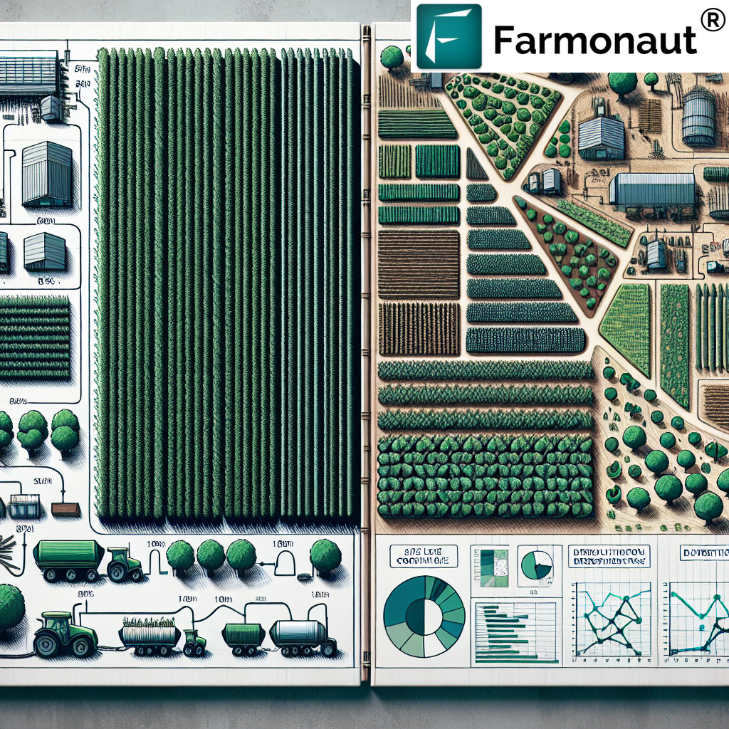
Accurate Plantation Area Estimation
Knowing the exact size of your plantation area is crucial for various aspects of plantation management, from resource allocation to yield estimation. At Farmonaut, we provide cutting-edge tools for precise plantation area estimation.
The Importance of Accurate Plantation Estimation
Accurate plantation area estimation offers numerous benefits:
- Optimized Resource Usage: Knowing the exact area helps in calculating the right amount of inputs needed, such as fertilizers, pesticides, and water.
- Improved Yield Predictions: Accurate area measurements lead to more precise yield estimates, crucial for planning and marketing.
- Better Financial Planning: With exact area measurements, you can more accurately budget for expenses and project potential revenues.
- Compliance and Reporting: Many regulatory bodies require accurate reporting of plantation areas, which our estimation tools facilitate.
Farmonaut’s Approach to Plantation Area Estimation
Our plantation area estimation process combines satellite imagery with advanced algorithms to provide highly accurate results. Here’s how it works:
- Satellite Imagery Acquisition: We use high-resolution satellite imagery of your geotagged plantation area.
- Image Processing: Our AI algorithms process the imagery to identify plantation boundaries accurately.
- Area Calculation: Using these defined boundaries, we calculate the precise area of your plantation.
- Verification and Refinement: Our experts verify the results and make any necessary refinements to ensure accuracy.
This process not only provides you with an accurate plantation area estimate but also offers valuable insights into your plantation’s layout and composition.
Beyond Basic Area Estimation
At Farmonaut, we go beyond just providing numbers. Our plantation area estimation service offers additional benefits:
- Subdivision Analysis: We can break down your plantation into different sections or blocks, helping you manage larger areas more effectively.
- Change Detection: Track changes in your plantation area over time, useful for monitoring expansion or contraction of your plantation.
- Integration with Health Monitoring: Combine area estimation with our crop health monitoring tools for a comprehensive view of your plantation’s performance.
By leveraging these advanced features, plantation owners can gain a more nuanced understanding of their plantation area and make more informed management decisions.
Plantation vs. Farm: Understanding the Differences
While the terms “plantation” and “farm” are often used interchangeably, there are significant differences between these two agricultural models. At Farmonaut, we provide solutions tailored to both plantations and farms, recognizing their unique characteristics and needs.
Defining Plantations and Farms
Before we delve into the comparison, let’s define these terms:
- Plantation: A large-scale agricultural estate, usually specialized in the cultivation of a single crop (e.g., tea, coffee, rubber, oil palm) over an extensive area.
- Farm: Typically a smaller-scale agricultural operation that may involve mixed cropping or livestock rearing, often managed by families or small communities.
Key Differences Between Plantations and Farms
| Aspect | Plantation | Farm |
|---|---|---|
| Size | Generally larger, often hundreds or thousands of hectares | Usually smaller, ranging from a few to several hundred hectares |
| Crop Type | Typically monoculture (single crop) | Often diversified (multiple crops or mixed with livestock) |
| Labor | Large workforce, often with specialized roles | Smaller workforce, often family-based or local community |
| Management | Corporate or large-scale management structure | Individual or family-based management |
| Technology Adoption | Often more advanced due to scale and resources | Varies, but generally less technologically intensive |
| Market Orientation | Primarily export or large-scale commercial | Can be subsistence, local market, or commercial |
How Farmonaut Caters to Both Plantations and Farms
At Farmonaut, we recognize the unique needs of both plantations and farms. Our solutions are designed to be scalable and adaptable:
- For Plantations:
- Large-scale satellite monitoring for extensive areas
- Advanced analytics for monoculture crop management
- Workforce management tools
- Supply chain and logistics optimization
- For Farms:
- Affordable precision agriculture solutions
- Multi-crop monitoring capabilities
- User-friendly interfaces for individual farmers
- Community-based data sharing options
Whether you’re managing a vast plantation or a smaller farm, Farmonaut’s tools can be tailored to meet your specific needs, helping you optimize your operations and increase productivity.
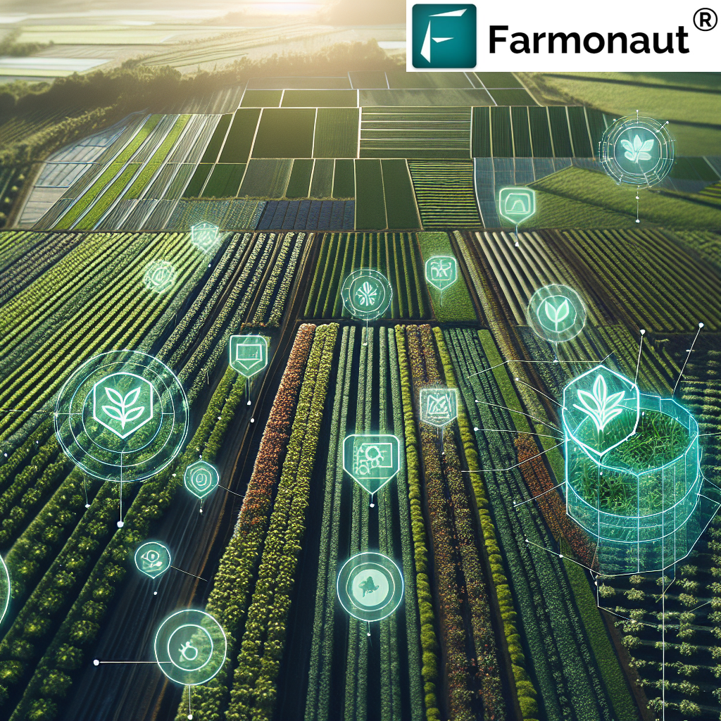
Leveraging Technology for Plantation Management
At Farmonaut, we’re at the forefront of technological innovation in agriculture. Our suite of tools combines satellite imagery, artificial intelligence, and blockchain technology to provide comprehensive plantation management solutions.
Satellite-Based Monitoring: A Game-Changer for Plantations
Our satellite-based monitoring system is revolutionizing the way plantations are managed. Here’s how it works:
- Regular Imagery Capture: We use high-resolution satellite imagery to capture detailed views of your plantation at regular intervals.
- Multispectral Analysis: Our system analyzes various spectral bands to assess crop health, soil moisture, and other vital parameters.
- AI-Powered Insights: Advanced algorithms process the data to provide actionable insights and early warning signals.
- Real-Time Updates: You receive regular updates and alerts through our user-friendly dashboard and mobile app.
This technology allows plantation managers to monitor vast areas efficiently, identify issues early, and make data-driven decisions.
The Farmonaut Advantage: Satellite vs. Drone and IoT
While drones and IoT devices have their place in agriculture, our satellite-based system offers unique advantages for plantation management:
| Feature | Farmonaut Satellite System | Drone-based Monitoring | IoT-based Monitoring |
|---|---|---|---|
| Coverage Area | Vast (entire plantations) | Limited (requires multiple flights) | Limited (depends on sensor placement) |
| Frequency of Data Collection | Regular (as frequent as daily) | Intermittent (manual flights required) | Continuous (but localized) |
| Initial Setup Cost | Low (no hardware required) | High (drone purchase and training) | High (multiple sensors needed) |
| Operational Complexity | Low (fully automated) | High (requires skilled operators) | Medium (maintenance of sensors) |
| Weather Dependency | Low (can penetrate clouds) | High (affected by wind, rain) | Medium (some sensors weather-sensitive) |
| Data Processing | Automated (AI-powered) | Often manual or semi-automated | Automated but limited in scope |
| Scalability | Highly scalable | Limited by operational capacity | Requires additional hardware for scaling |
Integrating AI for Smarter Plantation Management
Our AI-powered Jeevn AI Advisory System takes plantation management to the next level:
- Personalized Recommendations: Tailored advice based on your specific plantation conditions and crop types.
- Predictive Analytics: Forecast potential issues before they become problems, allowing for proactive management.
- Resource Optimization: AI-driven insights help optimize the use of water, fertilizers, and pesticides.
- Yield Prediction: Accurate yield forecasts to aid in planning and decision-making.
By leveraging AI, plantation managers can make more informed decisions, leading to increased efficiency and productivity.
Blockchain for Traceability and Transparency
For plantations focused on export markets or those dealing with high-value crops, our blockchain-based traceability solution offers significant benefits:
- End-to-End Tracking: Follow your produce from plantation to consumer, ensuring authenticity and quality.
- Increased Consumer Trust: Provide verifiable information about your plantation practices and product journey.
- Compliance Made Easy: Simplify adherence to international standards and certifications.
- Fraud Prevention: Reduce the risk of counterfeiting and maintain the integrity of your brand.
This technology is particularly valuable for plantations producing specialty crops like coffee, tea, or organic produce, where provenance and quality assurance are crucial.
Maximizing Efficiency: Best Practices for Plantation Management
At Farmonaut, we believe that technology should complement sound agricultural practices. Here are some best practices for plantation management that can be enhanced by our technology:
1. Regular Monitoring and Assessment
Consistent monitoring is key to successful plantation management. With Farmonaut’s satellite monitoring system, you can:
- Track crop health on a daily or weekly basis
- Identify areas of stress or potential disease outbreaks early
- Monitor soil moisture levels to optimize irrigation
2. Precision Resource Application
Our AI-driven insights allow for precise application of resources:
- Apply fertilizers only where and when needed, reducing waste and environmental impact
- Optimize irrigation schedules based on real-time soil moisture data
- Target pest control measures to affected areas, minimizing chemical usage
3. Data-Driven Decision Making
Leverage the power of data to make informed decisions:
- Use historical data to plan crop rotations and planting schedules
- Analyze yield patterns to identify high-performing and underperforming areas
- Make evidence-based decisions on crop varieties and management practices
4. Sustainable Practices
Our technology supports sustainable plantation management:
- Monitor and reduce carbon footprint using our carbon tracking tools
- Implement precision agriculture techniques to minimize resource use
- Use blockchain traceability to showcase sustainable practices to consumers
5. Continuous Learning and Adaptation
Stay ahead of the curve with Farmonaut’s resources:
- Access our knowledge base and expert insights
- Participate in webinars and training sessions on best practices
- Adapt quickly to changing conditions with real-time data and AI-powered recommendations
The Future of Plantation Management with Farmonaut
As we look to the future, Farmonaut is committed to continuing innovation in plantation management technology. Here are some exciting developments on the horizon:
Advanced Predictive Analytics
We’re working on enhancing our AI models to provide even more accurate predictions:
- Long-term yield forecasting based on historical data and climate trends
- Early detection of emerging plant diseases and pests
- Predictive maintenance for plantation equipment and infrastructure
Integration with IoT and Drones
While our satellite-based system offers comprehensive coverage, we’re exploring ways to integrate with other technologies:
- Combining satellite data with ground-level IoT sensors for hyper-local insights
- Integrating drone imagery for on-demand, high-resolution inspections
- Creating a unified data platform that combines multiple data sources for holistic plantation management
Enhanced Automation
We’re developing tools to further automate plantation management tasks:
- Automated irrigation systems that respond to real-time soil moisture data
- AI-driven pest control systems that can trigger targeted interventions
- Robotic harvesting solutions guided by our satellite and AI technology
Expanded Blockchain Applications
We’re exploring new ways to leverage blockchain technology in plantation management:
- Smart contracts for automated payments and resource allocation
- Enhanced traceability features for complex supply chains
- Blockchain-based carbon credit systems for sustainable plantations
Conclusion: Empowering Plantation Owners with Farmonaut
At Farmonaut, we’re dedicated to revolutionizing plantation management through cutting-edge technology and data-driven insights. Our comprehensive suite of tools, from geotag plantation capabilities to advanced AI advisory systems, empowers plantation owners to maximize efficiency, increase yields, and embrace sustainable practices.
By leveraging our satellite-based monitoring, precise area estimation, and comparative analysis tools, you can gain unprecedented insights into your plantation’s performance. Whether you’re managing a vast monoculture plantation or a diverse farming operation, Farmonaut’s scalable solutions are designed to meet your specific needs.
As we continue to innovate and expand our capabilities, we invite you to join us on this journey towards smarter, more sustainable plantation management. With Farmonaut, you’re not just adopting a technology platform; you’re partnering with a team committed to your success in the ever-evolving world of agriculture.
Ready to transform your plantation management approach? Explore our solutions and start your journey with Farmonaut today.
Subscribe to Farmonaut and unlock the full potential of your plantation:
Frequently Asked Questions (FAQ)
Q: How accurate is Farmonaut’s plantation area estimation?
A: Our plantation area estimation is highly accurate, typically within 1-2% of ground-truthed measurements. We use high-resolution satellite imagery and advanced AI algorithms to ensure precision.
Q: Can Farmonaut’s technology be used for all types of plantations?
A: Yes, our technology is versatile and can be applied to various types of plantations, including but not limited to tea, coffee, rubber, oil palm, and fruit orchards. We tailor our solutions to meet the specific needs of different crop types.
Q: How often is satellite data updated in the Farmonaut system?
A: The frequency of updates depends on your subscription plan. We offer options ranging from daily to weekly updates, ensuring you have access to the most current data for your plantation management needs.
Q: Is internet connectivity required to use Farmonaut’s services in remote plantation areas?
A: While an internet connection is needed to receive real-time updates and access our full suite of online tools, our mobile app has offline capabilities for basic functionalities. Data syncs automatically when a connection is re-established.
Q: How does Farmonaut’s AI advisory system work?
A: Our AI advisory system, Jeevn AI, analyzes data from satellite imagery, weather forecasts, and historical plantation performance. It then generates personalized recommendations for crop management, pest control, and resource allocation based on this comprehensive analysis.
Q: Can Farmonaut’s system integrate with my existing plantation management software?
A: Yes, we offer API integration capabilities that allow our system to work seamlessly with many existing farm management software solutions. Our team can assist you in setting up these integrations.
Q: How does Farmonaut ensure the security and privacy of my plantation data?
A: We take data security very seriously. All data is encrypted both in transit and at rest, and we employ industry-standard security protocols. We also adhere to strict privacy policies and never share your data without explicit permission.
Q: Is training provided for using Farmonaut’s tools?
A: Absolutely. We offer comprehensive training resources, including video tutorials, webinars, and documentation. For enterprise clients, we also provide personalized onboarding and training sessions.
Q: How can I get started with Farmonaut for my plantation?
A: Getting started is easy! You can sign up for a free trial on our website or download our mobile app from the Google Play Store or Apple App Store. For more information or to schedule a demo, please visit our website.
For more detailed information about our API services and developer resources, please visit our API documentation page.
Ready to revolutionize your plantation management? Join Farmonaut today and step into the future of precision agriculture!
