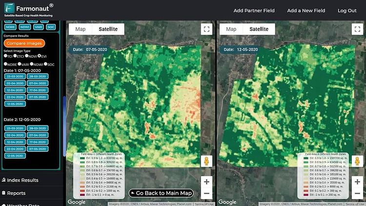
While Monitoring the farms, it is essential to observe how different parts of the field have shown growth changes through time to make better on-field decisions. This can be done through Farmonaut’s Web App by comparing two satellite images simultaneously. You can select any two dates of satellite visits and compare results side by side on the map of the Farmonaut web app itself. Try this out if you haven’t yet.
Happy Farming!
#webapp #newfeature #organicmatter #farming #organicfarming #crops #urbanfarming #fieldscouting #remotesensing #greentech #smartfarming #precisionagriculture #agro #agrotech #farm #agritech #vegetables #agriculture #foodsecurity #technology #greentech #satellite #vegetation #india #gis #soil #soilhealth #soc

