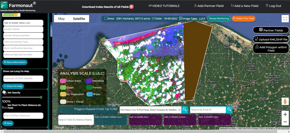
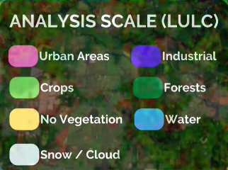
In the ever-evolving agricultural landscape, oil palm plantations play a ...
In the heart of America's breadbasket, Kansas hay farmers face ...
In the heartland of America, Kansas sorghum farmers face unique ...
In the heart of America's breadbasket, Kansas soybean farmers face ...
In the heartland of America, where corn fields stretch as ...
in the heart of America's breadbasket, Kansas wheat farmers face ...
In the heart of Arkansas, where wheat fields stretch as ...
In the heart of the Natural State, where corn fields ...
In the heart of Arkansas, where cotton fields stretch as ...
In the heart of the Natural State, where soybeans reign ...
In the heartland of American rice production, Arkansas farmers are ...
In the vast plains of Colorado, where sorghum fields stretch ...
In the vast agricultural landscape of Colorado, potato farmers are ...
In the vast plains of Colorado, where wheat fields stretch ...
In the vast plains and mountainous regions of Colorado, hay ...
In the vast cornfields of Colorado, where precision and efficiency ...
In the vast expanse of Texas farmlands, where wheat fields ...
In the vast agricultural landscape of Texas, where sorghum reigns ...
In the heart of Texas, where corn fields stretch as ...
In the vast expanses of Texas, where hay production is ...