POTATO MAPPING IN MADHYA PRADESH
by Farmonaut
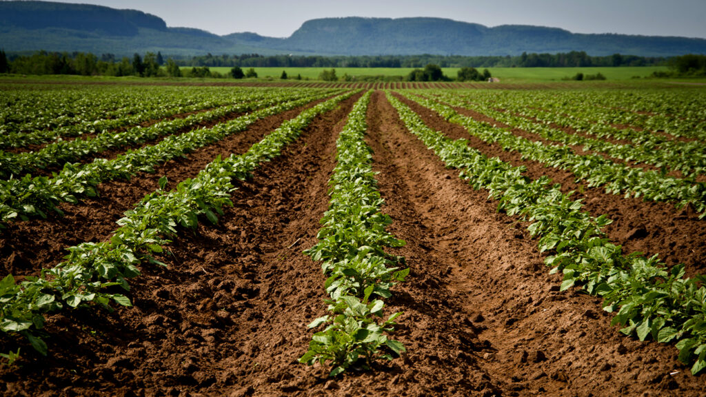
Potatoes are a staple crop in India and are grown extensively across the country. Madhya Pradesh, a state in central India, is one of the leading potato-producing states in the country with a total potato cultivation area of over 85,000 hectares. To ensure optimal potato farming and yield, it is important to have accurate information about the potato farms, including their location, size, and crop health. Keeping track of potato farms in Madhya Pradesh can be a challenging task, but with the help of advanced technology, it is now possible to map potato farms accurately. This is where the Farmonaut potato farm mapping service comes in.
Farmonaut is a digital agriculture company that offers a range of mapping services for farmers. The company uses satellite imagery and machine learning algorithms to provide farmers with accurate and up-to-date information about their crops, allowing them to make more informed decisions about planting, fertilizing, and harvesting.
Farmonaut has developed a potato farm mapping service that is tailored for the potato farmers of Madhya Pradesh. The service relies on high-quality satellite imagery to produce precise maps of potato fields, which encompass details about the condition of the soil, crop density, and overall health of the plants. These maps are further scrutinized by advanced machine learning algorithms to generate practical recommendations that farmers can use to enhance their potato cultivation procedures.
MERITS:
- Improved crop management
- Increased yields
- Enhanced sustainability
- Reduced costs
- Better decision making
“Potato farm mapping is a process of creating a visual representation of a potato farm, including the location of fields, soil types, water sources, drainage systems, and other features that can affect potato farming. This mapping is done using geographic information systems (GIS) and other mapping technologies that can help farmers make informed decisions about their production.”
Assets of Farmonaut's Potato Farm mapping Services
A significant advantage of the Farmonaut potato farm mapping service is that it furnishes farmers with current data about their crops. This empowers farmers to make well-informed decisions regarding planting, fertilization, and harvesting based on the latest details about the health and growth of their potato plants. As a result, farmers can enhance their crop yields and augment their profitability by leveraging this data to make critical decisions.
Moreover, the Farmonaut potato farm mapping service not only provides real-time information but also assists farmers in spotting any underperforming areas in their fields. Through analysis of data about soil health, crop density, and overall plant health, the service helps farmers to identify areas where crops may not be thriving and offers advice on how to tackle these concerns.
The purpose of potato farm mapping is to help farmers and other stakeholders make more informed decisions about potato production. By visualizing the layout and characteristics of a potato farm, farmers can identify areas where improvements can be made, optimize planting and irrigation strategies, and reduce the risk of crop loss due to factors such as pests, disease, or weather.
In other words, Potato farm mapping can be used to:
- track the progress of a crop over time
- monitor changes in soil or water quality
- identify areas of the farm that require maintenance or repair

Overall, the Farmonaut potato farm mapping service is a powerful tool for potato farmers in Madhya Pradesh. By providing real-time information and actionable insights, the service helps farmers to optimize their potato cultivation process, improve crop yields, and increase their profitability. As potato farming becomes increasingly competitive, services like this will be essential for farmers who want to stay ahead of the curve and succeed in this challenging industry.
Steps involved in the process of potato farm mapping and collecting ground truthing data for potato area estimation in Madhya Pradesh.
1. Planning and preparation
This step involves identifying the potato farming areas in Madhya Pradesh that need to be mapped. It may require coordination between agricultural departments, research institutions, and farmers’ associations. The necessary resources and personnel are allocated for the mapping project.
2. Field Visit and Data Collection
Trained personnel visit the potato farms in the identified areas. They carry out detailed field visits to collect data on various aspects of the farms. This includes using GPS devices or other accurate measurement tools to mark the boundaries of the potato fields.
3. Boundary marking and Field mapping
The personnel mark the boundaries of the potato fields using GPS coordinates or other precise measurements. This helps create an accurate representation of the fields on the map. The size and shape of each field are recorded, along with any distinguishing features or characteristics.
4. Data Recording
During the field visits, data on various farm features are recorded. This includes information on soil types, water sources, irrigation systems, drainage patterns, and any other relevant factors that can impact potato farming. The data is recorded systematically and in a standardized format to ensure consistency.
5. Data Analysis and Mapping
Once the field data is collected, it is compiled and analyzed. The collected data is then combined with remote sensing data, such as satellite imagery, to create detailed maps of each potato farm. GIS software or other mapping tools are used to process and visualize the data accurately.
6. Ground truthing validation
The ground truthing data collected during the field visits is compared and validated with the remote sensing data. This step helps ensure the accuracy and reliability of the mapping results. Any discrepancies or errors are identified and corrected to improve the quality of the potato farm maps.
7. Area Estimation
The accurate boundaries and features of the potato fields, along with the ground truthing data, are used to estimate the total area under potato cultivation in Madhya Pradesh. Statistical analysis or modeling techniques may be employed to extrapolate the data and provide reliable estimates of the potato crop’s area.
8. Utilization of mapping data
The generated potato farm maps and area estimation data are used by farmers, policymakers, researchers, and other stakeholders. Farmers can use the maps to make informed decisions about crop management, irrigation, and soil improvement. Policymakers can utilize the data for agricultural planning and resource allocation. Researchers can analyze the data to gain insights into potato farming practices and identify areas for improvement.
By following these steps, potato farm mapping in Madhya Pradesh allows for accurate estimation of the potato crop’s area and provides valuable information for farmers and stakeholders to enhance potato farming practices and productivity.
