Revolutionizing Agriculture: Harnessing Satellite Imagery and Vegetation Indices for Precision Crop Monitoring and Sustainable Farm Management
In the rapidly evolving world of agriculture, we at Farmonaut are at the forefront of a technological revolution that is transforming the way we approach farming. By harnessing the power of satellite imagery and advanced vegetation indices, we’re enabling farmers, agronomists, and agricultural stakeholders to monitor crops with unprecedented precision and manage farms more sustainably. This blog post delves into the intricate world of satellite-based agricultural intelligence, exploring how these technologies are reshaping the landscape of modern farming.
The Power of Satellite Imagery in Agriculture
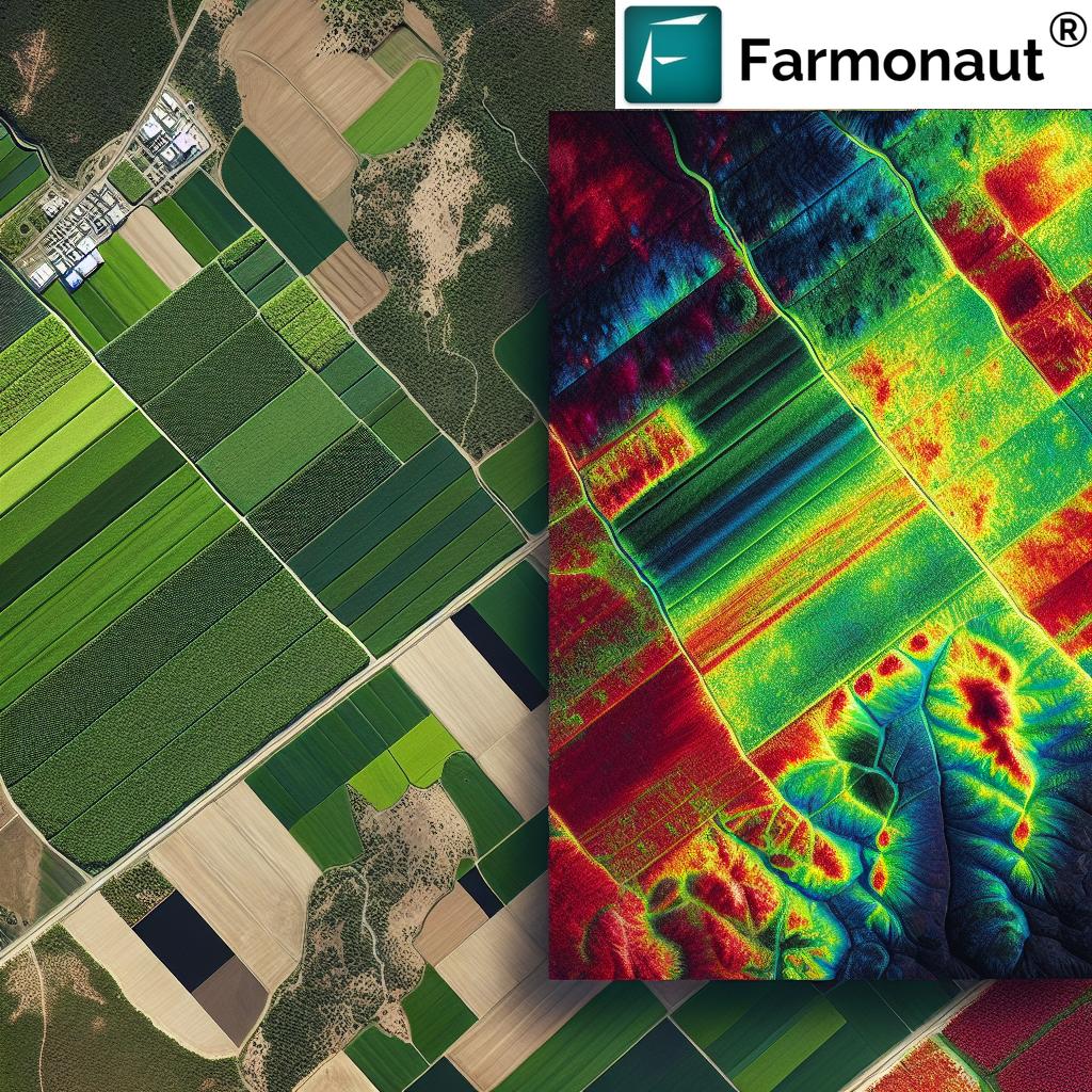
Satellite imagery has become an indispensable tool in modern agriculture. At Farmonaut, we utilize high-resolution satellite images to provide farmers with a bird’s-eye view of their fields. These images offer valuable insights into crop health, soil conditions, and overall farm performance.
Types of Satellite Imagery Used in Agriculture
- Multispectral Imagery: This type of imagery captures data from multiple bands of the electromagnetic spectrum, including visible light (red, green, blue) and near-infrared (NIR).
- Hyperspectral Imagery: Offering even more detailed spectral information, hyperspectral imagery can detect subtle changes in crop health and soil composition.
- Thermal Imagery: Used to measure surface temperatures, thermal imagery is particularly useful for assessing crop stress and water management.
Benefits of Satellite Imagery in Agriculture
- Large-scale Monitoring: Satellite imagery allows for the monitoring of vast agricultural areas, providing a comprehensive view of entire regions or countries.
- Temporal Analysis: Regular satellite passes enable the tracking of changes over time, crucial for understanding crop development and identifying issues early.
- Cost-effective: Compared to traditional ground-based surveys, satellite imagery offers a more economical solution for large-scale agricultural monitoring.
- Non-invasive: Satellite-based monitoring doesn’t require physical presence in the fields, reducing disturbance to crops and soil.
Understanding Vegetation Indices
Vegetation indices are mathematical combinations of different spectral bands that highlight specific features of vegetation. At Farmonaut, we use a variety of these indices to provide comprehensive insights into crop health and field conditions.
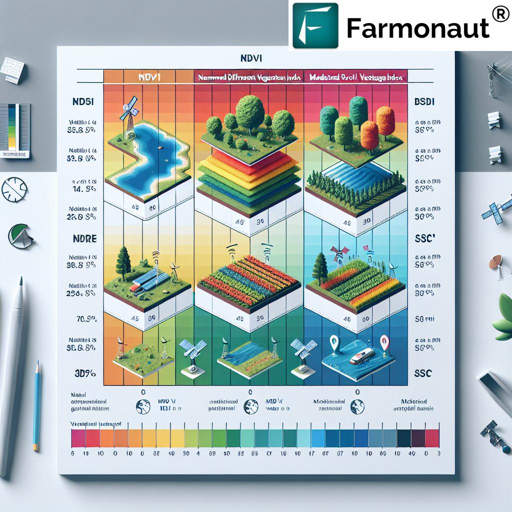
Key Vegetation Indices Used in Agriculture
| Index | Full Name | Application | Benefits |
|---|---|---|---|
| NDVI | Normalized Difference Vegetation Index | General crop health assessment | Identifies healthy vegetation and overall biomass |
| NDWI | Normalized Difference Water Index | Water content assessment | Helps in monitoring drought stress and irrigation needs |
| NDRE | Normalized Difference Red Edge | Nitrogen content assessment | Useful for fertilizer management and crop vigor analysis |
| MSAVI | Modified Soil Adjusted Vegetation Index | Vegetation monitoring in areas with exposed soil | Minimizes soil background influences for more accurate vegetation assessment |
| NDMI | Normalized Difference Moisture Index | Vegetation water content assessment | Helps in monitoring plant water stress and forest fire risk |
| NDSI | Normalized Difference Snow Index | Snow cover detection | Useful for monitoring snow melt and water resource management in agricultural areas |
NDVI: The Cornerstone of Vegetation Monitoring
The Normalized Difference Vegetation Index (NDVI) is perhaps the most widely used vegetation index in agriculture. At Farmonaut, we rely heavily on NDVI for its versatility and effectiveness in assessing crop health.
How NDVI Works
NDVI is calculated using the following formula:
NDVI = (NIR – Red) / (NIR + Red)
Where:
- NIR = reflectance in the near-infrared band
- Red = reflectance in the red band
Healthy vegetation absorbs most of the visible light that hits it and reflects a large portion of near-infrared light. Unhealthy or sparse vegetation reflects more visible light and less near-infrared light. This difference in reflectance patterns allows NDVI to effectively distinguish between healthy and stressed vegetation.
Applications of NDVI in Agriculture
- Crop Health Monitoring: NDVI helps identify areas of stress within fields, allowing for targeted interventions.
- Yield Prediction: By tracking NDVI values throughout the growing season, we can estimate potential crop yields.
- Drought Assessment: Changes in NDVI over time can indicate the onset and severity of drought conditions.
- Pest and Disease Detection: Sudden changes in NDVI can alert farmers to potential pest infestations or disease outbreaks.
Beyond NDVI: Exploring Other Vital Vegetation Indices
While NDVI is incredibly useful, at Farmonaut, we recognize that a single index cannot capture all aspects of crop health and field conditions. That’s why we employ a range of vegetation indices to provide a comprehensive view of agricultural landscapes.
NDWI: Assessing Water Content
The Normalized Difference Water Index (NDWI) is crucial for monitoring crop water stress and managing irrigation.
NDWI Formula:
NDWI = (Green – NIR) / (Green + NIR)
Applications of NDWI:
- Irrigation Management: NDWI helps identify areas that require more or less water, optimizing irrigation practices.
- Drought Monitoring: By tracking changes in NDWI over time, we can detect the onset and progression of drought conditions.
- Flood Mapping: NDWI is also useful for identifying areas affected by flooding, which is crucial for disaster response in agricultural regions.
NDRE: Focusing on Crop Vigor and Nitrogen Content
The Normalized Difference Red Edge (NDRE) index is particularly useful for assessing crop vigor and nitrogen content, making it invaluable for precision fertilizer management.
NDRE Formula:
NDRE = (NIR – Red Edge) / (NIR + Red Edge)
Benefits of NDRE:
- Nitrogen Management: NDRE is more sensitive to variations in chlorophyll content, making it excellent for assessing nitrogen levels in crops.
- Early Stress Detection: NDRE can detect stress in crops earlier than NDVI, allowing for more timely interventions.
- Yield Prediction: NDRE correlates well with crop biomass, making it useful for yield estimation.
MSAVI: Addressing Soil Background Effects
The Modified Soil Adjusted Vegetation Index (MSAVI) is designed to minimize the influence of soil background when assessing vegetation health, making it particularly useful in areas with sparse vegetation or exposed soil.
MSAVI Formula:
MSAVI = (2 * NIR + 1 – sqrt((2 * NIR + 1)^2 – 8 * (NIR – Red))) / 2
Advantages of MSAVI:
- Improved Accuracy: MSAVI provides more accurate vegetation assessments in areas with significant soil exposure.
- Early Growth Monitoring: It’s particularly useful for monitoring crop emergence and early growth stages.
- Arid Region Analysis: MSAVI is valuable for agricultural monitoring in semi-arid and arid regions where soil background effects are prominent.
Integrating Vegetation Indices for Comprehensive Agricultural Intelligence
At Farmonaut, we understand that the true power of vegetation indices lies in their integration. By combining multiple indices, we provide farmers and agricultural stakeholders with a holistic view of their fields.
Multi-Index Analysis for Precision Agriculture
Our approach involves analyzing multiple vegetation indices simultaneously to gain comprehensive insights:
- Crop Health Assessment: Combining NDVI, NDRE, and MSAVI provides a nuanced understanding of crop vigor, nitrogen content, and overall health.
- Water Management: Integrating NDWI with other indices helps optimize irrigation strategies while considering overall crop health.
- Stress Detection: By analyzing patterns across different indices, we can differentiate between various types of crop stress, such as water stress, nutrient deficiencies, or pest infestations.
Temporal Analysis for Trend Identification
We don’t just look at single snapshots; our platform tracks changes in vegetation indices over time, allowing for:
- Growth Stage Monitoring: Tracking index values throughout the growing season helps identify key growth stages and potential issues.
- Long-term Trend Analysis: By comparing data across multiple growing seasons, we can identify long-term trends in field performance and environmental changes.
- Anomaly Detection: Sudden changes in index values can alert farmers to potential problems, enabling rapid response.
Advanced Applications of Satellite-Based Agricultural Intelligence
The integration of satellite imagery and vegetation indices opens up a world of advanced applications in agriculture. At Farmonaut, we’re continually exploring new ways to leverage this technology for the benefit of farmers and the agricultural industry as a whole.
Precision Agriculture and Variable Rate Applications
By providing detailed, spatially explicit information about crop and soil conditions, our satellite-based intelligence enables precision agriculture practices:
- Variable Rate Fertilization: Using NDRE and other indices, farmers can apply fertilizers at variable rates across their fields, optimizing nutrient use and reducing waste.
- Targeted Irrigation: NDWI-based maps allow for precise irrigation management, ensuring water is applied where it’s needed most.
- Selective Harvesting: By identifying areas of higher crop quality or maturity, farmers can optimize their harvesting strategies.
Crop Yield Forecasting and Risk Assessment
Our advanced analytics combine historical data with current vegetation indices to provide valuable insights:
- Yield Prediction Models: By analyzing NDVI and other indices throughout the growing season, we can provide increasingly accurate yield forecasts.
- Risk Mapping: Identifying areas prone to stress or poor performance helps in risk assessment and mitigation planning.
- Insurance Support: Our data aids in crop insurance assessments, providing objective measures of crop health and potential losses.
Environmental Monitoring and Sustainability
Beyond direct agricultural applications, our satellite-based intelligence contributes to broader environmental monitoring efforts:
- Carbon Sequestration Assessment: By monitoring vegetation health and density, we can estimate carbon sequestration in agricultural lands.
- Biodiversity Monitoring: Analyzing vegetation patterns helps in assessing habitat quality and biodiversity in agricultural landscapes.
- Climate Change Impact Studies: Long-term vegetation index trends provide valuable data for studying the impacts of climate change on agriculture.
Challenges and Future Directions in Satellite-Based Agricultural Intelligence
While satellite-based agricultural intelligence offers immense potential, it also comes with challenges that we at Farmonaut are actively addressing:
Current Challenges
- Cloud Cover: Optical satellite imagery is affected by cloud cover, which can limit data availability in some regions.
- Resolution Limitations: While improving, the spatial resolution of freely available satellite imagery may not be sufficient for all applications.
- Data Integration: Combining satellite data with ground-based sensors and other data sources remains a complex task.
- Interpretation Complexity: Translating satellite-derived indices into actionable insights requires expertise and sophisticated algorithms.
Future Directions and Innovations
At Farmonaut, we’re excited about the future of satellite-based agricultural intelligence. Some areas we’re focusing on include:
- AI and Machine Learning: Developing more advanced algorithms to interpret satellite data and provide even more accurate and timely insights.
- Hyperspectral Imaging: Exploring the use of hyperspectral satellite data for even more detailed crop and soil analysis.
- Integration with IoT: Combining satellite data with ground-based IoT sensors for a more comprehensive view of field conditions.
- Real-time Analytics: Working towards providing near-real-time insights to farmers, enabling rapid response to changing conditions.
- Customized Indices: Developing crop-specific and region-specific vegetation indices for more targeted analysis.
Conclusion: Empowering Sustainable Agriculture Through Satellite Intelligence
As we navigate the challenges of feeding a growing global population in the face of climate change and resource constraints, satellite-based agricultural intelligence emerges as a powerful tool for sustainable and efficient farming. At Farmonaut, we’re committed to harnessing this technology to empower farmers, agronomists, and agricultural stakeholders with the insights they need to make informed decisions.
By combining advanced satellite imagery with sophisticated vegetation indices and cutting-edge analytics, we’re not just monitoring crops; we’re revolutionizing the way agriculture is practiced. From optimizing resource use to predicting yields and managing risks, our technology is helping to create a more resilient and sustainable agricultural sector.
As we look to the future, we see endless possibilities for satellite-based agricultural intelligence. With ongoing advancements in satellite technology, data analytics, and artificial intelligence, we’re poised to unlock even greater insights and drive further innovations in precision agriculture.
We invite you to join us on this exciting journey towards a more intelligent, efficient, and sustainable agricultural future. Whether you’re a farmer looking to optimize your operations, an agronomist seeking advanced analytical tools, or an agricultural stakeholder interested in cutting-edge farm management solutions, Farmonaut is here to support you with state-of-the-art satellite-based agricultural intelligence.
Explore our services and see how we can help you transform your agricultural practices:
- Try our app for comprehensive farm monitoring and management.
- Integrate our satellite and weather data API into your existing systems.
- Download our mobile app for on-the-go farm management:
- For developers, check out our API documentation to start building with our data.
Together, let’s cultivate a smarter, more sustainable future for agriculture.
FAQs
- Q: What is satellite-based agricultural intelligence?
A: Satellite-based agricultural intelligence involves using satellite imagery and advanced analytics to monitor crop health, soil conditions, and overall farm performance. It provides farmers with valuable insights to optimize their agricultural practices. - Q: How accurate are vegetation indices like NDVI?
A: Vegetation indices like NDVI are highly accurate for assessing relative crop health and vigor. However, their absolute values can be affected by factors such as atmospheric conditions and sensor calibration. At Farmonaut, we use advanced processing techniques to ensure high accuracy. - Q: Can satellite imagery replace ground-based crop monitoring?
A: While satellite imagery provides valuable large-scale insights, it’s most effective when used in conjunction with ground-based monitoring. The two approaches complement each other, offering a comprehensive view of crop health and field conditions. - Q: How often is satellite imagery updated?
A: The frequency of satellite imagery updates depends on the satellite system used. At Farmonaut, we typically provide updates every 3-5 days, depending on cloud cover and satellite availability. - Q: Is satellite-based monitoring suitable for small farms?
A: Yes, satellite-based monitoring can be beneficial for farms of all sizes. While it’s particularly powerful for large-scale operations, small farmers can also gain valuable insights into their crop health and field conditions. - Q: How does cloud cover affect satellite imagery?
A: Cloud cover can obstruct optical satellite sensors, potentially limiting data availability. However, we use advanced cloud-detection algorithms and, when necessary, integrate data from multiple satellite passes to ensure consistent coverage. - Q: Can satellite imagery detect specific crop diseases?
A: While satellite imagery can detect changes in crop health that may indicate disease, it typically can’t identify specific diseases. However, it can alert farmers to potential issues, allowing for targeted ground inspections. - Q: How does Farmonaut ensure data privacy and security?
A: At Farmonaut, we take data privacy and security seriously. We use industry-standard encryption and security protocols to protect all farm data. Our systems are designed to ensure that each user’s data is kept confidential and secure. - Q: Can satellite-based intelligence help with organic farming?
A: Absolutely. Satellite-based intelligence can be particularly valuable for organic farmers by helping monitor crop health without the need for chemical inputs, identifying areas that may require attention, and optimizing resource use. - Q: How does climate change impact the effectiveness of satellite-based agricultural monitoring?
A: Climate change can affect crop growth patterns and introduce new stressors, making accurate monitoring even more crucial. Our systems are continually updated to account for changing environmental conditions, ensuring that our insights remain relevant and accurate in the face of climate change.