Revolutionizing Agriculture: The Power of Precision Farming and Satellite Imagery
In the ever-evolving world of agriculture, we’re witnessing a remarkable transformation. The integration of cutting-edge technology with traditional farming practices is ushering in a new era of efficiency, sustainability, and productivity. At the forefront of this revolution is precision agriculture, a game-changing approach that’s reshaping how we cultivate our land and manage our resources.
As experts in the field, we at Farmonaut are excited to share our insights on how satellite imagery and advanced remote sensing techniques are revolutionizing the agricultural landscape. In this comprehensive guide, we’ll explore the intricate world of modern farming, delving into the technologies and strategies that are boosting crop yields, enhancing soil health, and paving the way for a more sustainable future in agriculture.
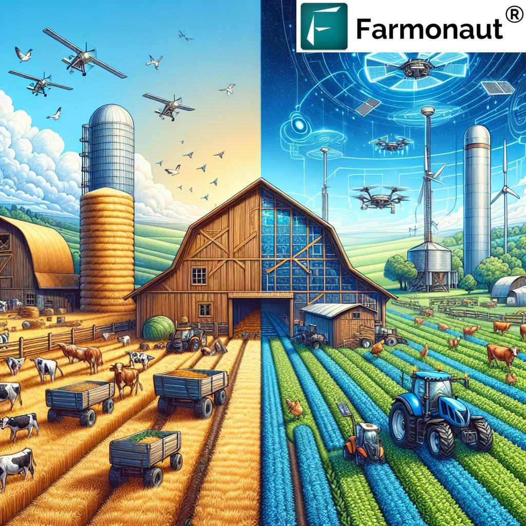
The Evolution of Farming: From Traditional to Smart
Throughout history, farming has been the backbone of human civilization. From the earliest days of agriculture to the present, farmers have continually sought ways to improve their yields and efficiency. However, the advent of technology in recent decades has accelerated this progress at an unprecedented rate.
Traditional farming methods, while time-tested, often rely on generalized approaches and intuition. In contrast, smart farming leverages data-driven insights and precision technologies to optimize every aspect of crop production. This shift represents a quantum leap in agricultural practices, allowing farmers to make more informed decisions and maximize their resources.
Understanding Precision Agriculture
Precision agriculture is a farming management concept that uses digital techniques to monitor and optimize agricultural production processes. At its core, it’s about doing the right thing, in the right place, at the right time, and in the right way. This approach allows farmers to:
- Increase crop productivity
- Reduce production costs
- Minimize environmental impact
- Improve the quality and quantity of agricultural products
By leveraging technologies such as satellite imagery, GPS guidance, control systems, sensors, robotics, drones, autonomous vehicles, variable rate technology, and farm management software, precision agriculture enables a more accurate and controlled approach to cultivation and crop management.
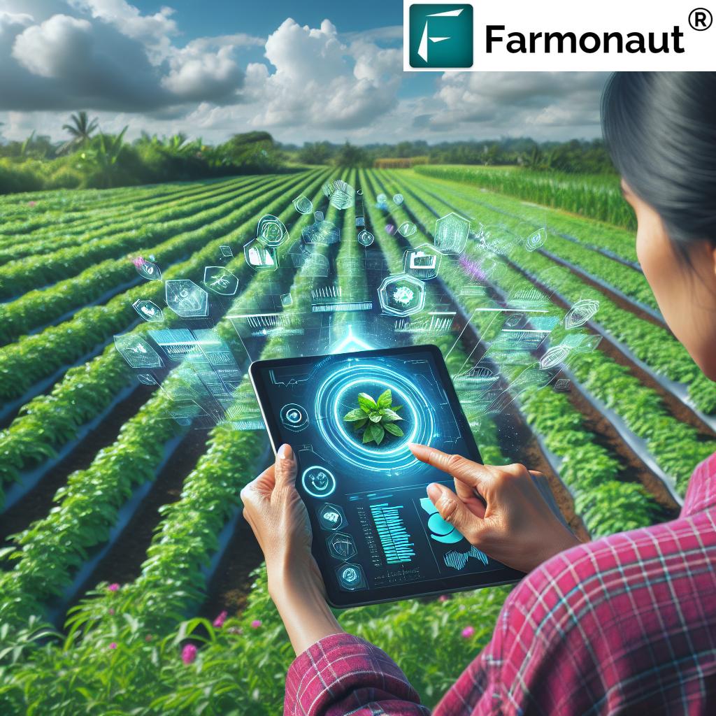
The Role of Satellite Imagery in Modern Farming
Satellite imagery has emerged as a cornerstone of precision agriculture. These high-resolution images from space provide farmers with a bird’s-eye view of their fields, offering invaluable insights that were previously unattainable. Here’s how satellite imagery is transforming agriculture:
1. Crop Health Monitoring
One of the most significant applications of satellite imagery in agriculture is crop health monitoring. Advanced sensors on satellites can detect subtle changes in plant reflectance, which are indicative of various health conditions. The Normalized Difference Vegetation Index (NDVI) is a key metric derived from satellite data that quantifies vegetation health and density.
By regularly analyzing NDVI values, farmers can:
- Identify areas of stress in crops before they become visible to the naked eye
- Detect pest infestations and diseases early
- Monitor crop growth stages
- Assess the effectiveness of applied treatments
This proactive approach to crop health management allows for timely interventions, potentially saving entire harvests from devastating losses.
2. Precision Irrigation
Water scarcity is a growing concern in many agricultural regions. Satellite-based remote sensing technologies offer innovative solutions for efficient irrigation management. By analyzing multispectral imagery, we can assess soil moisture levels and crop water stress across vast areas.
This information enables farmers to:
- Implement targeted irrigation strategies
- Reduce water waste
- Optimize water usage for different crop types and growth stages
- Identify and address irrigation system inefficiencies
The result is not only water conservation but also improved crop quality and yield, as plants receive precisely the amount of water they need, when they need it.
3. Fertilizer Application Optimization
Efficient fertilizer use is crucial for both economic and environmental reasons. Satellite imagery, combined with soil analysis and crop growth models, allows for the creation of detailed nutrient maps. These maps guide variable-rate fertilizer applications, ensuring that each part of the field receives the optimal amount of nutrients.
Benefits of precision fertilizer application include:
- Reduced fertilizer costs
- Minimized environmental impact from excess nutrient runoff
- Improved crop quality and yield uniformity
- Enhanced soil health through balanced nutrient management
4. Yield Prediction and Harvest Planning
Accurate yield prediction is vital for farm planning, market forecasting, and food security assessments. Satellite imagery, coupled with machine learning algorithms, provides increasingly accurate yield estimates weeks or even months before harvest.
This technology enables:
- Better harvest timing decisions
- Improved logistics and storage planning
- More informed market decisions for farmers
- Enhanced food supply chain management
By leveraging these predictive insights, farmers can optimize their harvesting operations and maximize the value of their crops.
Weather Monitoring and Climate Adaptation
In an era of climate change, accurate weather monitoring and forecasting have become more critical than ever for agriculture. Satellite-based weather monitoring systems provide farmers with:
- High-resolution, real-time weather data
- Short-term and seasonal weather forecasts
- Climate trend analysis for long-term planning
This information is crucial for:
- Optimizing planting and harvesting schedules
- Managing frost risks
- Planning for extreme weather events
- Adapting crop varieties and farming practices to changing climate patterns
By integrating weather data with other farm data, farmers can make more informed decisions that mitigate risks and capitalize on favorable conditions.
Pest Management in the Age of Precision Agriculture
Effective pest management is crucial for protecting crops and ensuring high yields. Precision agriculture technologies, including satellite imagery and ground-based sensors, are revolutionizing how we approach this challenge. Here’s how:
Early Detection and Monitoring
Satellite imagery can detect subtle changes in crop health that may indicate pest infestations before they become visible to the human eye. By analyzing spectral signatures, we can:
- Identify areas of stress in crops that may be caused by pests
- Monitor the spread of infestations over time
- Assess the effectiveness of pest control measures
Targeted Treatment
With precise information about pest locations and severity, farmers can implement targeted treatment strategies. This approach:
- Reduces the overall use of pesticides
- Minimizes environmental impact
- Lowers costs associated with pest control
- Helps prevent the development of pesticide resistance in pest populations
Integrated Pest Management (IPM)
Precision agriculture technologies support the implementation of Integrated Pest Management strategies. IPM combines various pest control methods to manage pest populations in an environmentally sensitive and economically sound manner. Satellite data and other precision farming tools contribute to IPM by:
- Providing data for predictive pest models
- Facilitating the timely application of biological control agents
- Supporting decision-making for crop rotation and other cultural control methods
Soil Health and Management
Healthy soil is the foundation of productive agriculture. Precision farming techniques, including satellite-based remote sensing, are providing unprecedented insights into soil health and enabling more effective management practices.
Soil Mapping
High-resolution satellite imagery, combined with on-ground sampling and analysis, allows for the creation of detailed soil maps. These maps provide information on:
- Soil type and texture
- Organic matter content
- Nutrient levels
- pH levels
- Salinity
This comprehensive view of soil conditions across a field or farm enables targeted management strategies that optimize soil health and crop productivity.
Precision Soil Management
With detailed soil maps and ongoing monitoring, farmers can implement precision soil management practices such as:
- Variable-rate fertilizer application based on soil nutrient needs
- Targeted soil amendments to address specific deficiencies or imbalances
- Precision tillage practices that minimize soil disturbance
- Optimized crop rotation plans that promote soil health
Erosion Monitoring and Prevention
Satellite imagery plays a crucial role in monitoring and preventing soil erosion. By analyzing changes in land cover and topography over time, we can:
- Identify areas at risk of erosion
- Monitor the effectiveness of erosion control measures
- Plan and implement targeted conservation practices
The Role of Big Data in Agriculture
The integration of various data sources, including satellite imagery, weather data, soil sensors, and historical yield information, has given rise to the era of big data in agriculture. This wealth of farm data is transforming how decisions are made on the farm and across the agricultural supply chain.
Data-Driven Decision Making
By analyzing large datasets, farmers and agricultural professionals can:
- Identify patterns and trends that inform long-term planning
- Make more accurate predictions about crop yields and market conditions
- Optimize resource allocation for maximum efficiency
- Develop tailored strategies for each field or even specific zones within fields
Predictive Analytics
Advanced analytics and machine learning algorithms are being applied to agricultural data to:
- Predict pest and disease outbreaks
- Forecast crop yields with increasing accuracy
- Optimize planting and harvesting schedules
- Anticipate equipment maintenance needs
Challenges and Opportunities
While the potential of big data in agriculture is immense, there are challenges to overcome, including:
- Data standardization and interoperability
- Data privacy and security concerns
- The need for user-friendly interfaces that make data accessible to farmers
- Ensuring equitable access to data and technology across different scales of farming operations
Addressing these challenges will be crucial for realizing the full potential of big data in transforming agriculture.
Sustainable Farming Practices Enabled by Technology
Sustainable farming is no longer just an ideal; it’s becoming a necessity as we face the challenges of climate change, resource depletion, and growing food demand. Precision agriculture technologies are playing a pivotal role in making sustainable farming practices more achievable and economically viable.
Resource Efficiency
Precision agriculture enables significant improvements in resource efficiency:
- Water Conservation: Precision irrigation systems reduce water waste by up to 30%
- Fertilizer Optimization: Variable-rate application can reduce fertilizer use by 20-30% while maintaining or improving yields
- Energy Savings: Optimized field operations reduce fuel consumption and greenhouse gas emissions
Soil Conservation
Sustainable soil management practices supported by precision agriculture include:
- Reduced tillage or no-till farming, guided by precise soil data
- Cover cropping strategies optimized for specific field conditions
- Targeted soil amendments to improve soil health and carbon sequestration
Biodiversity Preservation
Precision farming techniques contribute to biodiversity preservation by:
- Minimizing chemical inputs that can harm beneficial insects and wildlife
- Enabling precision conservation, where less productive areas of fields are set aside for natural habitats
- Supporting integrated pest management strategies that reduce reliance on broad-spectrum pesticides
Climate-Smart Agriculture
The data and insights provided by precision agriculture technologies are essential for implementing climate-smart agricultural practices:
- Adaptation: Farmers can adjust planting dates, crop varieties, and management practices based on changing climate patterns
- Mitigation: Precision techniques help reduce greenhouse gas emissions from agriculture
- Resilience: Improved resource management and diversification strategies enhance farm resilience to climate shocks
The Economic Impact of Precision Agriculture
While the environmental benefits of precision agriculture are clear, its economic impact is equally significant. For farmers adopting these technologies, the potential for increased profitability comes from multiple sources:
Increased Yields
Precision agriculture techniques have been shown to increase crop yields by:
- Optimizing plant health through precise nutrient and water management
- Reducing crop losses due to pests, diseases, and environmental stresses
- Enabling better timing of planting and harvesting operations
Cost Reduction
Significant cost savings can be achieved through:
- Reduced input costs (water, fertilizer, pesticides)
- Lower labor costs through automation and optimized operations
- Decreased fuel consumption due to more efficient field operations
Improved Product Quality
Precision management often leads to higher quality crops, which can command premium prices in the market. This is achieved through:
- More uniform crop growth and maturity
- Reduced stress on plants, leading to better flavor and nutritional content
- Precise timing of harvest to optimize quality
Risk Management
Precision agriculture technologies provide tools for better risk management:
- Early detection of crop health issues allows for timely interventions
- Improved weather forecasting and monitoring help mitigate climate-related risks
- Data-driven decision-making reduces the uncertainty in farming operations
The Future of Agriculture: Trends and Innovations
As we look to the future, several emerging trends and innovations are set to further transform agriculture:
Artificial Intelligence and Machine Learning
AI and machine learning algorithms are becoming increasingly sophisticated, offering potential for:
- Automated crop and pest identification from satellite and drone imagery
- Predictive modeling for yield forecasting and risk assessment
- Robotic systems for planting, weeding, and harvesting
Internet of Things (IoT) in Agriculture
The proliferation of IoT devices is creating a more connected farm environment:
- Smart sensors for real-time monitoring of soil conditions, crop health, and weather
- Automated irrigation and fertigation systems
- Connected farm equipment for optimized fleet management
Vertical Farming and Urban Agriculture
As urbanization continues, new forms of agriculture are emerging:
- Vertical farms using LED lighting and hydroponic systems
- Rooftop gardens and urban greenhouses
- Integration of agriculture into smart city planning
Gene Editing and Biotechnology
Advances in genetic technologies are opening new possibilities:
- Development of crop varieties with enhanced resilience to climate change
- Improved nutritional profiles of staple crops
- Reduced environmental impact through pest-resistant varieties
Blockchain in Agriculture
Blockchain technology is being explored for various agricultural applications:
- Enhancing traceability in the food supply chain
- Facilitating fair trade and transparent pricing
- Improving the efficiency of agricultural insurance and financing
Farmonaut’s Role in the Agricultural Revolution
At Farmonaut, we’re proud to be at the forefront of this agricultural revolution. Our platform integrates cutting-edge satellite technology with advanced analytics to provide farmers with actionable insights for improved crop management and sustainable farming practices.
Key Features of Farmonaut’s Platform
- Real-time crop health monitoring using NDVI and other vegetation indices
- Precision irrigation management based on satellite-derived soil moisture data
- Weather forecasting and historical weather data analysis
- Yield prediction and harvest optimization tools
- Pest and disease early warning system
By leveraging these tools, farmers can make data-driven decisions that lead to increased yields, reduced input costs, and more sustainable farming practices.
Accessibility and Ease of Use
We understand that technology is only valuable if it’s accessible and easy to use. That’s why we’ve designed our platform with the user in mind:
- User-friendly mobile app for on-the-go access to farm data
- Intuitive web interface for detailed analysis and planning
- Integration with existing farm management software
- Customizable alerts and notifications for critical farm events
Our goal is to empower farmers of all scales with the tools they need to thrive in the era of precision agriculture.
Continuous Innovation
At Farmonaut, we’re committed to ongoing research and development to stay at the cutting edge of agricultural technology. Our team of agronomists, data scientists, and software engineers work tirelessly to:
- Improve the accuracy and reliability of our satellite-based insights
- Develop new features based on user feedback and emerging agricultural needs
- Explore the integration of new technologies like AI and blockchain into our platform
Comparing Traditional Farming with Farmonaut’s Precision Farming Approach
To illustrate the transformative impact of precision agriculture, let’s compare traditional farming methods with the advanced techniques enabled by Farmonaut’s satellite-based solutions:
| Aspect | Traditional Farming | Farmonaut’s Precision Farming |
|---|---|---|
| Crop Monitoring | Visual inspection, time-consuming field walks | Real-time satellite imagery, NDVI analysis, automated alerts |
| Irrigation Management | Uniform watering, often based on intuition or simple schedules | Precision irrigation based on satellite-derived soil moisture data and crop water stress analysis |
| Fertilizer Application | Uniform application across fields | Variable-rate application based on detailed nutrient maps and crop needs |
| Pest Control | Routine, often preventative spraying | Targeted pest management based on early detection and precision application |
| Yield Prediction | Based on historical averages and visual estimates | AI-powered yield prediction using satellite data, weather information, and historical trends |
| Weather Monitoring | Reliance on general forecasts | Field-specific weather data and forecasts, integration with farm management decisions |
| Resource Efficiency | Often inefficient use of water, fertilizers, and pesticides | Optimized resource use, reducing waste and environmental impact |
| Data Management | Manual record-keeping, limited data analysis | Automated data collection, advanced analytics, and actionable insights |
This comparison clearly demonstrates how Farmonaut’s precision farming approach offers superior efficiency, sustainability, and productivity compared to conventional methods.
Getting Started with Precision Agriculture
For farmers looking to adopt precision agriculture techniques, getting started may seem daunting. However, with the right approach and tools, the transition can be smooth and rewarding. Here are some steps to consider:
1. Assess Your Current Operations
- Evaluate your current farming practices and identify areas for improvement
- Consider your farm’s specific challenges and goals
- Assess your technical readiness and willingness to adopt new technologies
2. Start with Satellite Imagery
Satellite-based crop monitoring is an excellent entry point into precision agriculture:
- It requires minimal on-farm hardware investment
- Provides immediate insights into crop health and field variability
- Scales easily from small plots to large farms
3. Implement Data-Driven Decision Making
- Begin using farm management software to track and analyze your operations
- Integrate weather data into your planning and decision-making processes
- Use yield maps and soil analysis to inform your management strategies
4. Gradual Technology Adoption
Start with basic precision agriculture tools and gradually expand:
- Begin with GPS-guided machinery for more precise field operations
- Implement variable-rate technology for fertilizer and pesticide applications
- Explore precision irrigation systems as you become more comfortable with the technology
5. Seek Education and Support
- Attend workshops and webinars on precision agriculture techniques
- Consult with agricultural extension services or precision ag specialists
- Join farmer networks or cooperatives that focus on technology adoption
6. Start with Farmonaut
Farmonaut offers an accessible entry point into precision agriculture:
- Sign up for a free trial to explore our satellite-based crop monitoring tools
- Utilize our mobile app for easy access to farm data on the go
- Take advantage of our customer support and training resources
To get started with Farmonaut, visit our app redirect page or download our app from the Google Play Store or the Apple App Store.
Frequently Asked Questions (FAQ)
As we explore the world of precision agriculture and satellite-based farming solutions, many questions arise. Here are some of the most frequently asked questions we encounter:
Q: What is precision agriculture?
A: Precision agriculture is a farming management concept that uses digital techniques and data to monitor and optimize agricultural production processes. It aims to do the right thing, in the right place, at the right time, and in the right way, leading to increased efficiency and sustainability in farming practices.
Q: How does satellite imagery help in agriculture?
A: Satellite imagery provides valuable insights for agriculture by offering a bird’s-eye view of fields. It helps in crop health monitoring, irrigation management, yield prediction, and early detection of pest and disease outbreaks. This technology allows farmers to make data-driven decisions for better crop management.
Q: What is NDVI and why is it important for farmers?
A: NDVI (Normalized Difference Vegetation Index) is a measure of plant health derived from satellite imagery. It’s important for farmers because it provides a quick and accurate assessment of crop vigor, allowing for early detection of stress factors and more efficient crop management.
Q: How can precision agriculture improve crop yields?
A: Precision agriculture can improve crop yields by enabling more targeted and efficient use of resources such as water, fertilizers, and pesticides. It also allows for early detection and management of crop health issues, optimized planting and harvesting schedules, and better overall farm management based on data-driven insights.
Q: Is precision agriculture only for large farms?
A: No, precision agriculture can benefit farms of all sizes. While some technologies may have been initially developed for larger operations, many tools, especially satellite-based solutions like Farmonaut, are scalable and accessible to small and medium-sized farms as well.
Q: How does weather monitoring integrate with precision agriculture?
A: Weather monitoring is a crucial component of precision agriculture. It provides farmers with accurate, localized weather data and forecasts, which are essential for making informed decisions about planting, irrigation, pest management, and harvesting. This integration helps farmers optimize their operations and mitigate weather-related risks.
Q: What are the environmental benefits of precision agriculture?
A: Precision agriculture offers several environmental benefits, including reduced use of water, fertilizers, and pesticides, which leads to less environmental pollution. It also promotes soil health, reduces greenhouse gas emissions from farm operations, and can help in preserving biodiversity.
Q: How does Farmonaut’s platform work?
A: Farmonaut’s platform uses satellite imagery and advanced analytics to provide farmers with real-time insights about their crops. It offers features such as crop health monitoring, precision irrigation management, weather forecasting, and yield prediction. Farmers can access this information through a user-friendly mobile app or web interface.
Q: Is it difficult to transition to precision agriculture techniques?
A: While transitioning to precision agriculture does involve a learning curve, it doesn’t have to be difficult. Many tools, like Farmonaut, are designed to be user-friendly and can be adopted gradually. Starting with satellite-based crop monitoring is often an easy and effective first step.
Q: How can I get started with Farmonaut?
A: Getting started with Farmonaut is easy. You can sign up for a free trial on our website, download our mobile app, or contact our team for a demonstration. We offer customer support and training resources to help you make the most of our precision agriculture tools.
Conclusion: Embracing the Future of Agriculture
As we’ve explored throughout this comprehensive guide, the integration of precision agriculture technologies, particularly satellite-based solutions, is revolutionizing the farming landscape. From enhancing crop yields and optimizing resource use to promoting sustainability and resilience, these innovations are paving the way for a more efficient and environmentally friendly agricultural sector.
At Farmonaut, we’re committed to making these transformative technologies accessible to farmers of all scales. Our platform combines cutting-edge satellite imagery with user-friendly interfaces and powerful analytics to provide actionable insights for improved farm management.
As we look to the future, the potential for further advancements in agricultural technology is immense. From artificial intelligence and machine learning to the Internet of Things and blockchain, new innovations continue to emerge, promising even greater efficiencies and possibilities for the world of farming.
We invite you to join us on this exciting journey towards a more sustainable and productive agricultural future. Whether you’re a small-scale farmer looking to optimize your operations or a large agribusiness seeking to implement cutting-edge technologies, Farmonaut is here to support your precision agriculture needs.
To learn more about how Farmonaut can transform your farming practices, visit our website or reach out to our team of experts. Together, we can cultivate a smarter, more sustainable future for agriculture.
Ready to take the next step in precision agriculture? Explore our subscription options below: