Satellite-Powered Crop Management: Revolutionizing Agriculture with Advanced Monitoring Technologies
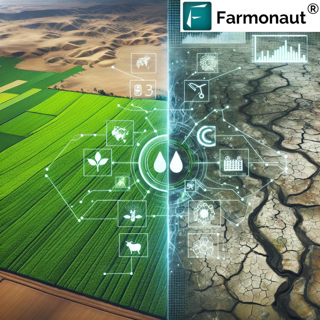
In the ever-evolving landscape of modern agriculture, we find ourselves at the forefront of a technological revolution that is transforming the way we approach crop management and resource utilization. At Farmonaut, we are proud to be pioneers in this field, offering cutting-edge solutions that harness the power of satellite technology to provide farmers and agronomists with unprecedented insights into their fields and forests.
The Evolution of Agricultural Monitoring
For centuries, farmers have relied on traditional methods to monitor their crops and manage their resources. However, as we face increasing challenges such as climate change, water scarcity, and the need for sustainable practices, it has become clear that we need more advanced tools to ensure food security for a growing global population.
This is where satellite-powered crop management comes into play. By leveraging state-of-the-art geospatial technologies, we can now offer farmers a comprehensive view of their agricultural operations, from soil moisture levels to carbon sequestration potential.
The Power of Satellite Imagery in Agriculture
Satellite imagery has revolutionized the way we approach agricultural monitoring. With regular, high-resolution images of vast areas, we can now detect changes in crop health, soil conditions, and water availability with unprecedented accuracy and timeliness.
- Real-time crop health assessment
- Early detection of pest infestations and diseases
- Precise irrigation management
- Optimal fertilizer application
- Yield prediction and harvest planning
These capabilities allow farmers to make informed decisions quickly, reducing waste and maximizing productivity while minimizing environmental impact.
Soil Moisture Monitoring: The Foundation of Precision Agriculture
One of the most critical aspects of modern crop management is the accurate monitoring of soil moisture. Traditional methods often relied on manual sampling or in-field sensors, which can be time-consuming and provide limited coverage. With satellite-based monitoring, we can now offer comprehensive soil moisture maps that cover entire fields or regions.
Our advanced algorithms process multispectral satellite imagery to estimate soil moisture content with remarkable accuracy. This information is crucial for:
- Optimizing irrigation schedules
- Preventing water stress in crops
- Reducing water waste and runoff
- Improving fertilizer efficiency
- Enhancing overall crop yield and quality
By providing farmers with this vital data, we enable them to make precise decisions about water management, ensuring that crops receive exactly what they need, when they need it.
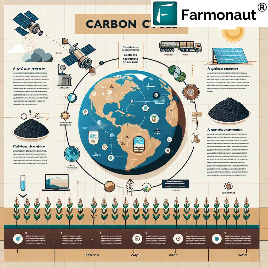
Carbon Monitoring and Sequestration
In the face of global climate change, the role of agriculture in carbon sequestration has become increasingly important. Our satellite-based monitoring systems allow us to track organic carbon levels in soils and vegetation, providing valuable insights into the carbon cycle within agricultural ecosystems.
This capability is essential for:
- Assessing the effectiveness of carbon-sequestering practices
- Monitoring the impact of different tillage methods on soil carbon
- Calculating carbon credits for sustainable farming practices
- Guiding policy decisions on agricultural carbon management
By quantifying carbon storage in agricultural lands, we empower farmers to participate in carbon markets and contribute to global climate mitigation efforts.
Water Resource Management in Agriculture
Water is the lifeblood of agriculture, and effective water resource management is crucial for sustainable farming. Our satellite-based systems provide comprehensive data on:
- Surface water availability
- Groundwater recharge rates
- Evapotranspiration levels
- Precipitation patterns
This information allows farmers and water managers to:
- Allocate water resources more efficiently
- Plan for drought conditions
- Implement water conservation measures
- Optimize crop selection based on water availability
By providing a holistic view of water resources, we help ensure that this precious commodity is used sustainably in agricultural operations.
Forest Resource Monitoring
While much of our focus is on croplands, we also recognize the critical role that forests play in global ecosystems and climate regulation. Our satellite monitoring capabilities extend to forest resources, allowing us to track:
- Deforestation rates
- Forest health and biodiversity
- Carbon sequestration in forest ecosystems
- The impact of climate change on forest composition
This information is invaluable for:
- Conservation efforts
- Sustainable forestry practices
- Climate change mitigation strategies
- Biodiversity preservation
By monitoring both agricultural and forest lands, we provide a comprehensive view of land use and its impact on global ecosystems.
Agronomic Insights for Improved Crop Management
Our satellite-powered monitoring systems don’t just provide raw data; they offer actionable agronomic insights that can significantly improve crop management practices. By analyzing multispectral imagery and combining it with other data sources, we can provide farmers with:
- Crop growth stage assessments
- Nutrient deficiency detection
- Pest and disease risk alerts
- Yield potential maps
- Harvest timing recommendations
These insights enable farmers to make data-driven decisions that optimize inputs, reduce costs, and maximize yields while minimizing environmental impact.
Environmental Monitoring and Sustainability
In today’s agricultural landscape, environmental considerations are paramount. Our satellite monitoring systems play a crucial role in assessing the environmental impact of farming practices and guiding sustainable agriculture initiatives. We provide data on:
- Soil erosion rates
- Biodiversity indicators
- Greenhouse gas emissions from agricultural activities
- The effectiveness of conservation practices
This information helps farmers and policymakers:
- Implement sustainable farming practices
- Comply with environmental regulations
- Participate in ecosystem service markets
- Develop long-term strategies for climate-resilient agriculture
By integrating environmental monitoring into our crop management solutions, we ensure that agricultural productivity goes hand in hand with ecological responsibility.
The Role of Artificial Intelligence in Satellite-Powered Crop Management
At the heart of our satellite-powered crop management system lies advanced artificial intelligence (AI) and machine learning algorithms. These sophisticated tools allow us to process vast amounts of satellite data and extract meaningful insights for farmers and agronomists.
Our AI capabilities include:
- Automated crop classification
- Anomaly detection in crop health
- Predictive modeling for yield forecasting
- Pattern recognition for early stress detection
- Time-series analysis for trend identification
By leveraging AI, we can provide farmers with timely, accurate, and actionable information that would be impossible to derive through manual analysis alone.
Integrating Weather Data for Comprehensive Crop Monitoring
To provide a complete picture of agricultural conditions, we integrate high-resolution weather data into our satellite monitoring system. This combination allows us to offer:
- Precise weather forecasts for specific field locations
- Historical weather data analysis
- Climate trend assessments
- Extreme weather event warnings
By correlating weather data with satellite imagery, we can provide farmers with unparalleled insights into how climate conditions are affecting their crops and what actions they should take to mitigate risks.
The Benefits of Satellite-Powered Crop Management
The advantages of adopting our satellite-powered crop management system are numerous and significant:
- Increased Productivity: By optimizing resource use and identifying issues early, farmers can significantly boost their yields.
- Cost Reduction: Precise application of inputs reduces waste and lowers operational costs.
- Environmental Stewardship: Sustainable practices guided by accurate data help preserve natural resources and biodiversity.
- Risk Mitigation: Early warning systems for pests, diseases, and weather events help farmers prepare and protect their crops.
- Compliance: Easy tracking and reporting of environmental metrics assist in meeting regulatory requirements.
- Market Access: Data-driven farming practices can open doors to premium markets that value sustainability and traceability.
Comparison: Traditional Methods vs. Farmonaut Satellite System
| Monitoring Aspect | Traditional Method | Farmonaut Satellite System |
|---|---|---|
| Soil Moisture Tracking | Manual sampling, limited coverage | Comprehensive, real-time moisture maps |
| Carbon Monitoring | Infrequent soil tests, estimates | Continuous monitoring, precise quantification |
| Water Resource Management | Local observations, historical data | Wide-area analysis, predictive modeling |
| Climate Change Adaptation | Reactive measures based on past events | Proactive strategies using AI-driven forecasts |
| Forest Resource Monitoring | Periodic ground surveys, limited scope | Continuous, large-scale monitoring with detailed analytics |
Case Studies: Satellite-Powered Crop Management in Action
While we cannot share specific success stories, we can highlight hypothetical scenarios that demonstrate the potential impact of our satellite-powered crop management system:
Scenario 1: Optimizing Irrigation in Water-Scarce Regions
Imagine a large-scale farm in a semi-arid region facing severe water shortages. By implementing our satellite-based soil moisture monitoring system, the farm could potentially:
- Reduce water usage by up to 30% through precision irrigation
- Increase crop yields by 15% by avoiding water stress
- Save significant costs on pumping and water distribution
Scenario 2: Enhancing Carbon Sequestration in Agricultural Soils
Consider a group of farmers participating in a carbon credit program. Using our satellite monitoring capabilities, they could:
- Accurately measure and verify carbon sequestration in their soils
- Implement and track the effectiveness of various carbon-sequestering practices
- Potentially earn additional income through carbon credit markets
Scenario 3: Protecting Crops from Extreme Weather Events
In a region prone to sudden frost events, our integrated weather and crop monitoring system could:
- Provide early warnings of impending frost risks
- Guide targeted frost protection measures
- Potentially save millions in crop losses annually
The Future of Satellite-Powered Crop Management
As technology continues to advance, we anticipate even more exciting developments in satellite-powered crop management:
- Higher resolution imagery for even more precise monitoring
- Integration with IoT devices for real-time ground truthing
- Advanced AI models for autonomous farm management recommendations
- Expanded capabilities in tracking soil health and biodiversity
- Enhanced integration with precision agriculture equipment
These advancements will further empower farmers to make data-driven decisions that optimize productivity while promoting environmental sustainability.
Accessing Farmonaut’s Satellite-Powered Crop Management Solutions
We offer a range of flexible options for accessing our satellite-powered crop management tools:
- Mobile app for on-the-go monitoring and alerts (Android | iOS)
- Web-based platform for detailed analysis and reporting (Farmonaut Web App)
- API access for integration with existing farm management systems (Farmonaut API)
- Custom solutions for large-scale operations and research institutions
To explore our subscription options and find the best fit for your needs, please visit our pricing page:
Conclusion: Embracing the Future of Agriculture
Satellite-powered crop management represents a significant leap forward in agricultural technology. By providing farmers, agronomists, and policymakers with unprecedented insights into crop health, soil conditions, water resources, and environmental impacts, we are paving the way for a more sustainable and productive agricultural future.
At Farmonaut, we are committed to continually advancing our technologies and services to meet the evolving needs of the agricultural sector. We invite you to join us in this exciting journey towards smarter, more sustainable farming practices that will help feed the world while preserving our planet for future generations.
Frequently Asked Questions (FAQ)
1. What is satellite-powered crop management?
Satellite-powered crop management is an advanced agricultural technique that uses satellite imagery and data to monitor and manage crops, soil health, water resources, and environmental factors. It provides farmers with real-time insights to make informed decisions about irrigation, fertilization, pest control, and harvesting.
2. How accurate is satellite-based soil moisture monitoring?
Satellite-based soil moisture monitoring can be highly accurate, typically within 3-5% of ground-based measurements. The accuracy depends on factors such as satellite resolution, frequency of imagery, and the sophistication of the algorithms used to process the data.
3. Can satellite monitoring detect crop diseases?
Yes, satellite monitoring can detect signs of crop diseases by analyzing changes in vegetation indices and spectral signatures. While it may not identify specific pathogens, it can alert farmers to areas of stress in their fields that may indicate disease presence.
4. How often is satellite imagery updated?
The frequency of satellite imagery updates varies depending on the satellite system used. Some systems provide daily updates, while others may offer imagery every 3-5 days. At Farmonaut, we strive to provide the most frequent updates possible to ensure timely decision-making.
5. Is satellite-powered crop management suitable for small farms?
Absolutely! Our solutions are scalable and can be tailored to farms of all sizes. Small farmers can benefit greatly from the insights provided by satellite monitoring, often seeing significant improvements in yield and resource efficiency.
6. How does satellite monitoring contribute to sustainable agriculture?
Satellite monitoring promotes sustainable agriculture by optimizing resource use, reducing waste, minimizing environmental impact, and enhancing biodiversity. It allows farmers to implement precision agriculture techniques that maximize productivity while conserving resources.
7. Can satellite data be integrated with other farm management tools?
Yes, our satellite data can be integrated with various farm management tools through our API (Farmonaut API). This allows for seamless incorporation of satellite insights into existing farm management systems.
8. How does climate change impact satellite-powered crop management?
Climate change increases the importance of satellite-powered crop management by providing crucial data on changing weather patterns, shifting growing seasons, and extreme weather events. This information helps farmers adapt their practices to changing climate conditions.
9. What types of crops can be monitored using satellite technology?
Satellite technology can monitor virtually all types of crops, from grains and vegetables to fruit orchards and forestry. The specific insights provided may vary depending on the crop type and growth characteristics.
10. How can I get started with Farmonaut’s satellite-powered crop management system?
To get started, you can download our mobile app (Android | iOS) or sign up for our web platform (Farmonaut Web App). We offer various subscription options to suit different needs and farm sizes. For more information, please visit our website or contact our customer support team.
By embracing satellite-powered crop management, we can work together to create a more sustainable, productive, and resilient agricultural future. Join us in revolutionizing farming practices for the benefit of farmers, consumers, and the planet.