Cloud Coverage Insights: How to Check, Map, and Analyze Live Cloud Data for Precision Agriculture
In the ever-evolving world of precision agriculture, understanding and utilizing cloud coverage data has become increasingly crucial. At Farmonaut, we recognize the importance of this information for farmers, agronomists, and agricultural businesses. In this comprehensive guide, we’ll delve deep into the world of cloud coverage, exploring how to check, map, and analyze live cloud data to enhance your agricultural practices.
Table of Contents
- Introduction to Cloud Coverage in Agriculture
- The Importance of Cloud Coverage Data
- How to Check Cloud Coverage
- Understanding Cloud Coverage Maps
- Analyzing Cloud Coverage Percentage
- Visual Observation of Cloud Coverage
- Live Cloud Coverage: Real-time Data for Real-time Decisions
- Farmonaut’s Approach to Cloud Coverage Analysis
- Integrating Cloud Coverage Data into Precision Agriculture
- FAQs
- Conclusion
1. Introduction to Cloud Coverage in Agriculture
Cloud coverage plays a significant role in agriculture, influencing various aspects of crop growth and farm management. As we at Farmonaut continue to innovate in the field of agricultural technology, we understand that cloud coverage data is a crucial component of precision farming.
Clouds affect the amount of sunlight reaching crops, impact local temperature and humidity, and can even influence precipitation patterns. For farmers and agricultural professionals, having accurate and timely cloud coverage information can make a substantial difference in decision-making processes.
2. The Importance of Cloud Coverage Data
Cloud coverage data is more than just a weather forecast element; it’s a vital tool for precision agriculture. Here’s why it matters:
- Sunlight Management: Clouds directly impact the amount of sunlight reaching crops. This affects photosynthesis, growth rates, and overall plant health.
- Temperature Regulation: Cloud cover can significantly influence ground temperature, which is crucial for seed germination, plant growth, and pest activity.
- Irrigation Planning: Understanding cloud patterns helps in predicting rainfall and planning irrigation schedules more effectively.
- Crop Protection: Certain agricultural activities, such as spraying pesticides or harvesting, are best done under specific cloud conditions.
- Long-term Planning: Analyzing cloud coverage trends over time can assist in crop selection and long-term agricultural planning.
At Farmonaut, we integrate cloud coverage data into our comprehensive satellite-based farm management solutions, providing farmers with actionable insights for improved decision-making.
3. How to Check Cloud Coverage
Checking cloud coverage has become more accessible and accurate with advancements in technology. Here are several methods to check cloud coverage:
- Satellite Imagery: Platforms like Farmonaut utilize high-resolution satellite imagery to provide accurate cloud coverage information. Our advanced algorithms process this data to give farmers real-time insights.
- Weather Apps: Many weather applications now include cloud coverage information as part of their forecasts.
- Meteorological Websites: National weather services often provide detailed cloud coverage data and forecasts.
- Ground-based Sensors: Some advanced agricultural systems use ground-based sensors to measure local cloud coverage.
- Visual Observation: While less precise, visual observation can still provide useful information about current cloud conditions.
At Farmonaut, we combine satellite imagery with advanced AI algorithms to provide accurate and timely cloud coverage data. Our platform allows farmers to easily check cloud coverage for their specific location, integrating this information with other crucial agricultural data.
4. Understanding Cloud Coverage Maps
A cloud coverage map is a visual representation of cloud distribution over a geographical area. These maps are invaluable tools for farmers and agricultural professionals. Here’s what you need to know about cloud coverage maps:
- Color Coding: Most cloud coverage maps use color schemes to represent different levels of cloud density. For example, white might indicate heavy cloud cover, while blue represents clear skies.
- Temporal Data: Many maps show cloud coverage over time, allowing users to see how cloud patterns change throughout the day or week.
- Resolution: The resolution of cloud coverage maps can vary. High-resolution maps provide more detailed and localized information.
- Integration with Other Data: Advanced platforms like Farmonaut integrate cloud coverage maps with other agricultural data, such as soil moisture levels and crop health indices.

Our Farmonaut platform provides detailed cloud coverage maps that are easy to interpret and use. These maps are regularly updated, ensuring that farmers have access to the most current cloud coverage data for their specific areas of interest.
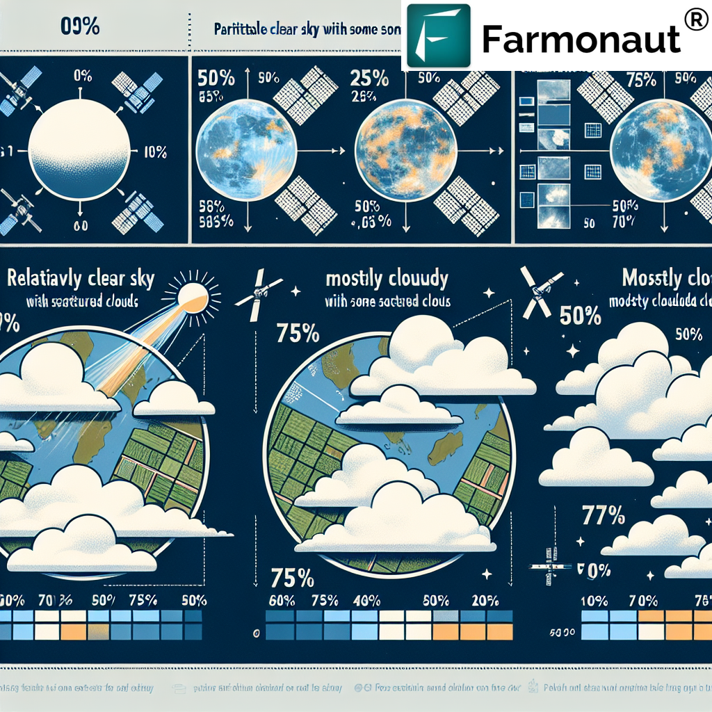
5. Analyzing Cloud Coverage Percentage
Understanding cloud coverage percentage is crucial for precise agricultural planning. This metric represents the fraction of the sky covered by clouds, typically expressed as a percentage or in oktas (eighths of the sky).
Here’s how to interpret cloud coverage percentages:
- 0-10%: Clear skies
- 10-30%: Mostly clear
- 30-70%: Partly cloudy
- 70-90%: Mostly cloudy
- 90-100%: Overcast
At Farmonaut, we provide precise cloud coverage percentage data for specific farm locations. This information is crucial for:
- Irrigation Management: Higher cloud coverage percentages might indicate less evaporation, potentially reducing irrigation needs.
- Crop Protection: Certain levels of cloud cover can create ideal conditions for pest infestations or fungal growth.
- Harvest Planning: Some crops require specific light conditions for optimal harvesting, which can be predicted using cloud coverage percentages.
- Solar Energy Management: For farms using solar power, cloud coverage percentages help in predicting energy generation.
Our AI-powered Jeevn advisory system incorporates cloud coverage percentage data to provide tailored recommendations for farm management, ensuring that every decision is backed by comprehensive environmental data.
6. Determine the Cloud Coverage by Visual Observation
While advanced technologies provide precise cloud coverage data, there’s still value in being able to determine the cloud coverage by visual observation. This skill can be particularly useful for quick assessments or when technology isn’t readily available.
Here’s a step-by-step guide to visually assess cloud coverage:
- Find an Open Area: Choose a location with an unobstructed view of the sky.
- Divide the Sky: Mentally divide the sky into eight equal sections.
- Count Cloudy Sections: Determine how many of these sections are covered by clouds.
- Calculate Percentage: Multiply the number of cloudy sections by 12.5 (100/8) to get the approximate cloud coverage percentage.
While visual observation can be useful, it’s important to note that it’s subjective and less accurate than technological methods. At Farmonaut, we encourage farmers to combine visual observations with our precise satellite-based data for the most comprehensive understanding of cloud conditions.
7. Live Cloud Coverage: Real-time Data for Real-time Decisions
Live cloud coverage data is a game-changer in precision agriculture. It provides real-time information about cloud conditions, allowing farmers to make immediate, informed decisions. Here’s why live cloud coverage matters:
- Immediate Response: Farmers can quickly adjust their plans based on current cloud conditions.
- Precision Timing: Activities like spraying or harvesting can be timed perfectly with up-to-the-minute cloud data.
- Enhanced Forecasting: When combined with other meteorological data, live cloud coverage improves short-term weather predictions.
- Resource Optimization: Real-time data helps in optimizing resource use, particularly for irrigation and solar energy systems.
At Farmonaut, we provide live cloud coverage data through our advanced satellite-based system. Our platform updates this information frequently, ensuring that farmers always have access to the most current cloud conditions for their specific locations.
To access our live cloud coverage data and other precision farming tools, visit our Farmonaut application.
8. Farmonaut’s Approach to Cloud Coverage Analysis
At Farmonaut, we’ve developed a sophisticated approach to cloud coverage analysis that sets us apart in the field of precision agriculture. Our method combines cutting-edge satellite technology, artificial intelligence, and agronomic expertise to provide farmers with unparalleled insights into cloud conditions and their impact on agriculture.
Key Features of Farmonaut’s Cloud Coverage Analysis:
- High-Resolution Satellite Imagery: We use the latest satellite technology to capture detailed images of cloud formations over agricultural areas.
- AI-Powered Analysis: Our advanced algorithms process satellite data to provide accurate cloud coverage percentages and patterns.
- Real-Time Updates: Farmers can access live cloud coverage data through our user-friendly platform.
- Historical Data Analysis: We offer insights based on historical cloud coverage trends, helping in long-term planning.
- Integration with Other Agricultural Data: Cloud coverage information is seamlessly integrated with other crucial data points like soil moisture, crop health indices, and weather forecasts.
To illustrate the superiority of our satellite-based system over traditional methods, here’s a comparison table:
| Feature | Farmonaut Satellite System | Drone-based Monitoring | IoT-based Monitoring |
|---|---|---|---|
| Coverage Area | Large scale (Global) | Limited (Local) | Limited (Point-based) |
| Real-time Data | Yes | Limited by flight time | Yes, but local |
| Cost-effectiveness | High | Medium | Low (requires multiple sensors) |
| Data Accuracy | Very High | High | Moderate |
| Ease of Use | Very Easy (Web/Mobile App) | Requires skilled operator | Requires setup and maintenance |
| Weather Independence | High | Low (affected by wind, rain) | Moderate |
As evident from the comparison, our satellite-based system offers unparalleled advantages in terms of coverage, accuracy, and ease of use.
9. Integrating Cloud Coverage Data into Precision Agriculture
Integrating cloud coverage data into precision agriculture practices can significantly enhance farm productivity and resource management. At Farmonaut, we’ve developed several ways to utilize this crucial information:
- Irrigation Scheduling: By combining cloud coverage data with soil moisture information, we help farmers optimize their irrigation schedules, saving water and improving crop health.
- Crop Protection: Our system alerts farmers to conditions that might be conducive to pest infestations or disease outbreaks based on cloud cover and other weather data.
- Yield Prediction: Long-term cloud coverage trends are factored into our AI-driven yield prediction models, providing more accurate forecasts.
- Energy Management: For farms using solar power, we provide insights on expected energy generation based on predicted cloud coverage.
- Harvest Planning: Our platform suggests optimal harvest times by considering cloud coverage forecasts alongside crop maturity data.
To leverage these features and more, farmers can access our comprehensive suite of tools through the Farmonaut Android app or the Farmonaut iOS app.
10. FAQs
Q1: How often is the cloud coverage data updated on Farmonaut?
A: Our cloud coverage data is updated multiple times daily, ensuring you always have access to the most current information.
Q2: Can Farmonaut’s cloud coverage data be integrated with other farm management systems?
A: Yes, we offer API access to our cloud coverage data. For more information, visit our API documentation.
Q3: How accurate is satellite-based cloud coverage data compared to ground observations?
A: Satellite-based data is generally more accurate and consistent over large areas compared to ground observations, which can be subjective and limited in scope.
Q4: Does Farmonaut provide historical cloud coverage data?
A: Yes, we offer historical cloud coverage data, which is invaluable for long-term trend analysis and seasonal planning.
Q5: How does cloud coverage affect satellite imagery used for crop monitoring?
A: Cloud cover can obstruct satellite views of the Earth’s surface. However, our advanced algorithms can often work around partial cloud cover to provide accurate crop health assessments.
11. Conclusion
Understanding and utilizing cloud coverage data is crucial in modern precision agriculture. At Farmonaut, we’re committed to providing farmers with the most accurate, up-to-date, and actionable cloud coverage information. By integrating this data with our comprehensive suite of agricultural technology solutions, we empower farmers to make informed decisions that optimize crop yields, conserve resources, and improve overall farm management.
We invite you to experience the power of precision agriculture enhanced by cloud coverage insights. Subscribe to Farmonaut today and take your farming practices to the next level.
For more information on our satellite weather API and developer documentation, visit our developer documentation page.
Join us in revolutionizing agriculture through technology. With Farmonaut, the future of farming is clear, even when the skies aren’t.
