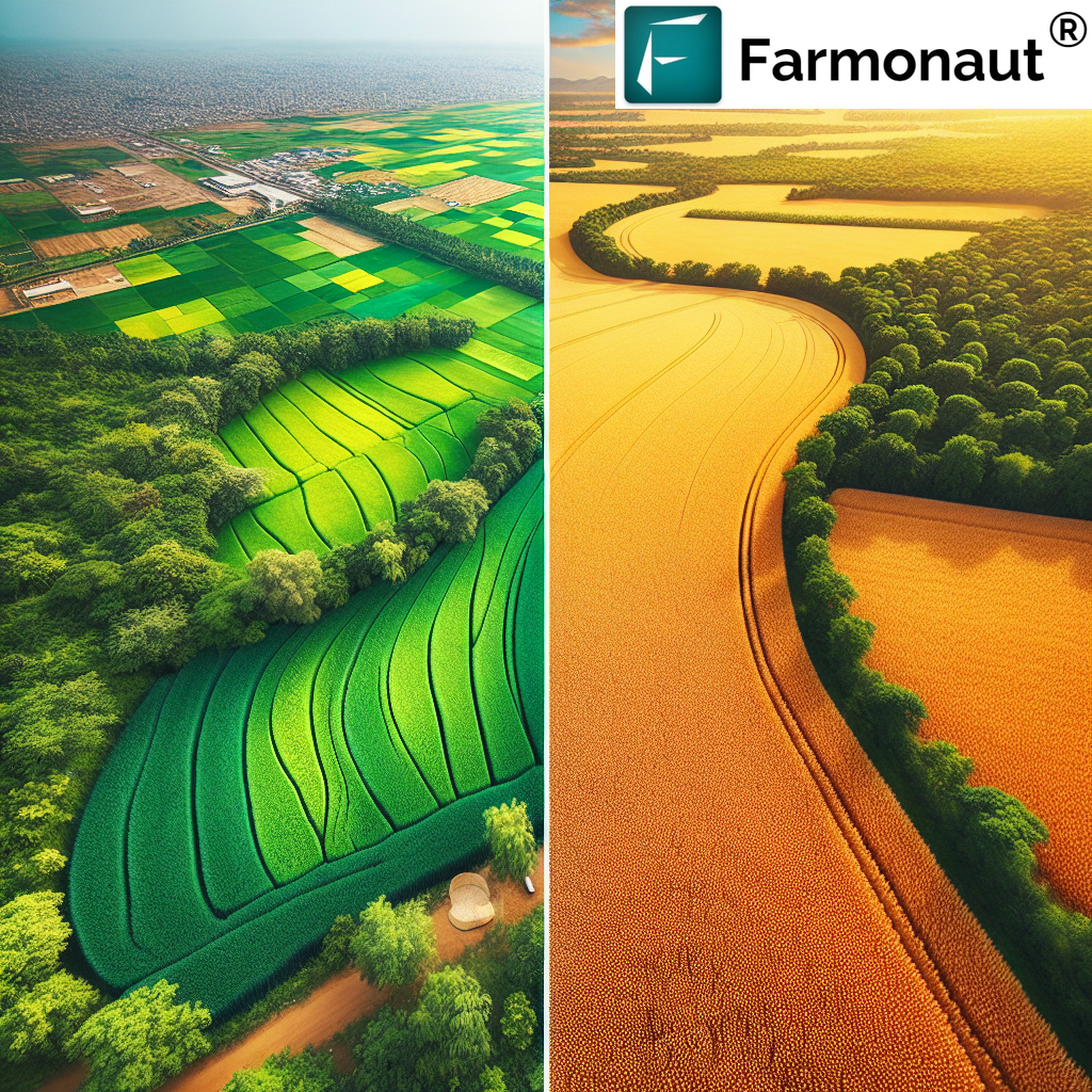
Comparing Wheat Fields: A Satellite-Based Analysis of MP Sehore and Texas
At Farmonaut, we’re passionate about leveraging cutting-edge satellite technology to revolutionize agriculture. Today, we’re embarking on an exciting journey to compare two iconic wheat-growing regions: Sehore in Madhya Pradesh, India, and the vast wheat fields of Texas, USA. Through our advanced satellite-based analysis, we’ll explore the unique characteristics, challenges, and opportunities in these diverse agricultural landscapes.
Understanding the Importance of Wheat Production
Before we dive into our comparative analysis, let’s take a moment to appreciate the significance of wheat production in both regions:
- MP Sehore Wheat: Known as the “Wheat Bowl” of Madhya Pradesh, Sehore district is renowned for its high-quality wheat production. The region’s favorable climate and rich soil contribute to its status as a major wheat-producing area in India.
- Texas Wheat Fields: Texas is one of the leading wheat-producing states in the United States, with vast expanses of wheat fields stretching across the Texas Panhandle and the High Plains region.
Satellite-Based Analysis: Our Approach
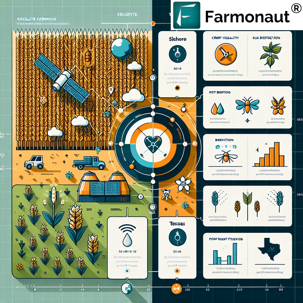
At Farmonaut, we utilize state-of-the-art satellite technology to conduct comprehensive analyses of agricultural regions. Our approach includes:
- High-resolution multispectral imaging
- Advanced vegetation indices (e.g., NDVI)
- Soil moisture analysis
- Crop health monitoring
- Weather pattern tracking
By combining these data points, we can provide invaluable insights into the similarities and differences between the wheat fields of Sehore and Texas.
Comparing Sehore Wheat and Texas Wheat Fields
Let’s explore the key aspects of both regions:
1. Climate and Growing Conditions
Sehore, Madhya Pradesh:
- Semi-arid climate with hot summers and mild winters
- Average annual rainfall: 1000-1200 mm
- Main growing season: Rabi (winter) crop, sown in November-December and harvested in March-April
Texas Wheat Fields:
- Varies from semi-arid in the west to humid subtropical in the east
- Average annual rainfall: 400-1000 mm, depending on the region
- Main growing seasons: Winter wheat (planted in fall, harvested in spring) and spring wheat (planted in spring, harvested in summer)
2. Soil Characteristics
Our satellite-based soil analysis reveals:
Sehore Wheat Fields:
- Predominantly black cotton soil (vertisols)
- High water retention capacity
- Rich in organic matter
Texas Wheat Fields:
- Varied soil types, including clay loams, sandy loams, and alluvial soils
- Generally well-draining soils
- Some regions with calcic horizons
3. Field Sizes and Farming Practices
MP Sehore Wheat:
- Smaller average field sizes (1-5 hectares)
- Mix of traditional and modern farming practices
- Increasing adoption of mechanization
Texas Wheat Fields:
- Large-scale operations with field sizes often exceeding 100 hectares
- Highly mechanized farming practices
- Extensive use of precision agriculture techniques
4. Irrigation Methods
Sehore:
- Primarily rainfed agriculture
- Supplemental irrigation through canals and tube wells
- Increasing adoption of drip and sprinkler irrigation
Texas:
- Mix of dryland and irrigated wheat production
- Center pivot irrigation systems common in irrigated areas
- Increasing focus on water conservation techniques
5. Crop Health and Vigor
Our satellite-based vegetation analysis using NDVI (Normalized Difference Vegetation Index) reveals:
Sehore Wheat Fields:
- Generally high NDVI values during peak growing season
- Some variations due to localized soil and moisture conditions
- Occasional stress patterns related to water availability
Texas Wheat Fields:
- Wide range of NDVI values across the state
- Higher values in irrigated areas
- Dryland wheat shows more variability in crop health
Challenges and Opportunities
Through our satellite-based analysis, we’ve identified several challenges and opportunities for both regions:
Sehore, Madhya Pradesh:
Challenges:
- Water scarcity during dry years
- Soil erosion in some areas
- Limited access to advanced farming technologies for small-scale farmers
Opportunities:
- Potential for increased yields through improved water management
- Adoption of climate-smart agriculture practices
- Expansion of precision farming techniques
Texas Wheat Fields:
Challenges:
- Increasing water scarcity in some regions
- Vulnerability to extreme weather events (e.g., droughts, heat waves)
- Soil degradation in intensively farmed areas
Opportunities:
- Further optimization of water use efficiency
- Adoption of drought-resistant wheat varieties
- Integration of advanced satellite-based monitoring for precision agriculture
How Farmonaut Can Help
At Farmonaut, we’re committed to empowering farmers and agricultural stakeholders with cutting-edge satellite-based solutions. Our platform offers:
- Real-time crop health monitoring
- AI-powered advisory services
- Precision agriculture tools
- Weather forecasting and analysis
- Soil moisture tracking
Whether you’re managing wheat fields in Sehore or Texas, our technology can help you optimize your operations and increase productivity. To get started with Farmonaut, visit our app page or explore our API services.
Farmonaut Satellite System vs. Drone and IoT-based Farm Monitoring
| Feature | Farmonaut Satellite System | Drone-based Monitoring | IoT-based Monitoring |
|---|---|---|---|
| Coverage Area | Global | Limited to flight range | Limited to sensor placement |
| Data Frequency | Daily to weekly | On-demand | Real-time |
| Initial Investment | Low | High | Medium to High |
| Operational Costs | Low | Medium | Low to Medium |
| Ease of Use | High | Requires skilled operator | Moderate |
| Weather Dependency | Low | High | Low |
| Scalability | Highly scalable | Limited scalability | Moderately scalable |
Conclusion
Our satellite-based analysis of wheat fields in Sehore, Madhya Pradesh, and Texas reveals fascinating insights into the similarities and differences between these two important agricultural regions. While they face unique challenges, both areas have significant opportunities for growth and optimization through the adoption of advanced technologies like Farmonaut’s satellite-based solutions.
By leveraging our platform, farmers and agricultural stakeholders in both regions can make data-driven decisions, improve resource management, and ultimately increase their productivity and sustainability. Whether you’re managing wheat fields in the heart of Madhya Pradesh or the vast expanses of Texas, Farmonaut is here to support your journey towards smarter, more efficient agriculture.
Ready to revolutionize your wheat farming operations? Download the Farmonaut app today:
For developers interested in integrating our powerful satellite and weather data into their own applications, check out our API documentation.
FAQs
Q: How accurate is satellite-based crop monitoring compared to ground-based methods?
A: Satellite-based monitoring can be highly accurate, often within 90-95% of ground-based measurements. At Farmonaut, we continuously refine our algorithms to ensure the highest possible accuracy.
Q: Can Farmonaut’s technology be used for crops other than wheat?
A: Absolutely! Our satellite-based monitoring and analysis tools are applicable to a wide range of crops, including rice, corn, soybeans, and many others.
Q: How often is satellite data updated on the Farmonaut platform?
A: Our satellite data is typically updated every 3-5 days, depending on the specific location and satellite coverage.
Q: Is Farmonaut’s technology suitable for small-scale farmers?
A: Yes, we’ve designed our platform to be accessible and affordable for farmers of all scales, from small-scale operations to large agribusinesses.
Q: How can I get started with Farmonaut for my wheat fields?
A: Getting started is easy! Simply download our app or visit our website to create an account. You can then input your field boundaries and start receiving valuable insights right away.
Subscribe to Farmonaut
Ready to transform your agricultural operations with the power of satellite technology? Subscribe to Farmonaut today and unlock a world of data-driven insights for your farm:
By subscribing to Farmonaut, you’re not just gaining access to cutting-edge agricultural technology – you’re joining a community of forward-thinking farmers committed to sustainable and efficient agriculture. Together, we can revolutionize wheat farming in Sehore, Texas, and beyond!
