Mastering Land Classification: An Expert Guide to Categorizing Different Types of Land
At Farmonaut, we understand the critical importance of land classification in agriculture, urban planning, and environmental management. As experts in remote sensing and agricultural technology, we’re excited to share our comprehensive guide on how to classify land into different types. This knowledge is essential for farmers, urban planners, environmentalists, and policymakers alike.
Table of Contents
- Introduction to Land Classification
- The Importance of Land Classification
- Methods to Classify Land
- Types of Land Classifications
- Farmonaut’s Approach to Land Classification
- Benefits of Accurate Land Classification
- Challenges in Land Classification
- Future Trends in Land Classification
- FAQs
- Conclusion
1. Introduction to Land Classification
Land classification is the process of categorizing land based on its characteristics, uses, and potential. It’s a fundamental aspect of land management that helps us understand the earth’s surface and make informed decisions about its use and conservation.
When we classify land, we’re essentially creating a systematic framework to organize and understand the diverse landscapes around us. This process involves analyzing various factors such as soil type, vegetation cover, topography, climate, and human activities.
2. The Importance of Land Classification
Understanding how to classify land into different types is crucial for several reasons:
- Resource Management: It helps in the efficient allocation and use of land resources.
- Urban Planning: Aids in making informed decisions about urban development and expansion.
- Agricultural Planning: Assists farmers in choosing suitable crops and farming practices.
- Environmental Conservation: Helps identify areas that need protection or restoration.
- Policy Making: Provides a basis for land-use policies and regulations.
- Economic Valuation: Helps in assessing the economic value of different land types.
3. Methods to Classify Land
There are several methods we use to classify land. Here are some of the most common approaches:
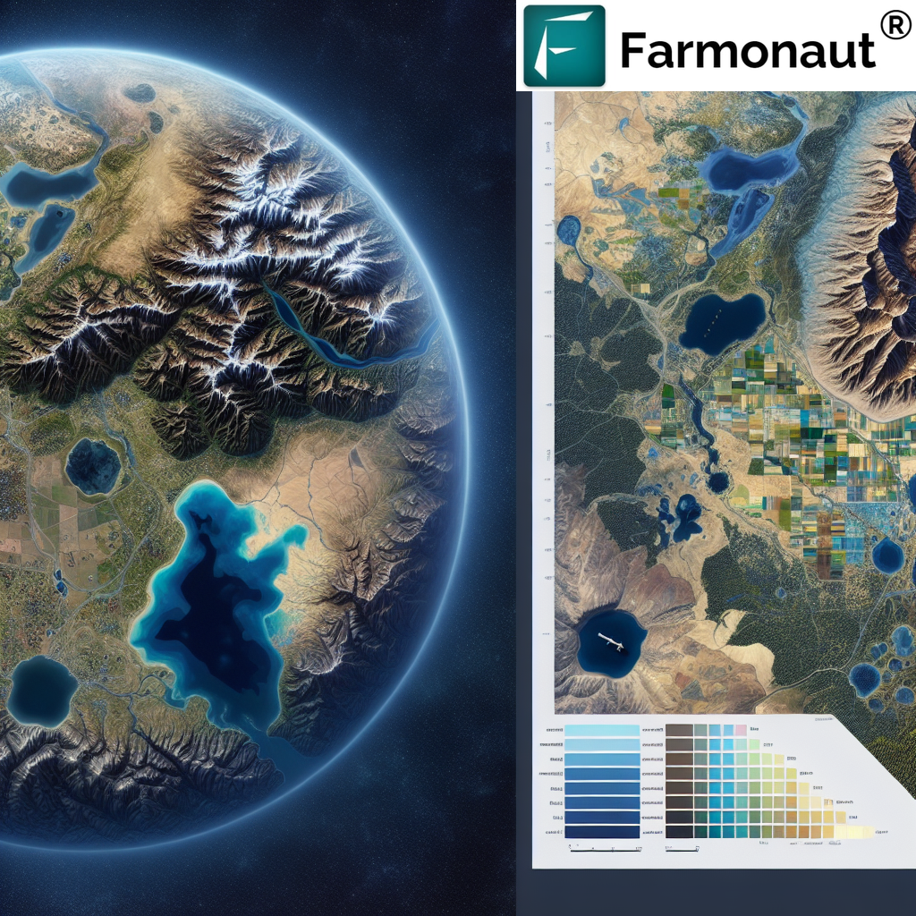
3.1 Remote Sensing
Remote sensing is a powerful tool for land classification. At Farmonaut, we specialize in using satellite imagery to classify land. Our advanced satellite-based farm management solutions provide high-resolution images that allow us to analyze land cover and use patterns over large areas.
Remote sensing offers several advantages:
- Coverage of large areas
- Regular updates
- Cost-effectiveness
- Ability to detect changes over time
Our Farmonaut app leverages this technology to provide farmers with real-time insights about their land.
3.2 Field Surveys
While remote sensing provides a broad overview, field surveys are essential for ground-truthing and collecting detailed information. Our experts conduct field surveys to verify satellite data and gather additional information about soil properties, vegetation types, and land use practices.
3.3 GIS (Geographic Information Systems)
GIS technology allows us to integrate various data sources, including satellite imagery, field survey data, and existing maps. This integration helps create comprehensive land classification maps.
3.4 Machine Learning and AI
At Farmonaut, we use advanced machine learning algorithms to analyze satellite imagery and classify land automatically. Our AI-powered system, Jeevn AI, can quickly process vast amounts of data to provide accurate land classification results.
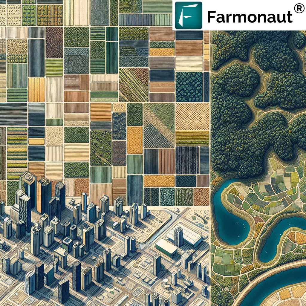
4. Types of Land Classifications
When we classify land, we typically consider several categories. Here are some of the main types of land classifications:
4.1 Agricultural Land
Agricultural land is further classified into:
- Cropland: Used for growing crops
- Pastureland: Used for grazing livestock
- Orchards: Used for growing fruit trees
- Fallow Land: Agricultural land left to rest
4.2 Forest Land
Forest land can be classified as:
- Dense Forest: Areas with high tree density
- Open Forest: Areas with lower tree density
- Scrubland: Areas with small or stunted trees
4.3 Urban Land
Urban land includes:
- Residential Areas: Housing zones
- Commercial Areas: Business and retail zones
- Industrial Areas: Factories and manufacturing zones
- Transportation Infrastructure: Roads, railways, airports
4.4 Water Bodies
This category includes:
- Rivers and Streams
- Lakes and Ponds
- Coastal Areas
- Wetlands
4.5 Barren Land
Barren land includes areas with little or no vegetation, such as:
- Deserts
- Rocky Areas
- Sand Dunes
5. Farmonaut’s Approach to Land Classification
At Farmonaut, we’ve developed a sophisticated approach to land classification that combines cutting-edge technology with agricultural expertise. Our method involves:
5.1 Satellite Imagery Analysis
We use high-resolution multispectral satellite imagery to capture detailed information about land cover. Our advanced image processing algorithms can detect subtle differences in vegetation, soil moisture, and land use patterns.
5.2 AI and Machine Learning
Our Jeevn AI system uses machine learning algorithms to analyze satellite data and classify land automatically. This AI-driven approach allows us to process vast amounts of data quickly and accurately.
5.3 Ground Truthing
We combine satellite data with on-the-ground observations to ensure the accuracy of our classifications. Our team of experts conducts field surveys to verify and refine our satellite-based classifications.
5.4 Temporal Analysis
By analyzing satellite images taken at different times, we can track changes in land use over time. This temporal analysis is crucial for understanding land use dynamics and predicting future trends.
5.5 Integration with Other Data Sources
We integrate our satellite data with other information sources, such as soil maps, climate data, and historical land use records, to create comprehensive land classification maps.
6. Benefits of Accurate Land Classification
Accurate land classification provides numerous benefits:
- Improved Agricultural Planning: Farmers can make informed decisions about crop selection and land management practices.
- Enhanced Resource Management: Policymakers can allocate resources more effectively based on accurate land use data.
- Better Urban Planning: Urban planners can make informed decisions about city expansion and infrastructure development.
- Environmental Conservation: Conservationists can identify areas that need protection or restoration.
- Disaster Management: Accurate land classification helps in assessing vulnerability to natural disasters and planning mitigation strategies.
- Economic Valuation: It provides a basis for assessing the economic value of different land types.
7. Challenges in Land Classification
While land classification is crucial, it comes with its own set of challenges:
7.1 Data Accuracy
Ensuring the accuracy of satellite data and ground observations can be challenging, especially in areas with complex land cover patterns.
7.2 Temporal Variations
Land use can change rapidly, making it difficult to keep classifications up-to-date.
7.3 Mixed Land Use
Areas with mixed land use (e.g., agroforestry systems) can be difficult to classify into a single category.
7.4 Technical Limitations
Cloud cover and atmospheric conditions can affect the quality of satellite imagery.
7.5 Cost
High-resolution satellite imagery and field surveys can be expensive, especially for large areas.
8. Future Trends in Land Classification
The field of land classification is continuously evolving. Here are some trends we’re excited about:
8.1 Hyperspectral Imaging
Hyperspectral sensors can capture data across a wide range of the electromagnetic spectrum, allowing for more detailed and accurate land classification.
8.2 Deep Learning
Advanced deep learning algorithms are improving the accuracy of automated land classification systems.
8.3 Integration of Big Data
The integration of satellite data with other big data sources (e.g., social media data, IoT sensor data) is opening up new possibilities for land classification.
8.4 Citizen Science
Involving citizens in data collection and verification is becoming increasingly popular and can help improve the accuracy of land classification.
8.5 Real-Time Monitoring
Advances in satellite technology and data processing are making real-time land cover monitoring a reality.
Farmonaut Satellite System vs. Drone and IoT-based Farm Monitoring
| Feature | Farmonaut Satellite System | Drone-based Monitoring | IoT-based Monitoring |
|---|---|---|---|
| Coverage Area | Large (Global) | Medium | Small (Local) |
| Frequency of Updates | Daily to Weekly | On-demand | Real-time |
| Cost | Low | High | Medium |
| Weather Dependency | Low | High | Low |
| Data Processing | Automated (AI-driven) | Semi-automated | Automated |
| Scalability | High | Medium | Low |
| Regulatory Constraints | Low | High | Medium |
9. FAQs
Q1: How can we classify the land accurately?
A1: Accurate land classification involves a combination of remote sensing techniques, field surveys, and advanced data analysis. At Farmonaut, we use high-resolution satellite imagery, AI-powered image analysis, and ground truthing to ensure accurate land classification.
Q2: What are the main types of land classification?
A2: The main types of land classification include agricultural land, forest land, urban land, water bodies, and barren land. Each of these categories can be further subdivided based on specific characteristics.
Q3: How often should land classification be updated?
A3: The frequency of updates depends on the rate of land use change in the area. In rapidly changing areas, annual updates may be necessary. In more stable regions, updates every 3-5 years might be sufficient.
Q4: How does Farmonaut’s satellite system compare to drone-based monitoring?
A4: While drones can provide high-resolution imagery for small areas, Farmonaut’s satellite system offers broader coverage, more frequent updates, and is less affected by weather conditions. Our system is also more cost-effective for large-scale monitoring.
Q5: Can Farmonaut’s system classify land in real-time?
A5: Our system provides near real-time land classification. We receive daily satellite imagery updates, which are processed and analyzed by our AI system to provide up-to-date land classification information.
10. Conclusion
Land classification is a complex but crucial process that underpins effective land management and sustainable development. At Farmonaut, we’re committed to advancing the field of land classification through our innovative satellite-based solutions.
Our approach combines cutting-edge technology with agricultural expertise to provide accurate, timely, and actionable land classification data. Whether you’re a farmer looking to optimize your crop production, an urban planner designing sustainable cities, or a policymaker developing land use strategies, our tools can provide the insights you need.
We invite you to explore our Farmonaut app and experience the power of satellite-based land classification for yourself. For developers interested in integrating our technology into their own applications, check out our API and documentation.
Join us in revolutionizing land management and agricultural practices. Together, we can build a more sustainable and productive future.
Download our app now:
Ready to get started with Farmonaut? Subscribe to our services here:
