Revolutionizing Agriculture: How Farmonaut® is Leveraging Satellite Technology for Smarter, Sustainable Farming
In the ever-evolving landscape of agriculture, technology continues to play a pivotal role in shaping the future of farming. At the forefront of this agricultural revolution stands Farmonaut®, a pioneering company that is harnessing the power of satellite technology to transform the way we approach farming. In this comprehensive blog post, we’ll dive deep into how Farmonaut® is leveraging cutting-edge satellite technology to revolutionize agricultural practices through Land Use and Land Classification (LULC) insights.
The Power of Satellite Technology in Agriculture
Satellite technology has emerged as a game-changer in the agricultural sector, offering unprecedented insights into crop health, land use patterns, and environmental conditions. At Farmonaut®, we’ve recognized the immense potential of this technology and have made it the cornerstone of our innovative approach to farming.
How Satellite Farming Technology Works
Satellite farming technology, also known as precision agriculture or satellite-based agriculture, utilizes data collected from Earth-observing satellites to provide farmers with detailed information about their fields. This technology offers several key advantages:
- Wide Coverage: Satellites can monitor vast areas of land, making it possible to assess entire regions or countries at once.
- Frequent Updates: Many satellites provide daily or weekly imagery, allowing for near real-time monitoring of crop conditions.
- Non-Invasive: Unlike ground-based sensors or drones, satellite technology doesn’t require physical access to the fields, minimizing disruption to farming operations.
- Multispectral Imaging: Satellites can capture data across various spectral bands, revealing information invisible to the naked eye, such as plant stress or soil moisture levels.
Farmonaut’s Approach to Satellite-Based Agriculture
At Farmonaut®, we’ve developed a sophisticated platform that integrates satellite data with advanced analytics to provide farmers with actionable insights. Our system leverages the following key technologies:
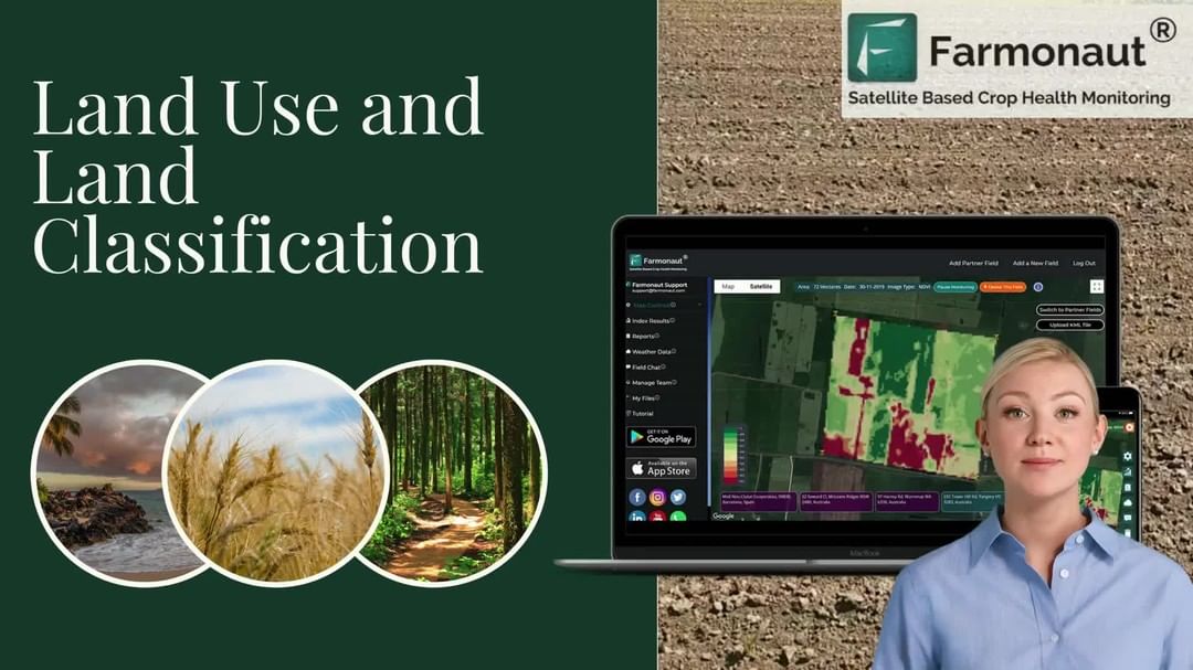
1. Land Use and Land Classification (LULC) Insights
Land Use and Land Classification (LULC) is a critical component of our satellite-based agricultural system. This technology allows us to:
- Identify different types of crops and vegetation
- Monitor changes in land use over time
- Assess soil quality and composition
- Detect areas of deforestation or land degradation
By providing detailed LULC insights, we empower farmers and agricultural planners to make informed decisions about crop selection, rotation, and land management strategies.
2. Crop Health Management
Our satellite-based crop health management system utilizes multispectral imagery to assess the health and vigor of crops across entire fields. This technology enables farmers to:
- Detect early signs of crop stress or disease
- Identify areas of nutrient deficiency
- Optimize irrigation practices
- Monitor crop growth and development throughout the season
By providing real-time insights into crop health, we help farmers take proactive measures to address issues before they escalate, ultimately leading to improved yields and reduced resource waste.
3. Weather Monitoring and Forecasting
Accurate weather information is crucial for successful farming. Our satellite-based weather monitoring system provides:
- Real-time weather data for specific field locations
- Short-term and long-term weather forecasts
- Historical weather data for trend analysis
- Alerts for extreme weather events
This information allows farmers to plan their activities more effectively, from planting and harvesting to pest control and irrigation.
The Advantages of Farmonaut’s Satellite System
While there are various technologies available for farm monitoring, including drones and IoT sensors, Farmonaut®’s satellite-based system offers several unique advantages:
| Feature | Farmonaut® Satellite System | Drone-based Monitoring | IoT-based Monitoring |
|---|---|---|---|
| Coverage Area | Global | Limited to flight range | Limited to sensor placement |
| Frequency of Updates | Daily to weekly | As needed (labor-intensive) | Continuous (limited by battery life) |
| Initial Setup Cost | Low | High (equipment purchase) | Medium to High (sensor network) |
| Maintenance Requirements | Minimal | Regular (equipment upkeep) | Regular (battery replacement, repairs) |
| Data Processing | Automated and scalable | Manual or semi-automated | Automated but limited by sensor capabilities |
| Regulatory Compliance | No restrictions | Subject to local drone laws | Generally unrestricted |
Practical Applications of Farmonaut’s Satellite Technology
Our satellite-based agricultural solutions have a wide range of practical applications across the farming industry. Here are some key areas where our technology is making a significant impact:
1. Precision Agriculture
Precision agriculture is all about optimizing resource use and maximizing yields. Our satellite technology enables farmers to:
- Create precise zone maps for variable rate application of inputs
- Identify areas of low productivity within fields
- Monitor crop growth stages for timely interventions
- Assess the effectiveness of different farming practices
By providing detailed, field-level insights, we help farmers make data-driven decisions that lead to more efficient and productive farming practices.
2. Sustainable Resource Management
Sustainability is a key concern in modern agriculture. Our satellite-based solutions contribute to sustainable farming by:
- Optimizing water use through precise irrigation scheduling
- Reducing chemical inputs by identifying areas that truly need treatment
- Monitoring soil health and recommending conservation practices
- Tracking carbon sequestration in agricultural lands
These applications not only benefit the environment but also help farmers reduce costs and improve their long-term profitability.
3. Crop Insurance and Risk Management
Our satellite technology plays a crucial role in crop insurance and risk management by:
- Providing objective, verifiable data on crop conditions
- Assessing damage from natural disasters or pest outbreaks
- Monitoring compliance with insurance policy requirements
- Facilitating faster and more accurate claim processing
This not only benefits farmers by ensuring fair compensation for losses but also helps insurance companies manage their risks more effectively.
4. Agricultural Policy and Planning
Government agencies and policymakers can leverage our satellite-based insights for:
- Monitoring national and regional crop production
- Assessing the impact of agricultural policies
- Planning infrastructure development in rural areas
- Managing food security programs
By providing comprehensive, up-to-date information on agricultural activities, we support evidence-based policymaking and more effective agricultural planning at all levels.
The Future of Satellite Technology in Agriculture
As we look to the future, we at Farmonaut® are excited about the continued evolution of satellite technology and its applications in agriculture. Some emerging trends and developments we’re watching closely include:
1. Integration with Artificial Intelligence and Machine Learning
The combination of satellite data with AI and machine learning algorithms will enable even more sophisticated analysis and predictions. This could lead to:
- Automated crop yield forecasting
- Early detection of pest and disease outbreaks
- Personalized crop management recommendations
- Predictive maintenance for farm equipment
2. Hyperspectral Imaging
Advancements in satellite technology are making hyperspectral imaging more accessible. This will allow for:
- More detailed analysis of crop health and soil conditions
- Identification of specific plant diseases or nutrient deficiencies
- Enhanced monitoring of water quality and environmental impacts
3. Integration with IoT and Ground-Based Sensors
While satellite technology offers many advantages, the future lies in integrating it with other data sources. We’re working on:
- Combining satellite data with IoT sensor networks for more comprehensive monitoring
- Integrating satellite insights with farm management software and machinery
- Developing hybrid systems that leverage the strengths of satellite, drone, and ground-based technologies
How to Get Started with Farmonaut®
Ready to revolutionize your farming practices with satellite technology? Here’s how you can get started with Farmonaut®:
- Sign Up for an Account: Visit our website at https://farmonaut.com/app_redirect to create your Farmonaut® account.
- Download Our Mobile App: Get real-time insights on the go with our mobile apps:
- Android: Farmonaut on Google Play
- iOS: Farmonaut on the App Store
- Explore Our API: For developers and businesses looking to integrate our satellite data into their own systems, check out our API documentation at Farmonaut API Documentation.
- Subscribe to Our Services: Choose the plan that best fits your needs:
Conclusion
At Farmonaut®, we’re committed to leveraging the power of satellite technology to transform agriculture and create a more sustainable, productive future for farming. By providing farmers, agribusinesses, and policymakers with powerful, data-driven insights, we’re helping to optimize resource use, increase crop yields, and promote sustainable farming practices.
As we continue to innovate and expand our services, we invite you to join us on this exciting journey. Whether you’re a small-scale farmer looking to improve your crop management or a large agribusiness seeking to optimize your operations, Farmonaut® has the tools and insights you need to succeed in the ever-changing world of modern agriculture.
Subscribe to our newsletter and follow us on social media to stay updated on the latest innovations in agricultural technology. Together, we can build a more sustainable and prosperous future for agriculture!
Frequently Asked Questions (FAQ)
-
Q: How accurate is satellite-based crop monitoring?
A: Satellite-based crop monitoring can be highly accurate, with modern systems achieving accuracy rates of 90% or higher for many applications. However, the exact accuracy depends on factors such as satellite resolution, frequency of imaging, and the specific metrics being measured. -
Q: Can Farmonaut®’s technology work for small farms?
A: Absolutely! Our technology is scalable and can provide valuable insights for farms of all sizes, from small family-owned operations to large commercial enterprises. -
Q: How often is satellite data updated?
A: The frequency of updates depends on the satellite system used. Many commercial satellites provide updates every 1-5 days, while some systems offer daily revisits. At Farmonaut®, we strive to provide the most up-to-date information possible. -
Q: Is satellite monitoring affected by cloud cover?
A: Cloud cover can indeed affect optical satellite imagery. However, we use a combination of optical and radar satellites, with the latter being able to penetrate clouds. This ensures consistent monitoring regardless of weather conditions. -
Q: How does Farmonaut® ensure data privacy and security?
A: We take data privacy and security very seriously. All user data is encrypted and stored securely. We adhere to strict data protection regulations and never share individual farm data without explicit consent.
Have more questions? Don’t hesitate to reach out to our support team. We’re here to help you make the most of our satellite-based agricultural solutions!