Revolutionizing Agriculture: How Remote Sensing and Drones are Transforming Crop Monitoring and Sustainable Food Production
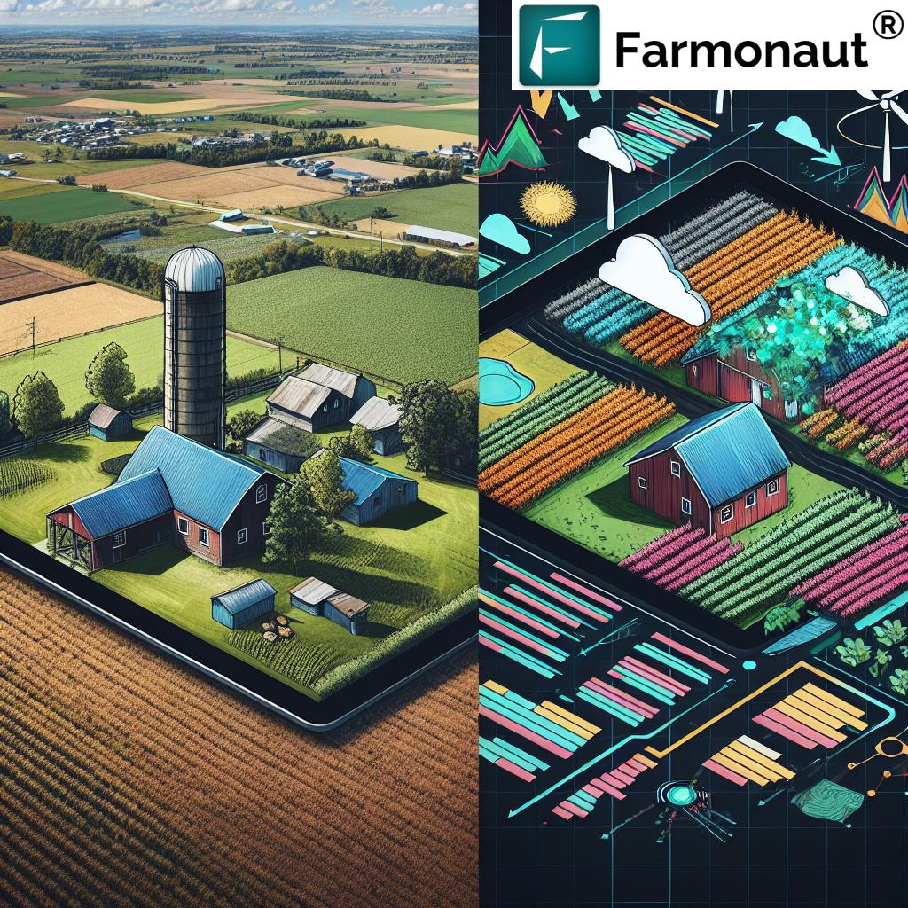
In the ever-evolving landscape of modern agriculture, we are witnessing a revolutionary transformation driven by cutting-edge technologies. At the forefront of this agricultural revolution are remote sensing and drone technologies, which are reshaping the way we approach crop monitoring, farm management, and sustainable food production. As experts in the field, we at Farmonaut are proud to be at the helm of this transformation, offering innovative solutions that empower farmers and revolutionize agricultural practices.
The Power of Remote Sensing in Agriculture
Remote sensing has emerged as a game-changing technology in the agricultural sector, providing farmers and agronomists with unprecedented insights into crop health, soil conditions, and overall farm productivity. By harnessing the power of satellite imagery and advanced sensors, remote sensing enables us to gather vast amounts of data about agricultural lands without the need for physical presence on the field.
Key Applications of Remote Sensing in Agriculture:
- Crop Health Monitoring: Remote sensing allows us to assess crop health by analyzing vegetation indices such as NDVI (Normalized Difference Vegetation Index). These indices provide valuable information about plant vigor, stress levels, and overall crop condition.
- Soil Moisture Analysis: By utilizing specific wavelengths of light, remote sensing technologies can measure soil moisture levels across large areas, helping farmers optimize irrigation practices and conserve water resources.
- Yield Prediction: Advanced algorithms combined with remote sensing data enable accurate yield predictions, allowing farmers to make informed decisions about harvesting, storage, and market planning.
- Crop Classification: Remote sensing techniques facilitate the identification and classification of different crop types over vast areas, aiding in agricultural planning and policy-making.
- Field Boundary Mapping: Satellite imagery helps in accurately delineating field boundaries, which is crucial for precision agriculture and land management.
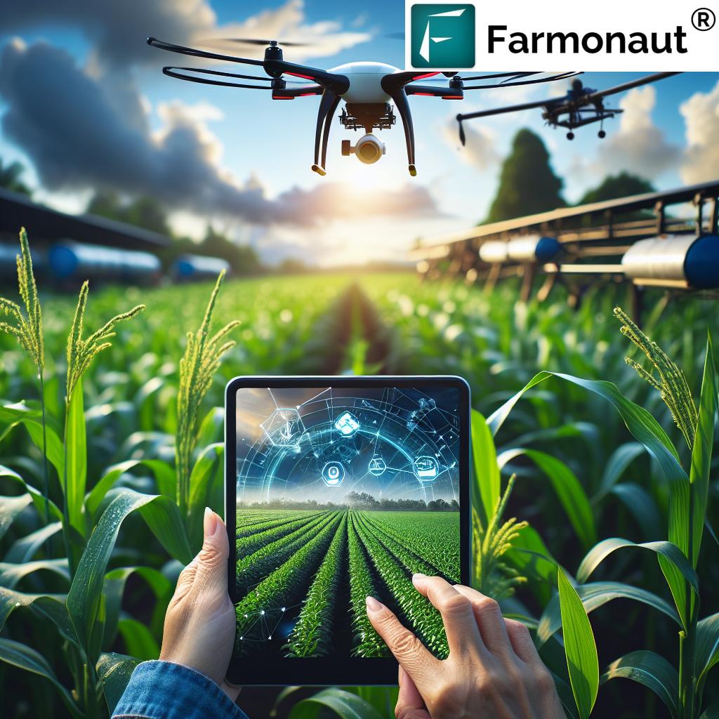
Drones: The Eyes in the Sky for Precision Agriculture
While satellite-based remote sensing provides broad coverage, drones offer a complementary solution for high-resolution, on-demand data collection. These unmanned aerial vehicles have become indispensable tools in precision agriculture, offering farmers a bird’s-eye view of their fields with unparalleled detail.
Advantages of Drone Technology in Agriculture:
- High-Resolution Imagery: Drones can capture extremely detailed images of crops, allowing for the detection of subtle variations in plant health, pest infestations, or nutrient deficiencies.
- Flexibility and Timeliness: Unlike satellites, drones can be deployed at will, providing farmers with real-time data whenever they need it.
- Precision Application: Equipped with specialized sensors and sprayers, drones can be used for targeted application of fertilizers or pesticides, reducing waste and environmental impact.
- 3D Mapping: Drones can create accurate 3D maps of agricultural lands, aiding in terrain analysis and water management planning.
- Crop Scouting: Drones enable efficient crop scouting, allowing farmers to quickly identify problem areas in their fields without the need for time-consuming manual inspections.
The Synergy of Remote Sensing and Drones in Sustainable Agriculture
The combination of satellite-based remote sensing and drone technology creates a powerful synergy that is driving sustainable agricultural practices. This integrated approach allows for a multi-scale understanding of agricultural ecosystems, from broad regional patterns to individual plant health.
Key Benefits of Integrating Remote Sensing and Drones:
- Comprehensive Monitoring: Satellite data provides regular, wide-area coverage, while drones offer on-demand, high-resolution insights for specific areas of interest.
- Enhanced Decision Making: The wealth of data from both sources enables more informed decision-making, leading to optimized resource use and improved crop yields.
- Sustainable Resource Management: By providing precise information on crop needs, these technologies help minimize the use of water, fertilizers, and pesticides, promoting environmental sustainability.
- Early Problem Detection: The combination of broad and detailed monitoring allows for early detection of crop stress, disease outbreaks, or pest infestations, enabling prompt intervention.
- Climate Change Adaptation: Remote sensing and drone data help farmers adapt to changing climate conditions by providing insights into long-term trends and short-term weather impacts on crops.
Farmonaut’s Approach to Precision Agriculture
At Farmonaut, we have harnessed the power of remote sensing and drone technologies to create a comprehensive suite of tools for precision agriculture. Our platform integrates satellite imagery, AI-driven analytics, and user-friendly interfaces to provide farmers with actionable insights for improved crop management and sustainable food production.
Key Features of Farmonaut’s Platform:
- Real-Time Crop Monitoring: Our satellite-based monitoring system provides regular updates on crop health, allowing farmers to track the progress of their fields throughout the growing season.
- AI-Powered Analytics: We employ advanced machine learning algorithms to analyze satellite and drone imagery, providing insights on crop classification, yield prediction, and anomaly detection.
- Soil Moisture Tracking: Our platform includes soil moisture analysis capabilities, helping farmers optimize irrigation practices and conserve water resources.
- Weather Integration: We incorporate local weather data and forecasts into our analytics, providing a comprehensive view of environmental factors affecting crop growth.
- Mobile Accessibility: Our mobile app allows farmers to access critical information about their fields anytime, anywhere, facilitating timely decision-making.
To experience the power of Farmonaut’s precision agriculture solutions, visit our web application or download our mobile app for Android or iOS.
The Role of Geospatial Analytics in Modern Agriculture
Geospatial analytics forms the backbone of modern precision agriculture, allowing us to process and interpret the vast amounts of data collected through remote sensing and drone technologies. By combining spatial information with other relevant data sets, we can uncover valuable insights that drive agricultural innovation and sustainability.
Applications of Geospatial Analytics in Agriculture:
- Crop Yield Optimization: By analyzing historical yield data alongside environmental factors, we can identify patterns and optimize planting strategies for maximum productivity.
- Risk Assessment: Geospatial analytics help in identifying areas prone to natural disasters, pest infestations, or disease outbreaks, allowing for proactive risk management.
- Resource Allocation: By mapping resource availability and crop requirements, farmers can make informed decisions about irrigation, fertilization, and other inputs.
- Supply Chain Optimization: Geospatial data can be used to optimize transportation routes and storage locations, reducing costs and improving efficiency in the agricultural supply chain.
- Policy Making: Government agencies use geospatial analytics to inform agricultural policies, subsidy distribution, and land use planning.
The Impact of Climate Change on Agriculture and the Role of Technology
Climate change poses significant challenges to global food production, with shifting weather patterns, increased frequency of extreme events, and changing growing seasons affecting crop yields worldwide. In this context, the role of remote sensing and geospatial technologies in agriculture becomes even more crucial.
How Technology Aids in Climate Change Adaptation:
- Climate Monitoring: Remote sensing provides valuable data on long-term climate trends, helping farmers adapt their practices to changing conditions.
- Drought Management: Satellite-based soil moisture monitoring aids in early drought detection and efficient water management.
- Crop Selection: Data-driven insights help farmers choose crop varieties best suited to changing local climates.
- Carbon Sequestration: Remote sensing can track changes in vegetation cover and soil organic carbon, supporting efforts to increase carbon sequestration in agricultural lands.
- Extreme Weather Preparedness: Advanced weather forecasting integrated with agricultural data helps farmers prepare for and mitigate the impacts of extreme weather events.
The Future of Food Production: Sustainable and Data-Driven
As we look to the future, it’s clear that sustainable food production will rely heavily on data-driven approaches and precision agriculture technologies. The integration of remote sensing, drones, and geospatial analytics is paving the way for a more efficient, productive, and environmentally friendly agricultural sector.
Key Trends Shaping the Future of Agriculture:
- Internet of Things (IoT) Integration: The proliferation of IoT devices in agriculture will provide even more granular data on crop and soil conditions.
- Artificial Intelligence and Machine Learning: Advanced AI algorithms will continue to improve our ability to interpret complex agricultural data and provide actionable insights.
- Blockchain for Traceability: Blockchain technology will enhance supply chain transparency and food traceability, building consumer trust.
- Vertical Farming and Urban Agriculture: Remote sensing and precision agriculture techniques will be adapted for use in urban and indoor farming environments.
- Genetic Engineering and Crop Optimization: Data-driven insights will inform crop breeding programs, leading to more resilient and productive crop varieties.
Farmonaut’s Role in Shaping the Future of Agriculture
At Farmonaut, we are committed to driving innovation in the agricultural sector through our advanced remote sensing and data analytics platform. Our goal is to make precision agriculture accessible to farmers of all scales, promoting sustainable practices and improving global food security.
How Farmonaut is Contributing to Agricultural Innovation:
- Democratizing Access to Technology: Our affordable, satellite-based solutions bring the benefits of precision agriculture to smallholder farmers worldwide.
- Promoting Sustainable Practices: By providing detailed insights on resource usage and environmental impact, we help farmers adopt more sustainable agricultural practices.
- Enhancing Food Security: Our yield prediction and crop monitoring tools contribute to better planning and reduced crop losses, enhancing overall food security.
- Supporting Data-Driven Decision Making: We empower farmers with actionable insights, enabling them to make informed decisions about crop management and resource allocation.
- Facilitating Research and Development: Our platform serves as a valuable tool for agricultural researchers, supporting advancements in crop science and agronomy.
To learn more about how Farmonaut can help transform your agricultural operations, explore our API documentation or visit our developer resources.
Comparison: Farmonaut’s Remote Sensing vs. Traditional Methods
| Monitoring Aspect | Traditional Method | Farmonaut Satellite System | Benefits |
|---|---|---|---|
| Crop Health | Manual field scouting | NDVI and other vegetation indices | Faster, more comprehensive coverage, early detection of issues |
| Soil Moisture | Soil sampling | Satellite-based soil moisture estimation | Non-invasive, large-scale monitoring, frequent updates |
| Yield Prediction | Historical data and manual estimation | AI-powered analysis of satellite imagery | More accurate predictions, real-time updates |
| Field Boundary Mapping | GPS surveying | High-resolution satellite imagery analysis | Faster, more cost-effective, regular updates |
The Importance of Sustainable Development in Agriculture
As we continue to innovate and advance agricultural technologies, it’s crucial to keep sustainable development at the forefront of our efforts. Sustainable agriculture aims to meet the current food needs without compromising the ability of future generations to meet their own needs. This involves balancing environmental stewardship, economic profitability, and social responsibility.
Key Aspects of Sustainable Agriculture:
- Conservation of Natural Resources: Implementing practices that preserve soil health, water quality, and biodiversity.
- Efficient Resource Use: Optimizing the use of water, fertilizers, and pesticides to minimize waste and environmental impact.
- Climate Change Mitigation: Adopting practices that reduce greenhouse gas emissions and increase carbon sequestration in agricultural lands.
- Economic Viability: Ensuring that farming practices are economically sustainable for farmers and rural communities.
- Social Responsibility: Promoting fair labor practices and contributing to food security and rural development.
How Remote Sensing and Precision Agriculture Support Sustainable Development:
- Optimized Resource Management: By providing detailed insights into crop needs, these technologies help reduce overuse of water, fertilizers, and pesticides.
- Soil Conservation: Remote sensing data can guide conservation tillage practices and crop rotation strategies to maintain soil health.
- Biodiversity Monitoring: Satellite imagery can track changes in natural habitats and help in implementing conservation measures.
- Precision Farming: By enabling targeted interventions, precision agriculture reduces waste and minimizes the environmental footprint of farming operations.
- Climate-Smart Agriculture: Data-driven insights support the implementation of climate-resilient farming practices.
The Role of Vegetation Indices in Crop Monitoring
Vegetation indices are crucial tools in remote sensing-based crop monitoring. These mathematical combinations of spectral bands provide valuable information about vegetation health, biomass, and productivity. At Farmonaut, we utilize a range of vegetation indices to provide comprehensive insights into crop conditions.
Common Vegetation Indices Used in Agriculture:
- Normalized Difference Vegetation Index (NDVI): A widely used index that provides information on plant health and density.
- Enhanced Vegetation Index (EVI): An optimized index that improves sensitivity in high biomass regions and reduces atmospheric influences.
- Soil Adjusted Vegetation Index (SAVI): Minimizes soil brightness influences in areas with sparse vegetation.
- Normalized Difference Water Index (NDWI): Used to monitor changes in water content of leaves and water stress in vegetation.
- Leaf Area Index (LAI): Estimates the leaf area of vegetation canopies, crucial for understanding photosynthetic capacity.
Applications of Vegetation Indices in Precision Agriculture:
- Crop Health Assessment: Identifying areas of stress or disease in crops before they become visible to the naked eye.
- Yield Estimation: Using vegetation indices as inputs for yield prediction models.
- Fertilizer Management: Guiding variable rate application of fertilizers based on plant vigor.
- Irrigation Planning: Identifying areas of water stress to optimize irrigation practices.
- Harvest Timing: Determining optimal harvest dates based on crop maturity indicators.
The Importance of Soil Organic Carbon in Sustainable Agriculture
Soil organic carbon (SOC) plays a crucial role in soil health and agricultural sustainability. It affects soil structure, water retention, nutrient availability, and microbial activity. Moreover, increasing SOC levels is an effective strategy for carbon sequestration, contributing to climate change mitigation.
Benefits of Increased Soil Organic Carbon:
- Improved Soil Structure: SOC enhances soil aggregation, leading to better water infiltration and root penetration.
- Enhanced Water Retention: Soils with higher organic carbon content can hold more water, increasing resilience to drought.
- Increased Nutrient Availability: Organic matter serves as a reservoir of nutrients, slowly releasing them for plant uptake.
- Boosted Microbial Activity: Higher SOC levels support diverse and active soil microbial communities, improving nutrient cycling.
- Carbon Sequestration: Increasing SOC levels helps remove carbon dioxide from the atmosphere, mitigating climate change.
Remote Sensing and Soil Organic Carbon Monitoring:
While direct measurement of SOC through remote sensing is challenging, advanced techniques are being developed to estimate SOC levels using satellite and airborne sensors. These methods typically involve:
- Hyperspectral Imaging: Analyzing specific wavelengths of light reflected from soil surfaces to estimate organic carbon content.
- Multitemporal Analysis: Tracking changes in vegetation cover and productivity over time as indicators of soil health and carbon content.
- Integration with Ground Data: Combining remote sensing data with field measurements to develop accurate SOC estimation models.
- Machine Learning Approaches: Using AI algorithms to interpret complex spectral data and predict SOC levels.
At Farmonaut, we are actively researching and developing methods to incorporate SOC estimation into our platform, aiming to provide farmers with comprehensive soil health insights.
The Power of APIs in Agricultural Technology
Application Programming Interfaces (APIs) play a crucial role in modern agricultural technology, enabling seamless integration of diverse data sources and tools. At Farmonaut, we offer robust API solutions that allow developers, researchers, and agribusinesses to leverage our satellite-based insights in their own applications and systems.
Benefits of Agricultural APIs:
- Data Integration: APIs allow for easy integration of satellite imagery, weather data, and other agricultural insights into existing farm management systems.
- Customization: Developers can build custom applications tailored to specific agricultural needs using our API.
- Real-time Updates: APIs enable access to the latest data, ensuring that decisions are made based on current information.
- Scalability: As agricultural operations grow, APIs allow for seamless scaling of data processing and analysis capabilities.
- Innovation: By providing access to advanced agricultural data, APIs foster innovation in the agritech sector.
Farmonaut’s API Offerings:
Our comprehensive API suite includes:
- Satellite Imagery API: Access to high-resolution, multi-spectral satellite imagery for crop monitoring.
- Weather Data API: Detailed weather forecasts and historical data for agricultural planning.
- Crop Health API: NDVI and other vegetation indices for assessing crop vigor and stress.
- Soil Moisture API: Estimates of soil moisture levels to guide irrigation decisions.
- Yield Prediction API: AI-powered yield forecasts based on satellite and weather data.
To explore our API capabilities and documentation, visit our API Developer Documentation.
Frequently Asked Questions (FAQ)
1. What is remote sensing in agriculture?
Remote sensing in agriculture refers to the use of satellite or airborne sensors to gather information about crops and soil without physical contact. It involves analyzing electromagnetic radiation reflected or emitted from the Earth’s surface to derive valuable insights about crop health, soil moisture, and other agricultural parameters.
2. How do drones contribute to precision agriculture?
Drones contribute to precision agriculture by providing high-resolution, on-demand imagery of crops. They can be used for crop scouting, creating detailed field maps, monitoring plant health, and even applying targeted treatments. Drones offer farmers a flexible and cost-effective way to gather detailed data about their fields.
3. What are vegetation indices, and why are they important?
Vegetation indices are mathematical combinations of different spectral bands from satellite or drone imagery. They provide information about vegetation health, density, and productivity. Indices like NDVI (Normalized Difference Vegetation Index) are crucial for assessing crop health, predicting yields, and guiding farm management decisions.
4. How does Farmonaut’s platform help in sustainable agriculture?
Farmonaut’s platform promotes sustainable agriculture by providing farmers with detailed insights that enable more efficient use of resources. Our satellite-based monitoring helps optimize irrigation, reduce chemical inputs, and improve overall farm productivity, leading to more sustainable farming practices.
5. Can small-scale farmers benefit from remote sensing technologies?
Absolutely! Farmonaut’s goal is to make remote sensing technologies accessible to farmers of all scales. Our platform provides affordable solutions that allow small-scale farmers to benefit from precision agriculture techniques, improving their productivity and sustainability.
6. How accurate are satellite-based yield predictions?
Satellite-based yield predictions have become increasingly accurate thanks to advanced machine learning algorithms and the integration of multiple data sources. While exact accuracy can vary depending on crop type and local conditions, many studies show correlations of over 90% between predicted and actual yields.
7. How often is satellite imagery updated on Farmonaut’s platform?
The frequency of satellite imagery updates depends on the specific service package. Generally, we provide updates every 3-5 days, with options for more frequent monitoring in critical growing periods.
8. Can Farmonaut’s technology detect crop diseases?
While we can’t directly identify specific diseases, our platform can detect anomalies in crop health that may indicate disease presence. By providing early warning of potential issues, we enable farmers to investigate and address problems promptly.
9. How does climate change impact the effectiveness of remote sensing in agriculture?
Climate change can affect growing seasons, crop distributions, and environmental conditions, which may require adaptations in remote sensing methodologies. However, remote sensing technologies are also crucial tools in monitoring and adapting to these changes, helping farmers respond to shifting climate patterns.
10. What is the role of AI in Farmonaut’s agricultural solutions?
AI plays a crucial role in our platform, from interpreting complex satellite data to generating actionable insights. Our AI algorithms analyze multiple data sources to provide accurate crop health assessments, yield predictions, and personalized recommendations for farm management.
Subscribe to Farmonaut
Ready to transform your agricultural operations with cutting-edge remote sensing technology? Subscribe to Farmonaut today and unlock the power of precision agriculture.
By leveraging the power of remote sensing, drones, and advanced analytics, we at Farmonaut are committed to driving the future of sustainable agriculture. Our comprehensive platform empowers farmers with the tools and insights they need to optimize their operations, increase yields, and contribute to global food security. As we continue to innovate and expand our capabilities, we invite you to join us on this exciting journey towards a more sustainable and productive agricultural future.