Revolutionizing Agriculture: How Satellite Data and Remote Sensing Drive Sustainable Crop Management and Yield Optimization
In the ever-evolving world of agriculture and horticulture, we are witnessing a remarkable transformation driven by cutting-edge technologies. At the forefront of this revolution are satellite data, remote sensing, and advanced analytics, which are reshaping the way we approach crop management, field monitoring, and sustainable food production. As we delve into this exciting realm, we’ll explore how these innovations are not only boosting yields but also promoting environmental stewardship and ensuring the future of our global food supply.
The Power of Satellite Data in Modern Agriculture
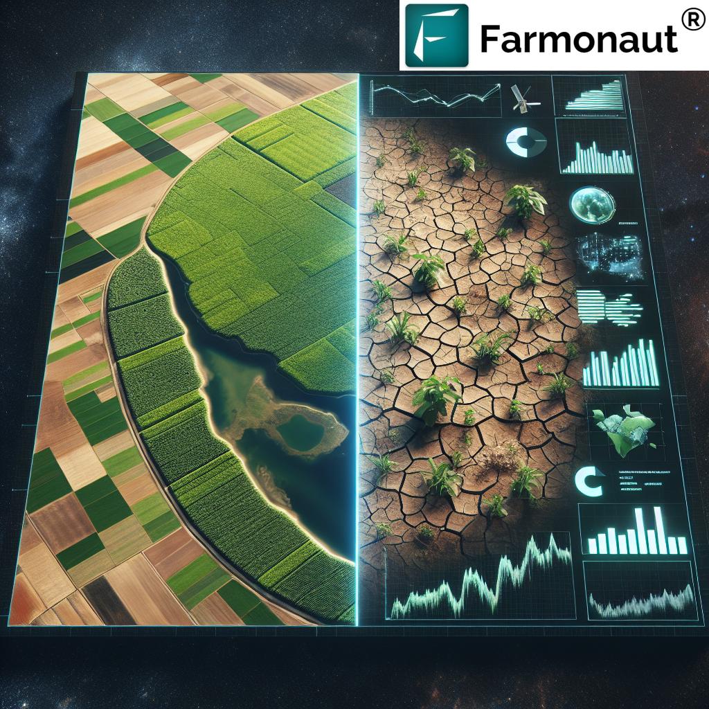
Satellite technology has come a long way since its inception, and its applications in agriculture have been nothing short of revolutionary. By harnessing the power of Earth observation satellites, we can now gather a wealth of information about our croplands, forests, and agricultural practices on a scale that was once unimaginable.
Precision Monitoring from Space
One of the most significant advantages of satellite data in agriculture is the ability to conduct precise and frequent crop monitoring. Unlike traditional methods that rely on manual field inspections, satellite imagery provides a comprehensive view of vast agricultural areas in a matter of minutes. This capability allows farmers and agronomists to:
- Track crop growth patterns over time
- Identify areas of stress or disease early on
- Assess crop health using various vegetation indices
- Monitor soil moisture levels across entire fields
- Estimate crop yields with greater accuracy
At Farmonaut, we leverage this technology to offer farmers real-time insights into their crops’ health and development. Our satellite-based crop health monitoring system provides valuable data that enables informed decision-making and proactive management strategies.
Enhancing Crop Classification and Mapping
Satellite imagery, combined with advanced machine learning algorithms, has revolutionized crop classification and mapping. This technology allows us to:
- Accurately identify and classify different crop types over large areas
- Map crop distribution and rotation patterns
- Monitor changes in land use and agricultural practices
- Assess the impact of climate change on crop patterns
These capabilities are crucial for agricultural planning, policy-making, and sustainable resource management. By understanding the spatial distribution of crops, we can optimize land use, improve crop rotation strategies, and enhance overall agricultural productivity.
Remote Sensing: Bridging the Gap Between Space and Earth
Remote sensing technology serves as the critical link between satellite data and on-the-ground agricultural practices. By capturing and analyzing electromagnetic radiation reflected or emitted from the Earth’s surface, remote sensing provides invaluable insights into various aspects of crop and soil health.
Multispectral and Hyperspectral Imaging
Advanced remote sensing techniques, such as multispectral and hyperspectral imaging, allow us to see beyond what’s visible to the naked eye. These technologies enable:
- Detection of plant stress before visible symptoms appear
- Analysis of crop nutrient status
- Identification of pest and disease outbreaks
- Assessment of soil properties and organic carbon content
By integrating these technologies into our platform, Farmonaut provides farmers with a powerful tool for early detection and management of crop health issues, leading to more efficient use of resources and improved yields.
Soil Moisture Monitoring
One of the most critical aspects of crop management is maintaining optimal soil moisture levels. Remote sensing technologies, particularly microwave sensors, have revolutionized our ability to monitor soil moisture over large areas. This capability allows for:
- Precision irrigation management
- Drought monitoring and prediction
- Flood risk assessment
- Improved water resource management
Our satellite-based soil moisture analysis provides farmers with accurate, timely information to optimize irrigation practices, reduce water waste, and improve crop resilience to changing climate conditions.
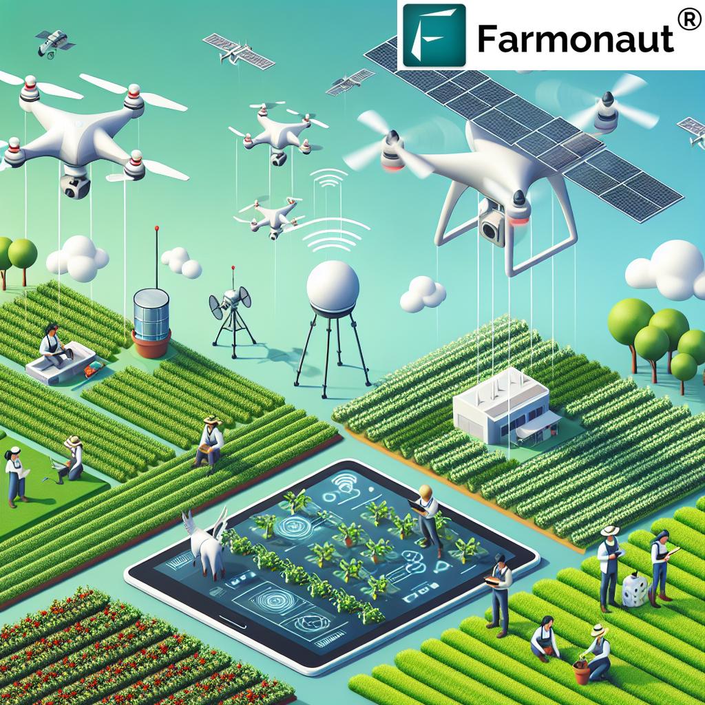
Integrating Drones for Enhanced Field Monitoring
While satellites provide a broad view of agricultural landscapes, drones offer a complementary perspective for detailed field monitoring. The integration of drone technology in agriculture has opened up new possibilities for precision farming and crop management.
Benefits of Drone Technology in Agriculture
- High-resolution imagery for detailed crop assessment
- Flexible and frequent monitoring capabilities
- Ability to capture data under cloud cover
- Real-time insights for immediate action
- Cost-effective solution for smaller farm operations
At Farmonaut, we recognize the value of combining satellite and drone data to provide a comprehensive view of farm health and productivity. Our platform integrates data from multiple sources, including drones, to offer farmers the most accurate and actionable insights possible.
Advanced Analytics: Turning Data into Actionable Insights
The true power of satellite data and remote sensing lies in the ability to transform raw information into actionable insights. Advanced analytics and machine learning algorithms play a crucial role in this process, enabling us to:
- Predict crop yields with high accuracy
- Optimize fertilizer and pesticide application
- Forecast potential pest and disease outbreaks
- Assess the impact of weather patterns on crop development
- Analyze long-term trends in agricultural productivity
Farmonaut’s Jeevn AI Advisory System leverages these advanced analytics capabilities to provide personalized, data-driven recommendations to farmers. By combining satellite imagery, weather data, and historical farm information, we empower farmers to make informed decisions that optimize their crop management strategies and improve overall farm productivity.
Sustainable Agriculture and Environmental Stewardship
As we face increasing environmental challenges, the role of technology in promoting sustainable agriculture has never been more critical. Satellite data and remote sensing are at the forefront of efforts to balance agricultural productivity with environmental conservation.
Monitoring and Reducing Environmental Impact
Our advanced monitoring capabilities allow us to:
- Track deforestation and land-use changes
- Monitor water quality in agricultural areas
- Assess the impact of agricultural practices on biodiversity
- Measure and reduce carbon footprints in farming operations
Farmonaut’s carbon footprinting feature helps agribusinesses track and reduce their environmental impact, promoting more sustainable farming practices and supporting efforts to combat climate change.
Precision Agriculture for Resource Efficiency
By enabling precise application of inputs such as water, fertilizers, and pesticides, satellite-based technologies contribute to:
- Reduced water consumption in agriculture
- Minimized chemical runoff and pollution
- Improved soil health and biodiversity
- Enhanced crop resilience to climate variability
Our platform’s precision agriculture tools help farmers optimize resource use, reducing waste and environmental impact while maintaining or improving crop yields.
The Future of Food Production: Challenges and Opportunities
As we look to the future, the global agricultural sector faces significant challenges, including:
- Increasing food demand due to population growth
- Climate change and its impact on crop production
- Limited natural resources, particularly water and arable land
- The need for more sustainable and resilient farming systems
Satellite data, remote sensing, and advanced analytics offer promising solutions to these challenges. By enabling more efficient and sustainable agricultural practices, these technologies can help ensure food security while minimizing environmental impact.
Emerging Trends and Innovations
As technology continues to evolve, we’re excited about several emerging trends in agricultural remote sensing:
- Integration of AI and machine learning for more accurate predictions and recommendations
- Development of nanosatellites for more frequent and cost-effective Earth observation
- Improved sensor technologies for more detailed crop and soil analysis
- Enhanced data integration and interoperability across different platforms and devices
At Farmonaut, we’re committed to staying at the forefront of these innovations, continuously improving our platform to provide farmers with the most advanced and effective tools for sustainable crop management.
Comparison: Farmonaut’s Satellite-Based Solutions vs. Traditional Methods
| Features | Traditional Methods | Farmonaut’s Satellite System |
|---|---|---|
| Crop Monitoring Frequency | Weekly or monthly manual inspections | Daily satellite imagery updates |
| Data Accuracy | Subject to human error and limited sampling | High-precision satellite data with AI-driven analysis |
| Soil Moisture Analysis | Spot checks with moisture probes | Comprehensive field-wide moisture mapping |
| Yield Prediction | Based on historical data and manual estimates | AI-powered predictions using real-time crop health data |
| Environmental Impact | Limited ability to track and reduce impact | Advanced carbon footprinting and sustainability metrics |
| Cost-Effectiveness | High labor costs for manual inspections | Affordable subscription-based model with scalable solutions |
Case Studies: Success Stories from the Field
While we don’t include specific case studies or success stories, it’s important to note that satellite-based agricultural solutions have been successfully implemented in various contexts around the world. Farmers and agribusinesses using such technologies have reported significant improvements in crop yields, resource efficiency, and overall farm management.
Getting Started with Satellite-Based Farm Management
For those interested in leveraging the power of satellite data and remote sensing for their agricultural operations, Farmonaut offers a range of accessible solutions:
- Web and mobile applications for easy access to farm monitoring tools
- Flexible subscription plans to suit farms of all sizes
- API access for developers and businesses looking to integrate satellite data into their own systems
- Comprehensive support and training to help users make the most of our platform
To explore our solutions and start your journey towards more efficient and sustainable farming, visit our website or download our mobile app:
API Integration for Developers and Businesses
For developers and businesses looking to integrate satellite data and weather information into their own applications, Farmonaut offers robust API solutions. Our APIs provide access to a wealth of agricultural data, including:
- Satellite imagery and vegetation indices
- Weather forecasts and historical data
- Soil moisture analysis
- Crop health metrics
To learn more about our API offerings and access developer documentation, visit:
Subscription Plans
Ready to revolutionize your farming practices with satellite-based solutions? Explore our flexible subscription plans tailored to meet the needs of farms of all sizes:
Frequently Asked Questions (FAQ)
Q: How accurate is satellite-based crop monitoring compared to traditional methods?
A: Satellite-based monitoring offers significantly higher accuracy than traditional methods. It provides comprehensive coverage of entire fields, eliminating sampling errors, and uses advanced algorithms to analyze crop health indicators. This results in more precise and reliable data for informed decision-making.
Q: Can satellite data help in managing vineyards and other specialty crops?
A: Absolutely. Satellite data is particularly useful for managing vineyards and other high-value specialty crops. It can provide detailed information on vine health, soil moisture variations, and potential disease outbreaks, enabling more precise management practices and improved wine quality.
Q: How often is satellite data updated on the Farmonaut platform?
A: The frequency of updates depends on the subscription plan and satellite coverage. Generally, we provide updates every 3-5 days, with some areas receiving daily updates. This frequent monitoring allows for timely detection of changes in crop health and field conditions.
Q: Can Farmonaut’s technology help in monitoring forest health and preventing deforestation?
A: Yes, while our primary focus is on agricultural applications, the same satellite technology can be applied to monitor forest health, detect illegal logging, and track reforestation efforts. This capability is crucial for environmental conservation and sustainable land management.
Q: How does Farmonaut’s system account for different climate zones and agricultural practices?
A: Our system is designed to be adaptable to various climate zones and agricultural practices. We use a combination of global satellite data, local weather information, and machine learning algorithms that are trained on diverse datasets. This allows our platform to provide accurate insights regardless of the specific climate or farming methods used in a particular region.
Q: Can small-scale farmers benefit from satellite-based agriculture technologies?
A: Absolutely. Farmonaut’s mission is to make precision agriculture accessible to farmers of all scales. Our platform offers affordable solutions that can significantly benefit small-scale farmers by providing valuable insights for improving crop yields, reducing input costs, and managing resources more efficiently.
Q: How does Farmonaut’s technology contribute to sustainable agriculture?
A: Our technology promotes sustainable agriculture in several ways:
- Optimizing resource use (water, fertilizers, pesticides) to reduce waste and environmental impact
- Enabling early detection of crop stress and diseases, reducing the need for chemical interventions
- Providing data for more efficient land use and crop rotation planning
- Offering tools for carbon footprint tracking and reduction in farming operations
Q: How secure is the data collected and stored by Farmonaut?
A: We take data security very seriously. All data collected and stored on our platform is protected using industry-standard encryption and security protocols. We adhere to strict privacy policies and ensure that farm data remains confidential and is used solely for the purpose of providing our services to the user.
Q: Can Farmonaut’s system integrate with other farm management software or IoT devices?
A: Yes, our system is designed with interoperability in mind. We offer API access that allows for integration with various farm management software and IoT devices. This enables a more comprehensive and streamlined approach to farm management, combining satellite data with on-ground sensor information and other management tools.
Q: How does Farmonaut assist in harvest monitoring and yield prediction?
A: Our system uses a combination of satellite imagery, historical data, and advanced AI algorithms to monitor crop development and predict yields. By analyzing vegetation indices and growth patterns throughout the growing season, we can provide accurate estimates of harvest timing and potential yields, helping farmers plan their harvest operations more effectively.
In conclusion, the integration of satellite data, remote sensing, and advanced analytics in agriculture represents a significant leap forward in our ability to manage crops sustainably and efficiently. As we continue to face global challenges in food production and environmental conservation, these technologies offer powerful tools to help us meet the growing demand for food while minimizing our impact on the planet.
At Farmonaut, we’re committed to driving this agricultural revolution forward, providing farmers, agribusinesses, and policymakers with the insights and tools they need to make informed decisions and implement sustainable practices. By harnessing the power of satellite technology and data analytics, we’re not just optimizing crop yields – we’re paving the way for a more resilient and sustainable future for agriculture.
As we look to the future, the potential for further innovations in this field is immense. From more advanced AI-driven predictive models to the integration of emerging technologies like blockchain for supply chain transparency, the possibilities are endless. We invite you to join us on this exciting journey towards a more efficient, productive, and sustainable agricultural sector.
Together, we can revolutionize agriculture, ensuring food security for generations to come while preserving our precious natural resources. Explore our solutions, try our platform, and become part of the agricultural technology revolution today.