Farmonaut For Oil Palm Plantation
For partnerships/ large scale/ custom requirements contact us at: [email protected], [email protected], Contact No. +91-9899199976
Introduction
We would like to share our technologies that helps large scale exercise on age estimation, tree counting and crop health on Oil Palm Plantations.
1. Importance of Tree Age Estimation
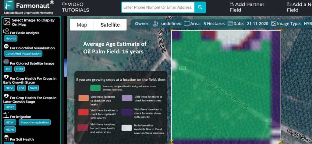
- Having prior knowledge of the age of oil palm trees at various locations can help us decide what kind of care do we need to provide at different locations.
- Furthermore it also helps us estimate the potential high yield areas.
2. Importance of Tree Number Estimation
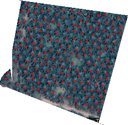
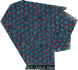
- The estimation of the number of trees within a farm can help us identify whether the field has an optimum number of trees planted per acre.
- If a lesser count is detected, they need to be informed to correct this problem by planting more trees.
3. Importance of Crop Health of Oil Palm Trees
- Farmers can select their field and identify the regions of the field at which the crop growth is not normal.
- Upon identifying that region of their fields, they can simply pay a visit to that part of the field and identify if the problem has already started. If it has not, the farmer can take preventive remedies by applying more fertilizers, plant growth regulators etc.
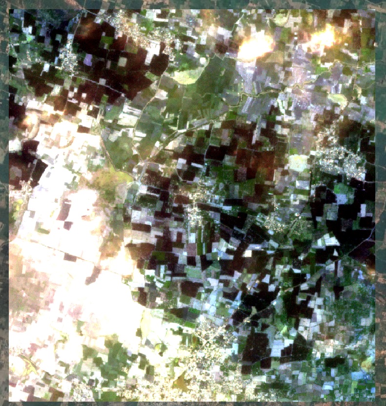
- The satellite imagery is updated every 2-5 days and has a resolution of 10 meters which is 2 times better than google maps in rural India.
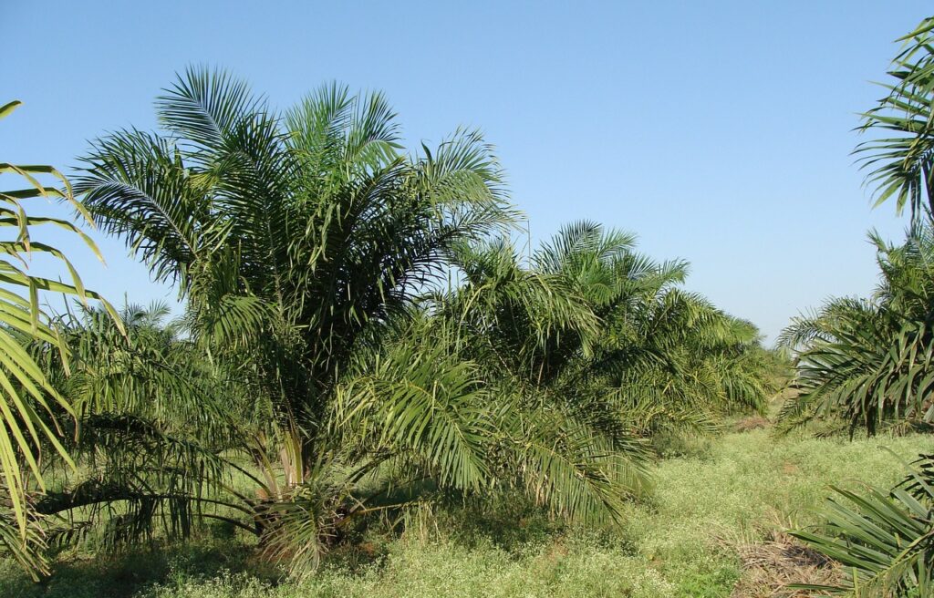
Now, a question arises, why Oil Palm Plantation?
- Well, Oil Palm is the only perennial & Eco-friendly crop that gives the highest oil yield of 4-5 T/ha among other edible oil crops.
- Giving regular and assured income to farmers up to 30 years.
- Palm oil, being the cheapest among the edible oil, is widely consumed among Indian household.
Why Farmonaut For Oil Palm Plantation?
At Farmonaut, we performed Oil Palm Plantation analysis for one of our business clients for more than 800 farmlands totalling 1000+ hectares in area.
- Not only did our system get the results pretty accurate, but also the automation system developed by us made the estimation at a faster pace.
- The system is developed in such a way that it can estimate these results for as many fields as required.
- With this, we have done an age estimation of the plantation to understand the yield outcome.
Well who can utilize benefits of our technology?
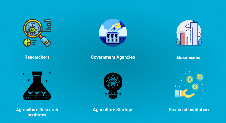
- Any corporate group, large businesses who are directly trading in Oil palms, can connect with us and take business to next levels.
- Use our system, to monitor your farms to know vegetation and water stress.
- Save your crop before its too late.
- Get pdf reports and redirect ground efforts to areas that are in actual need.
- Prevention is better than cure. Same rule applies to crops. Save money on farm inputs by identifying pin point locations with stress. Upload your farm and start receiving data.
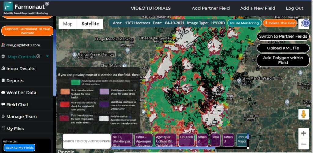
We Will Help You With
Mapping Farms In Large Quantity
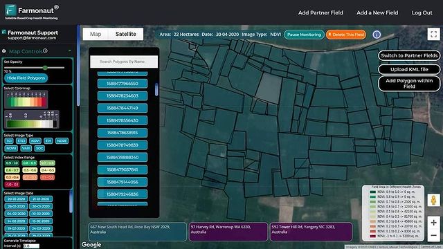
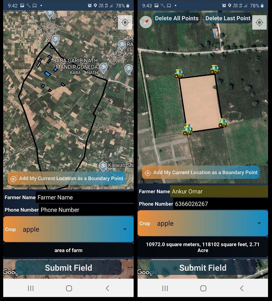
- Your ground team can use Farmonaut’s platform to map the Oil Palm Plantation
- Your ground team can map field using GPS on the field perimeters
- Admin rights will be provided to you to approve the palm fields uploaded by your ground team
- The data of farmers and other parameters will be included in the input field
- The data is available to you for further studies like crop health, water stress and farmer database
Recording Farm Level Data
For every added field, farm specific information will be saved, such as:
- Farm input (Seed, Fertilizer/ Plant protection etc.) given during various stages of the crop cycle.
- Disease/Infestation occurred during various stages of the crop cycle and geo-tagged images of the disease from the field.
API's We Provide
We provide you multiple API end points to work with, so that you can do things easily and quickly not only through android and web app but also through your internal infrastructure.
Submit Polygon
Submit filed polygons into the database.
Submit Farm Infestation Data
Submit information regarding pest or disease attack into the database.
Submit Farmer Info Data
Submit various profile related information about the farmer into the database.
Submit Farm Input Data
Submit information about various farm inputs given about the farm into the database.
Update Farmer Name
Update name of the farmer into the database.
Update Farmer Phone Number
Update phone number of the farmer into the database.
Update Farm Coordinates
Update coordinates of the field into the database.
Update Added By Phone Number
Update phone number of the ground team member who added the field into the database.
Deleting A Polygon
Delete a polygon from the database.
Search By Farmer Code,Land Id
Search polygons by using farmer code and land id in the database.
Get Master Fields
Retrieve the master location in which the polygon mapping is to be done from the database.
Get Fields Added By A Member
Retrieve the fields added by a field team member from the database.
Get Fields Added By Me
Retrieve the fields added by the logged in user from the database.
Get My Polygons
Retrieve all the polygons from the database.
Get Polygon Farmer Data
Retrieve the farmer details of a particular polygon from the database.
Find,Edit and Delete Overlapped Polygons
Retrieve, edit and delete the overlapped polygons from the database.
Tree Age Estimation
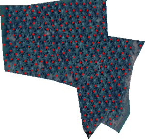
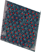
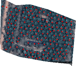
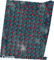
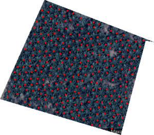
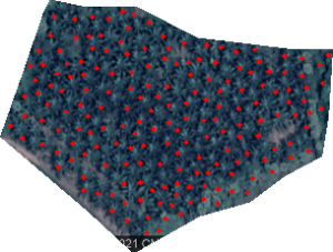
Tree Number Estimation
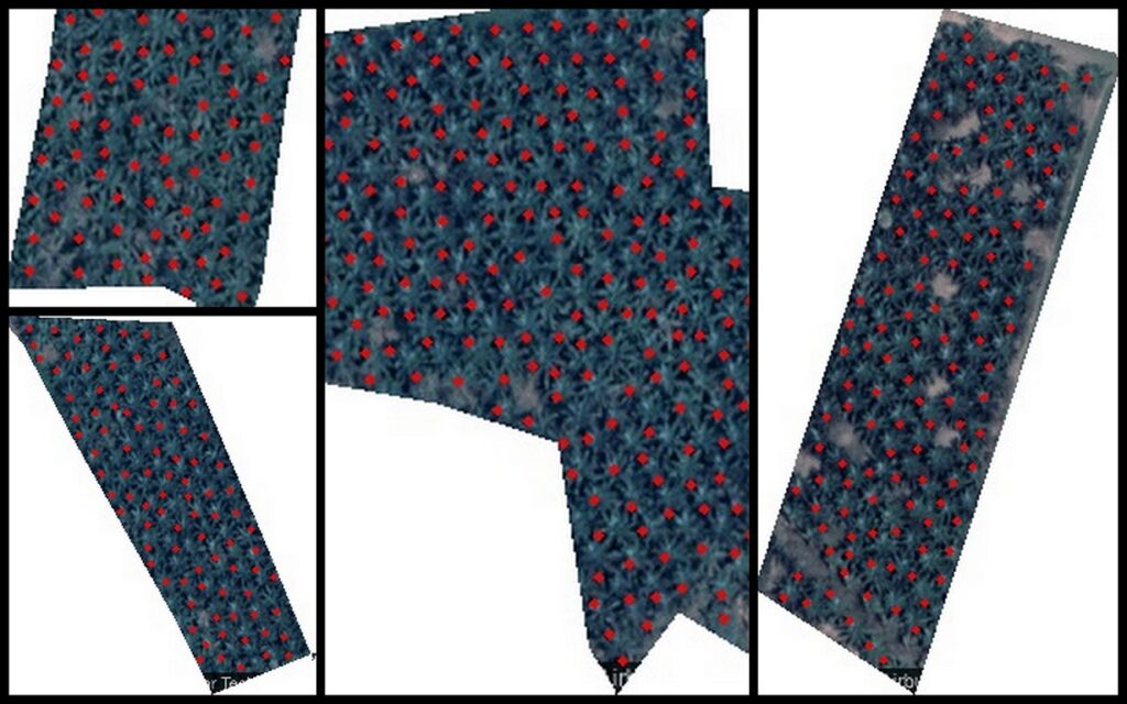
- The fields for counting of trees is mapped using Google maps data
- The fields are mapped using GPS coordinates and downloaded
- Various plant crown is mapped manually and stored in a file used as training set
- Algorithms are used to train the dataset of the mapped crown
- Plants crown are detected using object detection algorithm by running various iterations
- Results are assessed and more training is done based on results to improved the result in next iteration
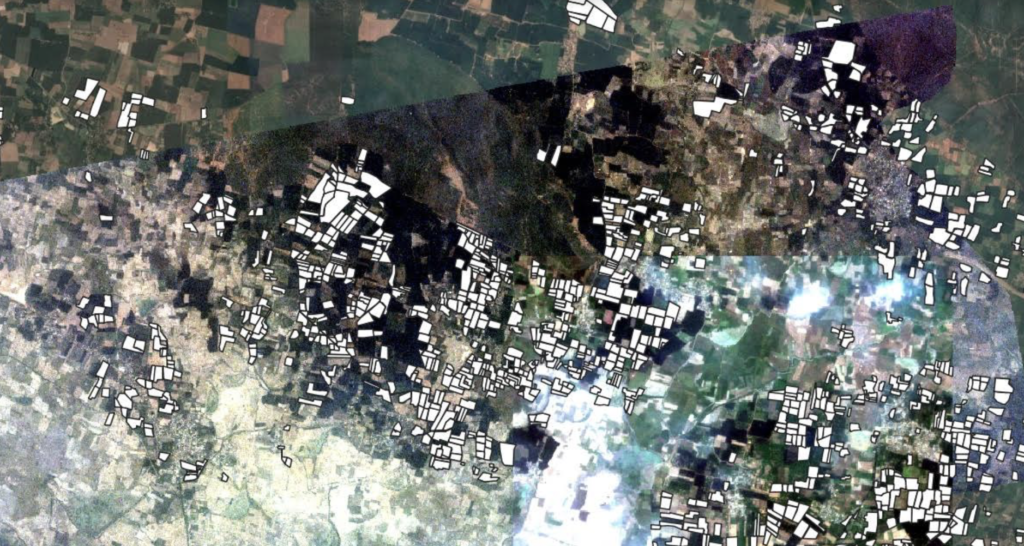
Oil Palm Area Detection
- Palm fields are mapped using Google maps on Farmonaut platform (using Sentinel 2) data based on GPS coordinates of a particular area
- Palm fields are then downloaded and used as a training set
- Palm fields are detected using object identification based on training set
- The palm fields detected and total area of each field perimeter is calculated
- The results obtained are then used for more training to improve the results on next iteration to obtain final result
Study Of Crop Health & Water Deficiency
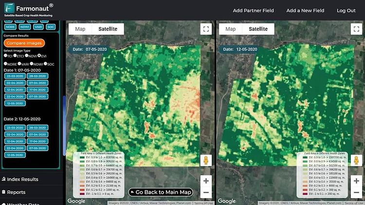
- The fields of palm fields will be mapped using Farmonaut platform by you ground team
- The fields are transferred on the Farmonaut platform and viewed using different wavelengths of light captured by satellites
- Various studies are done on crop health using Vegetation Indexes (NDVI, EVI, SAVI, NDRE)
- Water stress is studied on Farmonaut platform using NDWI, NDMI and Evapotranspiration
- Advances studies can be done using VARI, AVI, BSI and SI
- Studies like Digital Elevation Model can be done using Platform
- Studies can be done using Synthetic Aperture Radar (using Sentinel 1) during cloudy season
- Various Indexes database can be viewed and downloaded for more advanced studies
- Weather data is available for viewing and historical data can be downloaded for advanced studies Maps of various Index can be compared in parallel of various dates
