🌾 Introduction to Farm Management APIs
In today’s rapidly evolving agricultural landscape, efficient farm management is crucial for success. As the demand for innovative solutions in the agriculture technology industry grows, web app developers for agriculture technology and iOS app developers for the agtech industry are turning to powerful tools like satellite APIs providers to revolutionize farm management practices. This blog post will explore how these APIs can streamline field and farm management, making it easier than ever for agtech professionals to optimize their operations.
Whether you’re an agtech iOS developer, part of an agriculture technology industry iOS development firm, or a web app developer for agriculture technology, understanding and implementing these APIs can significantly enhance your applications and services. Let’s dive into the world of satellite APIs providers and discover how they’re transforming the way we manage farms.
🚀 Getting Started with Farm Management APIs
To begin leveraging the power of satellite APIs providers for farm management, the first step is to familiarize yourself with the API documentation. This comprehensive resource provides detailed information about various endpoints and how to use them effectively. For agtech iOS firms and web app developers in the agriculture technology sector, this documentation is an invaluable tool for integrating these powerful features into your applications.
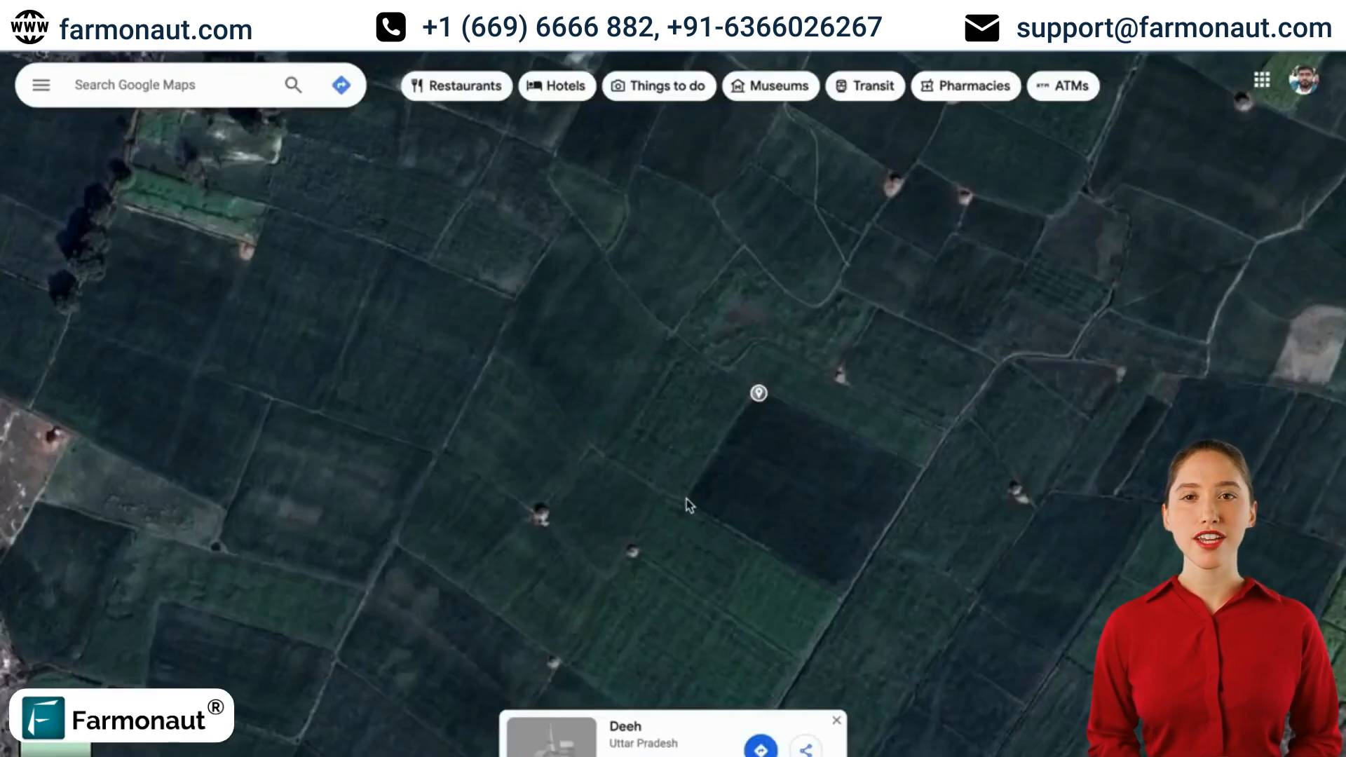
One of the most fundamental operations in farm management is submitting a new field. Let’s walk through this process step-by-step:
- Navigate to the API documentation page
- Search for the “submit new Farm plot” endpoint
- Copy the endpoint URL
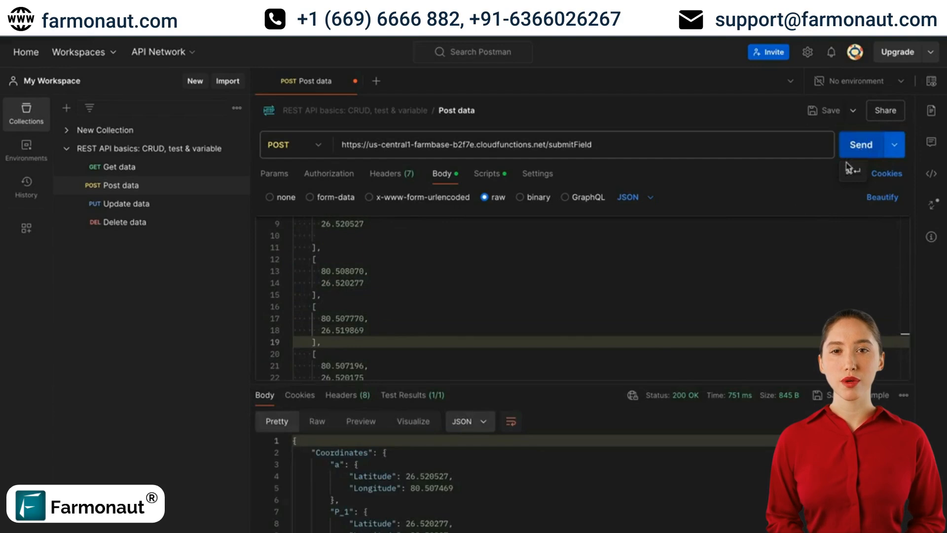
- Use a tool like Postman to send a POST request
- Set the request body to raw JSON format
📊 Crafting the Perfect API Request
When working with satellite APIs providers, it’s crucial to format your requests correctly. Here are some key points to remember:
- Use your unique API key (UID) for authentication
- Ensure coordinates are in longitude-latitude format
- Include the correct crop code and payment type
- Provide at least three coordinates to create a field boundary
For agtech iOS developers and web app developers for agriculture technology, paying attention to these details will ensure smooth integration and accurate data management.
🗺️ Managing Field Boundaries and Data
Once you’ve mastered the basics of submitting new fields, it’s time to explore more advanced features offered by satellite APIs providers. These capabilities are particularly valuable for agriculture technology industry iOS development firms looking to provide comprehensive solutions to their clients.
Here are some key operations you can perform:
- Modifying field boundaries
- Updating crop codes
- Changing multiple field data points simultaneously
- Deleting fields when necessary

🔄 Modifying Field Boundaries
As farms evolve, so do their boundaries. Satellite APIs providers offer endpoints to easily update field boundaries. This feature is particularly useful for situations where initial mapping may have been inaccurate or when land use changes occur. Here’s how to modify field boundaries:
- Search for the “modify field points” endpoint in the API documentation
- Prepare a request with your API key, new coordinates, and the field ID
- Send the request to update the boundary
Remember, changing field boundaries can affect various aspects of your farm data, including total area calculations.
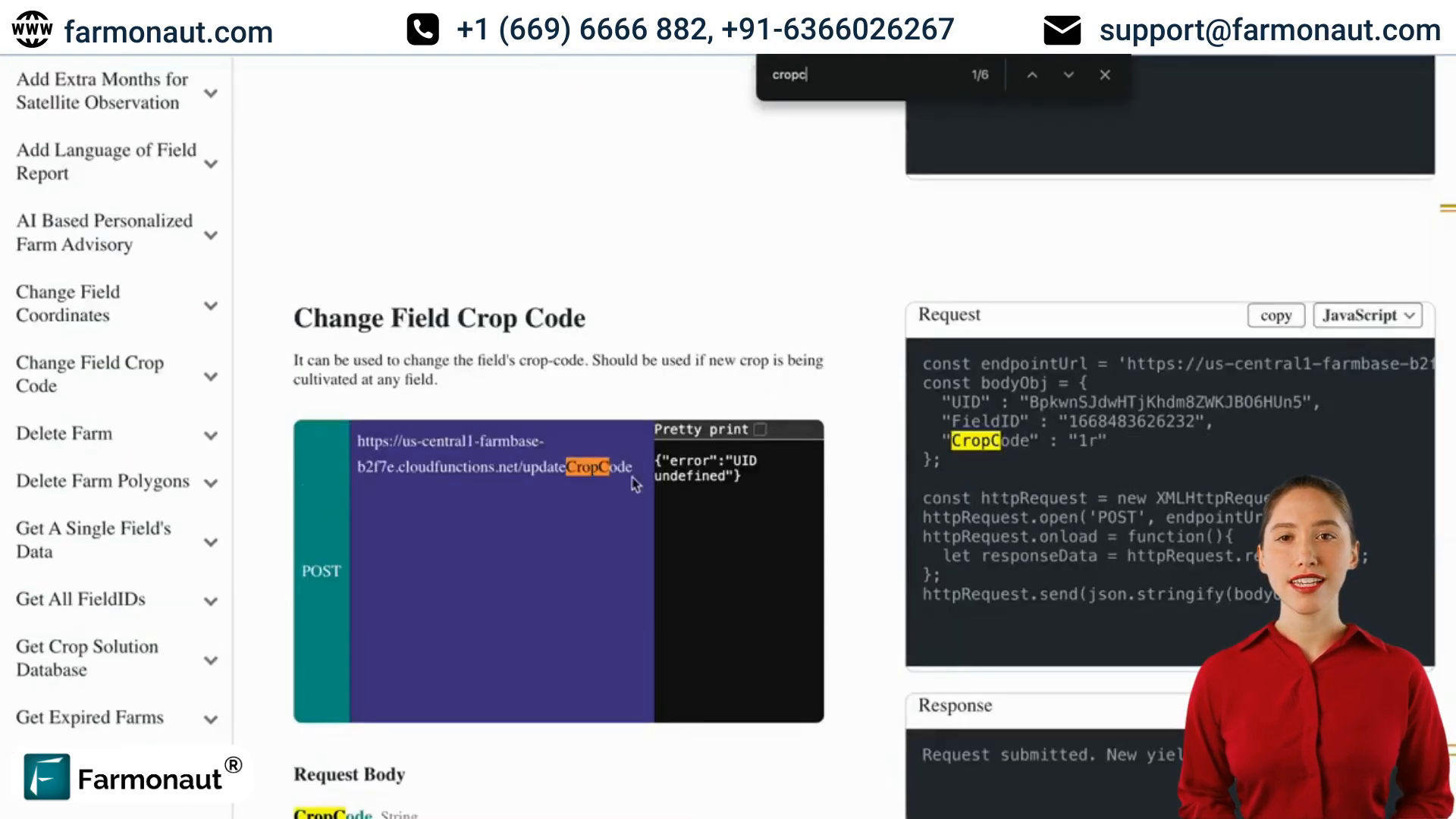
🌱 Updating Crop Codes
For agriculture technology industry iOS development firms and web app developers, providing the ability to update crop information is crucial. Satellite APIs providers offer a simple way to modify crop codes:
- Locate the “update crop code” endpoint in the API documentation
- Prepare a request with your API key, field ID, and the new crop code
- Send the request to update the crop information
This feature allows for accurate tracking of crop rotations and changes in land use, which is essential for comprehensive farm management.

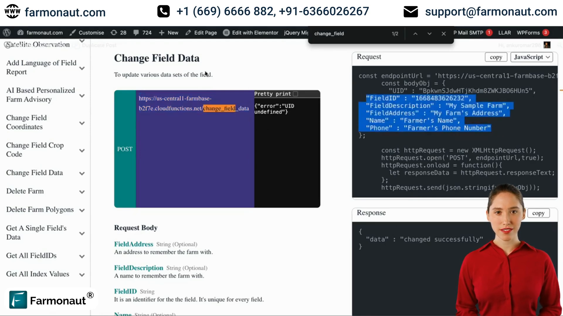
📝 Changing Multiple Field Data Points
Efficiency is key in farm management, and satellite APIs providers understand this. They offer endpoints that allow you to modify multiple data points in a single request. This feature is particularly valuable for agtech iOS developers looking to create streamlined user experiences. Here’s how it works:
- Find the “change field data” endpoint in the API documentation
- Prepare a request with your API key and field ID
- Include any combination of optional fields you wish to update (e.g., field description, address, name, phone number)
- Send the request to update multiple data points simultaneously
This powerful feature allows for quick and efficient updates to farm data, saving time and reducing the potential for errors.

🗑️ Deleting Fields
In some cases, you may need to remove a field from your database. Satellite APIs providers offer a straightforward method for deleting fields:
- Locate the “delete field” endpoint in the API documentation
- Prepare a request with your API key and the field ID you wish to delete
- Send the request to remove the field from your database
This feature ensures that your farm management system remains up-to-date and free of unnecessary data.
🔍 Leveraging Advanced Farm Data
Satellite APIs providers offer a wealth of information beyond basic field management. For web app developers in agriculture technology and agtech iOS firms, these advanced data points can provide valuable insights for farmers. Some of the additional data you can access includes:
- Soil analysis results
- Weather patterns and forecasts
- Crop health indicators
- Historical yield data
By integrating these data points into your applications, you can offer farmers a comprehensive view of their operations, enabling data-driven decision-making.

🚁 Integrating Drone Technology
While satellite APIs providers offer extensive data, combining this information with drone technology can take farm management to the next level. For agriculture technology industry iOS development firms, integrating drone capabilities can provide even more precise data. Consider these possibilities:
- Soil and field analysis with a drone for high-resolution mapping
- Real-time crop health monitoring
- Precise application of fertilizers and pesticides
- Identification of irrigation issues
By combining satellite data with drone-collected information, agtech iOS developers can create powerful, comprehensive farm management solutions.

📱 Developing iOS Apps for Agtech
For agtech iOS firms and developers, creating user-friendly and powerful mobile applications is crucial. When developing iOS apps for the agtech industry, consider the following tips:
- Focus on intuitive user interfaces that farmers can easily navigate
- Implement offline functionality for areas with poor internet connectivity
- Utilize push notifications for important alerts (e.g., weather warnings, optimal harvest times)
- Integrate data visualization tools to help farmers interpret complex information
- Ensure seamless synchronization between mobile devices and web platforms
By leveraging the power of satellite APIs providers and following these best practices, you can create iOS apps that truly revolutionize farm management.

❓ Frequently Asked Questions
Q: What are the benefits of using satellite APIs for farm management?
A: Satellite APIs provide access to a wealth of data, including field boundaries, crop health, weather patterns, and soil conditions. This information enables more informed decision-making and efficient farm management.
Q: How can agtech iOS developers integrate these APIs into their applications?
A: Developers can use the API documentation to understand the available endpoints, then use tools like Postman to test API calls before integrating them into their iOS applications using Swift or Objective-C.
Q: Are these APIs suitable for small-scale farmers?
A: Yes, satellite APIs can benefit farms of all sizes. The data provided can help small-scale farmers optimize their operations and make data-driven decisions, potentially increasing yields and reducing costs.
Q: How often is the satellite data updated?
A: The frequency of updates can vary depending on the specific API provider and the type of data. Some information, like weather data, may be updated multiple times daily, while other data, like crop health indicators, might be updated weekly or monthly.
Q: Can these APIs be integrated with other farm management tools?
A: Yes, many satellite APIs are designed to be compatible with other farm management software. Web app developers for agriculture technology can often create integrations between different tools to provide a comprehensive management solution.
🎯 Conclusion: Embracing the Future of Farm Management
As we’ve explored in this comprehensive guide, satellite APIs providers are revolutionizing the way we approach farm management. For web app developers in agriculture technology, agtech iOS firms, and agriculture technology industry iOS development companies, these powerful tools offer unprecedented opportunities to create innovative, data-driven solutions for the farming sector.
By harnessing the capabilities of satellite APIs, combined with advanced technologies like drone-based soil and field analysis, the agriculture technology industry is poised for significant advancements. As an agtech iOS developer or part of an agtech iOS firm, embracing these technologies and integrating them into your applications will position you at the forefront of this exciting industry.
Remember, the key to success lies in understanding the needs of farmers, leveraging the power of data, and creating intuitive, user-friendly applications that make farm management easier and more efficient. By doing so, you’ll not only be developing cutting-edge technology but also contributing to the future of sustainable agriculture.
Are you ready to transform the world of farming with innovative API solutions? The field is ripe for innovation, and the opportunities are boundless. Start exploring the possibilities today and be part of the agricultural revolution!