In today’s rapidly evolving agriculture technology industry, iOS development agencies are at the forefront of creating innovative solutions for farmers and agricultural consultants. One such groundbreaking development is the integration of APIs for efficient farm data retrieval. This blog post will guide you through the process of using these APIs to access crucial information about your farms, empowering you to make data-driven decisions and optimize your agricultural operations.
🌾 The Rise of Agriculture Technology in iOS Development
The agriculture technology industry has witnessed a significant surge in iOS development, with agencies focusing on creating robust applications for farm management. These agriculture technology iOS development agencies are revolutionizing the way farmers and agri consultants interact with their land, crops, and data.
One of the key areas where agriculture technology industry iOS developers are making a substantial impact is in the creation of farm field mapping apps. These apps utilize cutting-edge APIs to provide real-time data and insights, transforming the way agricultural operations are managed.
🔍 Understanding the ‘Get Farmer Data’ API Endpoint
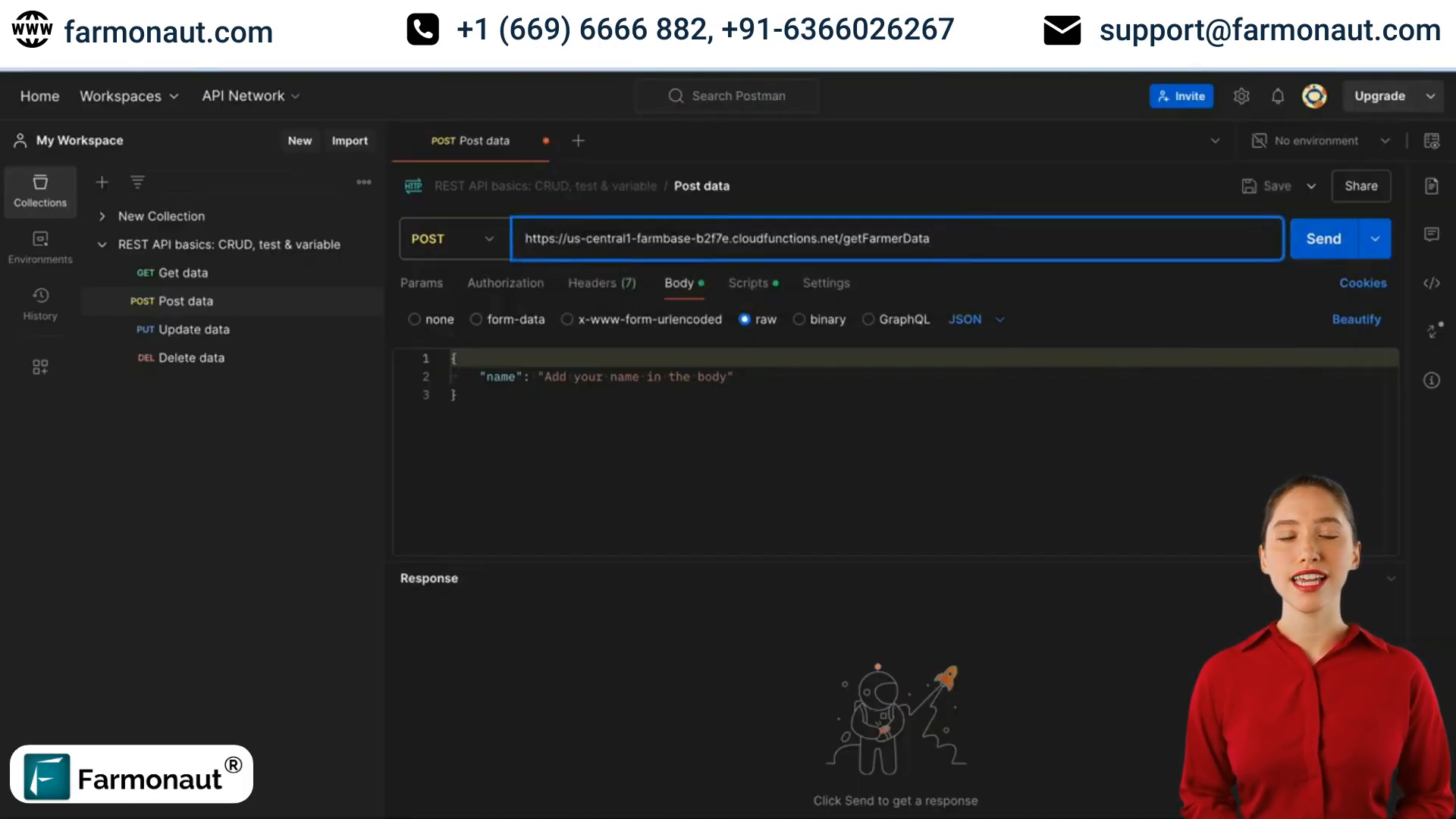
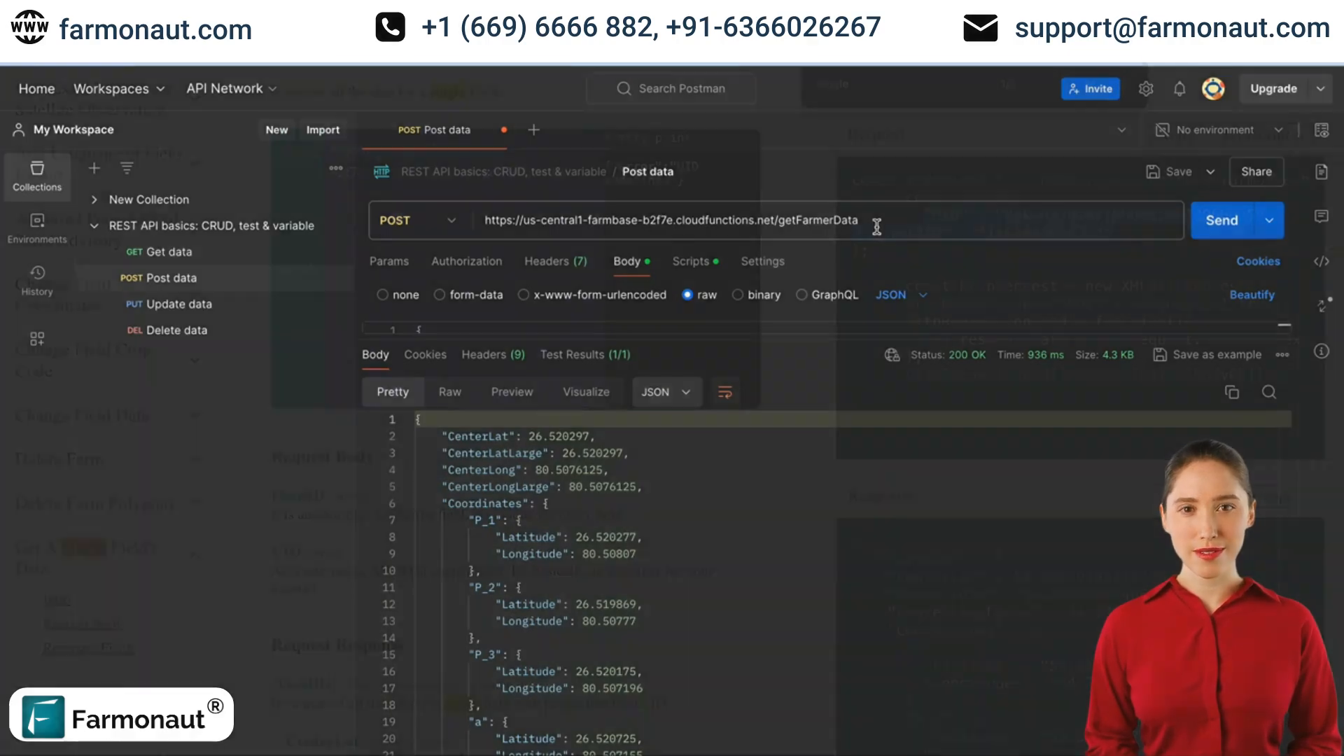
At the heart of this agricultural IoT satellite solution is the ‘get farmer data’ API endpoint. This powerful tool allows users to retrieve detailed information about a single field, providing a comprehensive overview of various parameters crucial for effective farm management.
To use this API, you’ll need two essential pieces of information:
- UID (User Identification)
- Field ID
The UID serves as your API key, while the Field ID identifies the specific plot of land you want to analyze. By inputting these parameters, you can access a wealth of information about your farm.
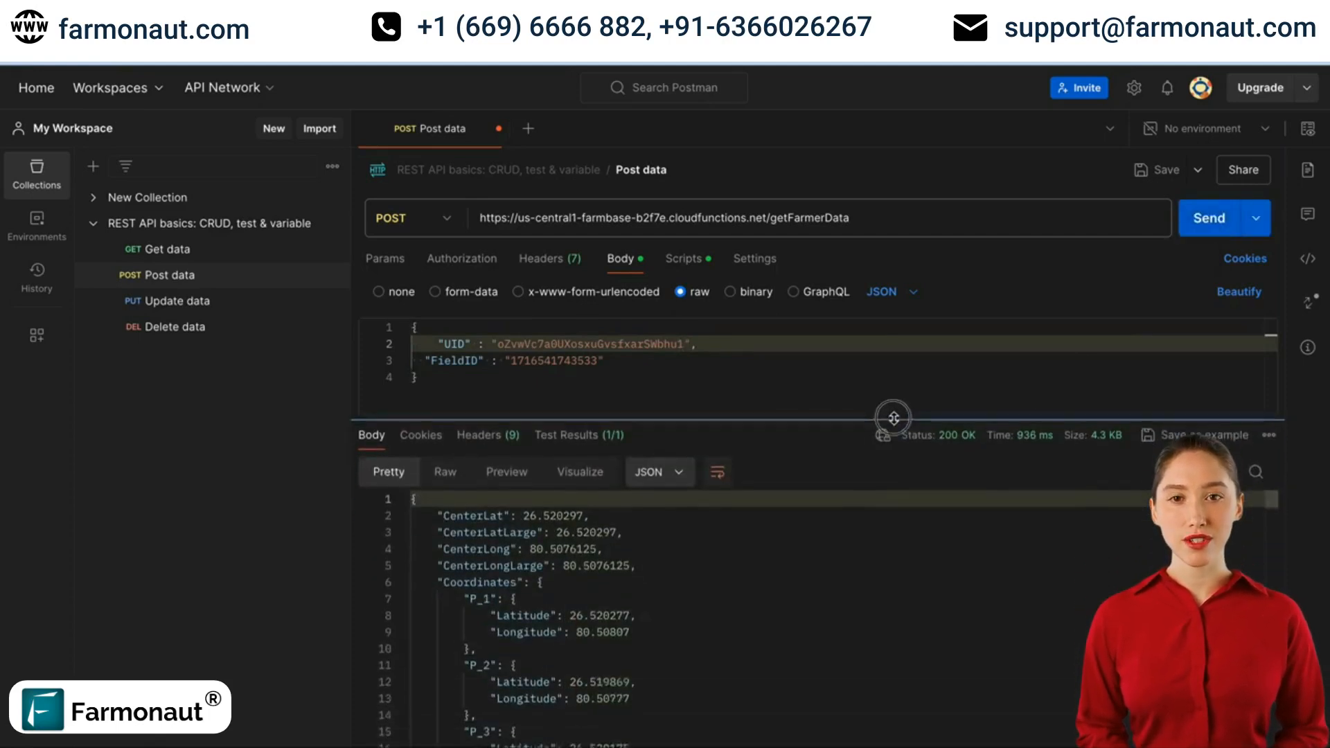
📊 Unveiling the Treasure Trove of Farm Data
Once you’ve sent your request through the API, you’ll receive a comprehensive set of data about your field. This information is invaluable for agriculture technology industry iOS development agencies working on farm management solutions. Let’s explore the key data points you’ll have access to:
Geographical Information
- Center Latitude and Longitude
- Field Coordinates
- Field Address
Farm Specifics
- Crop Code
- Area in Square Meters
- Field Description
- Field ID
Account Details
- Email ID (if provided)
- Farm Expiration Status
🛰️ Harnessing Satellite Indices for Precision Agriculture
One of the most powerful features of this agriculture technology iOS development tool is its ability to provide satellite-derived indices. These indices offer crucial insights into crop health and field conditions, enabling agri consultants and farmers to make informed decisions.
Key Satellite Indices
- NDVI (Normalized Difference Vegetation Index)
- NDWI (Normalized Difference Water Index)
The API not only provides current index values but also tracks how these indices change over time. This temporal data is invaluable for monitoring crop growth patterns and identifying potential issues early on.
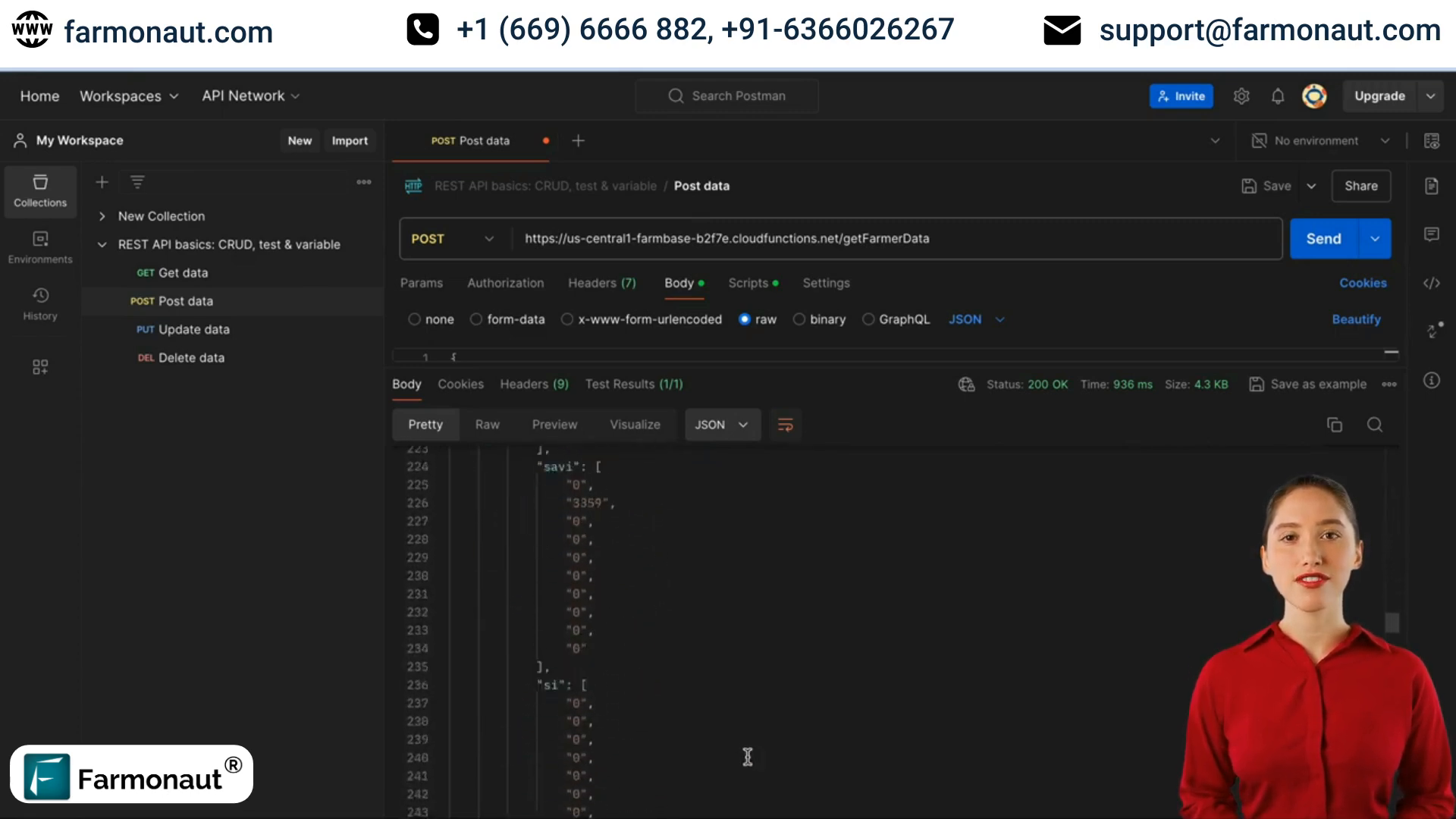
Index Breakdown
To make the satellite data even more actionable, the API provides an index breakdown. This feature shows how much of your farm area falls within different index ranges, giving you a clear picture of the overall health and condition of your fields.

🌐 Multilingual Support and Detailed Reporting
In our globalized world, agriculture technology industry iOS development agencies need to cater to a diverse user base. This API addresses that need by offering multilingual support for reports, ensuring that farmers and agri consultants worldwide can access information in their preferred language.
Additional Report Details
- Farm Name
- Order Date
- Payment Type (monitoring duration)
- Phone Number
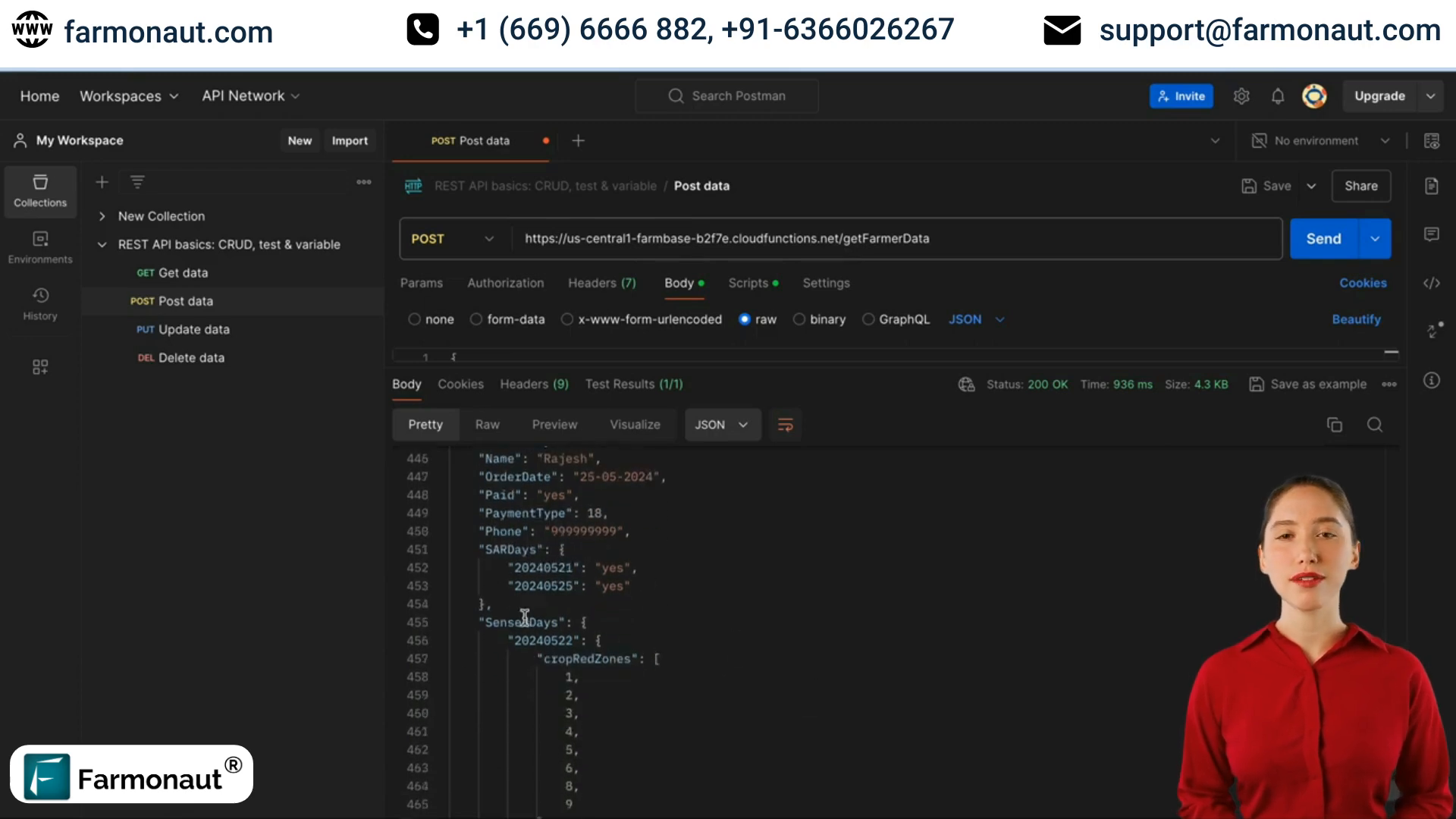
📡 Advanced Sensing Capabilities
The API provides information on two critical sensing parameters:
- Sensed Days: Days with available multi-spectral data
- SAR Days: Days with available radar data
This combination of multi-spectral and radar data ensures comprehensive field monitoring, even in challenging weather conditions. It’s a game-changer for agriculture technology iOS development, enabling the creation of more reliable and robust farm field mapping apps.
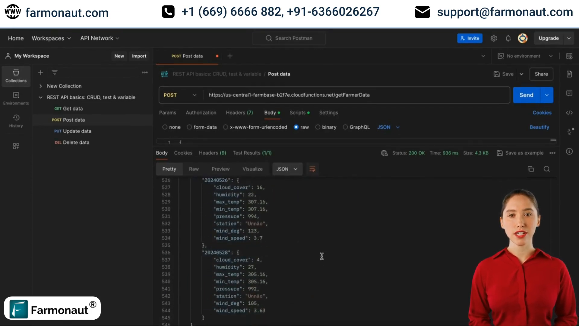
🌡️ Integrated Weather Data
To provide a holistic view of farm conditions, the API also includes weather data for the field. This integration of meteorological information with other farm data points allows for more accurate predictions and better-informed decision-making in agricultural operations.
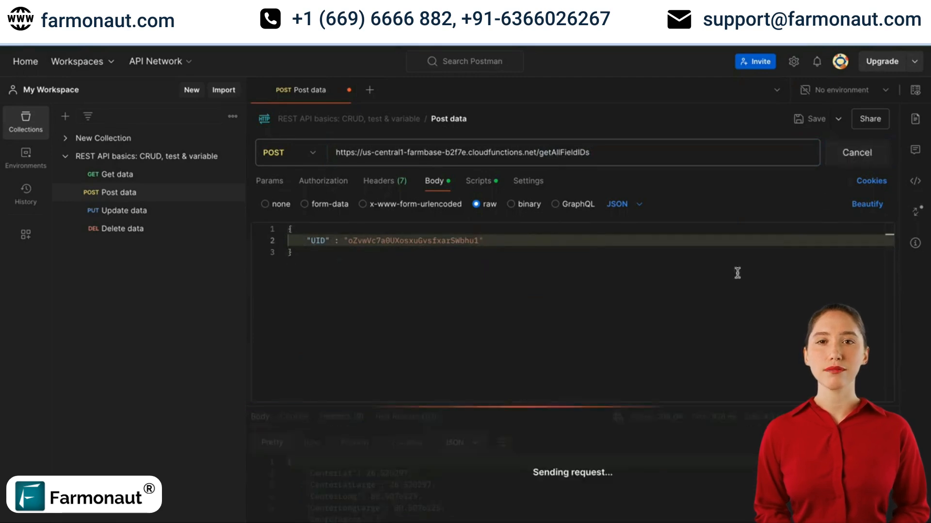
🔑 Retrieving All Field IDs
For agriculture technology industry iOS development agencies working on comprehensive farm management solutions, the ability to retrieve all field IDs associated with a user’s account is crucial. The ‘get all field IDs’ API endpoint serves this purpose perfectly.
To use this endpoint, simply pass your UID in the request object. The API will then return all field IDs linked to your account, allowing for efficient management of multiple farms or fields.
🤔 Frequently Asked Questions
Q: How often is the satellite data updated?
A: The frequency of satellite data updates depends on various factors, including weather conditions and satellite availability. Typically, you can expect updates every 5-7 days.
Q: Can I integrate this API into my existing farm management app?
A: Yes, the API is designed to be easily integrated into existing agriculture technology iOS development projects. Consult with your development team or an agriculture technology industry iOS development agency for seamless integration.
Q: Is the weather data historical or predictive?
A: The API provides both historical weather data and short-term forecasts, allowing for comprehensive climate analysis and planning.
Q: How accurate are the satellite indices?
A: Satellite indices like NDVI and NDWI are highly accurate and widely used in precision agriculture. However, ground truthing is always recommended for critical decisions.
Q: Can I access this data on mobile devices?
A: Yes, the API is designed to be compatible with mobile applications. Many agriculture technology iOS development agencies are creating mobile-friendly interfaces for easy access to this data in the field.
🚀 Conclusion: Empowering Agriculture Through Technology
The integration of APIs for farm data retrieval marks a significant leap forward in the agriculture technology industry. iOS development agencies specializing in this sector are leveraging these powerful tools to create sophisticated farm field mapping apps and comprehensive management solutions.
By harnessing the power of satellite data, weather information, and detailed field analytics, these agriculture technology iOS development solutions are empowering farmers and agri consultants to make data-driven decisions, optimize resource use, and increase productivity.
As we continue to face global challenges in food production and sustainability, the role of agriculture technology industry iOS development agencies becomes increasingly crucial. By creating intuitive, data-rich applications, these agencies are not just developing software – they’re cultivating a more efficient, sustainable, and productive future for agriculture.
Embrace the power of agricultural IoT satellite solutions and take your farming operations to the next level. Contact an agriculture technology industry iOS development agency today to explore how these innovative APIs can transform your agricultural practices and drive your business forward in the digital age.