Revolutionizing Agriculture: Harnessing Geospatial Intelligence for Sustainable Crop Management and Yield Prediction
In today’s rapidly evolving agricultural landscape, the integration of advanced technologies has become essential for sustainable and efficient farming practices. At Farmonaut, we are at the forefront of this agricultural revolution, harnessing the power of geospatial intelligence to transform crop management, yield prediction, and overall farm productivity. Our innovative approach combines satellite imagery, artificial intelligence, and data analytics to provide farmers with unprecedented insights into their fields, enabling them to make informed decisions and optimize their operations.
The Power of Geospatial Intelligence in Agriculture
Geospatial intelligence, or GEOINT, is the art and science of interpreting imagery and geospatial information to describe, assess, and visually depict physical features and geographically referenced activities on Earth. In the context of agriculture, this technology has opened up new avenues for precise and efficient farming practices.
At Farmonaut, we leverage high-resolution satellite imagery to provide farmers with a bird’s-eye view of their fields. This aerial perspective, combined with our advanced analytics, allows for:
- Comprehensive crop monitoring: Regular updates on crop health, growth stages, and potential issues
- Precise soil analysis: Detailed insights into soil moisture, organic carbon content, and nutrient levels
- Accurate yield prediction: Data-driven forecasts to help farmers plan and optimize their harvest
- Efficient resource management: Recommendations for optimal use of water, fertilizers, and other inputs
- Environmental impact assessment: Tools to monitor and reduce the carbon footprint of farming operations
The Farmonaut Advantage: Satellite-Based Farm Management
Our satellite-based farm management system offers numerous benefits over traditional agricultural methods. Let’s take a closer look at how Farmonaut’s approach compares to conventional farming practices:
| Aspect | Traditional Methods | Farmonaut Satellite System |
|---|---|---|
| Crop Monitoring | Manual field scouting, time-consuming and labor-intensive | Real-time satellite imagery, AI-powered analysis for quick and accurate assessments |
| Soil Analysis | Periodic soil testing, limited sampling points | Continuous monitoring of soil moisture and health across entire fields |
| Yield Prediction | Based on historical data and subjective assessments | AI-driven predictions using real-time crop health data and historical trends |
| Resource Management | Uniform application of inputs across fields | Variable Rate Application (VRA) maps for precise, need-based resource allocation |
| Environmental Impact | Limited ability to track and manage environmental footprint | Carbon footprint tracking and recommendations for sustainable practices |
Comprehensive Crop Monitoring: The Foundation of Precision Agriculture
Effective crop monitoring is the cornerstone of successful farming, and at Farmonaut, we’ve revolutionized this process through our advanced satellite-based system. Our platform provides farmers with unprecedented insights into their crops’ health and development, enabling them to make data-driven decisions throughout the growing season.
Real-Time Vegetation Health Monitoring
One of the key features of our crop monitoring system is the use of Normalized Difference Vegetation Index (NDVI) analysis. NDVI is a powerful indicator of plant health and vigor, derived from multispectral satellite imagery. Here’s how we utilize NDVI to benefit our farmers:
- Early stress detection: By analyzing NDVI values, we can identify areas of crop stress before they become visible to the naked eye, allowing for prompt intervention.
- Growth stage monitoring: NDVI trends help track crop development throughout the season, ensuring that management practices align with the crop’s current needs.
- Yield potential assessment: Historical NDVI data correlates strongly with final yield, providing valuable insights for harvest planning and marketing decisions.
Our system updates NDVI maps regularly, providing farmers with a continuous stream of actionable information about their fields’ health and productivity.
Precision Scouting with AI-Powered Anomaly Detection
To complement our satellite-based monitoring, we’ve developed an AI-powered anomaly detection system that revolutionizes field scouting practices:
- Automated issue identification: Our AI algorithms analyze satellite imagery to detect potential problems such as pest infestations, disease outbreaks, or nutrient deficiencies.
- Targeted scouting recommendations: Instead of walking entire fields, farmers can focus their efforts on specific areas flagged by our system, saving time and resources.
- Historical context: Our platform maintains a record of detected anomalies, allowing farmers to track recurring issues and refine their management strategies over time.
This intelligent scouting approach ensures that no potential issues go unnoticed, while significantly reducing the time and effort required for field inspections.
Weather Integration for Contextual Insights
Understanding the interplay between weather conditions and crop health is crucial for effective farm management. Our platform integrates local weather data with crop monitoring insights to provide a comprehensive view of field conditions:
- Weather-based alerts: We notify farmers of impending weather events that may impact their crops, allowing for proactive management decisions.
- Historical weather analysis: By correlating past weather patterns with crop performance, we help farmers identify optimal planting and harvesting windows.
- Microclimate mapping: Our high-resolution satellite data can reveal microclimatic variations within fields, enabling more precise management practices.
This weather-integrated approach ensures that farmers have all the necessary context to interpret crop health data and make informed decisions.
Advanced Soil Analysis: The Foundation of Sustainable Agriculture
At Farmonaut, we recognize that healthy soils are the foundation of sustainable and productive agriculture. Our satellite-based soil analysis goes beyond traditional methods, offering farmers a comprehensive and dynamic view of their soil’s health and properties.
Soil Moisture Monitoring
Efficient water management is crucial for both crop yield and environmental sustainability. Our platform provides continuous soil moisture monitoring across entire fields:
- High-resolution moisture maps: We generate detailed maps showing soil moisture distribution, helping farmers identify areas that may need additional irrigation or are at risk of waterlogging.
- Trend analysis: By tracking soil moisture changes over time, we help farmers optimize their irrigation schedules and detect potential issues with drainage or water retention.
- Integration with weather forecasts: Our system combines soil moisture data with weather predictions to provide actionable irrigation recommendations, ensuring optimal water use efficiency.
This precise moisture monitoring enables farmers to maintain ideal soil conditions for crop growth while conserving water resources.
Organic Carbon Content Assessment
Soil organic carbon is a key indicator of soil health and fertility. Our satellite-based analysis provides insights into organic carbon levels across fields:
- Carbon mapping: We generate maps showing the distribution of organic carbon in the soil, helping farmers identify areas that may benefit from additional organic matter inputs.
- Trend monitoring: By tracking changes in organic carbon levels over time, we help farmers assess the impact of their management practices on soil health.
- Carbon sequestration potential: Our analysis can identify areas with high potential for carbon sequestration, supporting farmers in participating in carbon credit programs.
This focus on organic carbon helps farmers improve soil structure, water retention, and nutrient availability while contributing to climate change mitigation efforts.
Nutrient Management Optimization
Efficient nutrient management is essential for maximizing crop yields while minimizing environmental impact. Our platform provides valuable insights for optimizing fertilizer use:
- Nutrient deficiency detection: By analyzing spectral signatures in satellite imagery, we can identify areas showing signs of nutrient deficiencies, enabling targeted fertilizer applications.
- Variable Rate Application (VRA) maps: We generate precise VRA maps for fertilizer application, ensuring that each area of the field receives the optimal amount of nutrients based on its specific needs.
- Nutrient uptake efficiency analysis: By correlating fertilizer applications with crop response, we help farmers assess and improve their nutrient use efficiency over time.
This data-driven approach to nutrient management helps farmers reduce input costs, minimize nutrient runoff, and optimize crop nutrition.
Cutting-Edge Yield Prediction: Empowering Farmers with Foresight
Accurate yield prediction is a game-changer in modern agriculture, allowing farmers to make informed decisions about resource allocation, marketing, and financial planning. At Farmonaut, we’ve developed a state-of-the-art yield prediction system that combines satellite imagery, historical data, and machine learning algorithms to provide highly accurate forecasts.
Multi-Factor Yield Modeling
Our yield prediction model takes into account a wide range of factors to ensure the most accurate forecasts possible:
- Crop health indices: We incorporate NDVI and other vegetation indices derived from satellite imagery to assess current crop conditions and potential.
- Historical yield data: By analyzing past performance, our model can identify trends and patterns that influence yield outcomes.
- Weather data: We integrate both historical and forecasted weather information to account for the significant impact of climatic conditions on crop yields.
- Soil characteristics: Our model considers soil type, organic matter content, and other relevant soil properties that affect crop productivity.
- Management practices: Information on planting dates, fertilizer applications, and other management decisions is factored into our predictions.
This comprehensive approach allows us to generate yield forecasts that are both highly accurate and field-specific.
Dynamic Yield Forecasting
Unlike traditional yield estimation methods that provide a single prediction, our system offers dynamic forecasting throughout the growing season:
- Regular updates: We update yield predictions as new satellite imagery and weather data become available, allowing farmers to track how changing conditions impact potential yields.
- Scenario modeling: Our platform enables farmers to explore how different management decisions or weather scenarios might affect final yields, supporting strategic decision-making.
- Yield variability mapping: We generate maps showing predicted yield variability within fields, helping farmers identify areas that may need additional attention or management.
This dynamic approach provides farmers with a continuously evolving picture of their potential harvest, enabling them to adapt their strategies as the season progresses.
AI-Powered Accuracy Improvements
Our yield prediction system leverages advanced artificial intelligence and machine learning techniques to continuously improve its accuracy:
- Self-learning algorithms: Our models learn from each season’s data, refining their predictions based on observed outcomes and improving accuracy over time.
- Regional calibration: We calibrate our models for specific regions and crop varieties, accounting for local factors that influence yield potential.
- Anomaly detection: Our AI systems can identify and account for unusual events or conditions that may impact yields, ensuring robust predictions even in atypical seasons.
This commitment to continuous improvement ensures that our yield predictions remain at the cutting edge of agricultural forecasting technology.
Efficient Resource Management: Maximizing Productivity While Minimizing Waste
In an era of increasing environmental awareness and resource scarcity, efficient resource management is crucial for sustainable agriculture. At Farmonaut, we’ve developed a suite of tools and technologies to help farmers optimize their use of water, fertilizers, and other inputs, ensuring maximum productivity with minimal waste.
Precision Irrigation Management
Water is one of the most critical and often scarce resources in agriculture. Our platform offers advanced irrigation management tools to help farmers use water more efficiently:
- Soil moisture monitoring: As mentioned earlier, our satellite-based soil moisture maps provide a comprehensive view of water distribution across fields.
- Evapotranspiration modeling: We use satellite data and weather information to estimate crop water use, helping farmers match irrigation to actual crop needs.
- Irrigation scheduling recommendations: Our system provides personalized irrigation schedules based on crop type, growth stage, soil moisture, and weather forecasts.
- Deficit irrigation strategies: For water-scarce regions, we offer guidance on optimal deficit irrigation strategies to maximize water use efficiency without significantly impacting yields.
These tools enable farmers to maintain optimal soil moisture levels while conserving water resources and reducing irrigation costs.
Variable Rate Application (VRA) for Inputs
One-size-fits-all approaches to fertilizer and pesticide application often lead to waste and potential environmental issues. Our VRA technology allows for precise, need-based application of inputs:
- Nutrient VRA maps: Based on our soil analysis and crop health monitoring, we generate detailed maps for variable rate fertilizer application, ensuring each area of the field receives the optimal amount of nutrients.
- Pesticide VRA recommendations: By identifying areas of pest or disease pressure, we can guide targeted pesticide applications, reducing overall chemical use while maintaining effective pest control.
- Seed rate optimization: Our platform can recommend variable seeding rates based on soil productivity zones, helping farmers optimize plant populations across their fields.
This precision approach not only reduces input costs but also minimizes the environmental impact of agricultural chemicals.
Equipment Efficiency and Fleet Management
Efficient use of agricultural equipment is essential for reducing costs and minimizing soil compaction. Our platform includes features to optimize equipment use:
- Field boundary mapping: We provide accurate field boundary maps to optimize equipment routes and minimize unnecessary travel.
- Traffic pattern optimization: Our system can suggest optimal traffic patterns for field operations, reducing soil compaction and improving overall field health.
- Equipment performance tracking: For larger operations, we offer fleet management tools to monitor equipment performance, fuel efficiency, and maintenance needs.
These features help farmers maximize the efficiency of their agricultural equipment, reducing fuel consumption and minimizing environmental impact.
Environmental Impact Assessment and Sustainability Practices
At Farmonaut, we believe that sustainable agriculture is not just an option but a necessity for the future of farming. Our platform incorporates various tools and features to help farmers assess and reduce their environmental impact while maintaining profitable operations.
Carbon Footprint Tracking and Reduction
Understanding and managing the carbon footprint of agricultural operations is becoming increasingly important. Our platform offers comprehensive carbon tracking and management tools:
- Carbon emission calculations: We provide estimates of carbon emissions associated with various farm activities, including fuel use, fertilizer applications, and soil disturbance.
- Carbon sequestration potential: Our soil analysis can identify areas with high potential for carbon sequestration, helping farmers implement practices that increase soil organic carbon.
- Emission reduction recommendations: Based on the farm’s carbon profile, we offer tailored suggestions for reducing emissions, such as optimizing fertilizer use or implementing conservation tillage practices.
These tools not only help farmers reduce their environmental impact but also position them to participate in emerging carbon credit markets.
Biodiversity and Ecosystem Services Monitoring
Maintaining biodiversity and ecosystem health is crucial for long-term agricultural sustainability. Our platform includes features to monitor and enhance biodiversity on farms:
- Habitat mapping: We use high-resolution satellite imagery to identify and map natural habitats within and around agricultural areas.
- Pollinator support: Our system can recommend strategies for supporting pollinator populations, such as planting flower strips or maintaining hedgerows.
- Ecosystem service valuation: We provide estimates of the economic value of ecosystem services provided by natural areas on farms, helping farmers make informed decisions about land use.
By promoting biodiversity, farmers can enhance natural pest control, improve pollination, and increase the overall resilience of their agricultural systems.
Sustainable Practice Implementation and Monitoring
Implementing sustainable agricultural practices is an ongoing process. Our platform supports farmers in adopting and monitoring the effectiveness of various sustainable practices:
- Cover crop management: We provide guidance on selecting, planting, and managing cover crops to improve soil health and reduce erosion.
- Conservation tillage monitoring: Our satellite imagery can track the implementation and effects of conservation tillage practices on soil health and crop performance.
- Integrated Pest Management (IPM) support: We offer tools to monitor pest populations and natural predators, supporting more sustainable pest management strategies.
- Water quality impact assessment: By analyzing land use patterns and management practices, we can help farmers assess and minimize their impact on local water quality.
These features enable farmers to implement and fine-tune sustainable practices, ensuring they achieve both environmental and economic benefits.
The Future of Agriculture: Integrating Advanced Technologies
As we look to the future of agriculture, the integration of advanced technologies will play an increasingly crucial role in meeting global food demand while ensuring environmental sustainability. At Farmonaut, we are continuously exploring and implementing cutting-edge technologies to enhance our services and empower farmers.
Artificial Intelligence and Machine Learning Advancements
The potential of AI and machine learning in agriculture is vast, and we are at the forefront of harnessing these technologies:
- Advanced crop classification: Our AI algorithms are becoming increasingly adept at identifying and classifying different crop types and varieties from satellite imagery, enabling more precise monitoring and management.
- Predictive analytics for pest and disease outbreaks: By analyzing historical data, weather patterns, and current field conditions, our AI systems are developing the ability to predict potential pest and disease outbreaks before they occur.
- Automated crop stage detection: Our machine learning models are improving in their ability to automatically detect and track crop growth stages, enabling more precise timing of management activities.
These AI-driven advancements will provide farmers with even more accurate and timely insights, further optimizing their decision-making processes.
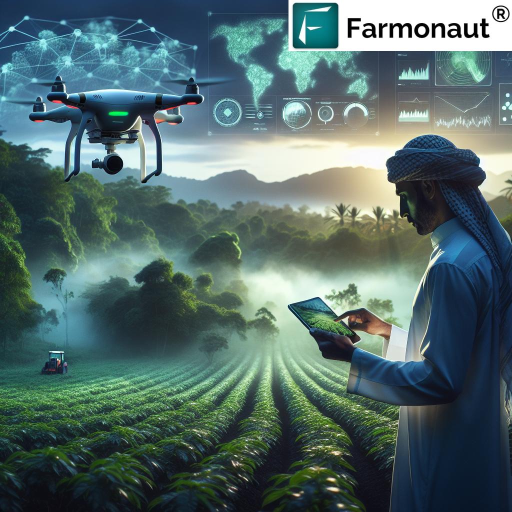
Integration of Drone Technology
While satellite imagery forms the core of our remote sensing capabilities, we recognize the complementary role that drone technology can play in precision agriculture:
- High-resolution imagery: Drones can provide ultra-high-resolution imagery for specific areas of interest, complementing our satellite-based monitoring.
- Real-time data collection: For time-sensitive applications, drones offer the ability to collect data on-demand, providing immediate insights when needed.
- Specialized sensors: Drones equipped with multispectral or thermal sensors can provide additional data layers for even more comprehensive field analysis.
We are exploring partnerships and integrations to incorporate drone-based data collection into our platform, offering farmers a multi-tiered approach to field monitoring.
Internet of Things (IoT) and Sensor Networks
The proliferation of IoT devices and sensors in agriculture opens up new possibilities for data collection and farm management:
- In-field sensor integration: We are developing capabilities to integrate data from in-field sensors (e.g., soil moisture probes, weather stations) with our satellite-based analytics for a more comprehensive view of field conditions.
- Equipment telematics: By integrating data from connected farm equipment, we can provide even more precise insights into field operations and resource use.
- Automated alerts and actions: The combination of satellite data, IoT sensors, and AI analytics will enable more sophisticated automated alert systems and even trigger automated actions (e.g., irrigation systems) based on real-time conditions.
This integration of multiple data sources will provide farmers with an unprecedented level of insight into their operations, enabling truly data-driven farming.
Empowering Farmers Through Education and Support
At Farmonaut, we believe that providing powerful tools is only part of the equation. To truly revolutionize agriculture, we must empower farmers with the knowledge and support they need to make the most of these advanced technologies.
Comprehensive Training Programs
We offer a range of training programs to help farmers and agronomists get the most out of our platform:
- Online courses: Self-paced e-learning modules covering everything from basic platform navigation to advanced data interpretation.
- Webinars and workshops: Regular online sessions featuring expert speakers and practical demonstrations of our tools.
- In-field training: For larger operations or farming cooperatives, we offer on-site training to provide hands-on experience with our technology.
These educational initiatives ensure that farmers can fully leverage the power of our geospatial intelligence tools.
Agronomic Consulting Services
To complement our technology, we offer agronomic consulting services to help farmers interpret data and implement best practices:
- Data interpretation support: Our team of agronomists can help farmers make sense of the wealth of data provided by our platform, offering context and actionable recommendations.
- Customized management plans: We work with farmers to develop tailored crop management strategies based on their specific goals, field conditions, and local environment.
- Ongoing support: Our agronomists are available throughout the growing season to answer questions and provide guidance as new challenges arise.
This combination of advanced technology and expert support ensures that farmers can make the most informed decisions possible.
Community Building and Knowledge Sharing
We recognize the value of peer-to-peer learning and community support in agriculture:
- User forums: We maintain active online forums where farmers can share experiences, ask questions, and offer advice to one another.
- Case studies and success stories: We regularly publish case studies highlighting how farmers are using our platform to achieve tangible results.
- Regional user groups: We facilitate the formation of regional user groups, allowing farmers to connect with others facing similar challenges in their area.
By fostering a strong user community, we create an ecosystem of continuous learning and improvement.
Conclusion: A Vision for Sustainable, Data-Driven Agriculture
As we navigate the challenges of feeding a growing global population while preserving our planet’s resources, the role of advanced technologies in agriculture becomes increasingly crucial. At Farmonaut, we are committed to leading this technological revolution, providing farmers with the tools, insights, and support they need to practice sustainable, efficient, and profitable agriculture.
Our comprehensive approach, combining satellite-based monitoring, AI-powered analytics, and expert agronomic support, empowers farmers to:
- Optimize crop health and yield through precise monitoring and management
- Improve resource efficiency, reducing waste and environmental impact
- Make data-driven decisions that balance productivity with sustainability
- Adapt to changing climate conditions and market demands
- Contribute to global efforts in carbon sequestration and biodiversity conservation
As we look to the future, we remain dedicated to pushing the boundaries of agricultural technology, continuously refining our platform to meet the evolving needs of farmers worldwide. By harnessing the power of geospatial intelligence, we are not just transforming individual farms – we are reshaping the future of agriculture itself, creating a more sustainable and food-secure world for generations to come.
Join us in this agricultural revolution. Explore how Farmonaut can transform your farming operations by visiting our website or downloading our mobile app today.
Visit Farmonaut Website
Download Android App
Download iOS App
Frequently Asked Questions (FAQ)
-
Q: How often are satellite images updated on the Farmonaut platform?
A: Our satellite imagery is typically updated every 3-5 days, depending on weather conditions and satellite availability. This frequent update schedule ensures that farmers have access to the most current data for their decision-making. -
Q: Can Farmonaut’s technology be used for all types of crops?
A: Yes, our platform is designed to work with a wide range of crops, including grains, fruits, vegetables, and specialty crops. The AI algorithms are trained on diverse datasets to ensure accuracy across various crop types. -
Q: How accurate are the yield predictions provided by Farmonaut?
A: Our yield predictions typically achieve accuracy rates of 85-95%, depending on the crop type and local conditions. The accuracy improves over time as our models learn from more data and farmer feedback. -
Q: Is an internet connection required to use Farmonaut in the field?
A: While an internet connection provides the most up-to-date information, our mobile app allows for offline access to previously downloaded data, ensuring you can access crucial information even in areas with limited connectivity. -
Q: How does Farmonaut ensure the privacy and security of farm data?
A: We take data privacy very seriously. All farm data is encrypted and stored securely in the cloud. We adhere to strict data protection protocols and never share individual farm data without explicit consent. -
Q: Can Farmonaut integrate with other farm management software or equipment?
A: Yes, we offer API integration capabilities that allow Farmonaut to connect with various farm management software and smart farming equipment. For more information on integration options, please visit our API documentation page. -
Q: What kind of support does Farmonaut offer to new users?
A: We provide comprehensive onboarding support, including video tutorials, live webinars, and one-on-one assistance from our customer support team. Additionally, our agronomic experts are available for consultations to help you make the most of the platform. -
Q: How does Farmonaut’s technology help in reducing environmental impact?
A: By enabling precise resource management, our technology helps reduce over-application of inputs like water and fertilizers. This not only saves costs but also minimizes nutrient runoff and water waste. Additionally, our carbon tracking tools help farmers implement and monitor sustainable practices. -
Q: Can Farmonaut be used for organic farming?
A: Absolutely! Our platform is equally valuable for organic farmers, providing insights on crop health, soil conditions, and pest pressures without relying on synthetic inputs. We can help organic farmers optimize their natural resource management and comply with organic certification requirements. -
Q: What is the pricing model for Farmonaut’s services?
A: We offer flexible pricing tiers based on farm size and desired features. For the most current pricing information and to find a plan that suits your needs, please check our subscription options below: