Revolutionizing Agriculture: High-Resolution Satellite Imagery for Advanced Crop Monitoring and Precision Farm Management
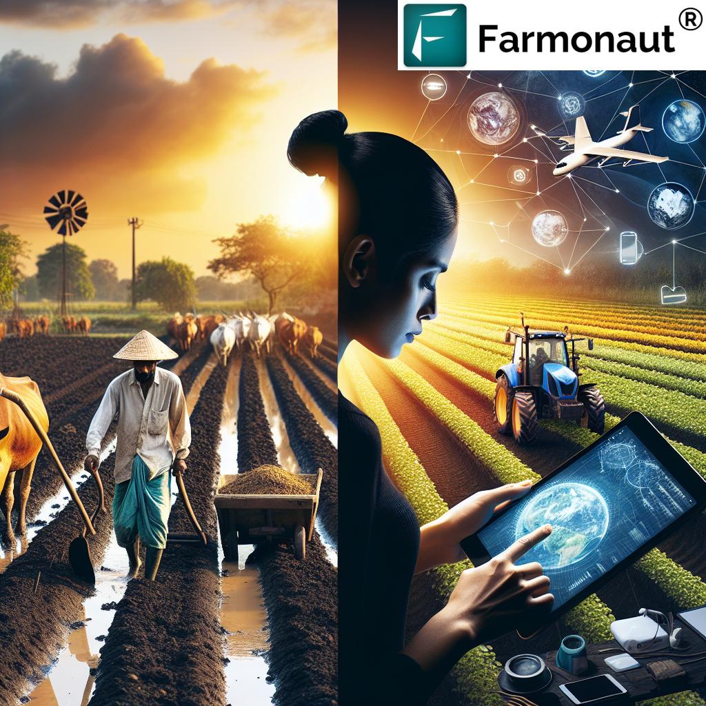
In the ever-evolving landscape of modern agriculture, we at Farmonaut are at the forefront of a technological revolution that is transforming the way we approach crop monitoring and farm management. Our cutting-edge platform harnesses the power of high-resolution satellite imagery to provide farmers, agricultural consultants, and industry professionals with unprecedented insights into their fields and forests. In this comprehensive guide, we’ll explore how our advanced satellite-based solutions are reshaping the agricultural sector, enhancing productivity, and promoting sustainable practices.
The Power of High-Resolution Satellite Imagery in Agriculture
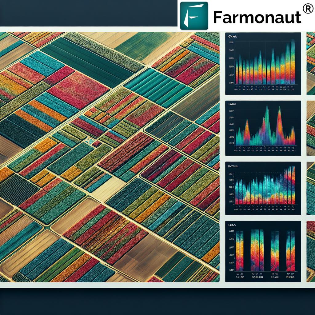
High-resolution satellite images have become an indispensable tool in modern agricultural management. These images provide a bird’s-eye view of vast areas, allowing farmers and agricultural professionals to monitor crops, assess soil conditions, and make informed decisions about their operations. At Farmonaut, we leverage the latest advancements in satellite technology to deliver crisp, detailed imagery that forms the backbone of our precision agriculture solutions.
Benefits of High-Resolution Satellite Imagery for Crop Monitoring
- Comprehensive Coverage: Satellite images can cover large areas quickly, making it possible to monitor entire farms or even regions with ease.
- Frequent Updates: We provide regular image updates, allowing for timely detection of crop health issues, pest infestations, or environmental stresses.
- Non-Invasive Monitoring: Unlike ground-based methods or drones, satellite imagery doesn’t disturb crops or soil, making it ideal for sensitive ecosystems.
- Historical Data: Our platform stores historical imagery, enabling farmers to track changes over time and make data-driven decisions for future seasons.
Advanced Crop Monitoring Techniques
At Farmonaut, we’ve developed sophisticated algorithms that analyze high-resolution satellite images to provide actionable insights for crop monitoring. Our advanced techniques go beyond simple visual interpretation, delving into the spectral signatures of plants to reveal hidden information about crop health and development.
Vegetation Indices and Crop Health Assessment
One of the most powerful tools in our arsenal is the use of vegetation indices, particularly the Normalized Difference Vegetation Index (NDVI). By analyzing the reflectance of different wavelengths of light, we can assess crop vigor, detect stress, and identify areas of concern within fields.
- NDVI Analysis: Our NDVI maps highlight variations in crop health across fields, allowing for targeted interventions.
- Stress Detection: Early identification of crop stress enables proactive management and can prevent yield losses.
- Growth Monitoring: Track crop development stages and compare growth rates across different areas of your farm.
Soil Moisture and Irrigation Management
Efficient water use is crucial for sustainable agriculture. Our satellite-based soil moisture analysis helps farmers optimize irrigation practices:
- Soil Moisture Maps: Visualize moisture distribution across your fields to identify areas that need attention.
- Irrigation Planning: Use our data to create precise irrigation schedules, reducing water waste and improving crop health.
- Drought Monitoring: Stay ahead of dry conditions with early warnings based on soil moisture trends.
Precision Agriculture and Resource Optimization
Farmonaut’s platform goes beyond monitoring to actively support precision agriculture practices. By integrating high-resolution satellite data with other sources of information, we provide farmers with the tools they need to optimize their operations and maximize resource efficiency.
Variable Rate Application (VRA) Maps
Our VRA maps enable farmers to apply inputs like fertilizers and pesticides with pinpoint accuracy:
- Custom Prescription Maps: Generate application maps based on satellite-derived crop health data.
- Input Optimization: Reduce waste and environmental impact by applying resources only where they’re needed most.
- Yield Improvement: Tailor input application to specific crop needs, potentially boosting overall yields.
Yield Prediction and Harvest Planning
Accurate yield predictions are essential for effective farm management and market planning. Our advanced algorithms combine satellite imagery with historical data and weather information to provide reliable yield forecasts:
- Early Yield Estimates: Get a head start on harvest planning with early-season yield predictions.
- Field Variability Analysis: Identify high and low-performing areas within your fields for targeted management.
- Harvest Scheduling: Optimize your harvest timing based on crop maturity data derived from satellite imagery.
Forest Monitoring and Management
Our high-resolution satellite imagery isn’t just for croplands; it’s also a powerful tool for forest monitoring and management. Forestry professionals can leverage our platform to gain valuable insights into forest health, detect illegal logging, and support sustainable forestry practices.
Forest Health Assessment
- Canopy Analysis: Monitor forest canopy density and detect changes over time.
- Disease Detection: Identify areas affected by pests or diseases for targeted interventions.
- Biodiversity Mapping: Use spectral signatures to map different tree species and assess forest composition.
Deforestation Monitoring
Our platform plays a crucial role in combating illegal logging and supporting forest conservation efforts:
- Change Detection: Automatically detect and alert users to sudden changes in forest cover.
- Logging Road Identification: Spot new access roads that may indicate illegal logging activities.
- Reforestation Tracking: Monitor the progress of reforestation projects with regular satellite updates.
Environmental Monitoring and Sustainability
At Farmonaut, we’re committed to promoting sustainable agricultural practices. Our satellite-based solutions provide valuable data for environmental monitoring and conservation efforts:
Carbon Sequestration and Climate Change Mitigation
- Carbon Stock Estimation: Use satellite data to estimate carbon storage in vegetation and soil.
- Land Use Change Monitoring: Track changes in land use that may impact carbon sequestration.
- Climate Resilience Planning: Identify areas vulnerable to climate change impacts for targeted adaptation strategies.
Biodiversity and Habitat Conservation
Our high-resolution imagery supports efforts to protect biodiversity and critical habitats:
- Habitat Mapping: Identify and map important wildlife habitats using spectral analysis.
- Corridor Monitoring: Track the health and continuity of wildlife corridors between protected areas.
- Invasive Species Detection: Spot the spread of invasive plant species that may threaten native ecosystems.
Data Integration and Analysis
The true power of Farmonaut’s platform lies in its ability to integrate multiple data sources and provide comprehensive analysis:
Weather Data Integration
- Historical Weather Analysis: Correlate crop performance with past weather patterns.
- Real-Time Weather Monitoring: Access current weather data to inform day-to-day decision-making.
- Climate Trend Analysis: Understand long-term climate trends and their potential impact on agriculture.
Soil Data and Analysis
Our platform incorporates soil data to provide a complete picture of field conditions:
- Soil Type Mapping: Visualize different soil types across your fields for targeted management.
- Organic Carbon Analysis: Monitor soil organic carbon levels to assess soil health and carbon sequestration potential.
- Erosion Risk Assessment: Identify areas at risk of soil erosion for preventive action.
Advanced Features for Agricultural Professionals
Farmonaut’s platform is designed to meet the needs of a wide range of agricultural professionals, from individual farmers to large agribusinesses and research institutions:
Field Boundary Detection and Management
- Automatic Field Detection: Our algorithms can automatically detect and map field boundaries from satellite imagery.
- Custom Field Management: Easily create, edit, and manage field boundaries within our user-friendly interface.
- Field History Tracking: Maintain a comprehensive record of field boundaries and crop rotations over time.
Crop Classification and Mapping
Accurate crop classification is essential for many applications in agriculture and land management:
- Multi-Temporal Classification: Utilize imagery from multiple dates to improve classification accuracy.
- Crop Diversity Mapping: Identify and map different crop types across large areas.
- Crop Rotation Analysis: Track crop rotations over time to assess sustainable farming practices.
Advanced Analytics and Reporting
Our platform offers powerful analytics tools to help users derive meaningful insights from their data:
- Custom Report Generation: Create tailored reports with the metrics and visualizations most relevant to your needs.
- Time Series Analysis: Analyze trends and patterns in crop health, soil moisture, and other parameters over time.
- Comparative Analytics: Benchmark field performance against regional averages or historical data.
Industry Applications
Farmonaut’s high-resolution satellite imagery and advanced analytics have applications across various industries:
Agriculture and Agribusiness
- Farm Management: Optimize operations with data-driven insights on crop health, soil conditions, and resource allocation.
- Supply Chain Management: Improve forecasting and logistics planning with accurate yield predictions.
- Commodity Trading: Gain market insights with large-scale crop monitoring and production estimates.
Forestry and Natural Resource Management
- Sustainable Forestry: Support sustainable forest management practices with detailed canopy analysis and change detection.
- Conservation Planning: Identify priority areas for conservation efforts based on habitat quality and biodiversity indicators.
- Fire Risk Management: Assess and monitor fire risk in forested areas using vegetation health and dryness indicators.
Government and Policy Making
- Land Use Planning: Inform policy decisions with up-to-date information on land use and land cover changes.
- Subsidy Management: Verify agricultural subsidies and monitor compliance with land use regulations.
- Disaster Response: Assess the impact of natural disasters on agricultural lands and forests for targeted relief efforts.
Research and Education
- Agricultural Research: Support scientific studies with high-quality spatial data and advanced analytics.
- Climate Change Studies: Monitor and analyze long-term changes in vegetation patterns and land use.
- Educational Tools: Provide students and researchers with hands-on experience in remote sensing and geospatial analysis.
Technology Behind Farmonaut’s Platform
Our cutting-edge platform is built on a foundation of advanced technologies and data processing techniques:
Satellite Data Sources
We utilize imagery from multiple satellite sources to ensure comprehensive coverage and frequent updates:
- Landsat 8: Provides medium-resolution multispectral imagery with a wide spectral range.
- Sentinel-2: Offers high-resolution multispectral data with frequent revisit times.
- Commercial High-Resolution Satellites: Supplement our dataset with very high-resolution imagery for detailed analysis.
Data Processing and Analysis
Our sophisticated data processing pipeline ensures that users receive accurate, actionable insights:
- Atmospheric Correction: Remove atmospheric effects to ensure consistent analysis across time and space.
- Cloud Masking: Automatically detect and mask out cloud cover for clear, usable imagery.
- Machine Learning Algorithms: Employ advanced ML techniques for tasks like crop classification and yield prediction.
User Interface and Accessibility
We’ve designed our platform with user experience in mind, making it easy for professionals of all technical backgrounds to access and utilize our powerful tools:
- Web-Based Interface: Access our platform from any device with an internet connection.
- Mobile App: Take the power of satellite monitoring with you in the field with our mobile application.
- API Access: Integrate our data and analytics into your own systems and workflows.
Farmonaut’s Commitment to Privacy and Data Security
At Farmonaut, we take the privacy and security of our users’ data very seriously. Our commitment to protecting your information is reflected in our robust privacy policies and security measures:
Data Privacy
- User Control: You have full control over your data and can choose what to share and with whom.
- Anonymization: We anonymize and aggregate data for analytical purposes to protect individual privacy.
- Transparent Policies: Our privacy policy clearly outlines how we collect, use, and protect your information.
Data Security
- Encryption: All data transmitted to and from our platform is encrypted using industry-standard protocols.
- Secure Storage: We employ state-of-the-art security measures to protect data stored on our servers.
- Regular Audits: Our systems undergo regular security audits to identify and address potential vulnerabilities.
Getting Started with Farmonaut
Ready to revolutionize your approach to agricultural management? Getting started with Farmonaut is easy:
- Sign Up: Create your account on our website or mobile app.
- Define Your Area of Interest: Use our intuitive tools to outline the fields or regions you want to monitor.
- Explore Our Features: Dive into our suite of tools for crop monitoring, soil analysis, and more.
- Integrate with Your Workflow: Use our API to seamlessly incorporate our data into your existing systems.
- Stay Updated: Receive regular notifications and reports on your monitored areas.
Visit our app redirect page to get started with Farmonaut today!
Pricing and Subscription Options
We offer flexible pricing plans to suit the needs of various users, from individual farmers to large enterprises:
Comparison: Farmonaut vs. Traditional Methods
| Features | Traditional Methods | Farmonaut Satellite System |
|---|---|---|
| Crop Monitoring Frequency | Limited by manual labor and time constraints | Daily updates with high-resolution satellite imagery |
| Data Accuracy | Subject to human error and sampling bias | Consistent, objective data across entire fields |
| Area Coverage | Limited to accessible areas | Comprehensive coverage of large areas |
| Soil Analysis Capabilities | Requires physical sampling and lab tests | Non-invasive spectral analysis for soil properties |
| Yield Prediction | Based on limited sampling and historical data | AI-powered predictions using comprehensive field data |
| Time Efficiency | Time-consuming manual inspections | Rapid, automated analysis of large areas |
| Cost-Effectiveness | High labor costs for large-scale monitoring | Scalable solution with lower per-acre costs |
FAQs
Q: How often are satellite images updated on the Farmonaut platform?
A: We provide daily updates for most areas, weather permitting. The exact frequency may vary depending on satellite coverage and atmospheric conditions.
Q: Can Farmonaut’s satellite imagery detect specific crop diseases?
A: While our system can detect general signs of crop stress, identifying specific diseases often requires additional ground-truth data. However, our early detection capabilities can alert you to potential issues for further investigation.
Q: Is Farmonaut’s platform suitable for small-scale farmers?
A: Absolutely! We offer scalable solutions that cater to farms of all sizes. Our user-friendly interface and affordable pricing make precision agriculture accessible to small-scale farmers.
Q: How accurate are Farmonaut’s yield predictions?
A: Our yield predictions have shown high accuracy in various crop types and regions. However, accuracy can vary depending on factors like data quality and local conditions. We continuously refine our models to improve prediction accuracy.
Q: Can I integrate Farmonaut’s data with my existing farm management software?
A: Yes, we offer API access that allows for seamless integration with many popular farm management systems. Check out our API documentation for more information.
Q: Does Farmonaut provide support for organic farming practices?
A: Yes, our platform can be particularly valuable for organic farmers. Our soil analysis and crop health monitoring tools can help optimize organic farming practices without relying on synthetic inputs.
Q: How does Farmonaut ensure the security of my farm data?
A: We employ industry-standard encryption and security protocols to protect your data. Our privacy policy ensures that your information is never shared without your explicit consent.
Q: Can Farmonaut’s platform be used for crops in greenhouses or indoor farming?
A: While our satellite-based system is primarily designed for outdoor agriculture, we offer complementary solutions for indoor farming that can integrate with our main platform.
Q: Does Farmonaut offer training or support for new users?
A: Yes, we provide comprehensive onboarding support, video tutorials, and regular webinars to help new users get the most out of our platform. Our customer support team is also available to answer any questions.
Q: How does Farmonaut contribute to sustainable agriculture practices?
A: By optimizing resource use, reducing waste, and promoting data-driven decision-making, our platform inherently supports sustainable agriculture. We also offer specific tools for carbon sequestration monitoring and environmental impact assessment.
Conclusion
As we’ve explored throughout this comprehensive guide, Farmonaut’s high-resolution satellite imagery and advanced analytics are revolutionizing the way we approach agriculture and land management. By providing timely, accurate, and actionable insights, we’re empowering farmers, foresters, researchers, and policymakers to make informed decisions that enhance productivity, promote sustainability, and address the complex challenges facing our food systems and natural resources.
The power of satellite technology, combined with cutting-edge data analysis and user-friendly interfaces, puts the tools of precision agriculture and environmental monitoring into the hands of users across the globe. From small-scale farmers looking to optimize their operations to large agribusinesses managing vast tracts of land, Farmonaut offers scalable solutions that drive efficiency, reduce costs, and support sustainable practices.
As we look to the future, the role of satellite imagery and remote sensing in agriculture and environmental management will only continue to grow. At Farmonaut, we’re committed to staying at the forefront of this technological revolution, constantly innovating and improving our platform to meet the evolving needs of our users and the planet.
We invite you to join us on this journey towards a more data-driven, sustainable, and productive future for agriculture and land management. Whether you’re a farmer, a researcher, a policymaker, or simply someone passionate about the intersection of technology and the environment, Farmonaut has the tools and insights to support your goals.
Ready to experience the power of high-resolution satellite imagery for yourself? Visit our website to learn more, sign up for a free trial, or contact our team for a personalized demonstration. Together, we can cultivate a smarter, more sustainable future for our planet and its people.
Download our mobile app today:
For developers interested in integrating our powerful satellite imagery and analytics into their own applications, check out our API documentation.
Join us in revolutionizing agriculture and environmental management with the power of high-resolution satellite imagery. The future of farming is here, and it’s powered by Farmonaut.