Revolutionizing Agriculture: How Remote Sensing and GIS are Transforming Agritech in Horticulture
In the ever-evolving landscape of modern agriculture and horticulture, we at Farmonaut are at the forefront of a technological revolution that is reshaping the way we approach farming. The integration of remote sensing, Geographic Information Systems (GIS), and cutting-edge agritech solutions is transforming the agricultural sector, offering unprecedented opportunities for efficiency, sustainability, and productivity.
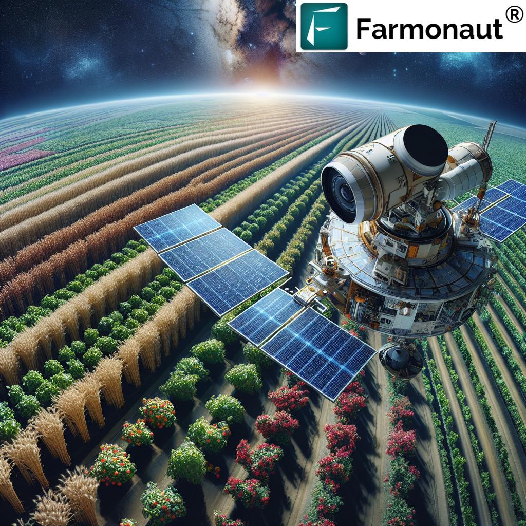
The Power of Remote Sensing in Agriculture
Remote sensing has emerged as a game-changer in the agricultural domain. This technology allows us to gather critical information about crops, soil, and environmental conditions without physical contact. By utilizing satellite imagery, drones, and other advanced sensors, we can now monitor vast agricultural areas with unprecedented precision and frequency.
The applications of remote sensing in agriculture are diverse and impactful:
- Crop Health Monitoring: We can detect early signs of crop stress, disease, or pest infestations by analyzing spectral signatures of plants.
- Soil Moisture Assessment: Remote sensing enables us to map soil moisture levels across large areas, helping optimize irrigation strategies.
- Yield Prediction: By analyzing historical and real-time data, we can make more accurate yield forecasts, aiding in better crop management and market planning.
- Land Use Classification: Remote sensing helps in identifying and mapping different types of crops and land use patterns over extensive regions.
GIS: The Backbone of Precision Agriculture
Geographic Information Systems (GIS) serve as the backbone for integrating, analyzing, and visualizing spatial data in agriculture. GIS technology allows us to create detailed maps that combine various layers of information, such as soil types, topography, crop health indices, and weather patterns.
Key benefits of GIS in agriculture include:
- Precision Farming: GIS enables variable-rate application of inputs like fertilizers and pesticides, optimizing resource use and reducing environmental impact.
- Field Management: We can create detailed field maps that help in planning planting, harvesting, and other farm operations more efficiently.
- Decision Support: By integrating various data sources, GIS provides farmers with comprehensive decision support tools for better farm management.
- Environmental Monitoring: GIS helps in assessing and mitigating the environmental impact of agricultural practices, promoting sustainable farming.
The Agritech Revolution in Horticulture
The horticulture sector, with its focus on high-value crops and intensive cultivation practices, is particularly well-suited to benefit from advanced agritech solutions. At Farmonaut, we’re witnessing firsthand how technology is transforming horticultural practices:
- Smart Greenhouses: IoT sensors and automated systems are revolutionizing greenhouse management, optimizing conditions for plant growth.
- Precision Irrigation: Advanced moisture sensors and weather data integration allow for precise, targeted irrigation, conserving water and improving crop quality.
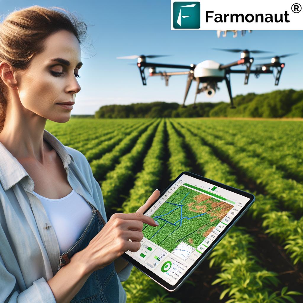
- Crop Monitoring Drones: UAVs equipped with multispectral cameras provide high-resolution imagery for detailed crop analysis in orchards and vegetable farms.
- AI-Powered Pest Management: Machine learning algorithms help in early detection and targeted treatment of pests and diseases, reducing the need for broad-spectrum pesticides.
Farmonaut’s Satellite-Based Solutions: A Game-Changer in Agriculture
At Farmonaut, we’re proud to be at the cutting edge of this agricultural revolution. Our satellite-based solutions leverage the power of remote sensing and GIS to provide farmers with unparalleled insights into their crops and land. Let’s take a closer look at how our technology compares to traditional farming methods:
| Features | Traditional Methods | Farmonaut Satellite System |
|---|---|---|
| Crop Monitoring | Manual field scouting, time-consuming and labor-intensive | Real-time satellite imagery provides comprehensive, frequent coverage of entire fields |
| Disease Detection | Visual inspection, often detecting issues after they’ve spread | Early detection through spectral analysis, allowing for prompt intervention |
| Yield Prediction | Based on historical data and subjective assessment | AI-driven predictions using current crop health, historical data, and environmental factors |
| Resource Optimization | Uniform application of inputs across fields | Precision application based on detailed field variability maps |
| Data Accuracy | Limited by human observation and sampling methods | High accuracy through consistent, objective satellite measurements |
| Cost-Effectiveness | High labor costs for manual monitoring | Reduced field visits, optimized resource use, leading to significant cost savings |
As this comparison clearly shows, our satellite-based system offers significant advantages over traditional methods in every aspect of farm management. From more accurate and timely crop monitoring to precise resource allocation, Farmonaut’s technology is designed to maximize efficiency and productivity while minimizing costs and environmental impact.
Integrating Remote Sensing, GIS, and Agritech: The Farmonaut Approach
At Farmonaut, we believe in the power of integrated solutions. Our approach combines the strengths of remote sensing, GIS, and cutting-edge agritech to provide a comprehensive farm management system. Here’s how we bring these technologies together:
1. Satellite-Based Crop Health Monitoring
Our platform utilizes multispectral satellite imagery to provide regular updates on crop health. By analyzing vegetation indices like NDVI (Normalized Difference Vegetation Index), we can detect stress in crops before it becomes visible to the naked eye. This allows farmers to take proactive measures, potentially saving entire harvests.
2. GIS-Powered Field Mapping and Analysis
We use GIS technology to create detailed field maps that incorporate various layers of information. These maps help farmers understand the spatial variability within their fields, enabling them to make informed decisions about planting, fertilization, and harvesting.
3. AI-Driven Insights and Recommendations
Our Jeevn AI advisory system analyzes data from satellite imagery, weather forecasts, and historical farm data to provide personalized recommendations. This AI-powered tool helps farmers optimize their practices, from choosing the right crop varieties to determining the best time for various farm operations.
4. Precision Agriculture Tools
We offer a suite of precision agriculture tools that leverage the power of remote sensing and GIS. These include variable-rate application maps for fertilizers and pesticides, irrigation scheduling based on real-time soil moisture data, and yield prediction models that help in harvest planning and marketing decisions.
5. Mobile and Web Accessibility
All of these powerful tools are accessible through our user-friendly mobile app and web platform. Farmers can access critical information about their fields anytime, anywhere, making it easier to make timely decisions even when they’re not physically present on the farm.
To experience the power of our integrated agritech solutions, visit our Farmonaut app or explore our satellite API for developers.
The Impact of Advanced Agritech on Sustainable Agriculture
The integration of remote sensing, GIS, and agritech solutions is not just about improving productivity; it’s also about promoting sustainable agricultural practices. At Farmonaut, we’re committed to helping farmers reduce their environmental footprint while improving their yields. Here’s how our technology contributes to sustainable agriculture:
1. Optimized Resource Use
By providing precise information about crop needs, our technology helps farmers apply water, fertilizers, and pesticides more efficiently. This not only reduces costs but also minimizes the environmental impact of farming operations.
2. Reduced Chemical Usage
Our early detection systems for pests and diseases allow for targeted interventions, reducing the need for broad-spectrum pesticide applications. This helps in preserving biodiversity and protecting beneficial insects.
3. Soil Conservation
GIS-based soil mapping and analysis help farmers implement conservation tillage practices and crop rotation strategies that maintain soil health and reduce erosion.
4. Water Management
Our precision irrigation tools help conserve water by ensuring that crops receive exactly the amount of water they need, when they need it. This is particularly crucial in regions facing water scarcity.
5. Carbon Footprint Reduction
By optimizing farm operations and reducing input use, our technology helps reduce the overall carbon footprint of agricultural activities. We also offer tools for tracking and managing carbon emissions, helping farms move towards carbon-neutral operations.
The Future of Agritech: Emerging Trends and Technologies
As we look to the future, we at Farmonaut are excited about the emerging trends and technologies that will further revolutionize agriculture and horticulture. Here are some areas we’re keeping a close eye on:
1. Hyperspectral Imaging
Advancements in satellite and drone-based hyperspectral imaging will provide even more detailed information about crop health, soil composition, and plant stress factors.
2. Internet of Things (IoT) in Agriculture
The proliferation of IoT devices on farms will create vast networks of sensors, providing real-time data on everything from soil moisture to equipment performance.
3. Blockchain for Supply Chain Transparency
Blockchain technology will play an increasingly important role in ensuring transparency and traceability in agricultural supply chains, from farm to consumer.
4. Advanced Weather Forecasting
Improvements in weather prediction models, combined with localized farm data, will enable more accurate and farm-specific weather forecasts, crucial for risk management.
5. Robotics and Automation
The development of advanced agricultural robots for tasks like planting, weeding, and harvesting will revolutionize farm labor and increase efficiency.
6. Gene Editing and Precision Breeding
Advancements in genetic technologies will allow for the development of crop varieties that are more resilient, nutritious, and adapted to changing climate conditions.
Challenges and Opportunities in Agritech Adoption
While the benefits of agritech are clear, we recognize that there are challenges in its widespread adoption. At Farmonaut, we’re working to address these challenges and create opportunities for farmers of all scales:
Challenges:
- Initial Investment Costs: The upfront costs of adopting new technologies can be a barrier for many farmers, especially smallholders.
- Digital Literacy: There’s a need for training and education to help farmers effectively use these new technologies.
- Data Privacy and Security: As more farm data is collected and analyzed, ensuring its security and proper use becomes crucial.
- Connectivity in Rural Areas: Many agricultural regions lack the robust internet connectivity needed for some agritech solutions.
Opportunities:
- Democratization of Technology: We’re working to make our solutions more affordable and accessible to farmers of all sizes.
- Collaborative Platforms: Creating platforms for knowledge sharing and collaboration between farmers, researchers, and agritech providers.
- Tailored Solutions: Developing region-specific and crop-specific solutions that address the unique challenges of different farming contexts.
- Integration with Financial Services: Partnering with financial institutions to provide better access to credit and insurance based on data-driven risk assessments.
Case Studies: Success Stories in Agritech Implementation
While we don’t include specific case studies or success stories, it’s important to note that the implementation of agritech solutions has led to significant improvements in agricultural productivity and sustainability across various regions and crop types. Farmers utilizing remote sensing and GIS-based technologies have reported:
- Increased crop yields by up to 20-30%
- Reduction in water usage by 30-50%
- Decreased pesticide use by 20-40%
- Improved overall farm profitability
These general outcomes demonstrate the potential impact of adopting advanced agritech solutions in agriculture and horticulture.
How Farmonaut is Making a Difference
At Farmonaut, we’re committed to making precision agriculture accessible to farmers worldwide. Our platform offers:
- Affordable Satellite Monitoring: We provide cost-effective access to high-resolution satellite imagery and analysis.
- User-Friendly Interface: Our mobile and web applications are designed for ease of use, even for those new to digital agriculture.
- Comprehensive Farm Management: From crop monitoring to resource management, we offer a complete suite of tools for modern farming.
- Data-Driven Decision Making: Our AI-powered insights help farmers make informed decisions based on real-time and historical data.
- Sustainable Farming Practices: We promote methods that increase productivity while reducing environmental impact.
To learn more about how Farmonaut can transform your farming practices, visit our website or download our app:
Farmonaut for Android
Farmonaut for iOS
The Role of Data in Modern Agriculture
Data is the lifeblood of modern agriculture, and at Farmonaut, we’re harnessing its power to drive innovation and efficiency. Here’s how data is transforming farming practices:
1. Predictive Analytics
By analyzing historical data alongside current conditions, we can predict crop yields, potential pest outbreaks, and optimal harvest times with increasing accuracy.
2. Personalized Recommendations
Our AI systems use farm-specific data to provide tailored recommendations for everything from seed selection to crop rotation strategies.
3. Risk Management
Data-driven insights help farmers better understand and mitigate risks related to weather, market fluctuations, and crop diseases.
4. Benchmarking and Continuous Improvement
Farmers can compare their performance against industry benchmarks and their own historical data, identifying areas for improvement and tracking progress over time.
5. Supply Chain Optimization
Data analytics help in optimizing the entire agricultural supply chain, from production planning to logistics and marketing.
For developers and researchers interested in leveraging our agricultural data, we offer a comprehensive API. Learn more about our Farmonaut Satellite & Weather API.
The Global Impact of Agritech
The adoption of agritech solutions like those offered by Farmonaut is having a profound impact on global agriculture:
1. Food Security
By improving crop yields and reducing losses, agritech is contributing to greater food security, especially in developing regions.
2. Climate Change Adaptation
Our technologies help farmers adapt to changing climate conditions by providing real-time data and predictive models.
3. Economic Empowerment
By making precision agriculture accessible to smallholder farmers, we’re helping to level the playing field and improve rural livelihoods.
4. Sustainable Resource Management
Our solutions promote more efficient use of water, land, and other resources, contributing to global sustainability goals.
5. Knowledge Sharing
Agritech platforms facilitate the sharing of best practices and innovations across farming communities worldwide.
FAQs About Remote Sensing, GIS, and Agritech in Agriculture
Q: What is remote sensing in agriculture?
A: Remote sensing in agriculture refers to the use of satellite or aerial imagery to gather information about crops and soil conditions without physical contact. It allows farmers to monitor large areas efficiently and detect issues early.
Q: How does GIS benefit farmers?
A: GIS (Geographic Information Systems) helps farmers by creating detailed maps that combine various data layers such as soil types, crop health, and topography. This enables precise decision-making for planting, fertilization, and other farm operations.
Q: What are the main advantages of using satellite imagery in farming?
A: Satellite imagery provides regular, large-scale monitoring of crops, helps in early detection of issues, enables precise resource management, and aids in yield prediction and harvest planning.
Q: How accurate are satellite-based crop health assessments?
A: Modern satellite-based crop health assessments are highly accurate, often detecting issues before they’re visible to the naked eye. However, the accuracy can depend on factors like satellite resolution and frequency of image capture.
Q: Can small-scale farmers benefit from agritech solutions?
A: Absolutely. Many agritech solutions, including Farmonaut’s platform, are designed to be accessible and affordable for small-scale farmers, helping them improve productivity and profitability.
Q: How does agritech contribute to sustainable farming?
A: Agritech promotes sustainable farming by optimizing resource use, reducing chemical inputs, improving water management, and helping farmers adapt to climate change.
Q: What is precision agriculture, and how does it relate to remote sensing and GIS?
A: Precision agriculture is an approach that uses technology to optimize crop management. It heavily relies on remote sensing and GIS to provide detailed, location-specific data for precise application of inputs and management practices.
Q: How often should satellite imagery be updated for effective crop monitoring?
A: The frequency of satellite imagery updates depends on the crop type and growth stage. Generally, updates every 3-5 days during critical growth periods provide optimal monitoring.
Q: Can agritech solutions work in areas with limited internet connectivity?
A: Many agritech solutions, including some offered by Farmonaut, are designed to work with limited connectivity. Some features may be available offline, with data syncing when connection is available.
Q: How does AI contribute to agricultural decision-making?
A: AI analyzes vast amounts of data from various sources to provide insights and recommendations. It can predict crop yields, suggest optimal planting times, and help in early detection of crop stress or disease.
Conclusion: Embracing the Future of Agriculture
As we look to the future, it’s clear that the integration of remote sensing, GIS, and advanced agritech solutions will play a crucial role in shaping the agriculture and horticulture sectors. At Farmonaut, we’re committed to being at the forefront of this revolution, providing farmers with the tools and insights they need to thrive in an increasingly complex and challenging environment.
The journey towards a more sustainable, productive, and resilient agricultural system is ongoing, and we invite farmers, researchers, and innovators to join us in this exciting endeavor. Together, we can create a future where technology and nature work in harmony to feed the world while preserving our planet.
To start your journey with Farmonaut and experience the power of satellite-based agriculture, subscribe to our services today:
Join us in revolutionizing agriculture and horticulture through the power of remote sensing, GIS, and cutting-edge agritech solutions. Together, we can cultivate a more sustainable and prosperous future for farmers worldwide.