Revolutionizing Agriculture: How Remote Sensing and GIS are Transforming Precision Farming and Crop Yield
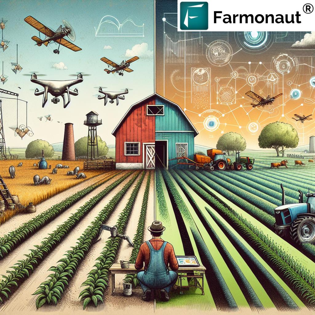
In recent years, the agricultural sector has witnessed a remarkable transformation, thanks to the integration of cutting-edge technologies like remote sensing and Geographic Information Systems (GIS). At Farmonaut, we are at the forefront of this agricultural revolution, harnessing the power of these technologies to revolutionize precision agriculture and enhance crop yield. In this comprehensive blog post, we’ll explore how remote sensing and GIS are reshaping the landscape of modern farming, offering unprecedented insights and efficiency to farmers worldwide.
The Role of Remote Sensing in Agriculture
Remote sensing has emerged as a game-changer in the agricultural sector. This technology allows us to gather information about the Earth’s surface without making physical contact, primarily through the use of satellites and drones. In agriculture, remote sensing provides invaluable data on various aspects of crop health, soil conditions, and environmental factors.
Key Applications of Remote Sensing in Agriculture:
- Crop Health Monitoring: By analyzing multispectral imagery, we can assess crop health and detect issues early.
- Soil Moisture Analysis: Remote sensing helps in monitoring soil moisture levels, crucial for irrigation management.
- Yield Prediction: Advanced algorithms can predict crop yields based on remote sensing data.
- Pest and Disease Detection: Early identification of pest infestations and diseases is possible through spectral analysis.
At Farmonaut, our satellite-based crop health monitoring system leverages these capabilities to provide farmers with real-time insights into their fields. This allows for timely interventions and optimized resource management.
GIS: Mapping the Future of Agriculture
Geographic Information Systems (GIS) complement remote sensing by providing a framework to analyze and visualize spatial data. In agriculture, GIS is instrumental in creating detailed maps of farmlands, integrating various data layers to provide a comprehensive view of agricultural operations.
GIS Applications in Agriculture:
- Field Mapping: Creating accurate, high-resolution maps of farm boundaries and crop distribution.
- Precision Agriculture: Enabling variable-rate application of inputs based on spatial data.
- Resource Management: Optimizing the use of water, fertilizers, and pesticides through spatial analysis.
- Yield Mapping: Generating detailed yield maps to identify productive and underperforming areas.
Our Farmonaut platform integrates GIS capabilities to provide farmers with intuitive, map-based interfaces for managing their farms efficiently.
The Synergy of Remote Sensing and GIS in Precision Agriculture
The combination of remote sensing and GIS forms the backbone of precision agriculture, a farming management concept based on observing, measuring, and responding to inter and intra-field variability in crops. This approach allows farmers to optimize returns on inputs while preserving resources.
Key Benefits of Precision Agriculture:
- Optimized Resource Use: Precise application of water, fertilizers, and pesticides based on actual needs.
- Increased Yield: Better crop management leads to higher yields and improved quality.
- Cost Reduction: Efficient use of inputs reduces overall farming costs.
- Environmental Sustainability: Minimized use of chemicals and water contributes to environmental conservation.
- Data-Driven Decision Making: Farmers can make informed decisions based on accurate, real-time data.
At Farmonaut, we harness these technologies to offer farmers a comprehensive suite of precision agriculture tools, accessible through our user-friendly platform.
Remote Sensing Technologies in Agriculture
The field of remote sensing in agriculture employs various technologies to gather crucial data about crops and soil conditions. Let’s delve deeper into these technologies and their applications:
1. Satellite Imagery
Satellite imagery is perhaps the most widely used form of remote sensing in agriculture. Satellites equipped with multispectral sensors orbit the Earth, capturing images that provide valuable information about crop health, soil moisture, and other environmental factors.
Key Advantages of Satellite Imagery:
- Wide Coverage: Satellites can cover vast areas in a single image, making them ideal for large-scale agricultural monitoring.
- Regular Updates: Most agricultural satellites provide frequent revisits, allowing for consistent monitoring throughout the growing season.
- Multispectral Capabilities: Satellites can capture data across various spectral bands, providing insights into different aspects of crop and soil health.
At Farmonaut, we utilize high-resolution satellite imagery to provide our users with up-to-date information about their fields, enabling them to make informed decisions about crop management.
2. Drone Technology
Drones, or Unmanned Aerial Vehicles (UAVs), have become increasingly popular in agricultural remote sensing. These agile flying platforms can capture high-resolution imagery and data at a more localized level than satellites.
Applications of Drones in Agriculture:
- Detailed Crop Scouting: Drones can fly at low altitudes, capturing highly detailed images of crop conditions.
- Precision Spraying: Some drones are equipped to apply pesticides or fertilizers precisely where needed.
- 3D Mapping: Drones can create accurate 3D models of fields, useful for drainage planning and topography analysis.
- Real-Time Monitoring: Farmers can deploy drones on-demand for immediate assessment of field conditions.
While our primary focus at Farmonaut is on satellite-based solutions, we recognize the complementary role that drone technology can play in precision agriculture.
3. Ground-Based Sensors
In addition to aerial and space-based technologies, ground-based sensors play a crucial role in agricultural remote sensing. These sensors provide localized, continuous data that complement the broader perspective offered by satellites and drones.
Types of Ground-Based Sensors:
- Soil Moisture Sensors: Measure water content in the soil at various depths.
- Weather Stations: Collect data on temperature, humidity, rainfall, and wind speed.
- Spectral Sensors: Measure light reflectance from crops to assess health and nutrient status.
- IoT Devices: Network-connected devices that can monitor various parameters and transmit data in real-time.
Our Farmonaut platform integrates data from various sensor types to provide a comprehensive view of farm conditions, enhancing the accuracy of our agricultural insights.
Vegetation Indices: The Key to Crop Health Monitoring
One of the most powerful applications of remote sensing in agriculture is the use of vegetation indices. These mathematical combinations of spectral bands provide quantitative measures of vegetation vigor and health. Let’s explore some of the most important vegetation indices used in precision agriculture:
1. Normalized Difference Vegetation Index (NDVI)
NDVI is perhaps the most widely used vegetation index in agriculture. It leverages the fact that healthy vegetation strongly absorbs visible light (for photosynthesis) and strongly reflects near-infrared light.
NDVI Formula: (NIR – Red) / (NIR + Red)
NDVI values range from -1 to 1, with higher values indicating healthier vegetation. At Farmonaut, we use NDVI to provide farmers with easy-to-interpret maps of crop health across their fields.
2. Enhanced Vegetation Index (EVI)
EVI is an optimized version of NDVI that corrects for some distortions in the reflected light caused by the atmosphere and the ground cover below the vegetation.
EVI Formula: G * ((NIR – Red) / (NIR + C1 * Red – C2 * Blue + L))
Where G is a gain factor, and C1, C2, and L are coefficients to correct for atmospheric conditions and background noise.
3. Soil Adjusted Vegetation Index (SAVI)
SAVI is designed to minimize soil brightness influences, making it particularly useful in areas with sparse vegetation cover.
SAVI Formula: ((NIR – Red) / (NIR + Red + L)) * (1 + L)
Where L is a soil brightness correction factor.
4. Normalized Difference Water Index (NDWI)
NDWI is used to monitor changes in water content of leaves, providing insights into plant water stress.
NDWI Formula: (NIR – SWIR) / (NIR + SWIR)
Where SWIR is the short-wave infrared reflectance.
At Farmonaut, we utilize these and other advanced vegetation indices to provide farmers with comprehensive insights into their crop health, water stress, and overall field conditions. Our platform processes satellite imagery to generate these indices, presenting them in easy-to-understand maps and reports.
GIS in Agriculture: Beyond Mapping
While mapping is a fundamental application of Geographic Information Systems (GIS) in agriculture, the technology offers much more. GIS serves as a powerful tool for integrating, analyzing, and visualizing various types of spatial and non-spatial data relevant to farming operations.
Advanced GIS Applications in Agriculture:
- Soil Mapping and Analysis: GIS allows for the creation of detailed soil maps, integrating data on soil type, texture, pH, and nutrient content. This information is crucial for precision fertilizer application and crop selection.
- Crop Rotation Planning: By analyzing historical yield data and soil conditions, GIS can help farmers plan optimal crop rotations to maintain soil health and maximize productivity.
- Irrigation Management: GIS can integrate data from soil moisture sensors, weather forecasts, and crop water requirements to optimize irrigation schedules and conserve water.
- Pest and Disease Management: By mapping the spread of pests and diseases over time, GIS helps in predicting future outbreaks and planning targeted interventions.
- Yield Forecasting: Combining historical yield data with current crop health indices and weather forecasts, GIS can provide accurate yield predictions.
- Logistics and Supply Chain Management: For large agricultural operations, GIS can optimize routes for harvesting, transportation, and distribution of produce.
At Farmonaut, we leverage advanced GIS capabilities to provide farmers with a comprehensive farm management platform. Our system integrates various data sources to offer actionable insights and decision support tools.
The Impact of Climate Change on Agriculture and the Role of Technology
Climate change poses significant challenges to agriculture worldwide. Rising temperatures, changing precipitation patterns, and increased frequency of extreme weather events are affecting crop yields and farming practices. In this context, the role of remote sensing and GIS technologies becomes even more crucial.
How Technology Helps in Climate Change Adaptation:
- Climate Monitoring: Remote sensing provides valuable data on long-term climate trends, helping farmers adapt their practices accordingly.
- Drought Detection: Vegetation indices derived from satellite imagery can detect early signs of drought stress in crops.
- Flood Risk Assessment: GIS analysis of topography and historical weather data can identify areas at risk of flooding.
- Crop Suitability Mapping: As climate zones shift, GIS can help identify suitable areas for different crops based on changing conditions.
- Carbon Sequestration Monitoring: Remote sensing can track changes in vegetation cover and soil organic matter, important for carbon credit programs.
At Farmonaut, we are committed to helping farmers navigate the challenges posed by climate change. Our platform provides tools for climate-smart agriculture, enabling farmers to make informed decisions in the face of changing environmental conditions.
The Future of Remote Sensing and GIS in Agriculture
As technology continues to advance, the future of remote sensing and GIS in agriculture looks increasingly promising. Here are some emerging trends and technologies that we at Farmonaut are excited about:
1. Artificial Intelligence and Machine Learning
AI and machine learning algorithms are revolutionizing the way we analyze remote sensing data. These technologies can:
- Automatically detect and classify crop types from satellite imagery
- Predict crop yields with increasing accuracy
- Identify early signs of crop stress or disease outbreaks
- Optimize irrigation and fertilizer application based on historical and real-time data
2. Internet of Things (IoT) Integration
The integration of IoT devices with remote sensing and GIS is creating a more connected and responsive agricultural ecosystem. This includes:
- Real-time data transmission from field sensors to central databases
- Automated irrigation systems that respond to soil moisture data
- Smart farming equipment that adjusts operations based on GIS data
3. Hyperspectral Imaging
Advancements in sensor technology are making hyperspectral imaging more accessible. This technology can:
- Provide more detailed information about crop health and soil conditions
- Detect subtle changes in plant physiology that may indicate stress or disease
- Improve the accuracy of crop yield predictions
4. Big Data Analytics
The increasing volume of data generated by remote sensing and IoT devices necessitates advanced big data analytics capabilities. This will enable:
- More comprehensive farm management insights
- Predictive analytics for various agricultural operations
- Enhanced decision support systems for farmers
5. Blockchain Integration
The integration of blockchain technology with remote sensing and GIS data can revolutionize agricultural supply chains by:
- Enhancing traceability of agricultural products
- Improving transparency in organic and fair-trade certifications
- Facilitating more efficient and secure data sharing among stakeholders
At Farmonaut, we are continuously exploring and integrating these emerging technologies to provide our users with the most advanced and effective agricultural management tools available.
Comparison: Farmonaut Satellite System vs. Traditional Farming Methods
| Aspects | Traditional Methods | Farmonaut System |
|---|---|---|
| Accuracy | Limited by human observation and manual data collection | High accuracy through satellite imagery and AI-driven analysis |
| Time Efficiency | Time-consuming manual field inspections | Real-time monitoring and instant access to field data |
| Cost-Effectiveness | High labor costs for field scouting and data collection | Reduced labor costs through automated monitoring and analysis |
| Data Insights | Limited to visible observations and manual measurements | Comprehensive insights from multispectral imagery and advanced analytics |
| Sustainability Impact | Potential overuse of resources due to lack of precise data | Optimized resource use leading to reduced environmental impact |
Sustainable Agriculture: The Role of Remote Sensing and GIS
Sustainability in agriculture is no longer just an option; it’s a necessity. As the global population grows and climate change intensifies, the need for sustainable farming practices becomes increasingly urgent. Remote sensing and GIS technologies play a crucial role in promoting and implementing sustainable agriculture.
How Remote Sensing and GIS Contribute to Agricultural Sustainability:
- Precision Resource Management: By providing detailed information about crop needs, these technologies help farmers apply water, fertilizers, and pesticides more efficiently, reducing waste and environmental impact.
- Soil Conservation: GIS-based soil maps and erosion models help farmers implement targeted soil conservation measures, preserving this vital resource for future generations.
- Biodiversity Monitoring: Remote sensing can track changes in natural habitats around farmlands, helping to maintain biodiversity and ecosystem services.
- Carbon Sequestration: By monitoring vegetation cover and soil organic matter, these technologies can help quantify carbon sequestration in agricultural lands, supporting carbon credit programs.
- Water Conservation: Precise irrigation scheduling based on remote sensing data helps conserve water, a critical resource in many agricultural regions.
- Reducing Chemical Use: By enabling targeted application of pesticides and herbicides, these technologies help reduce the overall use of chemicals in agriculture.
At Farmonaut, sustainability is at the core of our mission. Our platform is designed to help farmers implement sustainable practices while maintaining or even improving their productivity and profitability.
The Economic Impact of Precision Agriculture
The adoption of precision agriculture technologies, powered by remote sensing and GIS, has significant economic implications for farmers and the agricultural sector as a whole.
Economic Benefits of Precision Agriculture:
- Increased Crop Yields: By optimizing growing conditions and quickly addressing issues, precision agriculture can significantly increase crop yields.
- Reduced Input Costs: Precise application of water, fertilizers, and pesticides leads to substantial cost savings.
- Improved Crop Quality: Better management practices result in higher quality produce, often commanding premium prices.
- Risk Mitigation: Early detection of crop stress or disease outbreaks helps prevent large-scale crop losses.
- Efficient Labor Use: Automation and precise targeting of farming activities reduce labor requirements and costs.
- Enhanced Market Access: Traceability and sustainability practices enabled by these technologies can open up new market opportunities.
Our Farmonaut platform is designed to help farmers realize these economic benefits, providing tools and insights that drive efficiency and profitability in agricultural operations.
Challenges and Considerations in Implementing Remote Sensing and GIS in Agriculture
While the benefits of remote sensing and GIS in agriculture are substantial, there are challenges and considerations that need to be addressed for successful implementation:
1. Data Interpretation and Decision Making
The vast amount of data generated by remote sensing can be overwhelming. Farmers need support in interpreting this data and translating it into actionable insights.
2. Technology Adoption and Training
Many farmers, especially in developing regions, may lack the technical skills to fully utilize these technologies. Training and support are crucial for successful adoption.
3. Initial Investment Costs
While cost-effective in the long run, the initial investment in precision agriculture technologies can be significant, potentially limiting adoption by small-scale farmers.
4. Data Privacy and Security
As farming becomes more data-driven, ensuring the privacy and security of farm data becomes increasingly important.
5. Connectivity Issues
Many rural areas lack reliable internet connectivity, which can hinder the real-time transmission and utilization of remote sensing data.
6. Integration with Existing Practices
Implementing new technologies often requires changes to established farming practices, which can be challenging for some farmers.
At Farmonaut, we are committed to addressing these challenges. We offer user-friendly interfaces, comprehensive training and support, flexible pricing models, and robust data security measures to ensure that farmers can easily and confidently adopt our precision agriculture solutions.
The Global Impact of Remote Sensing and GIS in Agriculture
The application of remote sensing and GIS technologies in agriculture has far-reaching implications beyond individual farms. These technologies are playing a crucial role in addressing global challenges related to food security, environmental conservation, and rural development.
Global Food Security
As the world population continues to grow, ensuring food security becomes increasingly critical. Remote sensing and GIS contribute to this goal by:
- Improving crop yield predictions on a global scale
- Enabling early warning systems for potential food shortages
- Optimizing agricultural production in various climatic conditions
- Supporting more efficient distribution of food resources
Climate Change Mitigation and Adaptation
Agriculture is both affected by and a contributor to climate change. Remote sensing and GIS help in:
- Monitoring and reducing greenhouse gas emissions from agricultural activities
- Tracking deforestation and promoting reforestation efforts
- Developing climate-resilient farming strategies
- Assessing the impact of climate change on global crop production
Biodiversity Conservation
These technologies play a vital role in preserving biodiversity by:
- Monitoring habitat changes and their impact on wildlife
- Supporting sustainable land use planning
- Tracking the spread of invasive species
- Assessing the effectiveness of conservation efforts
Rural Development and Farmer Empowerment
By democratizing access to advanced agricultural technologies, remote sensing and GIS contribute to rural development by:
- Empowering smallholder farmers with data-driven insights
- Improving agricultural productivity and farmer incomes
- Supporting more efficient use of limited resources in developing regions
- Facilitating better integration of rural farmers into global supply chains
At Farmonaut, we are proud to be part of this global transformation in agriculture. Our platform not only serves individual farmers but also contributes to these broader goals of sustainable development and global food security.
The Future of Farming: Integrating Remote Sensing, GIS, and Emerging Technologies
As we look to the future, the integration of remote sensing and GIS with other emerging technologies promises to further revolutionize agriculture. Here are some exciting developments on the horizon:
1. Artificial Intelligence and Machine Learning
AI and ML algorithms will become increasingly sophisticated, offering:
- More accurate crop yield predictions
- Automated pest and disease detection
- Personalized crop management recommendations
- Advanced pattern recognition in satellite imagery
2. Internet of Things (IoT) and Smart Farming
The proliferation of IoT devices in agriculture will lead to:
- Real-time data integration from field sensors with satellite imagery
- Automated farm management systems
- Precision livestock farming
- Smart greenhouses and vertical farming solutions
3. Blockchain and Traceability
Blockchain technology will enhance agricultural supply chains by:
- Improving traceability from farm to table
- Enhancing food safety and quality assurance
- Facilitating fair trade and sustainable farming practices
- Streamlining agricultural finance and insurance
4. 5G and Enhanced Connectivity
The rollout of 5G networks will revolutionize data transmission in agriculture, enabling:
- Real-time data processing and decision-making
- Enhanced remote operations and autonomous farming equipment
- Improved connectivity in rural areas
- More efficient integration of various data sources
5. Advanced Robotics and Automation
The integration of robotics with remote sensing and GIS will lead to:
- Autonomous tractors and harvesters guided by GPS and satellite data
- Robotic systems for precise planting, weeding, and harvesting
- Drone swarms for detailed crop monitoring and management
- Automated greenhouse management systems
At Farmonaut, we are continuously exploring and integrating these emerging technologies to ensure that our platform remains at the cutting edge of agricultural innovation. Our goal is to provide farmers with the most advanced, efficient, and sustainable farming solutions possible.
Conclusion: Embracing the Future of Agriculture
As we’ve explored throughout this blog post, remote sensing and GIS technologies are fundamentally transforming agriculture. From precision farming and crop yield optimization to sustainable resource management and climate change adaptation, these technologies are helping farmers meet the challenges of the 21st century.
At Farmonaut, we are committed to being at the forefront of this agricultural revolution. Our platform integrates the power of satellite imagery, advanced analytics, and user-friendly interfaces to provide farmers with the tools they need to thrive in an increasingly complex and challenging environment.
We believe that the future of agriculture lies in the intelligent application of technology, data-driven decision-making, and sustainable practices. By embracing these principles, we can ensure food security, environmental sustainability, and economic prosperity for farmers around the world.
As we look to the future, we invite farmers, agronomists, researchers, and technology enthusiasts to join us on this exciting journey. Together, we can create a more sustainable, productive, and resilient agricultural sector that benefits both people and the planet.
To learn more about how Farmonaut can help transform your farming operations, visit our website or download our app today:
For developers interested in integrating our API into their applications, check out our API documentation.
FAQs
- Q: What is remote sensing in agriculture?
A: Remote sensing in agriculture refers to the use of satellite or aerial imaging technologies to gather information about crops, soil, and environmental conditions without physical contact. This data helps farmers make informed decisions about crop management. - Q: How does GIS benefit farming?
A: GIS (Geographic Information Systems) in farming allows for the integration, analysis, and visualization of spatial data. It helps in creating detailed farm maps, planning crop rotations, optimizing resource use, and making data-driven decisions. - Q: What is precision agriculture?
A: Precision agriculture is a farming management concept that uses technology to observe, measure, and respond to inter and intra-field variability in crops. It aims to optimize returns on inputs while preserving resources. - Q: How does satellite imagery help in crop monitoring?
A: Satellite imagery provides regular, wide-area coverage of farmlands. It can detect changes in crop health, estimate yields, monitor soil moisture, and identify areas of stress or disease, all of which are crucial for effective crop management. - Q: What are vegetation indices, and why are they important?
A: Vegetation indices are mathematical combinations of different spectral bands that provide quantitative measures of vegetation vigor and health. They are important because they help in assessing crop conditions, predicting yields, and detecting stress or disease in plants. - Q: How does Farmonaut use remote sensing and GIS?
A: Farmonaut integrates satellite imagery, weather data, and advanced analytics to provide farmers with real-time insights about their crops. Our platform uses GIS to create detailed farm maps and visualization tools that help farmers make informed decisions. - Q: Is remote sensing technology expensive for farmers to adopt?
A: While some remote sensing technologies can be expensive, platforms like Farmonaut aim to make these tools accessible and affordable for farmers of all scales. The long-term benefits often outweigh the initial investment costs. - Q: How does remote sensing contribute to sustainable agriculture?
A: Remote sensing contributes to sustainable agriculture by enabling precise resource management, reducing waste, minimizing environmental impact, and helping farmers adapt to climate change. It supports practices that are both environmentally friendly and economically viable. - Q: Can remote sensing and GIS help in pest management?
A: Yes, these technologies can detect early signs of pest infestations by identifying changes in crop health. They can also help in targeted application of pesticides, reducing overall chemical use and improving effectiveness. - Q: How accurate are crop yield predictions using remote sensing?
A: Crop yield predictions using remote sensing can be highly accurate, especially when combined with historical data, weather information, and machine learning algorithms. However, accuracy can vary depending on factors like crop type, field conditions, and the specific technologies used.
Subscribe to Farmonaut