Revolutionizing Agriculture: The Power of Satellite Analytics and Remote Sensing in Modern Farming
In today’s rapidly evolving world of agriculture, we’re witnessing a paradigm shift in how farming is approached and managed. At the forefront of this agricultural revolution are satellite analytics and remote sensing technologies, which are transforming the way we cultivate crops, manage resources, and ensure food security for a growing global population. In this comprehensive blog post, we’ll explore how these cutting-edge technologies are driving sustainable farming practices and shaping the future of agriculture.
The Rise of Precision Agriculture
Precision agriculture, also known as precision farming, is a management concept that utilizes data-driven insights to optimize agricultural practices. By leveraging satellite imagery, remote sensing, and advanced analytics, farmers can make more informed decisions about their crops, leading to increased yields, reduced resource consumption, and improved sustainability.
At Farmonaut, we’re at the forefront of this agricultural revolution, providing farmers with powerful tools and insights derived from satellite data and advanced analytics. Our platform enables farmers to monitor their crops in real-time, detect issues early, and make data-driven decisions that can significantly impact their bottom line.
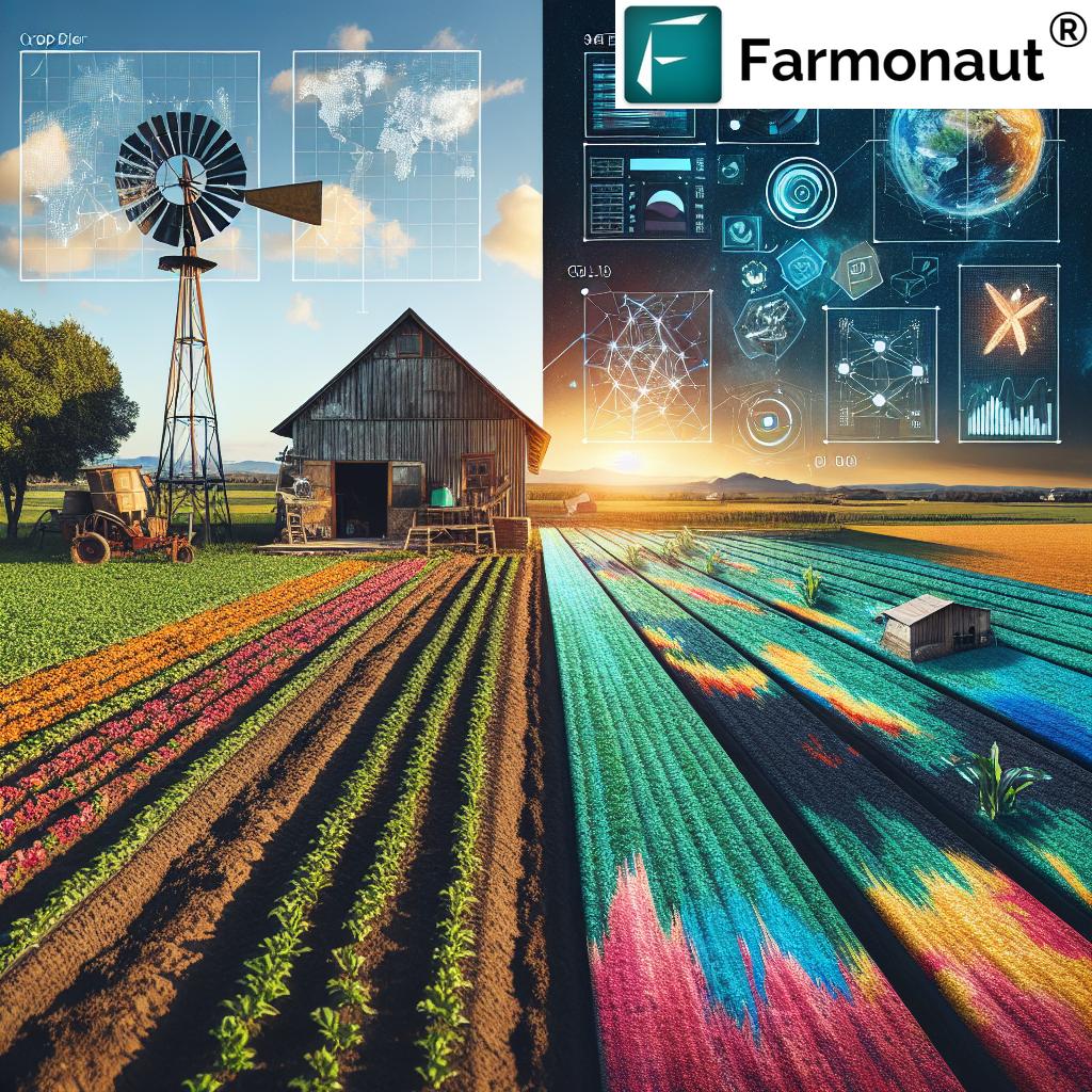
Satellite Analytics: A Game-Changer for Modern Farming
Satellite analytics has emerged as a game-changing technology in the field of agriculture. By harnessing the power of Earth observation satellites, we can now gather vast amounts of data about agricultural lands, crop health, and environmental conditions. This wealth of information, when processed and analyzed, provides invaluable insights for farmers and agronomists.
Key Benefits of Satellite Analytics in Agriculture:
- Crop Monitoring: Satellite imagery allows for continuous monitoring of crop health and growth stages across large areas.
- Early Detection of Issues: By analyzing spectral data, we can identify potential problems such as pest infestations or nutrient deficiencies before they become visible to the naked eye.
- Resource Optimization: Precise data on soil moisture and crop needs enables more efficient use of water and fertilizers.
- Yield Prediction: Advanced algorithms can predict crop yields with increasing accuracy, helping farmers and markets prepare accordingly.
- Climate Change Adaptation: Long-term satellite data assists in understanding and adapting to changing climate patterns.
Remote Sensing: The Eyes in the Sky for Agriculture
Remote sensing technologies play a crucial role in modern agriculture by providing a wealth of information about crops and agricultural lands without the need for on-the-ground measurements. These technologies utilize various sensors mounted on satellites, aircraft, and drones to collect data across the electromagnetic spectrum.
Applications of Remote Sensing in Agriculture:
- Vegetation Indices: Metrics like the Normalized Difference Vegetation Index (NDVI) help assess crop health and vigor.
- Soil Moisture Analysis: Remote sensing can estimate soil moisture levels, crucial for irrigation management.
- Land Use Classification: Satellite imagery aids in mapping and classifying agricultural lands, forests, and other land use types.
- Crop Type Identification: Different crop types can be identified and mapped using multispectral imagery.
- Disaster Assessment: Remote sensing helps in quickly assessing damage from floods, droughts, or other natural disasters.
The Role of AI and Machine Learning in Agricultural Analytics
Artificial Intelligence (AI) and Machine Learning (ML) are revolutionizing how we interpret and utilize satellite and remote sensing data in agriculture. These technologies enable us to process vast amounts of data quickly and accurately, extracting meaningful insights that can drive decision-making on the farm.
AI and ML Applications in Agricultural Analytics:
- Automated Crop Classification: AI algorithms can accurately identify and map different crop types over large areas.
- Yield Prediction Models: Machine learning models can predict crop yields based on historical data, current conditions, and weather forecasts.
- Pest and Disease Detection: AI-powered image analysis can identify signs of pest infestations or crop diseases early on.
- Precision Agriculture Recommendations: AI systems can provide personalized recommendations for fertilizer application, irrigation, and other management practices.
- Weather Forecasting: Machine learning improves the accuracy of short-term and long-term weather predictions, crucial for agricultural planning.
Sustainable Agriculture: The Intersection of Technology and Environmental Stewardship
As we face the challenges of climate change and increasing food demand, sustainable agriculture has become more important than ever. Satellite analytics and remote sensing technologies are playing a pivotal role in promoting sustainable farming practices by enabling more efficient resource use and better environmental management.
Sustainable Agriculture Practices Enabled by Satellite Analytics:
- Precision Irrigation: Satellite-derived soil moisture data allows for targeted irrigation, reducing water waste.
- Variable Rate Application (VRA): Precise application of fertilizers and pesticides based on crop needs, minimizing chemical use.
- Carbon Sequestration Monitoring: Satellite data helps track carbon storage in agricultural soils and vegetation.
- Biodiversity Conservation: Remote sensing aids in monitoring and protecting biodiversity in agricultural landscapes.
- Soil Health Management: Satellite imagery can help identify areas at risk of erosion or degradation, enabling proactive conservation measures.
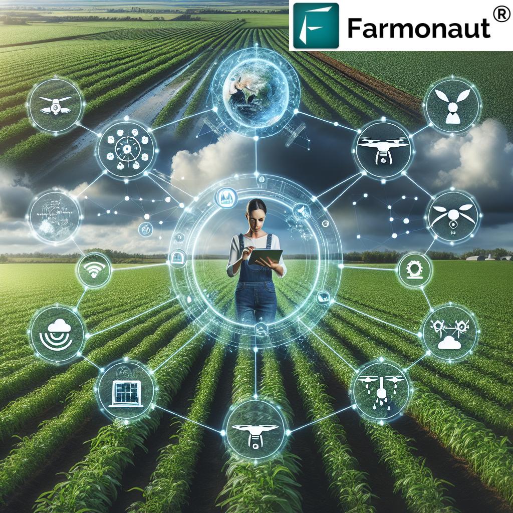
The Farmonaut Advantage: Empowering Farmers with Cutting-Edge Technology
At Farmonaut, we’re committed to making advanced agricultural technologies accessible to farmers of all sizes. Our platform integrates satellite analytics, AI-powered insights, and user-friendly tools to provide a comprehensive farm management solution.
Key Features of the Farmonaut Platform:
- Real-Time Crop Monitoring: Access up-to-date satellite imagery of your fields to track crop health and growth.
- AI-Powered Advisories: Receive personalized recommendations based on crop conditions and weather forecasts.
- Weather Forecasting: Get accurate, field-specific weather predictions to plan your farming activities.
- Yield Prediction: Utilize our advanced algorithms to estimate crop yields and plan your harvests.
- Resource Management Tools: Optimize your use of water, fertilizers, and other inputs with data-driven insights.
To experience the power of Farmonaut’s satellite analytics platform, visit our app or download it from the Google Play Store or Apple App Store.
Comparison: Traditional Farming vs. Farmonaut System
| Feature | Traditional Farming | Farmonaut System |
|---|---|---|
| Crop Monitoring | Manual field scouting, time-consuming and labor-intensive | Real-time satellite imagery and AI-powered analysis |
| Soil Moisture Analysis | Occasional soil testing, limited coverage | Continuous satellite-based soil moisture mapping |
| Yield Prediction | Based on historical data and farmer’s experience | AI-driven predictions using multiple data sources |
| Field Management | Uniform application of inputs across fields | Precision agriculture with variable rate application |
| Weather Forecasting | Reliance on general regional forecasts | Field-specific, AI-enhanced weather predictions |
| Carbon Sequestration Monitoring | Limited or no monitoring capabilities | Satellite-based tracking of carbon storage in soils and vegetation |
The Future of Agriculture: Integrating Satellite Analytics with Emerging Technologies
As we look to the future, the integration of satellite analytics with other emerging technologies promises to further revolutionize agriculture. Here are some exciting developments on the horizon:
1. Internet of Things (IoT) and Sensor Networks
The combination of satellite data with ground-based IoT sensors will provide an unprecedented level of detail about field conditions. This integration will enable:
- More accurate crop stress detection
- Real-time monitoring of soil conditions
- Automated irrigation systems that respond to both satellite and sensor data
2. Drone Technology
While satellites provide broad coverage, drones can offer high-resolution, on-demand imagery. The synergy between satellite and drone data will allow for:
- Detailed crop scouting and pest detection
- Precise application of inputs using drone sprayers
- Validation and enhancement of satellite-derived insights
3. Blockchain and Traceability
Integrating satellite analytics with blockchain technology will revolutionize supply chain management in agriculture:
- Enhanced traceability of food products from farm to table
- Verification of sustainable farming practices
- Improved transparency in organic and fair-trade certifications
4. 5G and Edge Computing
The rollout of 5G networks and advancements in edge computing will enable:
- Real-time processing of satellite data in the field
- Faster delivery of insights to farmers’ mobile devices
- Enhanced capabilities for autonomous agricultural machinery
Challenges and Considerations in Satellite-Based Agriculture
While the benefits of satellite analytics in agriculture are numerous, there are also challenges that need to be addressed:
1. Data Privacy and Security
As more agricultural data is collected and analyzed, ensuring the privacy and security of farmers’ information becomes crucial. At Farmonaut, we prioritize data protection and adhere to strict privacy policies to safeguard our users’ information.
2. Connectivity in Rural Areas
Many agricultural regions still lack reliable internet connectivity, which can limit access to real-time satellite data and analytics. Efforts to improve rural broadband infrastructure are essential to fully realize the potential of these technologies.
3. Education and Training
Adopting new technologies requires farmers to develop new skills. Providing education and training on how to effectively use satellite analytics tools is crucial for widespread adoption.
4. Integration with Existing Farm Management Systems
For many farmers, integrating satellite-based tools with their existing farm management practices can be challenging. User-friendly interfaces and seamless integration capabilities are essential for overcoming this hurdle.
The Environmental Impact of Satellite-Driven Agriculture
As we embrace satellite analytics in agriculture, it’s important to consider the environmental implications of these technologies:
Positive Impacts:
- Reduced Chemical Use: Precision application of fertilizers and pesticides minimizes environmental contamination.
- Water Conservation: Optimized irrigation based on satellite data helps conserve water resources.
- Soil Health Preservation: Better management practices enabled by satellite insights can reduce soil degradation.
- Carbon Sequestration: Satellite monitoring can help incentivize and verify carbon sequestration efforts in agriculture.
Considerations:
- Energy Consumption: The data centers and computing power required for processing satellite data consume significant energy.
- E-waste: As farmers adopt more technology, proper disposal of electronic devices becomes an important consideration.
- Biodiversity Impact: While satellite technology can help protect biodiversity, intensification of agriculture could potentially harm local ecosystems if not managed carefully.
Case Studies: Success Stories in Satellite-Driven Agriculture
To illustrate the real-world impact of satellite analytics in agriculture, let’s look at some success stories from around the globe:
1. Precision Viticulture in California
A large vineyard in Napa Valley used satellite-derived vegetation indices to optimize irrigation and fertilizer application. The result was a 20% reduction in water use and a 15% increase in grape quality, leading to premium pricing for their wines.
2. Smallholder Farming in India
A group of smallholder farmers in Maharashtra used Farmonaut’s platform to access satellite-based crop health monitoring. By detecting stress early and applying targeted interventions, they increased their cotton yields by 25% while reducing pesticide use by 30%.
3. Large-Scale Wheat Production in Australia
A major wheat producer in Western Australia utilized satellite analytics for variable rate application of fertilizers. This precision approach led to a 10% increase in yield and a 20% reduction in fertilizer costs, significantly improving profitability while reducing environmental impact.
4. Sustainable Palm Oil in Malaysia
A palm oil company used satellite monitoring to ensure compliance with sustainable practices and prevent deforestation. This not only improved their environmental credentials but also secured premium pricing for their certified sustainable palm oil.
The Role of Government and Policy in Promoting Satellite-Driven Agriculture
Government support and favorable policies play a crucial role in the adoption of satellite analytics in agriculture. Here are some ways in which governments can promote these technologies:
- Subsidies and Incentives: Providing financial support for farmers to adopt satellite-based technologies.
- Research Funding: Investing in research and development of new applications for satellite data in agriculture.
- Education Programs: Developing training programs to help farmers understand and utilize satellite analytics tools.
- Data Sharing Initiatives: Creating platforms for sharing agricultural satellite data between public and private sectors.
- Regulatory Frameworks: Establishing guidelines for the ethical use of satellite data in agriculture, ensuring privacy and data security.
The Economic Impact of Satellite Analytics in Agriculture
The adoption of satellite analytics in agriculture has far-reaching economic implications:
- Increased Farm Profitability: By optimizing inputs and improving yields, farmers can significantly enhance their bottom line.
- Job Creation: The growth of the agritech sector creates new job opportunities in data analysis, software development, and precision agriculture consulting.
- Rural Economic Development: As farming becomes more profitable and technologically advanced, it can help revitalize rural economies.
- Global Food Security: Improved agricultural productivity contributes to more stable food supplies and potentially lower food prices.
- New Market Opportunities: The data generated by satellite analytics can create new markets for agricultural insights and services.
Frequently Asked Questions (FAQ)
1. What is satellite analytics in agriculture?
Satellite analytics in agriculture refers to the use of data collected by Earth observation satellites to monitor and analyze various aspects of farming, including crop health, soil conditions, and weather patterns. This information is processed and interpreted to provide valuable insights for farmers and agricultural managers.
2. How does remote sensing benefit farmers?
Remote sensing benefits farmers by providing a broad, real-time view of their fields without the need for on-the-ground measurements. It helps in early detection of crop stress, optimizing resource use, predicting yields, and making informed management decisions.
3. Can satellite analytics work for small farms?
Yes, satellite analytics can be beneficial for farms of all sizes. At Farmonaut, we’ve designed our platform to be accessible and affordable for smallholder farmers, providing them with the same powerful insights that were once only available to large agricultural operations.
4. How accurate are satellite-based crop yield predictions?
The accuracy of satellite-based yield predictions has improved significantly in recent years. While it can vary depending on the crop and conditions, many models now achieve accuracy rates of 85-95% when combined with ground-truth data and advanced machine learning algorithms.
5. How does satellite analytics contribute to sustainable agriculture?
Satellite analytics promotes sustainable agriculture by enabling precise resource management, reducing chemical inputs, optimizing water use, and monitoring environmental impacts. It also helps in tracking carbon sequestration and biodiversity conservation efforts.
6. What is the cost of implementing satellite analytics in farming?
The cost of implementing satellite analytics can vary widely depending on the scale of operation and the level of service required. However, with platforms like Farmonaut, we’ve made it affordable for farmers of all sizes. You can check our pricing plans here:
7. How often is satellite data updated?
The frequency of satellite data updates can vary depending on the satellite system and service provider. At Farmonaut, we provide regular updates, typically every 3-5 days, ensuring that farmers have access to current information about their fields.
8. Can satellite analytics detect pest infestations or diseases?
While satellites cannot directly detect pests or diseases, they can identify patterns of crop stress that may indicate infestations or disease outbreaks. This early warning allows farmers to investigate and take action before the problem spreads.
9. How does weather forecasting integrate with satellite analytics?
Weather forecasting is an integral part of satellite analytics in agriculture. By combining satellite observations with weather models, we can provide highly localized and accurate weather predictions, helping farmers plan their activities and manage risks.
10. What kind of training is needed to use satellite analytics tools?
While some basic training is helpful, modern satellite analytics platforms like Farmonaut are designed to be user-friendly. We provide intuitive interfaces, mobile apps, and support resources to help farmers quickly learn and benefit from our tools.
Conclusion: Embracing the Future of Agriculture
As we’ve explored throughout this blog post, satellite analytics and remote sensing are transforming agriculture in profound ways. These technologies offer unprecedented insights into crop health, soil conditions, and environmental factors, enabling farmers to make more informed decisions and adopt sustainable practices.
At Farmonaut, we’re committed to making these powerful tools accessible to farmers of all sizes, helping to drive a more productive, sustainable, and resilient agricultural sector. As we face the challenges of feeding a growing global population in the face of climate change, the importance of these technologies cannot be overstated.
We invite you to join us in this agricultural revolution. Whether you’re a small-scale farmer looking to optimize your operations or a large agribusiness seeking to improve sustainability, Farmonaut’s satellite analytics platform can help you achieve your goals.
To learn more about how Farmonaut can benefit your farming operations, visit our website or download our app today. Together, we can cultivate a brighter future for agriculture and our planet.
For developers interested in integrating our satellite analytics capabilities into their own applications, check out our API documentation and developer resources.
Join us in revolutionizing agriculture with the power of satellite analytics and remote sensing. The future of farming is here, and it’s more precise, sustainable, and data-driven than ever before.