Revolutionizing Agriculture: Harnessing the Power of Satellite Technology for Sustainable Farming
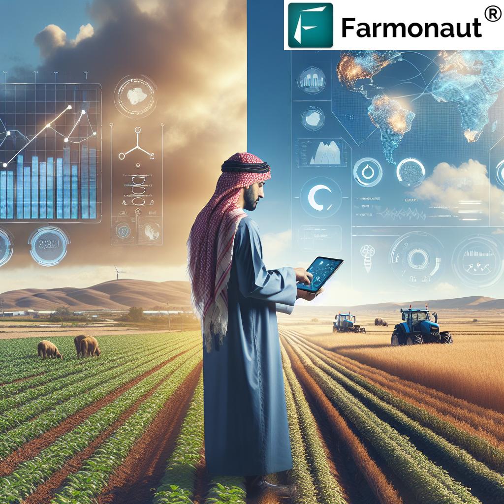
In today’s rapidly evolving agricultural landscape, we find ourselves at the forefront of a technological revolution that is reshaping the way we approach farming. As the global population continues to grow and climate change poses unprecedented challenges, the need for innovative solutions in agriculture has never been more critical. At Farmonaut, we are dedicated to leveraging cutting-edge satellite technology and advanced data analytics to empower farmers and revolutionize agricultural practices.
The Intersection of Technology and Agriculture
The agriculture industry has come a long way from traditional farming methods. Today, we are witnessing a paradigm shift towards precision agriculture, where advanced technologies play a pivotal role in optimizing crop production, conserving resources, and promoting sustainability. At the heart of this transformation lies satellite-powered crop monitoring and soil analytics – a game-changing approach that is redefining the boundaries of modern farming.
Understanding Satellite-Powered Crop Monitoring
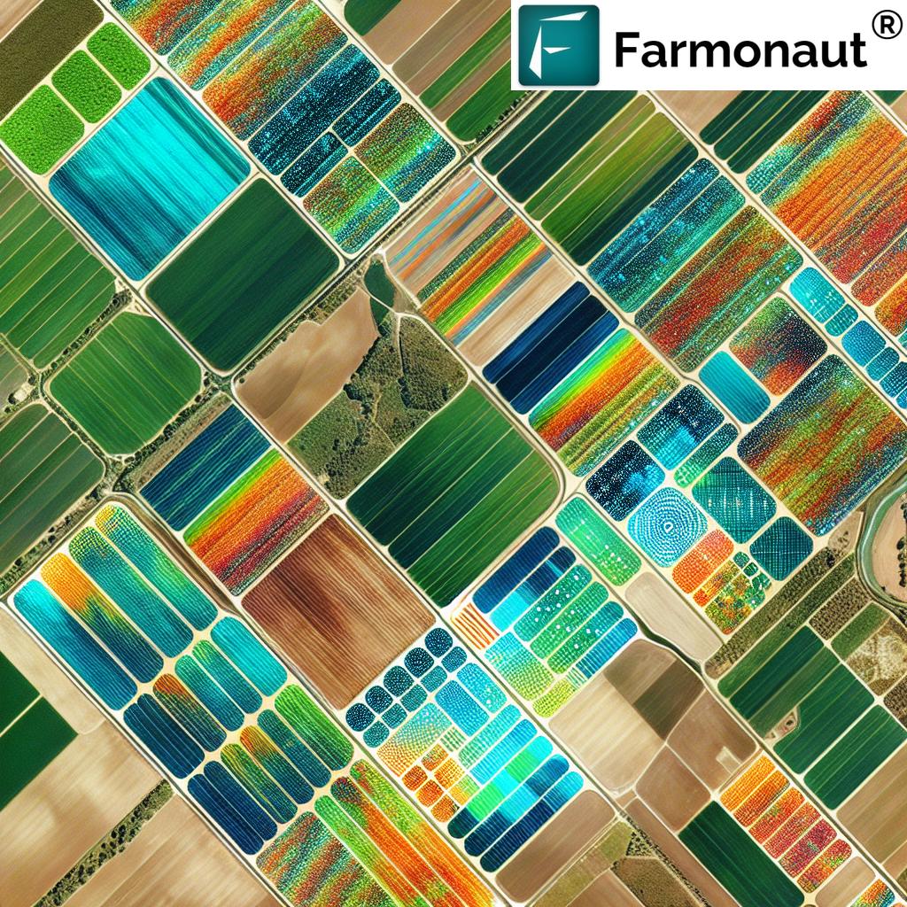
Satellite-powered crop monitoring is a sophisticated technology that utilizes high-resolution imagery captured by earth observation satellites to provide farmers with valuable insights into their fields. This innovative approach offers several key advantages:
- Real-time Crop Health Assessment: By analyzing multispectral satellite imagery, we can generate vegetation indices such as the Normalized Difference Vegetation Index (NDVI) to assess crop health and vigor across vast areas.
- Early Detection of Stress Factors: Satellite imagery enables the early identification of potential issues like pest infestations, diseases, or nutrient deficiencies, allowing farmers to take prompt corrective actions.
- Precision Resource Management: With accurate field-level data, farmers can optimize the application of inputs such as water, fertilizers, and pesticides, reducing waste and environmental impact.
- Yield Prediction and Harvest Planning: Advanced analytics applied to satellite data can provide accurate yield forecasts, helping farmers and agribusinesses make informed decisions about harvest timing and resource allocation.
The Power of Soil Analytics in Modern Agriculture
Complementing satellite-powered crop monitoring, soil analytics plays a crucial role in sustainable agriculture. By leveraging advanced sensing technologies and data analysis, we can gain deep insights into soil health and composition:
- Soil Moisture Monitoring: Satellite-based soil moisture sensors provide accurate data on water content in the soil, enabling precise irrigation scheduling and water conservation.
- Nutrient Analysis: Advanced soil testing techniques allow for detailed mapping of nutrient levels across fields, facilitating targeted fertilizer application and reducing environmental pollution.
- Soil Carbon Sequestration: Monitoring soil organic carbon levels helps in assessing the carbon sequestration potential of agricultural lands, contributing to climate change mitigation efforts.
- Erosion Risk Assessment: Geospatial analysis of soil data helps identify areas prone to erosion, allowing for the implementation of preventive measures to protect valuable topsoil.
The Farmonaut Approach: Integrating Satellite Technology and Agronomic Expertise
At Farmonaut, we have developed a comprehensive platform that seamlessly integrates satellite-powered crop monitoring with advanced soil analytics. Our approach combines cutting-edge technology with agronomic expertise to deliver actionable insights to farmers and agribusinesses:
- High-Resolution Satellite Imagery: We utilize the latest satellite technology to capture detailed images of agricultural lands, providing a clear view of crop conditions and field variations.
- Advanced Data Analytics: Our proprietary algorithms process vast amounts of satellite data, weather information, and historical records to generate meaningful insights for farmers.
- User-Friendly Interface: The Farmonaut platform offers an intuitive interface that allows users to easily access and interpret complex agronomic data, facilitating informed decision-making.
- Mobile Accessibility: Our mobile app ensures that farmers can access critical information about their fields anytime, anywhere, enabling responsive farm management.
- Integration with IoT Devices: We support integration with various Internet of Things (IoT) devices, such as weather stations and soil sensors, to provide a holistic view of farm conditions.
Comparing Traditional Farming with Farmonaut-Powered Farming
To illustrate the transformative impact of our technology, let’s compare traditional farming methods with the Farmonaut-powered approach:
| Aspects | Traditional Methods | Farmonaut’s Satellite-Powered Approach | Benefits |
|---|---|---|---|
| Crop Monitoring | Manual field scouting, time-consuming and labor-intensive | Real-time satellite imagery analysis, covering large areas efficiently | Early detection of issues, reduced labor costs, improved crop management |
| Soil Analysis | Periodic soil sampling, limited spatial coverage | Continuous monitoring through satellite and IoT sensors, comprehensive field mapping | Precise nutrient management, optimized fertilizer use, improved soil health |
| Yield Prediction | Based on historical data and subjective assessments | AI-driven predictive models using satellite data and machine learning | Accurate yield forecasts, better harvest planning, improved market decisions |
| Resource Management | Uniform application of inputs across fields | Precision application based on field variability and crop needs | Reduced input costs, minimized environmental impact, increased efficiency |
| Weather Monitoring | Reliance on regional weather forecasts | Field-specific weather data and predictive analytics | Improved risk management, timely interventions, optimized farm operations |
Driving Sustainability in Agriculture
The integration of satellite technology and advanced analytics in agriculture is not just about improving productivity – it’s also a crucial step towards sustainable farming practices. Here’s how Farmonaut’s approach contributes to agricultural sustainability:
- Resource Conservation: Precision application of water, fertilizers, and pesticides reduces waste and minimizes environmental impact.
- Soil Health Preservation: By providing detailed insights into soil conditions, our technology helps farmers implement practices that maintain and improve soil health over time.
- Carbon Footprint Reduction: Optimized farm management leads to reduced greenhouse gas emissions from agricultural activities.
- Biodiversity Protection: Precise pest management and reduced chemical use help preserve biodiversity in and around agricultural lands.
- Climate Resilience: By providing accurate weather forecasts and crop monitoring, our platform helps farmers adapt to changing climate conditions and mitigate risks.
The Future of Agriculture: Embracing Satellite Technology
As we look to the future, the role of satellite technology in agriculture is set to expand even further. Here are some exciting developments on the horizon:
- Hyperspectral Imaging: Next-generation satellites equipped with hyperspectral sensors will provide even more detailed insights into crop health and soil conditions.
- AI-Driven Predictive Analytics: Advanced artificial intelligence algorithms will offer increasingly accurate predictions of crop yields, pest outbreaks, and market trends.
- Blockchain Integration: Combining satellite data with blockchain technology will enhance traceability in the agricultural supply chain, ensuring food safety and transparency.
- Automated Farm Management: Integration with autonomous farm equipment will enable fully automated, data-driven farming operations.
- Climate Change Mitigation: Satellite technology will play a crucial role in monitoring and enhancing the carbon sequestration potential of agricultural lands.
Empowering Farmers with Farmonaut
At Farmonaut, we are committed to making advanced agricultural technology accessible to farmers of all scales. Our platform is designed to be user-friendly and affordable, ensuring that even small-scale farmers can benefit from the power of satellite-powered crop monitoring and soil analytics.
To experience the transformative potential of our technology, we invite you to try Farmonaut today:
- Visit our web application: Farmonaut Web App
- Download our mobile app:
- Explore our API documentation: Farmonaut API Docs
Conclusion: A New Era of Sustainable Agriculture
The integration of satellite technology and advanced analytics in agriculture marks the beginning of a new era in farming. At Farmonaut, we are proud to be at the forefront of this revolution, providing farmers with the tools they need to optimize their operations, increase yields, and promote sustainability.
As we continue to innovate and expand our capabilities, we remain committed to our mission of empowering farmers worldwide. By harnessing the power of satellite technology, we are not just transforming agriculture – we are helping to build a more sustainable and food-secure future for generations to come.
Frequently Asked Questions (FAQ)
- Q: How accurate is satellite-based crop monitoring?
A: Satellite-based crop monitoring can be highly accurate, with resolution capabilities down to sub-meter levels. The accuracy depends on factors such as satellite resolution, frequency of image capture, and the sophistication of analysis algorithms. At Farmonaut, we use high-resolution imagery and advanced analytics to provide accurate insights into crop health and field conditions. - Q: Can satellite technology detect specific crop diseases?
A: While satellite technology cannot directly identify specific diseases, it can detect anomalies in crop health that may indicate disease presence. By analyzing changes in vegetation indices and comparing them with known disease patterns, we can alert farmers to potential issues for further investigation. - Q: How often are satellite images updated on the Farmonaut platform?
A: The frequency of image updates depends on the satellite constellation used and the specific service package. Typically, we provide updates every 3-5 days, but this can be more frequent for premium services or in areas with higher satellite coverage. - Q: Is Farmonaut suitable for small-scale farmers?
A: Absolutely! We have designed our platform to be accessible and affordable for farmers of all scales. Our tiered pricing model ensures that small-scale farmers can benefit from advanced agricultural technology without a significant financial burden. - Q: How does Farmonaut contribute to reducing environmental pollution from agriculture?
A: By providing precise insights into crop needs and soil conditions, Farmonaut enables farmers to optimize their use of fertilizers and pesticides. This precision approach reduces excess application, minimizing runoff and pollution of water bodies. Additionally, our soil health monitoring helps farmers maintain soil quality, reducing erosion and associated environmental impacts. - Q: Can Farmonaut’s technology be used for organic farming?
A: Yes, Farmonaut’s technology is highly beneficial for organic farming. Our platform can help organic farmers monitor crop health, detect pest infestations early, and optimize resource use without relying on synthetic inputs. This aligns well with organic farming principles of sustainability and natural resource management. - Q: How does Farmonaut integrate weather data into its platform?
A: We incorporate high-resolution weather data from multiple sources, including satellite observations and ground-based weather stations. This data is integrated into our analytics to provide field-specific weather forecasts and to contextualize crop health information. Farmers can access detailed weather insights directly through our platform. - Q: Can Farmonaut’s technology be used for forest monitoring?
A: While our primary focus is on agricultural applications, the satellite technology we use can indeed be adapted for forest monitoring. This includes tracking deforestation, assessing forest health, and monitoring biodiversity. We’re continually exploring ways to expand our technology’s applications in environmental conservation. - Q: How does Farmonaut support climate-smart agriculture?
A: Farmonaut supports climate-smart agriculture in several ways:- Optimizing resource use to reduce greenhouse gas emissions
- Monitoring soil health and promoting practices that enhance carbon sequestration
- Providing climate data and predictions to help farmers adapt to changing conditions
- Supporting precision agriculture techniques that improve resilience to climate variability
- Q: Is training required to use the Farmonaut platform effectively?
A: While our platform is designed to be user-friendly, we do offer comprehensive training and support to ensure that farmers can maximize the benefits of our technology. This includes online tutorials, webinars, and personalized support from our team of agronomic experts.
Subscribe to Farmonaut
Ready to transform your farming practices with cutting-edge satellite technology? Subscribe to Farmonaut today and unlock the full potential of your agricultural operations: