Revolutionizing Earth Observation: How Satellite Data Empowers Agriculture, Forestry, and Disaster Management
In today’s rapidly evolving world, the importance of Earth observation and monitoring has never been more critical. At Farmonaut, we are at the forefront of this revolution, harnessing the power of satellite data to transform various sectors, including agriculture, forestry, and disaster management. Our advanced technologies and innovative solutions are reshaping how we interact with our planet, providing invaluable insights and empowering decision-makers across industries.
The Power of Satellite Data in Modern Earth Observation
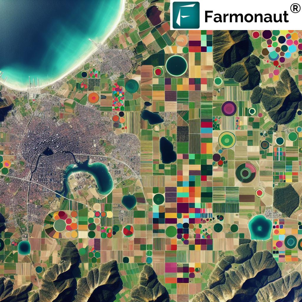
Satellite data has become an indispensable tool in our quest to understand and manage our planet’s resources more effectively. With a network of satellites orbiting the Earth, we can now capture high-resolution imagery and collect vast amounts of data on a global scale. This wealth of information allows us to monitor changes in land use, track environmental variables, and even predict natural disasters with unprecedented accuracy.
At Farmonaut, we leverage this satellite data to provide cutting-edge solutions for various sectors. Our platform integrates multispectral and hyperspectral imaging technologies, allowing us to capture detailed information about the Earth’s surface that goes far beyond what the human eye can see. This advanced imagery enables us to analyze vegetation health, soil moisture levels, and even detect subtle changes in land cover that might indicate potential environmental issues.
Transforming Agriculture with Satellite-Based Solutions
The agricultural sector stands to benefit immensely from satellite-based monitoring and analytics. Our solutions at Farmonaut are designed to empower farmers and agribusinesses with real-time, actionable insights that can significantly improve crop yields and resource management.
Precision Agriculture and Crop Monitoring
One of the key applications of satellite data in agriculture is precision farming. By analyzing multispectral imagery, we can provide farmers with detailed information about their crops’ health, allowing for targeted interventions and optimized resource allocation. Our platform offers:
- Vegetation Health Monitoring: Using Normalized Difference Vegetation Index (NDVI) and other advanced indices, we can assess crop vigor and identify areas of stress or potential disease outbreaks.
- Soil Moisture Analysis: Satellite-based soil moisture mapping helps farmers make informed decisions about irrigation, reducing water waste and improving crop resilience.
- Yield Prediction: By combining historical data with current satellite imagery, we can provide accurate yield forecasts, helping farmers and agribusinesses plan more effectively.
These capabilities are accessible through our user-friendly mobile app, available for both Android and iOS devices, ensuring that farmers can access critical information anytime, anywhere.
Sustainable Agriculture Practices
Sustainability is at the heart of modern agriculture, and satellite data plays a crucial role in promoting environmentally friendly farming practices. Our platform helps farmers:
- Optimize Resource Use: By providing precise information on crop needs, we help reduce the overuse of fertilizers and pesticides, minimizing environmental impact.
- Monitor Carbon Footprint: Our advanced analytics tools allow farmers to track their carbon emissions and identify opportunities for reduction, contributing to global climate change mitigation efforts.
- Implement Conservation Measures: Satellite imagery helps identify areas suitable for conservation practices, such as buffer strips or cover crops, enhancing biodiversity and soil health.
Revolutionizing Forestry Management
Forests play a critical role in maintaining our planet’s ecological balance, and effective forestry management is essential for their preservation. At Farmonaut, we provide innovative solutions that leverage satellite data to monitor and protect our forest resources.
Deforestation Tracking and Prevention
Our satellite-based monitoring systems offer unparalleled capabilities in tracking deforestation and forest degradation. By analyzing high-resolution imagery over time, we can:
- Detect Illegal Logging: Identify areas of unexpected forest loss, enabling rapid response to illegal activities.
- Monitor Forest Health: Assess changes in forest canopy density and composition, providing early warning of potential issues.
- Support Reforestation Efforts: Identify suitable areas for reforestation and track the progress of restoration projects.
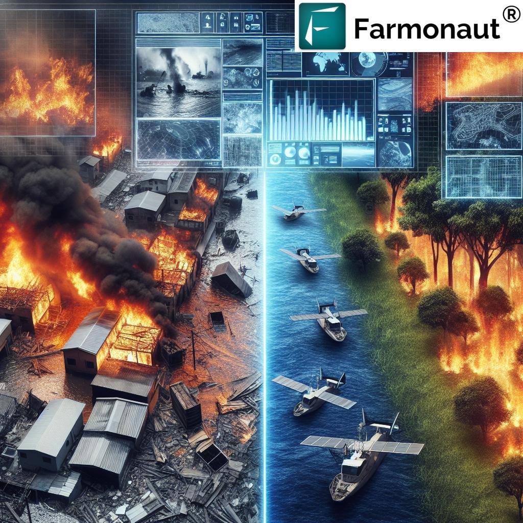
Fire Detection and Management
Forest fires pose a significant threat to ecosystems and communities worldwide. Our satellite-based fire detection system provides:
- Early Warning: Detect hotspots and potential fire outbreaks before they escalate into major incidents.
- Real-time Monitoring: Track fire spread and intensity, aiding in resource allocation and evacuation planning.
- Post-fire Assessment: Evaluate the extent of damage and support recovery efforts through detailed burn scar mapping.
Enhancing Disaster Management and Emergency Response
In the face of increasing natural disasters and emergencies, timely and accurate information is crucial for effective response and management. Farmonaut’s satellite-based solutions play a vital role in various aspects of disaster management:
Early Warning Systems
Our advanced analytics and monitoring capabilities contribute to robust early warning systems for various natural disasters:
- Flood Prediction: By analyzing rainfall patterns and river levels, we can provide early warnings for potential flooding events.
- Landslide Risk Assessment: Combining satellite imagery with topographical data allows us to identify areas at high risk of landslides.
- Drought Monitoring: Long-term analysis of vegetation health and soil moisture helps predict and mitigate the impacts of drought.
Rapid Damage Assessment
In the aftermath of a disaster, quick and accurate damage assessment is critical for effective response and recovery efforts. Our platform offers:
- Change Detection: Compare pre and post-event imagery to quickly identify affected areas and estimate the extent of damage.
- Infrastructure Mapping: Assess the condition of critical infrastructure, such as roads, bridges, and power lines, to guide restoration efforts.
- Population Impact Analysis: Estimate the number of people affected by a disaster to help prioritize aid and resources.
The Role of Artificial Intelligence and Machine Learning
At Farmonaut, we understand that the true power of satellite data lies in its analysis and interpretation. That’s why we’ve developed advanced artificial intelligence (AI) and machine learning (ML) algorithms to extract meaningful insights from the vast amounts of data we collect.
Automated Feature Detection
Our AI-powered systems can automatically detect and classify various features in satellite imagery, including:
- Crop types and growth stages
- Urban development and land use changes
- Water bodies and coastline changes
- Infrastructure elements like roads and buildings
This automated detection significantly speeds up the analysis process and allows for large-scale monitoring of vast areas.
Predictive Analytics
By combining historical data with current satellite observations, our ML models can provide valuable predictions and forecasts, such as:
- Crop yield estimates
- Disease outbreak risks in agriculture and forestry
- Potential areas of urban expansion
- Future climate change impacts on specific regions
These predictive capabilities enable proactive decision-making and long-term planning across various sectors.
Empowering Developers and Researchers
At Farmonaut, we believe in the power of collaboration and innovation. That’s why we offer robust API access to our satellite data and analytics tools, enabling developers and researchers to integrate our capabilities into their own applications and studies. Our API provides access to:
- Raw satellite imagery
- Processed data products (e.g., NDVI maps, soil moisture indices)
- Historical time series data
- Weather forecasts and climate data
By making our data and tools accessible, we aim to foster innovation and drive the development of new solutions across various industries. For detailed information on how to integrate our API into your projects, visit our developer documentation.
Sustainability and Environmental Monitoring
As global concerns about climate change and environmental degradation continue to grow, the role of satellite-based monitoring in promoting sustainability has become increasingly crucial. At Farmonaut, we’re committed to providing tools and insights that support sustainable practices across industries:
Carbon Sequestration Monitoring
Our advanced satellite imagery analysis allows for accurate estimation of carbon sequestration in forests and agricultural lands. This capability is invaluable for:
- Verifying carbon offset projects
- Monitoring the effectiveness of reforestation efforts
- Assessing the carbon storage potential of different land management practices
Biodiversity Conservation
Satellite data plays a crucial role in biodiversity conservation efforts. Our platform supports:
- Habitat mapping and monitoring for endangered species
- Tracking changes in ecosystem boundaries and composition
- Identifying potential wildlife corridors for conservation planning
Water Resource Management
Effective water resource management is critical for sustainability. Our satellite-based solutions provide:
- Monitoring of surface water bodies and their changes over time
- Assessment of water quality through remote sensing techniques
- Tracking of glacial retreat and its impact on water resources
Maritime Monitoring and Coastal Management
While much of our focus is on land-based applications, satellite data also plays a crucial role in maritime monitoring and coastal management. At Farmonaut, we’re expanding our capabilities to address challenges in these areas:
Coastal Erosion Monitoring
Our high-resolution satellite imagery allows for precise tracking of coastline changes, helping to:
- Identify areas at risk of erosion
- Plan and assess the effectiveness of coastal protection measures
- Monitor the impact of sea-level rise on coastal communities
Marine Ecosystem Health
Satellite data provides valuable insights into the health of marine ecosystems:
- Monitoring of algal blooms and water quality in coastal areas
- Tracking of coral reef health and bleaching events
- Assessment of seagrass bed extent and condition
Maritime Safety and Security
Our satellite monitoring capabilities extend to maritime safety and security applications:
- Vessel tracking and monitoring for maritime traffic management
- Detection of potential illegal fishing activities
- Support for search and rescue operations in marine environments
Energy Sector Applications
The energy sector is another area where satellite data and analytics can drive significant improvements in efficiency and sustainability. At Farmonaut, we’re developing solutions to support various aspects of energy production and distribution:
Renewable Energy Site Selection
Our satellite-based analytics help identify optimal locations for renewable energy projects:
- Solar potential mapping based on historical weather data and terrain analysis
- Wind resource assessment for wind farm placement
- Geothermal potential identification through thermal imaging
Infrastructure Monitoring
Satellite imagery provides a cost-effective way to monitor energy infrastructure:
- Power line corridor vegetation management
- Oil and gas pipeline monitoring for leak detection and security
- Assessment of dam and reservoir conditions for hydroelectric facilities
Environmental Impact Assessment
Our platform supports the energy sector in assessing and mitigating its environmental impact:
- Monitoring of land use changes associated with energy projects
- Tracking of greenhouse gas emissions from industrial facilities
- Assessment of habitat restoration efforts in areas affected by energy production
Defense and Intelligence Applications
While our primary focus is on civilian applications, the capabilities of satellite-based monitoring and analytics have significant implications for defense and intelligence sectors. At Farmonaut, we recognize the potential of our technology to support national security efforts:
Border Monitoring
Satellite imagery provides valuable support for border security operations:
- Detection of unauthorized border crossings or construction activities
- Monitoring of remote or inaccessible border areas
- Assessment of environmental changes that may impact border security
Infrastructure Protection
Our satellite monitoring capabilities can be applied to protect critical infrastructure:
- Continuous monitoring of key facilities and installations
- Early detection of potential threats or unusual activities
- Assessment of damage to infrastructure in conflict zones or disaster areas
Intelligence Gathering
While respecting privacy and legal constraints, our technology can support intelligence activities:
- Monitoring of areas of interest for strategic planning
- Detection of changes in military installations or activities
- Support for humanitarian efforts in conflict zones through accurate situational awareness
The Future of Satellite-Based Earth Observation
As we look to the future, the potential applications of satellite data and analytics continue to expand. At Farmonaut, we’re committed to staying at the forefront of this technological revolution, developing new capabilities and exploring emerging applications:
Hyperspectral Imaging
Advancements in hyperspectral imaging technology will allow for even more detailed analysis of Earth’s surface:
- Enhanced crop disease detection and soil composition analysis
- Improved mineral exploration capabilities
- More accurate water quality assessment in inland and coastal waters
Integration with IoT and Ground Sensors
The combination of satellite data with ground-based Internet of Things (IoT) sensors will provide unprecedented levels of detail and real-time monitoring:
- Enhanced precision agriculture through integration with soil sensors and weather stations
- Improved urban management with combined satellite and ground-based air quality monitoring
- More accurate natural disaster prediction and response through integrated early warning systems
Advanced AI and Machine Learning
Continued advancements in AI and machine learning will unlock new possibilities in data analysis and interpretation:
- Automated detection and classification of complex land use patterns
- Improved predictive modeling for climate change impacts and natural disasters
- Enhanced anomaly detection for early warning of environmental issues or security threats
Farmonaut’s Commitment to Innovation and Accessibility
At Farmonaut, we believe that the power of satellite data and analytics should be accessible to all who can benefit from it. That’s why we’re committed to:
- Continuous Innovation: We’re constantly exploring new technologies and applications to expand the capabilities of our platform.
- User-Friendly Solutions: Our mobile app and web platform are designed to make complex data accessible and actionable for users of all technical backgrounds.
- Affordable Access: We offer flexible pricing options to ensure that our solutions are accessible to businesses and organizations of all sizes.
- Education and Outreach: We’re committed to educating users about the potential of satellite data and supporting the next generation of Earth observation experts.
To explore how Farmonaut can support your specific needs, we invite you to try our platform or speak with one of our experts. Visit our app redirect page to get started with our mobile application, or explore our subscription options below:
Comparison of Farmonaut’s Satellite Data Applications Across Sectors
| Sector | Key Benefits | Farmonaut Solutions |
|---|---|---|
| Agriculture | Crop monitoring, yield prediction | Hyperspectral imaging |
| Forestry | Deforestation tracking, fire detection | Real-time mapping |
| Disaster Management | Early warning systems, damage assessment | Emergency response tools |
Frequently Asked Questions (FAQ)
Q: How accurate is satellite-based crop monitoring?
A: Our satellite-based crop monitoring is highly accurate, with resolution capabilities down to 3 meters for certain applications. The accuracy depends on factors such as satellite resolution, frequency of image capture, and the specific metrics being measured. For most agricultural applications, our system provides accuracy levels sufficient for informed decision-making and precise farm management.
Q: Can Farmonaut’s solutions be used for small-scale farming?
A: Absolutely! We’ve designed our platform to be scalable and accessible for farms of all sizes. Our mobile app and affordable pricing options make it possible for small-scale farmers to benefit from advanced satellite monitoring and analytics, helping them optimize their operations and increase yields.
Q: How often is satellite data updated on the Farmonaut platform?
A: The frequency of data updates depends on the specific service package and the satellites used. For most applications, we provide updates every 3-5 days, with some services offering daily updates. Real-time monitoring is available for certain applications, especially in disaster management scenarios.
Q: Is Farmonaut’s data compliant with privacy and data protection regulations?
A: Yes, we take data privacy and security very seriously. All our data collection, processing, and storage practices comply with relevant data protection regulations, including GDPR where applicable. We ensure that personal data is protected and that our satellite monitoring respects privacy laws and ethical considerations.
Q: Can Farmonaut’s satellite data be integrated with other farm management software?
A: Yes, we offer API access that allows for seamless integration with other farm management tools and software. Our developer documentation provides detailed information on how to integrate our data and analytics into third-party applications, enabling a more comprehensive farm management experience.
Q: How does Farmonaut support sustainability efforts?
A: Sustainability is at the core of our mission. Our solutions help reduce resource waste in agriculture, support sustainable forestry practices, and aid in environmental monitoring and conservation efforts. By providing accurate data and analytics, we enable our users to make more environmentally friendly decisions and track their sustainability progress over time.
Q: What kind of support does Farmonaut offer to its users?
A: We provide comprehensive support to our users, including:
- Technical support for our platform and mobile app
- Training and educational resources to help users maximize the benefits of our solutions
- Regular webinars and workshops on new features and best practices
- Dedicated account managers for enterprise clients
Q: Can Farmonaut’s solutions be customized for specific industries or use cases?
A: Yes, we offer customization options for our enterprise clients. Our team can work with you to develop tailored solutions that meet your specific industry needs, whether in agriculture, forestry, disaster management, or other sectors. Contact our sales team to discuss your unique requirements.
At Farmonaut, we’re committed to harnessing the power of satellite data and analytics to drive positive change across various sectors. From agriculture and forestry to disaster management and beyond, our innovative solutions are helping to create a more sustainable and resilient world. As we continue to push the boundaries of what’s possible with Earth observation technology, we invite you to join us on this exciting journey. Together, we can unlock new insights, drive informed decision-making, and shape a better future for our planet.