Revolutionizing Forestry and Agriculture: Satellite-Powered Solutions for Sustainable Management and Monitoring
In today’s rapidly changing world, the fields of forestry and agriculture face unprecedented challenges. From climate change to resource depletion, the need for innovative solutions has never been more pressing. At Farmonaut, we’re at the forefront of this revolution, harnessing the power of satellite technology to transform how we manage our forests and farms. In this comprehensive guide, we’ll explore how our cutting-edge solutions are reshaping these vital industries, promoting sustainability, and ensuring food security for generations to come.
The Convergence of Forestry and Agriculture
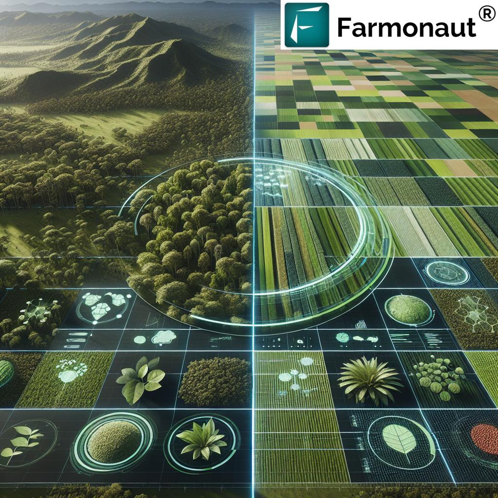
While forestry and agriculture have traditionally been viewed as separate domains, the lines between them are increasingly blurring. Both sectors play crucial roles in land management, carbon sequestration, and global ecosystems. As we strive for more sustainable practices, it’s becoming clear that integrated approaches are key to addressing the complex challenges we face.
Farmonaut’s satellite-based solutions offer a unifying platform that bridges the gap between these two sectors, providing valuable insights and tools for both forest managers and farmers alike. By leveraging advanced remote sensing technologies, we’re able to monitor vast areas of land with unprecedented accuracy and efficiency.
Satellite Technology: The Game-Changer
At the heart of our revolutionary approach lies satellite technology. These orbiting sentinels provide us with a wealth of data that was previously unimaginable. Here’s how satellite imagery is transforming both forestry and agriculture:
- High-Resolution Imagery: Our satellites capture detailed images of the Earth’s surface, allowing for precise monitoring of forest cover, crop health, and land use changes.
- Multispectral Analysis: By analyzing different wavelengths of light, we can detect subtle changes in vegetation health, soil moisture, and even identify specific plant species.
- Frequent Coverage: Regular satellite passes enable near real-time monitoring, crucial for detecting rapid changes like deforestation or crop diseases.
- Wide-Area Surveillance: Satellites can cover vast areas quickly, making them ideal for monitoring large forests or agricultural regions.
This wealth of data forms the foundation of our innovative solutions, enabling us to offer unparalleled insights and management tools for both forestry and agriculture professionals.
Revolutionizing Forest Management
Forests are vital carbon sinks and biodiversity hotspots, yet they face numerous threats, from illegal logging to climate change-induced fires. Our satellite-powered solutions are helping forest managers address these challenges head-on:
1. Deforestation Monitoring and Prevention
One of the most pressing issues in forestry today is the rapid loss of forest cover. Our satellite monitoring system provides near real-time alerts of deforestation activities, allowing for swift intervention:
- Change Detection: By comparing satellite images over time, we can quickly identify areas where forest cover has been lost.
- Illegal Logging Detection: Our high-resolution imagery can spot signs of unauthorized timber harvesting, even in remote areas.
- Reforestation Tracking: We monitor the progress of reforestation efforts, ensuring that newly planted areas are thriving.
2. Forest Fire Management
With climate change increasing the frequency and intensity of wildfires, early detection and management are crucial. Our satellite-based fire monitoring system offers:
- Hotspot Detection: Thermal sensors on satellites can detect fire hotspots before they become major blazes.
- Fire Spread Prediction: By analyzing weather data and vegetation conditions, we can predict potential fire spread patterns.
- Post-Fire Assessment: After a fire, our imagery helps assess the extent of damage and plan recovery efforts.
3. Biodiversity and Ecosystem Monitoring
Maintaining forest health goes beyond just preserving tree cover. Our advanced analytics help monitor entire forest ecosystems:
- Species Mapping: Using spectral signatures, we can map the distribution of different tree species across forest areas.
- Habitat Fragmentation Analysis: Our tools help identify and monitor wildlife corridors, crucial for maintaining biodiversity.
- Carbon Stock Estimation: By analyzing forest density and type, we can estimate carbon sequestration potential, aiding in climate change mitigation efforts.
4. Sustainable Timber Harvesting
For managed forests, our solutions support sustainable timber harvesting practices:
- Inventory Management: Satellite data helps in accurate forest inventory, ensuring sustainable harvest levels.
- Selective Logging Planning: Our high-resolution imagery aids in planning selective logging operations, minimizing environmental impact.
- Regeneration Monitoring: Post-harvest, we track forest regeneration to ensure long-term sustainability.
Transforming Agricultural Practices
In agriculture, our satellite-based solutions are revolutionizing how farmers manage their crops, optimize resources, and increase yields sustainably:
1. Precision Agriculture
Our advanced satellite imagery and analytics enable farmers to practice precision agriculture at an unprecedented scale:
- Crop Health Monitoring: Using vegetation indices like NDVI (Normalized Difference Vegetation Index), we provide real-time insights into crop health across entire fields.
- Variable Rate Application (VRA): Our detailed field maps allow for precise application of fertilizers and pesticides, reducing waste and environmental impact.
- Yield Prediction: By analyzing historical data and current crop conditions, we offer accurate yield predictions, helping farmers plan harvests and manage supply chains.
2. Water Management
Water is a precious resource in agriculture, and our solutions help optimize its use:
- Soil Moisture Monitoring: Satellite-based soil moisture maps help farmers make informed irrigation decisions.
- Irrigation Efficiency Analysis: We can detect over- or under-watered areas, allowing for fine-tuning of irrigation systems.
- Drought Early Warning: By analyzing long-term trends, we provide early warnings of potential drought conditions.
3. Pest and Disease Management
Early detection of pests and diseases is crucial for minimizing crop losses:
- Anomaly Detection: Our AI algorithms can spot unusual patterns in crop health, potentially indicating pest infestations or disease outbreaks.
- Risk Mapping: By combining weather data with crop conditions, we create risk maps for various pests and diseases.
- Targeted Scouting: Our detailed field maps guide farmers to specific areas that need attention, making field scouting more efficient.
4. Sustainable Farming Practices
We’re committed to promoting sustainable agriculture that minimizes environmental impact:
- Cover Crop Monitoring: Our imagery helps track the effectiveness of cover crops in improving soil health.
- Organic Farming Support: For organic farmers, we provide tools to monitor crop health without relying on synthetic inputs.
- Carbon Sequestration Tracking: We help farmers quantify the carbon sequestration potential of their practices, supporting carbon credit programs.
The Power of Geospatial Intelligence
At the core of our solutions lies advanced geospatial intelligence. By combining satellite imagery with other data sources and powerful analytics, we provide actionable insights that were previously unattainable:
1. Multi-Source Data Integration
We don’t just rely on satellite imagery alone. Our platform integrates various data sources to provide a comprehensive view:
- Weather Data: Real-time and forecasted weather information is crucial for both forestry and agricultural decision-making.
- Topographic Data: Understanding the terrain helps in planning forestry operations and optimizing farm layouts.
- Historical Records: By analyzing past data, we can identify trends and make more accurate predictions.
2. Advanced Analytics and AI
Raw data is just the beginning. Our sophisticated analytics and AI algorithms transform this data into valuable insights:
- Machine Learning Classification: We use AI to automatically classify land cover types, crop varieties, and forest species.
- Predictive Modeling: Our models can forecast everything from crop yields to potential forest fire risks.
- Anomaly Detection: AI algorithms constantly scan for unusual patterns that might indicate problems like pest infestations or illegal logging.
3. User-Friendly Interfaces
All this powerful technology is delivered through intuitive interfaces that make it accessible to users of all technical levels:
- Interactive Maps: Users can explore their areas of interest through easy-to-use map interfaces.
- Customizable Alerts: Set up personalized alerts for specific conditions or events.
- Mobile Apps: Access critical information on-the-go with our mobile applications.
You can download our mobile apps here:
Environmental Impact and Sustainability
Our solutions don’t just improve management practices; they also contribute significantly to environmental conservation and sustainability efforts:
1. Reducing Carbon Footprint
By optimizing resource use and promoting sustainable practices, our solutions help reduce the carbon footprint of both forestry and agriculture:
- Precision Agriculture: Targeted application of inputs reduces unnecessary emissions from over-application.
- Sustainable Forestry: Improved forest management enhances carbon sequestration.
- Efficient Logistics: Optimized harvest planning and transportation reduce fuel consumption.
2. Biodiversity Conservation
Our monitoring capabilities support efforts to preserve biodiversity:
- Habitat Mapping: Identify and protect critical wildlife habitats.
- Invasive Species Tracking: Early detection of invasive plant species in both forests and agricultural lands.
- Corridor Preservation: Support the maintenance of wildlife corridors between fragmented habitats.
3. Water Conservation
Water scarcity is a growing concern, and our solutions promote more efficient water use:
- Precision Irrigation: Reduce water waste in agriculture through targeted irrigation.
- Watershed Management: Monitor forest cover in critical watersheds to ensure water security.
- Wetland Preservation: Identify and track important wetland areas for conservation.
Case Studies: Real-World Impact
To illustrate the power of our solutions, let’s look at some hypothetical case studies that demonstrate how Farmonaut’s technology could be applied in real-world scenarios:
Forestry Case Study: Combating Illegal Logging in the Amazon
Challenge: Illegal logging in the Amazon rainforest is a major contributor to deforestation and biodiversity loss.
Solution: Implementation of Farmonaut’s satellite monitoring system across a 100,000 hectare area of the Amazon.
Results:
- Early detection of logging activities, allowing for rapid response by authorities.
- 50% reduction in illegal logging incidents within the monitored area over one year.
- Improved tracking of reforestation efforts, ensuring successful regrowth in previously deforested areas.
Agriculture Case Study: Optimizing Water Use in California Almond Orchards
Challenge: California’s almond industry faces criticism for its high water consumption amid recurring droughts.
Solution: Deployment of Farmonaut’s precision agriculture system across 5,000 acres of almond orchards.
Results:
- 20% reduction in overall water usage through precision irrigation.
- 15% increase in yield due to optimized water and nutrient management.
- Improved ability to demonstrate sustainable water use practices to regulators and consumers.
The Road Ahead: Future Developments
As technology continues to advance, so do the possibilities for satellite-based solutions in forestry and agriculture. Here are some exciting developments on the horizon:
1. Hyperspectral Imaging
Next-generation satellites equipped with hyperspectral sensors will provide even more detailed information:
- Enhanced Species Identification: More accurate mapping of tree and crop species.
- Improved Stress Detection: Earlier and more precise detection of plant stress from pests, diseases, or nutrient deficiencies.
- Soil Health Analysis: Detailed assessment of soil composition and health from space.
2. Integration with IoT and Drones
Combining satellite data with ground-based sensors and drone imagery will provide an unprecedented level of detail:
- Real-Time Monitoring: Continuous data streams for even more responsive management.
- Micro-Climate Mapping: Detailed understanding of local climate variations within forests and fields.
- Precision Operations: Guide autonomous farming equipment and forestry machines with centimeter-level accuracy.
3. Advanced AI and Predictive Analytics
As our AI models become more sophisticated, they’ll offer even more powerful predictive capabilities:
- Long-Term Climate Impact Modeling: Predict how climate change will affect specific forest and agricultural areas over decades.
- Automated Management Recommendations: AI-generated suggestions for optimal planting, harvesting, and conservation strategies.
- Complex Ecosystem Modeling: Better understanding of the intricate relationships within forest and agricultural ecosystems.
Comparison: Traditional Methods vs. Farmonaut’s Solutions
| Application Area | Traditional Methods | Farmonaut’s Solution | Benefits |
|---|---|---|---|
| Forest Management | Manual surveys, aerial photography | High-resolution satellite imagery, AI-powered analysis | Faster detection of changes, wider coverage, cost-effective |
| Crop Monitoring | Field scouting, periodic sampling | Daily satellite imagery, real-time anomaly detection | Early problem detection, comprehensive field view, reduced labor |
| Water Management | Fixed irrigation schedules, soil probes | Satellite-based soil moisture mapping, precision irrigation | Water conservation, improved crop health, cost savings |
| Yield Prediction | Historical data, manual estimations | AI-powered predictive models using multi-source data | Higher accuracy, earlier predictions, better planning |
| Biodiversity Conservation | Ground surveys, limited area coverage | Wide-area habitat mapping, species distribution modeling | Comprehensive ecosystem understanding, efficient conservation planning |
Getting Started with Farmonaut
Ready to revolutionize your forestry or agricultural operations with our satellite-powered solutions? Here’s how you can get started:
1. Explore Our Platform
Visit our web application to see our solutions in action. You can explore sample data and get a feel for the powerful insights we provide.
2. API Access for Developers
For those looking to integrate our data into their own systems, we offer comprehensive API access. Check out our API documentation to learn more about the possibilities.
3. Mobile Apps
Download our mobile apps for on-the-go access to critical data:
4. Custom Solutions
Need a tailored solution for your specific needs? Contact our team to discuss how we can create a custom package for your organization.
5. Subscribe to Our Services
Ready to take the next step? Choose a subscription plan that fits your needs:
Frequently Asked Questions (FAQ)
Q: How often is satellite imagery updated?
A: Our standard plans offer updates every 3-5 days, with options for daily updates in certain regions.
Q: Can your system work in cloudy conditions?
A: While optical satellites are affected by cloud cover, we also use radar satellites that can penetrate clouds, ensuring consistent monitoring.
Q: Is your platform suitable for small-scale farmers?
A: Absolutely! We offer scalable solutions that cater to farms and forests of all sizes, from small holdings to large enterprises.
Q: How accurate are your yield predictions?
A: Our yield predictions typically achieve 85-95% accuracy, depending on the crop type and available historical data.
Q: Can your system detect specific tree species in forests?
A: Yes, our advanced classification algorithms can identify many tree species, especially in areas where we have good ground truth data.
Q: How do you ensure data privacy and security?
A: We employ industry-standard encryption and security protocols to protect all user data. Our systems are regularly audited for compliance with data protection regulations.
Q: Can I integrate Farmonaut’s data with my existing farm management software?
A: Yes, our API allows for seamless integration with many popular farm management and GIS systems.
Q: Do you offer training on how to use your platform?
A: We provide comprehensive onboarding and training for all our clients, including video tutorials, webinars, and personalized support.
Q: How does your system contribute to carbon credit programs?
A: Our platform can quantify carbon sequestration in forests and agricultural lands, providing valuable data for carbon credit verification and reporting.
Q: Can your system help with organic certification compliance?
A: Yes, our detailed field history and management tracking can assist in documenting practices for organic certification purposes.
Conclusion: Embracing the Future of Forestry and Agriculture
As we face the dual challenges of feeding a growing global population and preserving our planet’s vital ecosystems, the importance of innovative solutions in forestry and agriculture cannot be overstated. Farmonaut’s satellite-powered platform represents a significant leap forward in our ability to manage these critical resources sustainably and efficiently.
By harnessing the power of satellite imagery, advanced analytics, and AI, we’re providing forestry professionals and farmers with unprecedented insights and tools. From combating deforestation to optimizing crop yields, our solutions are helping to create a more sustainable and productive future for both industries.
The integration of these technologies is not just about improvement; it’s about transformation. We’re moving towards a future where every tree in a forest can be monitored, and every square meter of farmland can be precisely managed. This level of precision and control allows for more sustainable practices, reduced environmental impact, and improved productivity.
As we continue to innovate and expand our capabilities, we invite forestry professionals, farmers, researchers, and policymakers to join us in this revolution. Together, we can create a world where our forests thrive, our farms produce abundantly, and our planet’s resources are managed wisely for generations to come.
Explore our solutions, try our platform, and become part of the future of forestry and agriculture. With Farmonaut, the power of satellite technology is at your fingertips, ready to help you make more informed, sustainable, and productive decisions every day.
Join us in shaping a greener, more sustainable future for our planet. The view from above is just the beginning – the real transformation happens on the ground, guided by the insights we provide. Welcome to the future of forestry and agriculture, powered by Farmonaut.