Revolutionizing Michigan Agriculture: The Power of Satellite-Based Crop Monitoring and Geospatial Intelligence
In the heart of America’s Midwest, Michigan’s agricultural landscape is undergoing a remarkable transformation. As we navigate the challenges of modern farming, we’re witnessing a technological revolution that’s reshaping the way we approach crop monitoring, soil management, and climate-smart agriculture. At the forefront of this revolution is the integration of satellite technology and geospatial intelligence into everyday farming practices.
The Michigan Agricultural Landscape: A Brief Overview
Michigan’s diverse agricultural sector is a cornerstone of the state’s economy. From the vast cornfields of the southern counties to the fruit orchards of the northwest, our state’s farms are as varied as they are productive. However, with changing climate patterns and the need for more sustainable farming practices, Michigan’s agricultural community is constantly seeking innovative solutions to age-old challenges.
Enter Satellite-Based Crop Monitoring
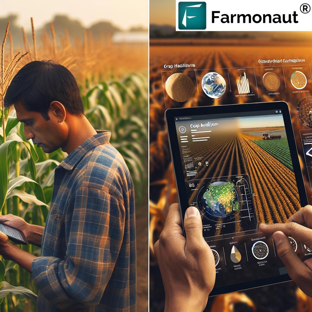
One of the most groundbreaking advancements in modern agriculture is the use of satellite technology for crop monitoring. This approach allows farmers to gain unprecedented insights into their fields without ever setting foot in them. But how does it work, and what benefits does it bring to Michigan’s farms?
The Science Behind Satellite Crop Monitoring
Satellite-based crop monitoring utilizes advanced sensors on orbiting satellites to capture multispectral images of agricultural land. These images provide a wealth of information about crop health, soil conditions, and environmental factors. Here’s how it works:
- Multispectral Imaging: Satellites capture images across various light spectrums, including visible and near-infrared light.
- Vegetation Indices: These images are processed to create vegetation indices, such as the Normalized Difference Vegetation Index (NDVI), which provide insights into crop health and vigor.
- Data Analysis: Sophisticated algorithms analyze the satellite data to detect patterns, anomalies, and trends in crop development.
Benefits for Michigan Farmers
The adoption of satellite-based crop monitoring offers numerous advantages for Michigan’s agricultural community:
- Timely Insights: Farmers can receive regular updates on crop health, allowing for quick responses to issues like pest infestations or nutrient deficiencies.
- Resource Optimization: By identifying areas of stress or low productivity, farmers can allocate resources more efficiently, reducing waste and improving yields.
- Environmental Stewardship: Precise monitoring enables more targeted use of inputs, reducing the environmental impact of farming practices.
- Time and Cost Savings: Satellite monitoring reduces the need for manual field scouting, saving time and labor costs.
Soil Moisture Monitoring: A Game-Changer for Michigan Agriculture
One of the most critical aspects of crop management is maintaining optimal soil moisture levels. In Michigan, where rainfall patterns can be unpredictable, accurate soil moisture monitoring is essential for successful crop production. Satellite-based technologies are revolutionizing this aspect of farm management.
How Satellite Technology Measures Soil Moisture
Satellite-based soil moisture monitoring relies on microwave remote sensing technology. Here’s a simplified explanation of the process:
- Microwave Emission: Soil emits microwave radiation, which varies depending on its moisture content.
- Satellite Detection: Specialized satellites equipped with microwave sensors detect these emissions.
- Data Processing: The satellite data is processed and analyzed to estimate soil moisture levels across large areas.
Advantages for Michigan Farmers
The ability to monitor soil moisture from space offers several benefits:
- Large-Scale Coverage: Satellite monitoring provides a comprehensive view of soil moisture across entire fields or regions.
- Frequent Updates: Regular satellite passes allow for continuous monitoring of soil moisture trends.
- Improved Irrigation Management: Farmers can make more informed decisions about when and where to irrigate, optimizing water use.
- Drought Monitoring: Early detection of dry conditions can help farmers implement drought mitigation strategies.
Organic Carbon Monitoring: Nurturing Michigan’s Soil Health
Soil organic carbon is a critical component of soil health, influencing factors such as water retention, nutrient availability, and overall soil structure. In Michigan, where soil types vary significantly across the state, monitoring and managing organic carbon levels is crucial for sustainable agriculture.
Satellite-Based Organic Carbon Assessment
While directly measuring soil organic carbon from space is challenging, satellite technology can provide valuable insights through indirect methods:
- Spectral Analysis: Certain wavelengths of light reflected from the soil surface can indicate organic carbon content.
- Vegetation Indices: Healthy vegetation, often associated with high organic carbon levels, can be detected through satellite imagery.
- Machine Learning: Advanced algorithms can correlate satellite data with ground-truth measurements to estimate organic carbon levels across large areas.
Benefits for Michigan’s Soil Health
Monitoring organic carbon through satellite technology offers several advantages:
- Large-Scale Assessment: Farmers and researchers can assess organic carbon levels across entire regions, identifying trends and areas of concern.
- Tracking Changes Over Time: Regular satellite monitoring allows for the observation of long-term changes in soil organic carbon.
- Targeted Management: Areas with low organic carbon can be identified for targeted interventions, such as cover cropping or reduced tillage.
- Carbon Sequestration Potential: By monitoring organic carbon levels, Michigan farmers can contribute to climate change mitigation efforts through carbon sequestration in agricultural soils.
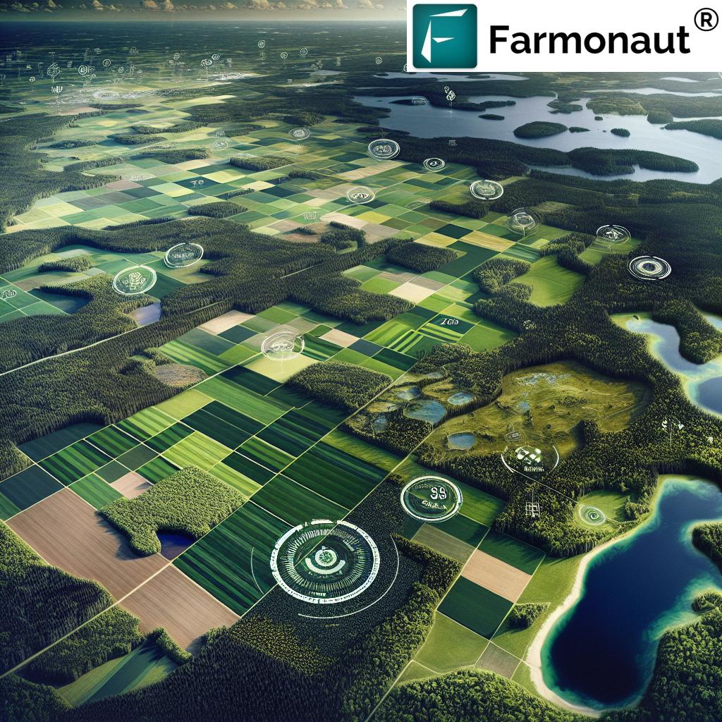
Climate-Smart Agriculture: Leveraging Geospatial Intelligence
As Michigan’s climate continues to evolve, adopting climate-smart agricultural practices is becoming increasingly important. Geospatial intelligence, powered by satellite technology, is playing a crucial role in helping farmers adapt to and mitigate the impacts of climate change.
What is Geospatial Intelligence in Agriculture?
Geospatial intelligence in agriculture refers to the collection, analysis, and interpretation of geographic information related to farming practices. It combines satellite imagery, weather data, soil information, and other relevant data sets to provide comprehensive insights for agricultural decision-making.
Applications in Climate-Smart Farming
Here are some ways geospatial intelligence is supporting climate-smart agriculture in Michigan:
- Climate Risk Assessment: By analyzing historical satellite data and climate models, farmers can assess the potential impacts of climate change on their specific locations.
- Crop Suitability Mapping: Geospatial analysis can help identify which crops are best suited for different areas based on changing climate conditions.
- Precision Agriculture: Satellite data enables precise application of inputs, reducing waste and minimizing environmental impact.
- Early Warning Systems: Geospatial intelligence can help predict and prepare for extreme weather events, such as droughts or heavy rainfall.
Benefits for Michigan’s Agricultural Resilience
The integration of geospatial intelligence into climate-smart agriculture offers numerous benefits:
- Improved Decision-Making: Farmers can make more informed decisions based on comprehensive, data-driven insights.
- Risk Mitigation: By anticipating climate-related challenges, farmers can implement strategies to reduce potential losses.
- Resource Efficiency: Climate-smart practices, guided by geospatial intelligence, can lead to more efficient use of water, fertilizers, and other inputs.
- Long-Term Sustainability: By adapting to changing climate conditions, Michigan’s agricultural sector can ensure its long-term viability and productivity.
Forest Management: Extending Geospatial Intelligence Beyond Croplands
While our focus has been primarily on crop monitoring, it’s important to note that satellite-based geospatial intelligence also plays a crucial role in managing Michigan’s forests. Our state’s extensive forested areas are not only economically important but also play a vital role in environmental conservation and carbon sequestration.
Satellite Applications in Forest Management
Satellite technology offers several applications for forest management:
- Forest Cover Mapping: Satellite imagery can provide accurate, up-to-date maps of forest cover and composition.
- Deforestation Monitoring: Regular satellite observations can detect and track changes in forest cover, helping to combat illegal logging and monitor reforestation efforts.
- Fire Risk Assessment: By analyzing factors such as vegetation dryness and weather conditions, satellite data can help predict and manage wildfire risks.
- Carbon Stock Estimation: Advanced algorithms can estimate the carbon stored in forests, contributing to climate change mitigation efforts.
Benefits for Michigan’s Forestry Sector
The use of satellite technology in forest management offers several advantages:
- Comprehensive Monitoring: Satellite imagery allows for the monitoring of large, often inaccessible forested areas.
- Cost-Effective Surveying: Compared to traditional ground-based surveys, satellite monitoring is more cost-effective for large-scale forest assessments.
- Timely Information: Regular satellite passes provide up-to-date information on forest health and changes.
- Integrated Land Management: Geospatial intelligence enables a more holistic approach to land management, considering both agricultural and forested areas.
The Role of Artificial Intelligence and Machine Learning
The true power of satellite-based crop monitoring and geospatial intelligence lies in the advanced analytics that process and interpret the vast amounts of data collected. Artificial Intelligence (AI) and Machine Learning (ML) play crucial roles in transforming raw satellite data into actionable insights for Michigan’s farmers and land managers.
AI and ML Applications in Agricultural Geospatial Intelligence
- Pattern Recognition: AI algorithms can identify patterns in crop growth, soil moisture, and other factors that might be imperceptible to the human eye.
- Predictive Analytics: Machine learning models can forecast crop yields, pest outbreaks, and optimal harvest times based on historical and real-time data.
- Anomaly Detection: AI can quickly identify areas of concern in fields, such as patches of diseased crops or irrigation issues.
- Data Fusion: Machine learning techniques can integrate multiple data sources, combining satellite imagery with ground sensors, weather data, and more for comprehensive analysis.
Benefits of AI-Powered Geospatial Intelligence
- Enhanced Accuracy: AI and ML algorithms can process and analyze data with a level of precision and consistency that surpasses human capabilities.
- Scalability: These technologies can handle vast amounts of data, making it possible to monitor and analyze large agricultural areas efficiently.
- Continuous Learning: Machine learning models improve over time as they process more data, leading to increasingly accurate and valuable insights.
- Customized Solutions: AI can be trained to recognize and analyze specific crops and conditions relevant to Michigan’s diverse agricultural landscape.
Implementing Satellite-Based Solutions: Practical Considerations for Michigan Farmers
While the benefits of satellite-based crop monitoring and geospatial intelligence are clear, implementing these technologies can seem daunting. Here are some practical considerations and steps for Michigan farmers looking to adopt these innovative solutions:
Getting Started with Satellite-Based Crop Monitoring
- Assess Your Needs: Determine which aspects of your farm management could benefit most from satellite monitoring (e.g., irrigation, fertilization, pest management).
- Choose a Service Provider: Research and select a reputable provider of satellite-based agricultural services. Look for providers with experience in Michigan’s agricultural conditions.
- Start Small: Consider starting with a pilot project on a portion of your farm to familiarize yourself with the technology and its benefits.
- Integrate with Existing Systems: Ensure that the satellite monitoring solution can integrate with your existing farm management software or practices.
- Training and Support: Invest time in learning how to interpret and act on the satellite data. Many service providers offer training and support to help you maximize the benefits of the technology.
Overcoming Common Challenges
As with any new technology, there may be challenges in adopting satellite-based solutions. Here are some common issues and how to address them:
- Data Interpretation: Understanding satellite data can be complex. Work closely with your service provider or consider hiring a consultant to help interpret the data initially.
- Internet Connectivity: Reliable internet access is often necessary to receive and process satellite data. If this is an issue in your area, discuss offline options with your service provider.
- Cost Concerns: While there is an initial investment, consider the long-term benefits and potential cost savings in resource management and improved yields.
- Weather Limitations: Satellite imagery can be affected by cloud cover. Look for solutions that use multiple satellites or integrate other data sources to provide consistent information.
The Future of Agriculture in Michigan: Embracing Technological Innovation
As we look to the future of agriculture in Michigan, it’s clear that technological innovation will play an increasingly important role. Satellite-based crop monitoring and geospatial intelligence are just the beginning of a broader transformation in how we approach farming and land management.
Emerging Trends and Technologies
Several exciting developments are on the horizon that will further enhance our ability to monitor and manage agricultural land:
- Hyperspectral Imaging: Next-generation satellites with hyperspectral sensors will provide even more detailed information about crop health and soil conditions.
- Internet of Things (IoT) Integration: The combination of satellite data with ground-based IoT sensors will offer unprecedented levels of precision in farm management.
- Blockchain for Traceability: Integrating satellite monitoring with blockchain technology could revolutionize supply chain management and food traceability.
- Advanced Climate Modeling: Improved climate models, combined with high-resolution satellite data, will enhance our ability to predict and adapt to changing weather patterns.
Preparing for the Future
To stay at the forefront of agricultural innovation, Michigan farmers and stakeholders should consider the following:
- Continuous Learning: Stay informed about emerging technologies and their potential applications in agriculture.
- Collaboration: Partner with research institutions, technology providers, and other farmers to share knowledge and resources.
- Investment in Infrastructure: Support initiatives to improve rural internet connectivity and other necessary infrastructure for advanced agricultural technologies.
- Policy Engagement: Advocate for policies that support the adoption of innovative agricultural technologies and sustainable farming practices.
Comparison: Traditional Methods vs. Farmonaut Satellite System
| Aspect | Traditional Methods | Farmonaut Satellite System |
|---|---|---|
| Soil Moisture Tracking | Manual soil sampling, limited coverage | Comprehensive, large-scale monitoring using microwave sensing |
| Organic Carbon Monitoring | Periodic lab tests, labor-intensive | Indirect assessment through spectral analysis and vegetation indices |
| Climate-Smart Decision Making | Based on local weather stations and historical data | Integration of satellite data, weather models, and AI for precise predictions |
| Forest Management | Ground surveys, aerial photography | Comprehensive monitoring of large areas, including inaccessible regions |
| Real-time Data Availability | Delayed, often requiring manual collection | Near real-time data updates through regular satellite passes |
| Cost-Effectiveness | High labor costs for extensive monitoring | More cost-effective for large-scale, frequent monitoring |
| Precision in Field Analysis | Limited by sampling frequency and coverage | High-resolution, consistent analysis across entire fields |
Conclusion: Embracing the Satellite Revolution in Michigan Agriculture
As we’ve explored throughout this comprehensive overview, satellite-based crop monitoring and geospatial intelligence are transforming agriculture in Michigan. From improving soil moisture management to enhancing forest conservation, these technologies offer unprecedented insights and capabilities to farmers, researchers, and land managers across our state.
The benefits are clear: increased efficiency, improved sustainability, and enhanced resilience in the face of changing climate conditions. By embracing these innovative solutions, Michigan’s agricultural sector is positioning itself at the forefront of modern, data-driven farming practices.
However, the true power of these technologies lies not just in the data they provide, but in how we use that data to make informed decisions. As we move forward, it will be crucial for farmers, agricultural organizations, and policymakers to work together to ensure that these technological advancements translate into tangible benefits for Michigan’s farms and forests.
The future of agriculture in Michigan is bright, and satellite-based technologies are lighting the way. By continuing to innovate, adapt, and collaborate, we can ensure that our state remains a leader in sustainable, productive, and resilient agriculture for generations to come.
FAQs: Satellite-Based Crop Monitoring and Geospatial Intelligence in Michigan Agriculture
-
Q: How often are satellite images of my farm updated?
A: The frequency of updates depends on the satellite system and service provider. Some services offer daily updates, while others may provide weekly or bi-weekly imagery. Farmonaut, for example, provides regular updates to ensure you have the most current information about your fields. -
Q: Can satellite monitoring replace ground-level observations?
A: While satellite monitoring provides valuable insights, it’s best used in conjunction with ground-level observations. The combination of satellite data and on-the-ground expertise offers the most comprehensive understanding of your farm’s conditions. -
Q: How accurate is satellite-based soil moisture monitoring?
A: Satellite-based soil moisture monitoring has become increasingly accurate in recent years. While it may not match the precision of direct soil probes, it provides a reliable overview of moisture conditions across large areas, which is particularly useful for irrigation management and drought monitoring. -
Q: Is satellite monitoring suitable for small farms in Michigan?
A: Yes, satellite monitoring can be beneficial for farms of all sizes. Many providers, including Farmonaut, offer scalable solutions that can be tailored to the needs of smaller operations. The insights gained can help even small farms optimize their resource use and improve productivity. -
Q: How can satellite data help with crop insurance claims?
A: Satellite imagery can provide objective evidence of crop conditions over time. This historical data can be valuable when filing crop insurance claims, as it offers a clear record of how your crops have developed and any damage they may have sustained due to weather events or other factors. -
Q: Can satellite monitoring help detect pest infestations or diseases?
A: Yes, satellite monitoring can often detect signs of pest infestations or diseases before they become visible to the naked eye. Changes in vegetation health indices can indicate stress in crops, which may be due to pests or diseases. Early detection allows for quicker intervention and potentially reduced crop losses. -
Q: How does satellite monitoring contribute to sustainable farming practices?
A: Satellite monitoring enables more precise application of inputs like water and fertilizers, reducing waste and environmental impact. It also helps in practices like conservation tillage and cover cropping by providing data on soil health and vegetation cover. These data-driven approaches contribute to more sustainable and environmentally friendly farming practices. -
Q: Is special equipment needed to use satellite monitoring services?
A: In most cases, no special equipment is needed. Services like Farmonaut provide access to satellite data and analysis through web and mobile applications. All you need is a computer or smartphone with internet access to view and interpret the data. -
Q: How can satellite data help with climate change adaptation in Michigan agriculture?
A: Satellite data provides valuable insights into changing climate patterns and their effects on crops. This information can help farmers make informed decisions about crop selection, planting times, and management practices to adapt to changing conditions. Long-term satellite data also contributes to more accurate climate models, aiding in future planning. -
Q: Are there any privacy concerns with satellite monitoring of farms?
A: Privacy is an important consideration. Reputable service providers like Farmonaut have strict data privacy policies in place. The satellite imagery used is typically of a resolution that doesn’t infringe on personal privacy. However, it’s always a good idea to review the privacy policies of any service you’re considering using.
For more information on how satellite-based crop monitoring can benefit your Michigan farm, visit Farmonaut’s application or explore our API services. You can also download our mobile app for on-the-go access to your farm’s data:
For developers interested in integrating our satellite and weather data into their own applications, check out our API documentation.
Ready to revolutionize your farming practices with satellite-based monitoring? Subscribe to Farmonaut’s services here: