
INTRODUCTION
Agriculture is one of the world’s most important industries, providing food and fiber for billions of people. However, it is also one of the most challenging, due to the variability of weather, pests, and diseases. In recent years, there has been a growing interest in using artificial intelligence (AI) and machine learning (ML) to improve agricultural productivity.
This is where Farmonaut uses AI and ML to monitor large and small scale farms. The company’s platform provides businesses with a variety of insights, including crop health, soil moisture, irrigation efficiency, evapotranspiration soil organic carbon and also provides different services such as crop area and yield estimation, radar data weather forecasting , land Use classification and plantation management
FARMONAUT'S SATELLITE BASED CROP HEALTH MONITORING
Farmonaut employs satellite-based crop health monitoring and utilizes remote sensing technology to gather crop data from space. This valuable information offers farmers and agricultural experts essential insights into crop growth, development, and overall health.
COMPREHEND THE OPERATIONAL FEATURES
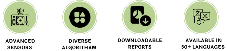
Satellite-based crop health monitoring operates through a series of well-defined steps. Initially, advanced sensors on orbiting satellites capture imagery in both visible and infrared spectra, detecting variations in light reflectance that signify changes in vegetation health and crop parameters.
Subsequently, Farmonaut’s system automatically processes and analyzes the satellite data using diverse algorithms and models. By integrating this information with weather data and soil samples, a comprehensive assessment of crop health and growth is obtained.
The outcomes are presented to farmers and agricultural experts in visually appealing formats, including maps and other visualizations that highlight areas requiring attention or intervention. Additionally, Farmonaut offers easily downloadable reports available in over 50 languages. This valuable information guides decisions on irrigation, fertilization, pest control, and other aspects of crop management, ultimately leading to enhanced crop yield and improved quality.
With the help Farmonaut, farmers have the flexibility to choose their fields and detect any areas with abnormal crop growth. Upon identifying such regions, farmers can visit the specific parts of their fields to assess the situation. If the issue has not yet manifested, farmers can proactively apply preventive measures like additional fertilizers or plant growth regulators. In case the problem has already emerged, they can seek assistance from Farmonaut’s crop issue identification system, which offers real-time government-approved remedies.
To aid farmers in this process, our system presents two distinct sets of images. The first set of images provides insights into the crop health during the early stages of growth, while the second set focuses on the crop health in the later stages of growth. This targeted approach enables farmers to make well-informed decisions and take timely actions to safeguard their crops effectively.
Farmonaut® Satellite Based Crop Health Monitoring - Explanatory Video
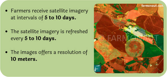
Through the implementation of an automated crop monitoring service, farmers will receive regular crop health reports and vegetation water level reports derived from the most recent satellite imagery at intervals of 5 to 10 days. Additionally, they will be kept informed with near real-time weather updates relevant to their specific fields, sourced from the nearest weather station. Farmers have the convenience of monitoring multiple fields by including them in their profile.
To ensure the technology’s efficacy for farmers, the satellite imagery is refreshed every 5 to 10 days, offering a resolution of 10 meters. For this service to be beneficial, a minimum land area of 2 hectares needs to be monitored.
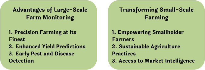
To put it in a nutshell, Farmonaut’s AI/ML satellite-based large-scale farm and small-scale farm monitoring represent a transformative force in modern agriculture. By utilizing the potential of advanced technologies, the company is empowering farmers to embrace data-driven decision-making, optimize resource utilization, and adopt sustainable practices. As the agricultural sector continues to evolve, businesses that make use of Farmonaut’s innovative solutions are poised to gain a competitive edge, reaping the benefits of enhanced productivity and profitability.