Floods are one of the most ubiquitous and pernicious natural calamities. They can wreak havoc on property and infrastructure, and even result in fatalities. In recent years, there has been a burgeoning interest in the use of AI. So the quest is Can AI/ML satellite technologies identify early indicators of floods and enhance flood management strategies? Let’s Find out !
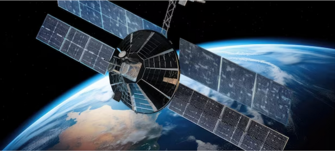
Understanding AI/ML Satellites Systems
AI/ML satellites are those systems that uses AI/ ML models to process and analyze data. This data can include images, videos, and other types of sensor data that can use this data to perform a variety of tasks.
AI/ML satellites systems integrate algorithms with advanced remote sensing capabilities, enabling them to analyze vast amounts of data collected from Earth’s surface. These satellites can process and interpret this data in real-time, providing valuable insights and actionable information.
How Farmonaut AI/ML satellite technologies can help?
Farmonaut visualizes the capabilities of these satellite technologies in detecting early signs of floods in a number of ways.
First, they can be used to monitor changes in land cover and vegetation. These changes can be an early warning sign of flooding, as they can indicate that the ground is becoming saturated with water. Second, Farmonaut system can be used to measure changes in water levels. This information can be used to track the progress of a flood and to predict when it is likely to reach a critical level.
In addition to detecting early signs of floods, the satellite technologies can also be used to improve flood management strategies. For example, Farmonaut platform can be used to analyze satellite data to identify areas that are at risk of flooding. This information can be used to develop targeted flood mitigation strategies.
Remote sensing data can also be used to optimize the allocation of resources during flood response operations. For example, this data can be used to identify areas that need to be evacuated, and to track the progress of rescue and relief efforts.

What Farmonaut Brings Forth ?
Farmonaut’s Satellite-based crop health monitoring primarily uses remote sensing technology to collect data on the health and condition of crops from space, providing individuals and organizations with valuable insights into the growth, development, and health of crops.
Contemplating the early detection of floods, Farmonaut envisions a possibility to mitigate the occurrence of such unlikely natural disasters with the optimization of satellite data. Following are some of the perks of using Farmonaut’s remote sensing data for early detection of floods:

- Monitoring changes in land cover : Farmonaut uses highly efficient satellite imagery to monitor changes in land cover and vegetation. This data can be used to identify areas that are at risk of flooding, as well as to track the progress of a flood.
- Measuring changes in water levels: Farmonaut also uses high resolution satellite imagery to measure changes in water levels. This data can be used to track the progress of a flood and to predict when it is likely to reach a critical level.
- Provide insights into flood risk: Farmonaut can use its satellite data to provide insights into flood risk, such as the areas that are most likely to flood and the factors that contribute to flooding. This information can be used to develop targeted flood mitigation strategies.
- Optimizing the allocation of resources during flood response operations: Farmonaut’s data can also be used to optimize the allocation of resources during flood response operations. For example, Farmonaut’s data can be used to identify areas that need to be evacuated, and to track the progress of rescue and relief efforts.

How Does Farmonaut Makes It Possible ?
Farmonaut’s web app allows continuous monitoring of an area in case of unlikely events. The ‘Farm mapping’ option in the application permits the flood prone areas to be mapped and constantly receive insights about those regions.
For example, if an individual is using Farmonaut to monitor their farm for flooding, they might see that the water levels in a nearby river are rising rapidly. This would be an indication that the region is at risk of flooding. In this way, people could then take steps to protect their crops and livestock, such as moving them to higher ground or evacuating them from the area.
Further, the option ‘Request Historical Satellite Data’ under Map Controls section which lays the opportunity to acquire data of any previous dates. In addition the ‘ Compare Images’ option in the Map Controls provides the images of two different dates and allows you to analyze the overall difference between both.
This option was used by Farmonaut in analyzing the various in the land cover and rise in water level during the 2023 North Indian floods.
Find below the differences between the satellite images of the Manali region before and after the floods in July 2023.
Farmonaut's Case Study : Cyclone Fani , May 2019
In May 2019, Farmonaut conducted a study on the Cyclone Fani, which inflicted severe damage on several east coast states of India, causing significant damage to the Balukhand-Konark Wildlife Sanctuary in Odisha. The impact of the cyclone resulted in the complete devastation of vegetation in the area. Additionally, the cyclone’s aftermath led to the disappearance of over 4000 spotted deer. In response to this disaster, a comprehensive analysis was conducted to explore the practicality of utilizing remote sensing techniques to optimize rescue efforts during such calamities.
Therefore, the AI/ML systems hold immense potential in transforming flood detection and management strategies. Farmonaut’s remote sensing data services play a crucial role in providing accurate and timely information, empowering authorities and communities to make informed decisions and take proactive measures against floods. We are committed to working with our customers to help them to use these technologies to save lives and property.
