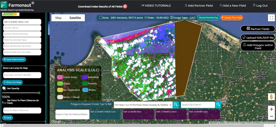
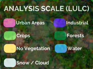
Land classification is basically providing information on the type of activity taking place on the land and categorizing it. The land uses are of different types such as for industrial use, residence use, rural, urban, water reserves, agriculture area, etc. It can be classified and displayed through remote sensing using the satellite. Remote sensing would provide reliable and accurate information on the land use.
Benefits of LULC
Land Use Land Classification helps the private and government institutions in following ways:
Initiate in formation of policies and schemes for development.
Know the land utilization aspects
Helps in managing, monitoring and planning at district, taluka and village level.
Keep an eye on the urban and rural development over years.
Study the changes in the environment.
Create a sustainable solution for future development.
Check the progress in every sector such as agriculture, forest, industrial, etc.
New Addition by FARMONAUT
Farmonaut has recently added a new feature to their application which majority can be useful to the industries and government as a whole. The feature added can be said as Land Classification based on its use. The Land on district level, taluka level or village level can be classified based on the activities being carried out. However there are multiple use cases to such addition being made by Farmonaut. We have been providing services to individual farmers and corporations on a large scale in the field of agriculture. With addition of land classification through satellite monitoring, we tend to help institutions beyond agriculture.
As stated above the benefits of land classification for institutions in a vast range, Farmonaut has received a request from their former client to introduce such features for their own use.
How to use Land Use Land Classification?
Step 1: Login to your account on the Farmonaut application.
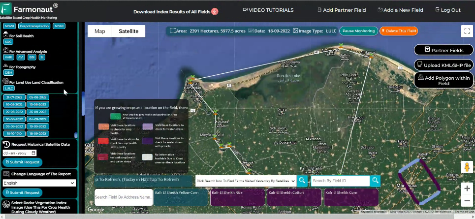
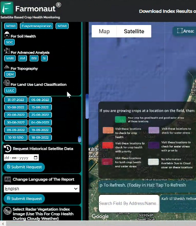
Step 2: Select the farm you want the Land classification for.
Step 3: Open the dropdown menu of the Map controls on the left.
Step 4: Click on the “LULC” button under the For Land Use Land Classification.