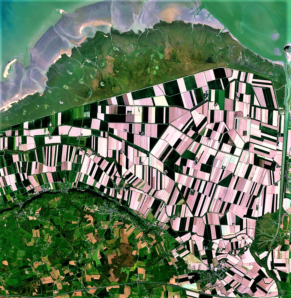
Month: April 2019

Normalized Difference Water Index - NDWI

Vegetation cover on the earth’s surface undergoes severe stress during a drought. If affected areas are not identified in time, entire crops may be damaged. Hence, the early detection of water stress can prevent many of the negative impacts on crops.  NDWI index can help us control irrigation in real time, significantly improving agriculture, especially in areas where meeting the need for water is difficult.

To calculated NDWI index, we need imagery from two different wavelengths, namely Near Infrared and Shortwave Infrared band imagery. And the NDWI ratio is calculated as:

NDWI = (NIR – SWIR)/(NIR + SWIR)

A short wave infrared imagery band is used because the high absorption of light by water occurs at this wavelength. NIR band is used because water does not absorb this part of the electromagnetic spectrum, thus the calculated NDWI index is resistant to atmospheric effects, making it distinguishable from NDVI.

The NDWI index is characterized by a more stable decrease in value upon reaching critical anthropogenic load, which can give an indication of the ecological state of forests.

farmonaut_ndwi2

The value of the NDVI index can range from -1.0 to 1.0. 

The high NDWI values correspond to high plant water content and coating of high plant fraction, whereas the low NDWI values correspond to low vegetation content and cover with low vegetation. NDWI rate will decrease during periods of water stress.

In the coming days, the Farmonaut’s Satellite Imagery for Farmers application will expand to include more remote sensing features beneficial for farmers. We will keep you posted about any new developments in this regards.  Stay tuned!!

For agricultural purposes, Farmonaut provides satellite based crop health monitoring system on our android app, through which farmers can select their field and identify the regions of the field at which the crop growth is not normal. Upon identifying that region of their fields, they can simply pay a visit to that part of the field and identify if the problem has already started. If it has not, the farmer can take preventive remedies by applying more fertilizers, plant growth regulators etc. If the problem has already started, they can simply explain their problem to Farmonaut’s crop issue identification system and get real-time govt. approved remedies. The satellite imagery is updated every 2-5 days and has a resolution of 10 meters which is 2 times better than google maps in rural India.

The app is available for android on Google PlayStore: 

https://play.google.com/store/apps/details?id=com.farmonaut.android

We will keep posting about any such informative information on to our blogs, to help as many people as possible. Farmonaut is built upon a vision to bridge the technological gap between farmers and strives to bring state-of-the-art technologies in the hands of each and every farmer. For any queries/suggestions, please contact us at [email protected]

We have some more interesting articles coming up soon. Stay tuned!

Wait!!

Before that…

Follow us at:

Facebook: https://facebook.com/farmonaut

Instagram: https://instagram.com/farmonaut

Twitter: https://twitter.com/farmonaut

LinkedIn: https://www.linkedin.com/company/farmonaut/

Pinterest: https://in.pinterest.com/farmonaut/

Tumblr: https://farmonaut.tumblr.com/

Youtube: https://www.youtube.com/channel/UCYWOOPPKATLgh4L6YRlYFOQ

AppLink: https://play.google.com/store/apps/details?id=com.farmonaut.android

Website: https://farmonaut.com

Satellite Imagery: https://farmonaut.com/satellite-imagery

Satellite Imagery Samples: https://farmonaut.com/satellite-imagery-samples

Minutes of Meeting - Farmonaut and Chippy Pushpangathan

chippy-pushpangathan

Chippy Pushpangathan is a Research Scholar and is pursuing her PhD at the Department of Geography, School of Earth Sciences, Central University of Karnataka. Her broad area of research covers crop yield modelling using geospatial technology.

Her research topic is broadly centered around: 

“Potential of Precision Agriculture Using Geospatial Information For Kharif Cultivation in Kalaburagi District, Karnataka, India”

This research work is funded by the Department of Science and Technology (DST, Govt. of India) under INSPIRE Scheme.

To read more in detail about the project and the collaboration please read the full article on the link below:

https://farmonaut.com/blogs/farming-blogs/research-collaboration-with-chippy-pushpangathan-on-a-dst-funded-project-in-precision-agriculture/


MINUTES OF MEETING

Usage of MODIS imagery in previous works

Chippy has downloaded and used modis images and has come to a conclusion that much can’t be done with these images because the spatial resolution of the images is 250 meters, hence, we can map vegetation only on district level or state level.


Requirement of previous years’ data for reference for the current study

Chippy does not have any field level data from 2018. National crop forecasting center gathers all the field level data (latitude longitude, crop cutting etc.), but they are hard to communicate with and they rarely reply to emails.

The premilinary data required is the Latitude, Longitude data for a few fields in Aland taluk in kalaburagi district for kharif season from june to December of 2018. Gulbarga kharif season crop does not exist much since the analysis done on 15 years of MODIS imagery revealed that fields during kharif season are severely drought affected.


Current Method of Accessing Satellite Imagery Data

Currently NRSC provides satellite imagery at around INR 4k-7k per tile (70kmx70km) with a resolution of around 5.4 meter for latest imagery. The pricing is less for older image requests. However, to access imagery it is required to request it from them every time through emails with a complete request form. Sometimes they don’t even consider providing satellite imagery and it is a very big hassle to get the imagery from them periodically.


Rough roadmap of the work

Before june 2019, Krishi vigyan Kendra will help Chippy get fields for the proposed study. All the study will be done on these fields. Chippy is planning to take taluk level fields, at least a minimum of 6 farms. Images will be taken from Farmonaut periodically for each stage of crop growth, simultaneously Chippy will work on her data as well.
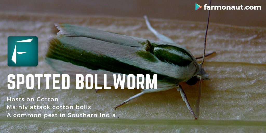
 The suggested study will have at least two to three crops for separability.


Devices to be used for ground level analysis

Leaf area index meter, Chlorophyll meter, Temperature meter etc.


Macro Level Objective and Expectations

The objective will be to correlate the ground level data with satellite data and create a yield prediction model.

If any kind of change that happens in a farm field in a particular time, the objective will be to identify how it will affect the farm. For example, if too much rainfall happens then, the objective will be to predict what could possibly happen and how much it will affect the yield.


Farmonaut currently provides two satellite imagery based products, namely:

Satellite Based Crop Health Monitoring System For Farmers (Android):

Farmonaut provides satellite based crop health monitoring system, through which farmers can select their field and identify the regions of the field at which the crop growth is not normal. Upon identifying that region of their fields, they can simply pay a visit to that part of the field and identify if the problem has already started. If it has not, the farmer can take preventive remedies by applying more fertilizers, plant growth regulators etc. If the problem has already started, they can simply explain their problem to Farmonaut’s crop issue identification system and get real-time govt. approved remedies.

Satellite Imagery Access For Research System (Android and Website)

For research purposes (non-farming usage), Farmonaut provides access to satellite imagery of any place around the through our website and android app. The satellite imagery is provided at the cheapest market rates. Accessing satellite imagery through our website is a fairly simple process:


Step 1:  Select the date range (From and To Date)

Step 2: Select Imagery bands required (You can select from 13 raw bands and 7 Farmonaut Processed bands)

Step 3: Select the area on the Map for which you are requesting the imagery for.

Step 4: Submit this request… wait for a few seconds

Step 5: Select specific days for which you need the imagery for.

Step 6: Make payment and voila!

You will receive the imagery automatically into your email address within the displayed time interval.

The app is available for android on Google PlayStore: 

https://play.google.com/store/apps/details?id=com.farmonaut.android

We will keep posting about any such informative information on to our blogs, to help as many people as possible. Farmonaut is built upon a vision to bridge the technological gap between farmers and strives to bring state-of-the-art technologies in the hands of each and every farmer. For any queries/suggestions, please contact us at [email protected]

We have some more interesting articles coming up soon. Stay tuned!

Wait!!

Before that…

Follow us at:

Facebook: https://facebook.com/farmonaut

Instagram: https://instagram.com/farmonaut

Twitter: https://twitter.com/farmonaut

LinkedIn: https://www.linkedin.com/company/farmonaut/

Pinterest: https://in.pinterest.com/farmonaut/

Tumblr: https://farmonaut.tumblr.com/

Youtube: https://www.youtube.com/channel/UCYWOOPPKATLgh4L6YRlYFOQ

AppLink: https://play.google.com/store/apps/details?id=com.farmonaut.android

Website: https://farmonaut.com

Satellite Imagery: https://farmonaut.com/satellite-imagery

Satellite Imagery Samples: https://farmonaut.com/satellite-imagery-samples

Spotted Bollworm

Caused by insect

Factors – 

a- Wilting of terminal shoots before flowering.

b- Shedding of squares and bolls.

c- Holes in bolls and rotten inside.

d- Cotton bolls may gradually become empty.

Hosting body – cotton

Identifiable traits

These larvae mainly attack bolls, but also feed on squares, shoots and flowers if bolls are not present. If infested during the vegetative state, the caterpillars feed through the terminal buds of the shoots and move downward.
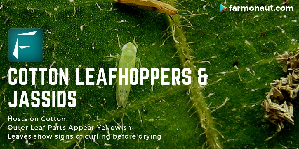
 This causes drying and shedding of terminal shoots before flowering. If the main stem is affected, the larvae will feed on flower buds and bolls, entering through holes bored around the base. Damaged flower buds sometimes spread prematurely, resulting in so-called ‘flared squares’. The damage to plant tissue and presence of excrement lead to colonization by fungal or bacterial infections, worsening the symptoms. The younger the plant is when it is attacked, the more damage this pest can cause. Alternative host plants for this pest are, among others, hibiscus and okra.

Inducing factors

Damage is caused by the larvae of the spotted bollworm, Earias vittella, a common pest in the southern regions of India.  The moths are mostly pale with green features, approximately 2 cm long and can be found on flowers or close to light sources. The forewings are pale with bright green streaks, the hind-wings are silky-white suffused with pale brownish-grey. Eggs are blue in color and laid singly on young shoots, leaves and squares. The young larvae is light brown with grey to green features, and pale along the mid dorsal line, fully grown larvae are up to 1.8 cm long. Tiny spines, visible under a hand lens, cover most of the body surface. As they reach maturity, they pupate in a silken cocoon attached to larvae or fallen plant parts. Under tropic conditions, a generation is complete within 20-25 days. Low temperatures can delay the process for up to two months. 


Organic remedies

Searching scouting for eggs or small larvae is crucial in the management of this pest. Some parasitoid insects of the family Braconidae, Scelionidae and Trichogrammatidae can be used biological control method. Also try predatory insects from the following orders: Coleoptera, Hymenoptera. Hemiptera and Neuroptera. Make sure to promote these species and avoid use of broad-scale pesticides. You can apply bioinsecticide sprays containing Bacillus Thuringiensis to control population peaks. Spray neem seed kernel extrack (NSKE) 5% or neem oil (1500 ppm) @ 5ml/L.

Chemical remedies

Always consider an integrated approach with preventive measures together with biological treatments. If available. Treatment is recommended when 10 eggs or five small worms per 100 plants are present during early bloom. As larvae become increasingly resilient to insecticidal treatment while growing, scouting for eggs and young larvae is crucial. Treatment is recommended to be applied during egg stage. Insecticides containing chlorantraniliprole, emamectin benzoate, flubendiamide, methomyl or esfenvalerate can be applied. Chemical treatment may be enviable in low value crops.


Extra remedies


Plant resilient varieties, f available in your locality/area. Ensure early planting to avoid peak populations. Leave sufficient distance between plants. Provide uncultivated marginal areas to break life cycle. Plant trap crops like hibiscus and okra. Avoid monocultures and implement intercropping with beneficial plants. Monitor the cotton field regularly for larvae and eggs of the spotted bollworm. Keep up a sufficient fertilization. Promote practices that bring and early harvest. Clear all harvest residue after each cropping cycle. Plough deeply to expose pupae to predators and elements.


We will keep posting about any such informative information on to our blogs, to help as many people as possible. Farmonaut is built upon a vision to bridge the technological gap between farmers and strives to bring state-of-the-art technologies in the hands of each and every farmer. For any queries/suggestions, please contact us at [email protected]

We have some more interesting articles coming up soon. Stay tuned!

Wait!!

Before that…

Follow us at:

Facebook: https://facebook.com/farmonaut

Instagram: https://instagram.com/farmonaut

Twitter: https://twitter.com/farmonaut

LinkedIn: https://www.linkedin.com/company/farmonaut/

Pinterest: https://in.pinterest.com/farmonaut/

Tumblr: https://farmonaut.tumblr.com/

Youtube: https://www.youtube.com/channel/UCYWOOPPKATLgh4L6YRlYFOQ

AppLink: https://play.google.com/store/apps/details?id=com.farmonaut.android

Website: https://farmonaut.com

Satellite Imagery: https://farmonaut.com/satellite-imagery

Satellite Imagery Samples: https://farmonaut.com/satellite-imagery-samples

Cotton Leafhoppers and Jassids

Amrasca devastans

Caused by insect

Factors – 

a- Nymph and adult leaf hoppers feed on leaves.

b- Outer leaf parts appear yellowish or burned and tend to curl upwards.

c- Leaves are similar and feature mosaic pattern.

Hosting body – cotton

Identifiable traits

The affected leaves turn yellowish, then brownish starting from the margins and migrating to the midrib. Leaves gradually show signs of curling before drying completely and shedding.
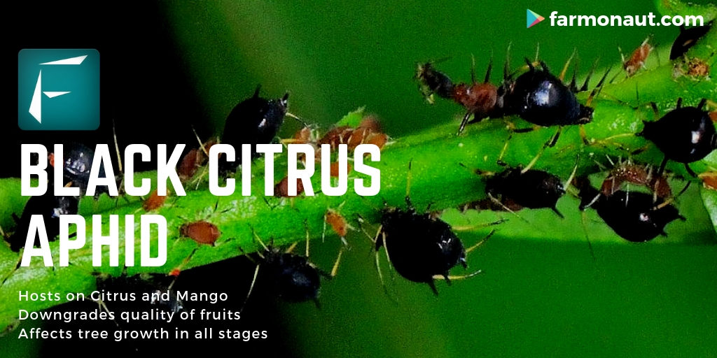
 Severe incidences result in “hopper burn” injury and death of leaves, eventually leading to the stunting of young plants. The fruiting capacity of the plants infested at later stages of growth is significantly affected and in many cases cause lower yields and poor quality of the fibres. Before becoming necrotic, leaves may show higher trichome density on the lower side of leaves and a hardening of the tissues. These traits confers some degree of resistance against the insect in that it makes ovoposition and movement more difficult. However, it has a negative effect on the agronomic performance.

Inducing factors

Both nymphs and adults of Amrasca devastans suck the plant sap and introduce salivary toxins that damage the tissue and impair photosynthesis in proportion to the amount of feeding and the number of insects. First and second generation of nymphs feed near the base of the leaf veins, older nymphs get distributed all over the leaves but feed chiefly from the lower side. Environmental factors such as moderate to high temperatures (21 to 31 ˚C), moderate to high humidity ranges (55 to 85%) either early in the morning or late in the evenings, and hours of sunshine affects positively the populations of this insect. Low temperatures and strong winds have a negative impact.

Organic remedies

Generalist predators of cotton leaf hopper are the common green lacewing (Chrysoperia carnea), species of the genus Orius or Geocoris, some species of Coccinellids and spiders. Make sure to promote those species and avoid use of broad-scale insecticides. Apply spinosad (0.35ml/L) when first symptoms occur.

Chemical remedies

Always consider an integrated approach with preventive measures together with biological treatments if available. Insecticide formulations based on malathion, cypernethrin (1 ml/L) or chlorantraniliprole + lambda-cyhalothrin (0.5 ml/L) can be applied. They may however also affect in severe cases and in a timely manner. Seed treatment with insecticides can also help to suppress leaf hopper populations on crop for 45-50 days.

Extra remedies

Plant resistant or tolerant varieties (several are available on the market). Monitor the orchards regularly for signs of cotton leaf hoppers. Maintain a balanced fertilization and especially do not apply excessive nitrogen.


We will keep posting about any such informative information on to our blogs, to help as many people as possible. Farmonaut is built upon a vision to bridge the technological gap between farmers and strives to bring state-of-the-art technologies in the hands of each and every farmer. For any queries/suggestions, please contact us at [email protected]

We have some more interesting articles coming up soon. Stay tuned!

Wait!!

Before that…

Follow us at:

Facebook: https://facebook.com/farmonaut

Instagram: https://instagram.com/farmonaut

Twitter: https://twitter.com/farmonaut

LinkedIn: https://www.linkedin.com/company/farmonaut/

Pinterest: https://in.pinterest.com/farmonaut/

Tumblr: https://farmonaut.tumblr.com/

Youtube: https://www.youtube.com/channel/UCYWOOPPKATLgh4L6YRlYFOQ

AppLink: https://play.google.com/store/apps/details?id=com.farmonaut.android

Website: https://farmonaut.com

Satellite Imagery: https://farmonaut.com/satellite-imagery

Satellite Imagery Samples: https://farmonaut.com/satellite-imagery-samples

Black Citrus Aphid

Toxoptera aurantii

Caused by insect 

Factors – 

a- Distortions of twigs and inflorescences and curling, rolling or folding of leaves.

b- Leaves turn black in presence of honeydew that is readily colonizes by sooty mold.

c- Downgraded quality of fruits and poor vigor in trees.

d- Tristeza virus is a possible infection.

Hosting body – Citrus and Mango

https://indoorgardenook.com/how-to-get-rid-of-bugs-on-indoor-plants/

Identifiable traits

It affects all citrus trees in all growth stages. The aphids have long piercing mouthparts which they use to suck the sap on shoot tips and young leaves, which leads to distortions of twigs and inflorescences and the curling, rolling or folding of leaves.
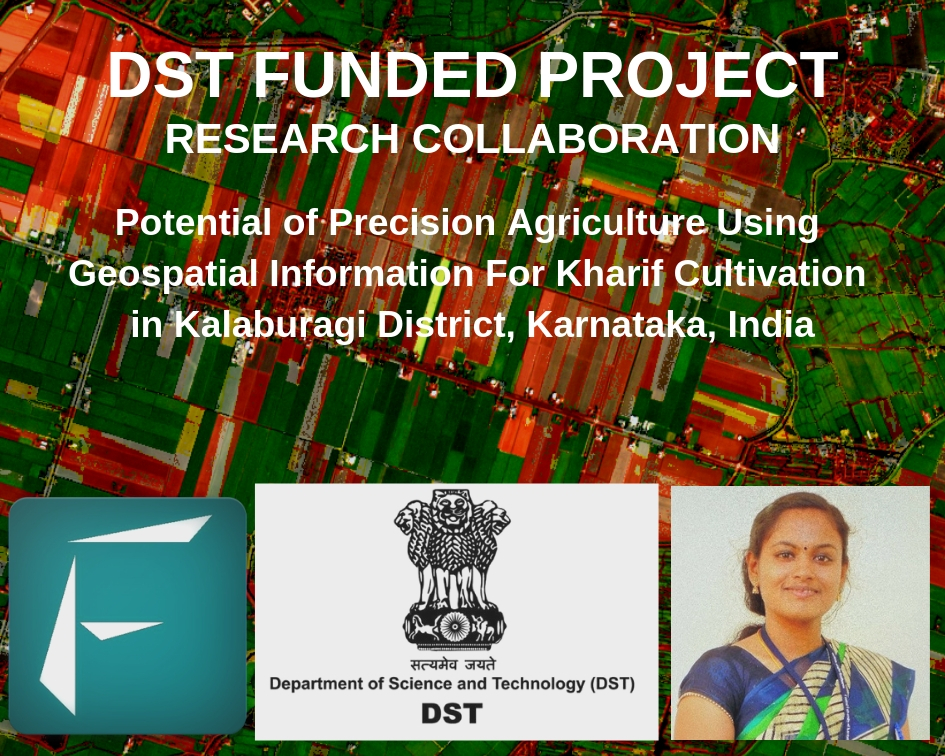
 They feed on sweet plant phloem, they excrete excess sugar in the form of honeydew. When this honeydew falls onto the leaves, it readily colonized by sooty mold fungi which make the leaves turn black. In result, this limits photosynthesis and has consequences on the vigor of the tree and the quality of the fruits. Tristeza virus is other causing factor which causes damage to citrus trees, which aphids carry.

Inducing factors

Symptoms are caused by the adults and nymphs of the black citrus aphid Toxoptera aurantii. They often co-infect citrus trees and other cultures together with another related species of aphid T. citicida, commonly known as brown citrus aphid. Adult aphids exist in two forms, either with or without wings. Winged aphids can fly a distance of up to 30 km and are found when they become too numerous or when food supply reduces or becomes limited. They have a dull brownish to black body with a length of about 1.5 mm. These black citrus aphids have a simple life cycle and a high reproduction rate that can lead to rapid and severe infestations. Favourable temperature range for development, survival and reproduction varies from 9.4 to 30.4 ˚C. The honeydew attracts ants, which in turn protect the aphids from natural predators. They are considered a vector of the Tristeza disease of citrus and the zucchini yellow mosaic virus.


Organic remedies

Predators include many species of hoverflies, lacewings and ladybirds that can attack aphids at all stages of development. Two commonly used coccinellids against this pest are adults and larvae of Cycloneda sanguinea and Hippodamia convergens. Some culture-specific parasitic wasps may also be available for citrus in the area of interest. The fungus Neozygites fresensii can be important check on aphid populations during humid weather. Ants can be killed with boiling water or with solutions containing natural pyrethrins. Insecticidial solutions can also be used against aphids, for example solutions based on soap, detergent soap, neem or chilli extracts.

Chemical remedies

If available, always consider an integrated approach with preventive measures together with biological treatments. Several insecticides can be used to control aphids but their effectiveness depends on a timely application, for example before the leaves curl or populations become too large. Commercial products containing petroleum oil can be sprayed on the underside of leaves, so that they directly contact the aphids. Synthetic pyrethroids are also likely to be effective against aphids and ants, but can have a negative impact on natural enemies, too.

 Extra remedies
Select seeds from healthy plants or from certified sources. If possible, plant in an area free of this pest, and isolated geographically. Keep monitoring fields regularly to assess the incidence of a disease or pest and determine their severity. Remove infected plant parts or hand-pick the aphids manually. Check weeds in and around the fields. Do not over-water or over-fertilize. Control ant populations that protect aphids with sticky bands or nets. Do not transport citrus trees between different farms or areas. Control the use of pesticides, as those can affect negatively the populations of beneficial insects. Prune the branches of your trees or remove the bottom leaves or your plants to favour the ventilation of the canopy.
 

We will keep posting about any such informative information on to our blogs, to help as many people as possible. Farmonaut is built upon a vision to bridge the technological gap between farmers and strives to bring state-of-the-art technologies in the hands of each and every farmer. For any queries/suggestions, please contact us at [email protected]

We have some more interesting articles coming up soon. Stay tuned!

Wait!!

Before that…

Follow us at:

Facebook: https://facebook.com/farmonaut

Instagram: https://instagram.com/farmonaut

Twitter: https://twitter.com/farmonaut

LinkedIn: https://www.linkedin.com/company/farmonaut/

Pinterest: https://in.pinterest.com/farmonaut/

Tumblr: https://farmonaut.tumblr.com/

Youtube: https://www.youtube.com/channel/UCYWOOPPKATLgh4L6YRlYFOQ

AppLink: https://play.google.com/store/apps/details?id=com.farmonaut.android

Website: https://farmonaut.com

Satellite Imagery: https://farmonaut.com/satellite-imagery

Satellite Imagery Samples: https://farmonaut.com/satellite-imagery-samples

Research Collaboration with Chippy Pushpangathan on a DST funded project in Precision Agriculture

At Farmonaut, we believe if any research is being conducted for the benefit of the farming community, we must stand together to make it’s benefits reach to as many farmers as possible. And, we are always delighted to work with researchers to help the farming community with providing the latest technologies. One such latest collaboration which we feel is going to contribute to the farming community is with Chippy Pushpangathan.


chippy-pushpangathan

Chippy Pushpangathan is a Research Scholar and is pursuing her PhD at the Department of Geography, School of Earth Sciences, Central University of Karnataka. Her broad area of research covers crop yield modelling using geospatial technology.

Her research topic is broadly centered around: 

“Potential of Precision Agriculture Using Geospatial Information For Kharif Cultivation in Kalaburagi District, Karnataka, India”

The research work is a crop centric work wherein the main focus will be towards identifying the potential of precision agriculture using geospatial information (more specifically the possibility of microwave remote sensing) for rain-fed pigeon pea (Kharif Tur Dal).  The research work will focus on the farming land in and around Kalaburagi district and will focus on Tur Dal of this Kharif season of 2019 (June to November). This research work is funded by the Department of Science and Technology (DST, Govt. of India) under INSPIRE Scheme.


Chippy aspires to make her research outcomes to reach the ground level farming community, hence this collaboration serves the common objective of both her and Farmonaut. Before the actual field work starts in June 2019, our combined objective is to ideate and gather kalaburagi district centric useful information as well as identifying the further technological needs which Farmonaut may be able to provide depending upon the feasibility (apart from our already publicly usable systems) once the actual work starts.

At Farmonaut, we believe that by combining the on-field research study conducted by Chippy Pushpangathan when combined with technological tools provided by Farmonaut as well the access to the growing farming community of Farmonaut, the entire research will surely provide a better insight to the farmers of Kalaburagi district and possibly the research work will be replicable to other parts of the country as well.

In the coming months, we will keep updating everyone of the progress of the ongoing research collaboration on atleast a monthly basis.

Farmonaut currently provides two satellite imagery based products, namely:

Satellite Based Crop Health Monitoring System For Farmers (Android):

Farmonaut provides satellite based crop health monitoring system, through which farmers can select their field and identify the regions of the field at which the crop growth is not normal. Upon identifying that region of their fields, they can simply pay a visit to that part of the field and identify if the problem has already started. If it has not, the farmer can take preventive remedies by applying more fertilizers, plant growth regulators etc. If the problem has already started, they can simply explain their problem to Farmonaut’s crop issue identification system and get real-time govt. approved remedies.


Satellite Imagery Access For Research System (Android and Website)

For research purposes (non-farming usage), Farmonaut provides access to satellite imagery of any place around the through our website and android app. The satellite imagery is provided at the cheapest market rates. Accessing satellite imagery through our website is a fairly simple process:


Step 1:  Select the date range (From and To Date)

Step 2: Select Imagery bands required (You can select from 13 raw bands and 7 Farmonaut Processed bands)

Step 3: Select the area on the Map for which you are requesting the imagery for.

Step 4: Submit this request… wait for a few seconds

Step 5: Select specific days for which you need the imagery for.

Step 6: Make payment and voila!

You will receive the imagery automatically into your email address within the displayed time interval.

The app is available for android on Google PlayStore: 

https://play.google.com/store/apps/details?id=com.farmonaut.android

We will keep posting about any such informative information on to our blogs, to help as many people as possible. Farmonaut is built upon a vision to bridge the technological gap between farmers and strives to bring state-of-the-art technologies in the hands of each and every farmer. For any queries/suggestions, please contact us at [email protected]

We have some more interesting articles coming up soon. Stay tuned!

Wait!!

Before that…

Follow us at:

Facebook: https://facebook.com/farmonaut

Instagram: https://instagram.com/farmonaut

Twitter: https://twitter.com/farmonaut

LinkedIn: https://www.linkedin.com/company/farmonaut/

Pinterest: https://in.pinterest.com/farmonaut/

Tumblr: https://farmonaut.tumblr.com/

Youtube: https://www.youtube.com/channel/UCYWOOPPKATLgh4L6YRlYFOQ

AppLink: https://play.google.com/store/apps/details?id=com.farmonaut.android

Website: https://farmonaut.com

Satellite Imagery: https://farmonaut.com/satellite-imagery

Satellite Imagery Samples: https://farmonaut.com/satellite-imagery-samples