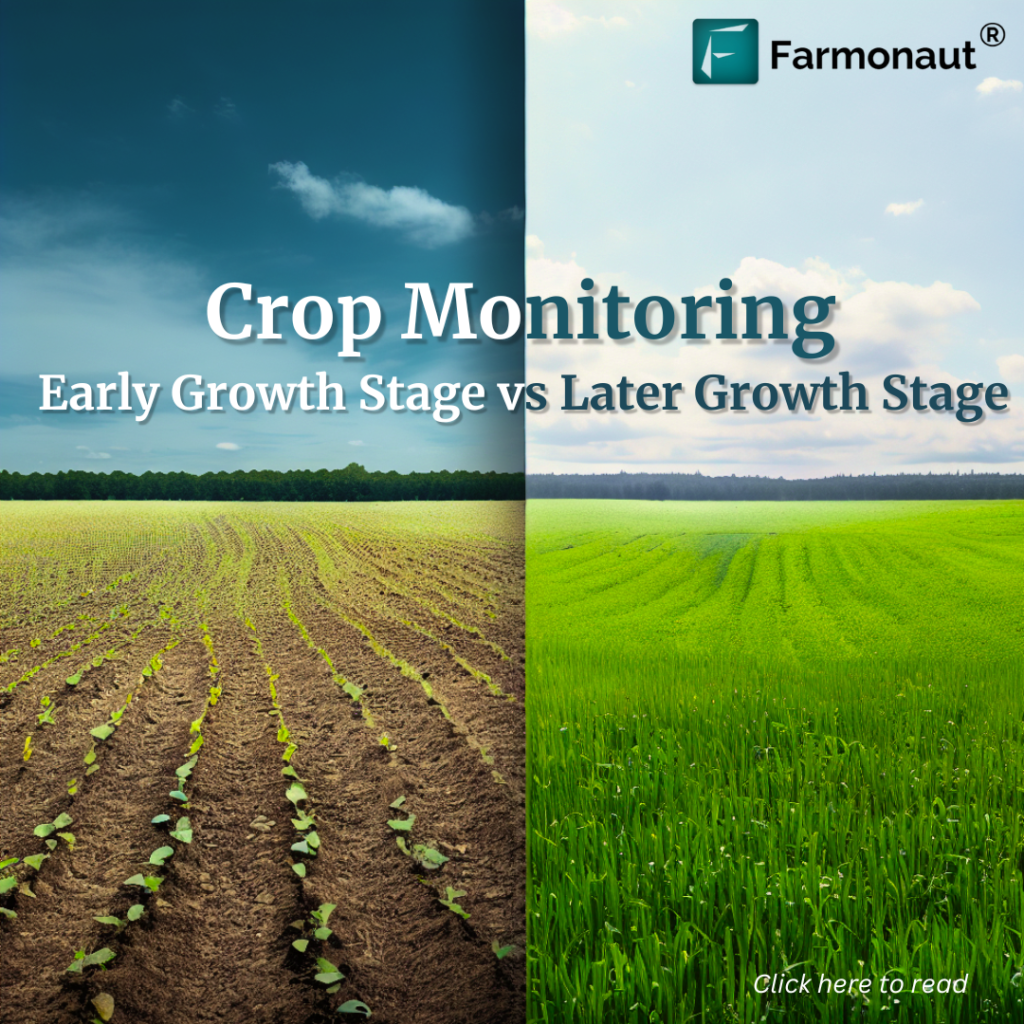
Research Collaboration with Chippy Pushpangathan on a DST funded project in Precision Agriculture
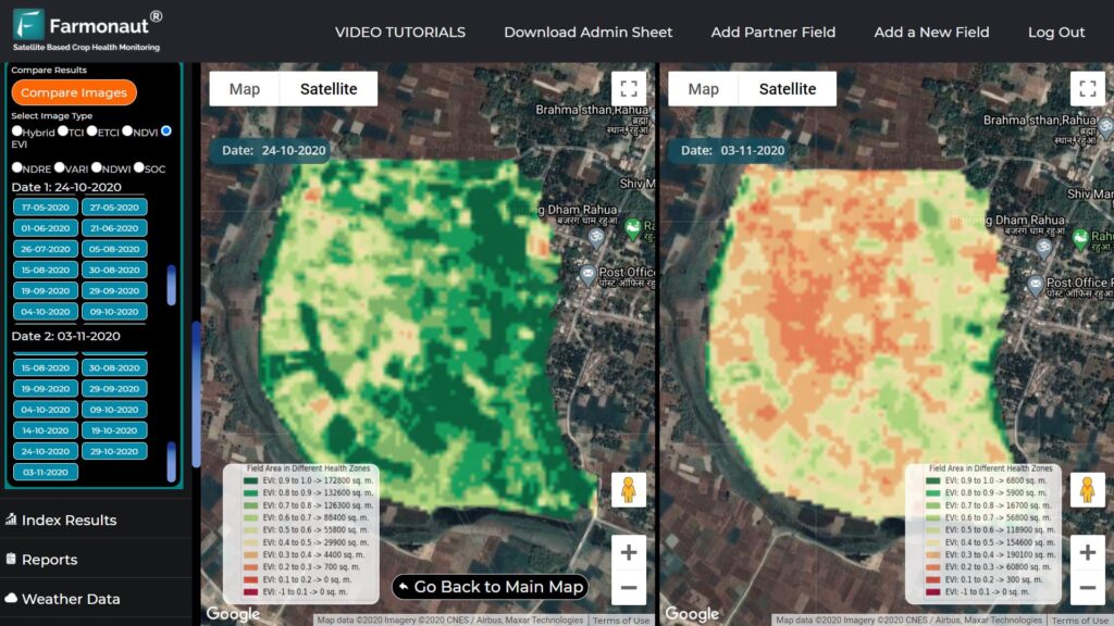
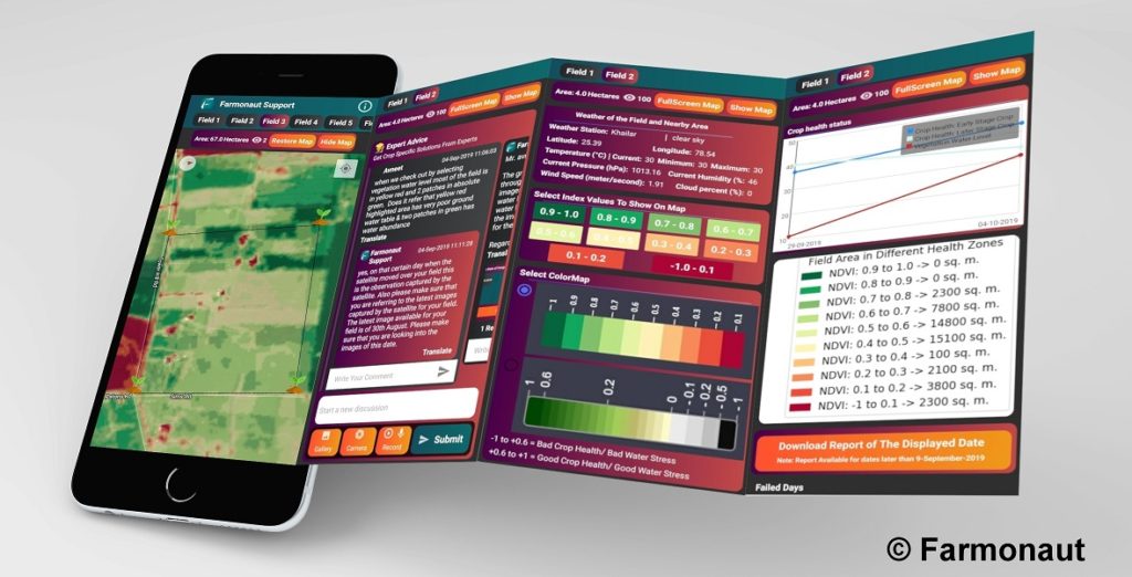
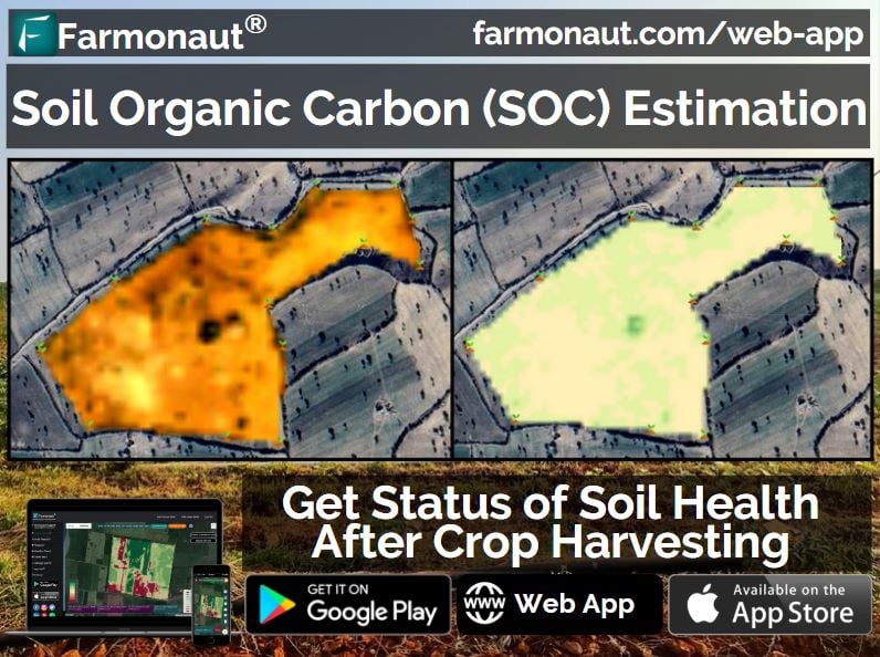
v Research Collaboration with Chippy Pushpangathan on a DST funded project in Precision Agriculture At Farmonaut, we believe if any research is being conducted for the benefit of the farming community, we must stand together to make it’s benefits reach to as many farmers as possible. And, we are always delighted to work with researchers to help the farming community with providing the latest technologies. One such latest collaboration which we feel is going to contribute to the farming community is with Chippy Pushpangathan. Chippy Pushpangathan is a Research Scholar and is pursuing her PhD at the Department of Geography, School of Earth Sciences, Central University of Karnataka. Her broad area of research covers crop yield modelling using geospatial technology. Her research topic is broadly centered around: “Potential of Precision Agriculture Using Geospatial Information For Kharif Cultivation in Kalaburagi District, Karnataka, India” The research work is a crop centric work wherein the main focus will be towards identifying the potential of precision agriculture using geospatial information (more specifically the possibility of microwave remote sensing) for rain-fed pigeon pea (Kharif Tur Dal). The research work will focus on the farming land in and around Kalaburagi district and will focus on Tur Dal of this Kharif season of 2019 (June to November). This research work is funded by the Department of Science and Technology (DST, Govt. of India) under INSPIRE Scheme. Chippy aspires to make her research outcomes to reach the ground level farming community, hence this collaboration serves the common objective of both her and Farmonaut. Before the actual field work starts in June 2019, our combined objective is to ideate and gather kalaburagi district centric useful information as well as identifying the further technological needs which Farmonaut may be able to provide depending upon the feasibility (apart from our already publicly usable systems) once the actual work starts. At Farmonaut, we believe that by combining the on-field research study conducted by Chippy Pushpangathan when combined with technological tools provided by Farmonaut as well the access to the growing farming community of Farmonaut, the entire research will surely provide a better insight to the farmers of Kalaburagi district and possibly the research work will be replicable to other parts of the country as well. In the coming months, we will keep updating everyone of the progress of the ongoing research collaboration on atleast a monthly basis. Farmonaut currently provides two satellite imagery based products, namely: Satellite Based Crop Health Monitoring System For Farmers (Android): Farmonaut provides satellite based crop health monitoring system, through which farmers can select their field and identify the regions of the field at which the crop growth is not normal. Upon identifying that region of their fields, they can simply pay a visit to that part of the field and identify if the problem has already started. If it has not, the farmer can take preventive remedies by applying more fertilizers, plant growth regulators etc. If the problem has already started, they can simply explain their problem to Farmonaut’s crop issue identification system and get real-time govt. approved remedies. Satellite Imagery Access For Research System (Android and Website) For research purposes (non-farming usage), Farmonaut provides access to satellite imagery of any place around the through our website and android app. The satellite imagery is provided at the cheapest market rates. Accessing satellite imagery through our website is a fairly simple process: Step 1: Select the date range (From and To Date) Step 2: Select Imagery bands required (You can select from 13 raw bands and 7 Farmonaut Processed bands) Step 3: Select the area on the Map for which you are requesting the imagery for. Step 4: Submit this request… wait for a few seconds Step 5: Select specific days for which you need the imagery for. Step 6: Make payment and voila! You will receive the imagery automatically into your email address within the displayed time interval. The app is available for android on Google PlayStore: https://play.google.com/store/apps/details?id=com.farmonaut.android We will keep posting about any such informative information on to our blogs, to help as many people as possible. Farmonaut is built upon a vision to bridge the technological gap between farmers and strives to bring state-of-the-art technologies in the hands of each and every farmer. For any queries/suggestions, please contact us at [email protected]. We have some more interesting articles coming up soon. Stay tuned! Wait!!