Revolutionize Your Farm: How GIS and Remote Sensing Drive Precision Agriculture Success
“Precision agriculture using GIS and remote sensing can reduce fertilizer use by up to 30% while maintaining crop yields.”
In today’s rapidly evolving agricultural landscape, the integration of Geographic Information Systems (GIS) and remote sensing technologies is revolutionizing the way we approach farming. At Farmonaut, we’re at the forefront of this agricultural revolution, harnessing the power of these cutting-edge tools to drive precision agriculture success. Our mission is to make these advanced technologies accessible and affordable for farmers worldwide, ushering in a new era of sustainable and efficient farming practices.

The Power of GIS in Modern Farming
Geographic Information Systems (GIS) have emerged as a game-changer in the agricultural sector. By allowing farmers to visualize, analyze, and interpret data to understand relationships, patterns, and trends, GIS is transforming farm management practices. Here’s how GIS is making a difference:
- Spatial Analysis: GIS enables farmers to analyze spatial patterns in crop yield, soil composition, and terrain, leading to more informed decision-making.
- Resource Optimization: By mapping and analyzing farm resources, GIS helps optimize the use of water, fertilizers, and pesticides.
- Precision Planting: GIS data informs precise seed placement, considering factors like soil type and topography.
- Yield Mapping: Creating detailed yield maps helps farmers identify areas of high and low productivity within their fields.
At Farmonaut, we integrate GIS technology into our farm management software, providing farmers with powerful tools to visualize and analyze their farm data. Our platform allows for easy creation of field boundaries, crop planning, and analysis of historical yield data, all of which contribute to more efficient farm operations.
Remote Sensing: Eyes in the Sky for Agriculture
Remote sensing in agriculture involves collecting data about crops and soil without making physical contact with them. This technology has revolutionized how we monitor and manage agricultural lands. Here’s why remote sensing is crucial for modern farming:
- Crop Health Monitoring: Satellite and drone imagery can detect early signs of crop stress, disease, or nutrient deficiencies.
- Large-Scale Observations: Remote sensing allows for monitoring vast areas of farmland quickly and efficiently.
- Temporal Analysis: Regular imaging enables tracking of crop growth and changes over time.
- Resource Management: Data from remote sensing helps in optimizing irrigation and fertilizer application.
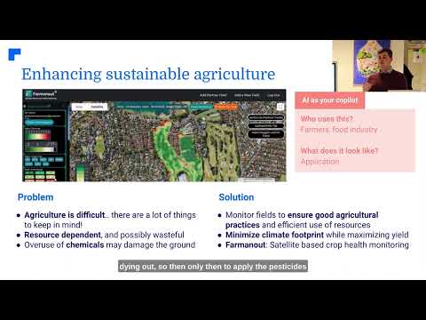
Farmonaut leverages advanced satellite technology to provide farmers with up-to-date information about their crops. Our platform uses multispectral satellite images to monitor crop health, providing insights into vegetation health (NDVI), soil moisture levels, and other critical metrics.
Precision Agriculture: The Future of Farming
Precision agriculture is a farming management concept that uses detailed, site-specific information to precisely manage production inputs. This approach allows farmers to:
- Optimize resource use
- Reduce environmental impact
- Increase crop yields
- Improve farm profitability
By combining GIS and remote sensing technologies, precision agriculture enables farmers to make data-driven decisions about every aspect of their operations. From determining the optimal planting density to precisely applying fertilizers and pesticides, these technologies are transforming agriculture into a high-tech industry.
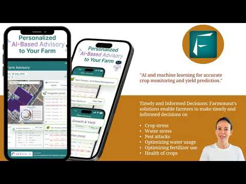
Farmonaut’s platform is designed to make precision agriculture accessible to farmers of all scales. Our Jeevn AI Advisory System analyzes satellite data and other inputs to generate customized advice, improving farm productivity and efficiency.
Crop Monitoring and Yield Prediction
Crop monitoring is a critical aspect of modern agriculture, and remote sensing technologies have made it more efficient than ever. At Farmonaut, we use satellite imagery to provide real-time insights into crop health and growth patterns. This allows farmers to:
- Detect early signs of crop stress or disease
- Monitor crop growth stages
- Identify areas of nutrient deficiency
- Track the impact of weather events on crops
Our advanced algorithms also enable accurate crop yield prediction, helping farmers and agribusinesses plan for harvests and make informed marketing decisions. By analyzing historical yield data, current crop health, and weather forecasts, we provide reliable yield estimates well before harvest time.
Smart Farming Techniques for Sustainable Agriculture
Smart farming techniques are at the heart of sustainable agriculture practices. These innovative approaches leverage technology to optimize resource use and minimize environmental impact. Some key smart farming techniques include:
- Variable Rate Technology (VRT): Applies inputs like fertilizers and pesticides at variable rates across a field, based on site-specific needs.
- Automated Irrigation Systems: Use soil moisture sensors and weather data to optimize water usage.
- Precision Planting: Ensures optimal seed spacing and depth for maximum yield potential.
- Robotics and Autonomous Vehicles: Perform tasks like weeding and harvesting with minimal human intervention.
At Farmonaut, we’re committed to promoting sustainable agriculture practices through our technology. Our platform integrates with various smart farming tools, allowing farmers to implement these techniques effectively and monitor their impact over time.
“Satellite imagery for crop analysis can cover over 100,000 acres per day, enabling rapid large-scale farm monitoring.”
Soil Health Analysis and Management
Soil health analysis is crucial for maintaining productive and sustainable agricultural systems. Remote sensing technologies provide valuable insights into soil properties, including:
- Organic matter content
- Moisture levels
- Nutrient composition
- pH levels
By analyzing this data, farmers can make informed decisions about soil management practices, such as:
- Targeted fertilizer application
- Cover crop selection
- Tillage practices
- Crop rotation strategies
Farmonaut’s platform includes advanced soil health analysis tools that help farmers maintain optimal soil conditions for their crops. Our satellite-based monitoring system provides regular updates on soil moisture levels, enabling farmers to make timely decisions about irrigation and other management practices.

Irrigation Management Systems
Effective irrigation management is critical for maximizing crop yields while conserving water resources. Modern irrigation management systems utilize a combination of technologies, including:
- Soil moisture sensors
- Weather stations
- Satellite imagery
- Smart irrigation controllers
These systems work together to provide farmers with real-time data on soil moisture levels and crop water needs, allowing for precise irrigation scheduling and application. At Farmonaut, our satellite-based monitoring system provides valuable insights into soil moisture levels across entire fields, helping farmers optimize their irrigation practices.
Check out our API for advanced irrigation management solutions
Pest Control and Weed Detection
Effective pest control and weed management are essential for maintaining healthy crops and maximizing yields. Advanced technologies are revolutionizing these aspects of farm management:
- Pest Control Technologies:
- Remote sensing for early detection of pest infestations
- AI-powered pest identification systems
- Precision application of pesticides using drones or smart sprayers
- Weed Detection Algorithms:
- Machine learning models for identifying weed species
- Automated weed mapping using drone or satellite imagery
- Targeted herbicide application systems
Farmonaut’s platform integrates these advanced technologies, providing farmers with powerful tools for pest and weed management. Our satellite imagery and AI algorithms can detect early signs of pest infestations or weed growth, allowing for timely and targeted interventions.
Drone Mapping and Satellite Imagery for Crop Analysis
Drone mapping and satellite imagery have become indispensable tools for modern crop analysis. These technologies offer several advantages:
- High-Resolution Imagery: Drones can capture extremely detailed images of crops, allowing for precise analysis of plant health and stress.
- Frequent Updates: Satellite imagery provides regular updates on crop conditions, often every few days.
- Large-Scale Coverage: Satellites can monitor vast areas of farmland quickly and efficiently.
- Multispectral Analysis: Both drones and satellites can capture data across multiple spectral bands, revealing information invisible to the naked eye.
At Farmonaut, we leverage advanced satellite technology to provide farmers with comprehensive crop analysis. Our platform uses multispectral satellite images to monitor crop health, providing insights into vegetation health (NDVI), soil moisture levels, and other critical metrics.
Explore our API Developer Docs for in-depth satellite imagery analysis
Farm Data Analytics and Decision Support Systems
Farm data analytics and agricultural decision support systems are transforming how farmers make critical management decisions. These systems combine various data sources, including:
- Historical yield data
- Weather information
- Soil analysis results
- Market trends
- Satellite and drone imagery
By analyzing this wealth of data, decision support systems can provide farmers with actionable insights and recommendations for:
- Crop selection and rotation
- Planting and harvesting schedules
- Fertilizer and pesticide application
- Irrigation management
- Risk assessment and mitigation
Farmonaut’s platform includes advanced data analytics and decision support tools. Our Jeevn AI Advisory System analyzes various data inputs to generate personalized recommendations, helping farmers make informed decisions that optimize their operations and improve profitability.
Agricultural IoT Solutions
The Internet of Things (IoT) is revolutionizing agriculture by connecting various farm devices and sensors to create a network of smart, interconnected systems. Agricultural IoT solutions offer numerous benefits, including:
- Real-time monitoring of crop and soil conditions
- Automated irrigation and climate control systems
- Livestock tracking and health monitoring
- Equipment performance tracking and predictive maintenance
- Supply chain optimization
At Farmonaut, we integrate IoT solutions into our platform, allowing farmers to connect and manage various smart devices and sensors. This integration provides a comprehensive view of farm operations and enables more efficient management of resources.
Crop Disease Prevention and Management
Crop disease prevention is a critical aspect of modern agriculture, and advanced technologies are making it more effective than ever. Here’s how GIS and remote sensing are revolutionizing crop disease management:
- Early Detection: Satellite and drone imagery can detect subtle changes in crop health that may indicate the onset of disease.
- Disease Mapping: GIS tools allow for the creation of detailed disease distribution maps, helping farmers and researchers understand patterns of spread.
- Predictive Modeling: By combining historical disease data with current environmental conditions, AI algorithms can predict the likelihood of disease outbreaks.
- Targeted Treatment: Precision application technologies enable farmers to apply treatments only where needed, reducing overall chemical use.
Farmonaut’s platform includes advanced disease detection and prevention tools. Our satellite monitoring system can identify early signs of crop stress that may indicate disease, allowing farmers to take proactive measures to protect their crops.
Fertilizer Optimization and Digital Farming Solutions
Fertilizer optimization is crucial for both crop productivity and environmental sustainability. Digital farming solutions are making this process more precise and efficient than ever before. Here’s how:
- Soil Nutrient Mapping: Detailed maps of soil nutrient levels guide precise fertilizer application.
- Variable Rate Application: Smart machinery applies fertilizers at varying rates based on specific field needs.
- Real-time Monitoring: Sensors and satellite imagery provide continuous data on crop nutrient status.
- Predictive Analytics: AI models predict crop nutrient needs based on various factors, including growth stage and weather conditions.
Farmonaut’s digital farming solutions incorporate these advanced technologies to help farmers optimize their fertilizer use. Our platform provides detailed insights into soil and crop conditions, enabling precise and efficient nutrient management.
Comparison of Precision Agriculture Technologies
| Technology | Data Resolution | Update Frequency | Cost-Effectiveness | Key Applications |
|---|---|---|---|---|
| Farmonaut Satellite System | 3-5m | Every 3-5 days | 8/10 | Crop health monitoring, yield prediction, irrigation management |
| Drone Mapping | 1-5cm | As needed | 6/10 | Detailed crop scouting, plant counting |
| Ground Sensors | Point-based | Continuous | 5/10 | Soil moisture monitoring, weather data collection |
| Traditional Field Scouting | Variable | Weekly/Monthly | 3/10 | Pest and disease identification, crop growth assessment |
The Future of Farming with GIS and Remote Sensing
As we look to the future, it’s clear that GIS and remote sensing technologies will continue to play an increasingly important role in agriculture. Some emerging trends and developments to watch include:
- AI and Machine Learning: More sophisticated algorithms for crop analysis and prediction.
- Hyperspectral Imaging: Even more detailed crop health and soil analysis.
- Integration with Autonomous Farm Machinery: Seamless connection between data collection and farm operations.
- Blockchain for Traceability: Enhanced supply chain transparency and food safety.
- Climate Change Adaptation: Using advanced modeling to prepare for and mitigate the effects of climate change on agriculture.
At Farmonaut, we’re committed to staying at the forefront of these technological advancements, continually improving our platform to provide farmers with the most cutting-edge tools and insights available.
Conclusion: Embracing the Agricultural Revolution
The integration of GIS and remote sensing technologies in agriculture represents a true revolution in how we approach farming. These advanced tools are enabling farmers to make more informed decisions, optimize resource use, and increase productivity while minimizing environmental impact.
As we’ve explored in this article, from precision agriculture and crop monitoring to soil health analysis and pest management, these technologies are transforming every aspect of farm management. At Farmonaut, we’re proud to be at the forefront of this revolution, providing farmers with accessible and affordable solutions that harness the power of satellite technology and AI.
By embracing these innovative technologies and approaches, farmers can not only improve their own operations but also contribute to greater global food security and sustainability. As we face the challenges of feeding a growing world population in the face of climate change, the role of GIS and remote sensing in agriculture will only become more crucial.
We invite you to join us in this agricultural revolution. Explore our platform, leverage our tools, and discover how you can revolutionize your farm with the power of GIS and remote sensing.
Frequently Asked Questions
- What is precision agriculture?
Precision agriculture is a farming management concept that uses detailed, site-specific information to precisely manage production inputs, optimizing resource use and crop yields. - How does GIS benefit farmers?
GIS helps farmers visualize, analyze, and interpret data to understand relationships, patterns, and trends in their fields, leading to more informed decision-making and improved farm management. - What is remote sensing in agriculture?
Remote sensing in agriculture involves collecting data about crops and soil without making physical contact, typically using satellite or drone imagery to monitor crop health and field conditions. - How does Farmonaut use satellite technology?
Farmonaut uses multispectral satellite images to monitor crop health, providing insights into vegetation health (NDVI), soil moisture levels, and other critical metrics for farm management. - What is the Jeevn AI Advisory System?
The Jeevn AI Advisory System is Farmonaut’s AI-driven personalized farm advisory tool that analyzes satellite data and other inputs to generate customized advice for improving farm productivity and efficiency.
Ready to revolutionize your farm with the power of GIS and remote sensing? Get started with Farmonaut today!


