EU CAP Reform: Simplifying Agriculture with Voluntary Geo-Tagged Photos for Enhanced Flexibility and Reduced Administrative Burden
“The EU’s CAP reform introduces voluntary geo-tagged photos, potentially impacting over 10 million farmers across 27 member states.“
In the ever-evolving landscape of European agriculture, we find ourselves at the cusp of a significant transformation. The European Commission’s recent simplification of the Common Agricultural Policy (CAP) marks a pivotal moment in EU farm policy reform. At Farmonaut, we’re keenly observing these developments and their potential impact on farmers, rural communities, and the broader agricultural sector.
This comprehensive blog post delves into the intricacies of this reform, with a particular focus on the voluntary use of geo-tagged photos in the Area Monitoring System. We’ll explore how this innovative approach aims to reduce administrative burdens for farmers while enhancing flexibility in agricultural practices.

Understanding the CAP Reform
The Common Agricultural Policy (CAP) has been a cornerstone of European Union policy since its inception. Its primary objectives have always been to support farmers, improve agricultural productivity, and ensure a stable supply of affordable food for EU citizens. However, as the agricultural landscape evolves, so too must the policies that govern it.
The latest CAP reform represents a significant shift towards simplification and flexibility. At its core, this reform aims to:
- Reduce administrative burdens for farmers
- Enhance flexibility in agricultural practices
- Promote sustainable farming methods
- Streamline policy implementation across member states
One of the most innovative aspects of this reform is the introduction of voluntary geo-tagged photos as part of the Area Monitoring System. This technology-driven approach has the potential to revolutionize how farmers interact with CAP requirements and how national administrations verify compliance.
The Role of Geo-Tagged Photos in Agriculture
Geo-tagged photos represent a significant leap forward in agricultural monitoring and verification. But what exactly are they, and how do they work in the context of the CAP reform?
Geo-tagged photos are images that contain geographical identification metadata. This metadata typically includes information such as latitude and longitude coordinates, altitude, and sometimes even the direction the camera was pointing when the photo was taken. In the context of agriculture, these photos can provide valuable evidence of crop types, land use, and farming practices.
Under the new CAP reform, farmers have the option to submit geo-tagged photos as part of their compliance documentation. This voluntary system offers several advantages:
- Reduced need for on-site inspections
- Faster verification processes
- Increased accuracy in land use reporting
- Greater flexibility for farmers in demonstrating compliance
At Farmonaut, we recognize the potential of this technology to streamline agricultural processes. Our satellite-based farm management solutions complement this approach, offering farmers additional tools to monitor and manage their land effectively.
The Area Monitoring System: A Game-Changer for EU Agriculture
The Area Monitoring System (AMS) is a crucial component of the new CAP reform. This system leverages satellite imagery and other geospatial data to monitor agricultural activities across the EU. The integration of voluntary geo-tagged photos into this system marks a significant enhancement in its capabilities.
Key features of the Area Monitoring System include:
- Continuous monitoring of agricultural land
- Real-time data on crop growth and land use
- Automated alerts for potential non-compliance
- Integration with other CAP management tools
The AMS, combined with voluntary geo-tagged photos, creates a robust framework for agricultural monitoring that balances the needs of farmers with the requirements of policy implementation.

Reducing Administrative Burdens: A Win for Farmers
One of the primary goals of the CAP reform is to reduce the administrative burden on farmers. The introduction of voluntary geo-tagged photos plays a significant role in achieving this objective. Here’s how:
- Simplified Reporting: Farmers can now provide visual evidence of their land use and farming practices through simple photographs, reducing the need for complex paperwork.
- Reduced On-Site Inspections: With geo-tagged photos providing clear evidence, the frequency of physical inspections can be reduced, saving time and resources for both farmers and administrators.
- Faster Claim Processing: Digital submission of geo-tagged photos allows for quicker verification and processing of CAP claims.
- Increased Accuracy: Visual evidence helps reduce errors in reporting and improves the overall accuracy of land use data.
This reduction in administrative burden aligns perfectly with Farmonaut’s mission to make precision agriculture more accessible and less cumbersome for farmers. Our satellite-based solutions complement these efforts by providing additional data and insights to support farm management decisions.
“Satellite imagery in the new CAP could monitor over 170 million hectares of agricultural land in the EU.“
Enhancing Flexibility in Agricultural Practices
The CAP reform’s emphasis on flexibility is a recognition of the diverse nature of European agriculture. By allowing farmers to use geo-tagged photos voluntarily, the policy acknowledges that one-size-fits-all approaches are not always effective in agriculture. This flexibility manifests in several ways:
- Choice in Compliance Methods: Farmers can choose whether to use geo-tagged photos or traditional methods of verification, depending on what works best for their situation.
- Adaptability to Different Farming Systems: The system can accommodate various farming practices, from small-scale organic farms to large industrial operations.
- Seasonal Flexibility: Farmers can provide visual evidence at different times of the year, reflecting the dynamic nature of agricultural activities.
- Technological Integration: The system allows for the integration of various technologies, including mobile devices and farm management software.
This flexibility is crucial in promoting innovation and sustainable practices in agriculture. It allows farmers to adopt new methods and technologies without being constrained by rigid policy requirements.
The Impact on Sustainable Agriculture Practices
Sustainability is at the heart of modern agricultural policy, and the CAP reform reflects this priority. The use of geo-tagged photos and satellite monitoring contributes to sustainable agriculture in several ways:
- Precision Agriculture: By providing accurate data on land use, these technologies support more precise and efficient use of resources.
- Environmental Monitoring: Satellite imagery and geo-tagged photos can help track environmental indicators, such as biodiversity and soil health.
- Encouragement of Best Practices: The system can be used to verify and reward sustainable farming practices, incentivizing their adoption.
- Reduced Carbon Footprint: Fewer on-site inspections mean less travel, contributing to reduced emissions in agricultural monitoring.
At Farmonaut, we’re particularly excited about the potential of these technologies to promote sustainable agriculture. Our satellite-based crop health monitoring and AI advisory systems are designed to support farmers in making environmentally conscious decisions while optimizing their yields.

Digital Farming Technologies: The Future of EU Agriculture
The integration of geo-tagged photos into the CAP framework is just one aspect of a broader trend towards digital farming in the EU. This digital transformation encompasses a wide range of technologies and practices:
- Satellite-Based Monitoring: As exemplified by Farmonaut’s services, satellite imagery provides valuable insights into crop health, soil moisture, and other critical agricultural parameters.
- IoT Sensors: Internet of Things devices are increasingly used to collect real-time data on soil conditions, weather, and crop growth.
- AI and Machine Learning: Advanced algorithms are being employed to analyze agricultural data and provide actionable insights to farmers.
- Blockchain Technology: This is being used to enhance traceability in the agricultural supply chain, improving food safety and transparency.
These digital technologies are not just improving efficiency; they’re also playing a crucial role in achieving the EU’s sustainability goals in agriculture.

Rural Development Policy: A Holistic Approach
The CAP reform’s impact extends beyond individual farms to encompass broader rural development policies. The simplification and flexibility introduced by the reform have significant implications for rural communities:
- Economic Sustainability: By reducing administrative burdens, farmers can focus more on productive activities, potentially improving their economic outcomes.
- Social Sustainability: The adoption of digital technologies can attract younger generations to farming, helping to address the issue of an aging agricultural workforce.
- Environmental Sustainability: The reform supports environmentally friendly practices, contributing to the overall sustainability of rural areas.
- Innovation and Research: The new framework encourages innovation in farming practices and technologies, potentially leading to new research opportunities in rural areas.
These developments align with Farmonaut’s vision of empowering farmers and rural communities through accessible and affordable precision agriculture technologies.
Cooperation Between National Administrations and Farmers
The success of the CAP reform hinges on effective cooperation between national administrations and farmers. This cooperation is facilitated by the new flexible approach:
- Simplified Communication: Geo-tagged photos provide a clear, visual means of communication between farmers and administrators.
- Trust-Building: The voluntary nature of the photo submission process fosters a more collaborative relationship between farmers and authorities.
- Data Sharing: The digital nature of the system allows for more efficient sharing of information between different stakeholders.
- Continuous Improvement: Feedback from farmers can be more easily incorporated into policy refinements.
This collaborative approach is crucial for the effective implementation of the CAP and for ensuring that the policy remains responsive to the needs of the agricultural sector.
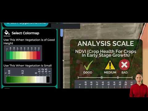
The Role of Satellite Imagery in Crop Monitoring
Satellite imagery plays a crucial role in the new CAP framework, complementing the use of geo-tagged photos. At Farmonaut, we specialize in leveraging satellite data for agricultural purposes, and we see immense potential in its application within the CAP:
- Large-Scale Monitoring: Satellites can provide consistent, frequent coverage of vast agricultural areas.
- Multispectral Analysis: Advanced sensors can detect crop health issues, water stress, and other factors not visible to the naked eye.
- Historical Data: Satellite imagery provides valuable historical context, allowing for year-on-year comparisons.
- Integration with Other Data: Satellite data can be combined with ground-level information, including geo-tagged photos, for a more comprehensive view.
The integration of satellite imagery with geo-tagged photos creates a powerful tool for agricultural monitoring and management, supporting both policy implementation and farm-level decision-making.
Economic and Environmental Sustainability: Striking a Balance
The CAP reform aims to strike a delicate balance between economic viability and environmental sustainability in agriculture. This balance is crucial for the long-term health of the sector and the planet:
- Economic Incentives: The reform maintains income support for farmers while encouraging sustainable practices.
- Environmental Measures: It promotes practices that protect biodiversity, soil health, and water quality.
- Market Orientation: The policy supports farmers in responding to market demands while maintaining environmental standards.
- Climate Change Mitigation: It includes measures to reduce greenhouse gas emissions from agriculture.
Farmonaut’s technologies support this balance by providing farmers with tools to optimize resource use, thereby improving both economic and environmental outcomes.
Impact on Farm Structures and Economics
The CAP reform has significant implications for farm structures and economics across the EU:
- Diversification: The flexibility offered by the new system may encourage farmers to diversify their activities.
- Technological Adoption: There’s likely to be an increased uptake of digital technologies in farming.
- Economies of Scale: The reform may benefit both small family farms and larger agricultural enterprises, depending on how they adapt to the new system.
- Investment Patterns: There may be shifts in investment towards more sustainable and technologically advanced farming methods.
These changes present both challenges and opportunities for farmers across the EU.
Farmonaut’s Perspective on the CAP Reform
As a company dedicated to advancing precision agriculture, we at Farmonaut see the CAP reform as a positive step towards a more efficient, sustainable, and technologically advanced agricultural sector in the EU. Our satellite-based farm management solutions align well with the objectives of the reform:
- Our crop health monitoring services can complement the Area Monitoring System, providing farmers with additional insights.
- Our AI-driven advisory system, Jeevn AI, can help farmers make informed decisions in line with CAP requirements.
- Our blockchain-based traceability solutions can support supply chain transparency, an increasingly important aspect of EU agricultural policy.
We’re excited about the potential for these technologies to support EU farmers in navigating the new policy landscape while improving their productivity and sustainability.

The Future of EU Agriculture: Trends and Predictions
As we look to the future of EU agriculture in light of the CAP reform, several trends and predictions emerge:
- Increased Digitalization: We expect to see a continued rise in the adoption of digital farming technologies.
- Focus on Sustainability: Environmental considerations will likely play an even more significant role in future agricultural policies.
- Precision Agriculture: Technologies that enable precise resource management will become increasingly important.
- Data-Driven Decision Making: Farmers will increasingly rely on data analytics to inform their farming practices.
- Diversification of Rural Economies: We may see more integration between agriculture and other rural economic activities.
At Farmonaut, we’re committed to staying at the forefront of these trends, continuously evolving our services to meet the changing needs of farmers and policymakers alike.
Conclusion: A New Era for European Agriculture
The EU CAP reform, with its emphasis on simplification, flexibility, and the use of advanced technologies like geo-tagged photos and satellite imagery, marks the beginning of a new era in European agriculture. This reform has the potential to significantly reduce administrative burdens, enhance agricultural sustainability, and promote innovation in farming practices.
As we’ve explored in this blog post, the implications of this reform are far-reaching, touching on aspects of rural development, environmental sustainability, and the very structure of farming in the EU. The integration of digital technologies, including those offered by companies like Farmonaut, will play a crucial role in realizing the full potential of this reform.
While challenges remain in implementing these changes and ensuring they benefit all stakeholders, the overall direction is clear: towards a more efficient, sustainable, and technologically advanced agricultural sector in the EU. As this new chapter in European agriculture unfolds, we at Farmonaut are excited to be part of the journey, supporting farmers and policymakers with our innovative satellite-based solutions.
The future of EU agriculture is digital, sustainable, and full of potential. By embracing these changes and leveraging the power of technology, we can work towards a vibrant, resilient, and prosperous agricultural sector that benefits farmers, consumers, and the environment alike.
Impact of EU CAP Reform on Agricultural Stakeholders
| Stakeholder | Administrative Burden Reduction | Flexibility Increase | Sustainability Impact | Key Benefits |
|---|---|---|---|---|
| Farmers | ★★★★★ | ★★★★☆ | ★★★★☆ |
|
| National Administrations | ★★★★☆ | ★★★☆☆ | ★★★★☆ |
|
| Environmental Organizations | ★★☆☆☆ | ★★★☆☆ | ★★★★★ |
|
| Geo-Tagged Photos Implementation | ★★★★★ | ★★★★★ | ★★★★☆ |
|
FAQ Section
Q1: What is the main goal of the EU CAP reform?
A1: The main goal is to simplify agricultural policy, reduce administrative burdens for farmers, enhance flexibility, and promote sustainable farming practices across the EU.
Q2: How do geo-tagged photos contribute to the CAP reform?
A2: Geo-tagged photos provide visual evidence of land use and farming practices, reducing the need for on-site inspections and simplifying the verification process for CAP compliance.
Q3: Is the use of geo-tagged photos mandatory for all farmers?
A3: No, the use of geo-tagged photos is voluntary. Farmers can choose whether to use this method or traditional verification processes.
Q4: How does the Area Monitoring System work?
A4: The Area Monitoring System uses satellite imagery and other geospatial data to continuously monitor agricultural activities across the EU, providing real-time information on land use and crop growth.
Q5: What are the environmental benefits of the CAP reform?
A5: The reform promotes sustainable farming practices, encourages biodiversity protection, and supports measures to reduce greenhouse gas emissions from agriculture.
Q6: How does the reform impact small vs. large farms?
A6: The reform aims to benefit both small and large farms by providing flexibility in compliance methods and promoting technological adoption across different farm sizes.
Q7: What role does satellite imagery play in the new CAP framework?
A7: Satellite imagery provides large-scale monitoring capabilities, offering consistent coverage of vast agricultural areas and supporting the Area Monitoring System with detailed crop and land use data.
Q8: How does the CAP reform address rural development?
A8: The reform supports rural development by reducing administrative burdens, encouraging innovation in farming practices, and promoting economic, social, and environmental sustainability in rural areas.
Q9: What are the expected long-term impacts of this reform on EU agriculture?
A9: Long-term impacts are expected to include increased digitalization of farming, greater focus on sustainability, wider adoption of precision agriculture techniques, and more data-driven decision-making in the agricultural sector.
Q10: How can farmers prepare for these changes?
A10: Farmers can prepare by familiarizing themselves with digital technologies, exploring precision agriculture tools, and staying informed about the specific requirements and opportunities presented by the new CAP framework.
Explore Farmonaut’s Solutions
At Farmonaut, we’re committed to supporting farmers and agricultural stakeholders in navigating the changing landscape of EU agriculture. Our suite of satellite-based farm management solutions aligns perfectly with the objectives of the CAP reform, offering tools for efficient, sustainable, and data-driven farming.
To learn more about how Farmonaut can help you adapt to these changes and optimize your agricultural practices, explore our services:


Farmonaut Subscriptions
By leveraging Farmonaut’s advanced technologies, farmers can not only comply with the new CAP requirements but also enhance their productivity, sustainability, and profitability. Join us in shaping the future of European agriculture!