Revolutionizing Climate Action: How Satellite-Based Carbon Monitoring is Transforming Sustainable Agriculture in California
“Hyperspectral imaging satellites can detect over 200 spectral bands, enabling precise carbon monitoring in agriculture.”
In the face of escalating climate change challenges, we find ourselves at a pivotal moment in history. The agricultural sector, a significant contributor to greenhouse gas emissions, is undergoing a radical transformation thanks to groundbreaking advancements in satellite-based carbon monitoring and greenhouse gas emission detection. As we delve into this revolutionary technology, we’ll explore how it’s reshaping sustainable farming practices, particularly in California, and paving the way for a greener future.
The Power of Space-Based Solutions in Agriculture
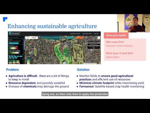
Satellite-based carbon monitoring is not just a technological marvel; it’s a game-changer for sustainable agriculture. By harnessing the power of advanced hyperspectral imaging technology deployed via a unique satellite constellation, we’re now able to gather unprecedented insights into environmental conditions and agricultural practices. This innovation is transforming how we approach climate change mitigation in farming.

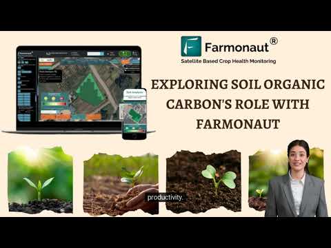
At the forefront of this revolution is Farmonaut, a pioneering agricultural technology company. Their precision agriculture data analytics platform leverages these space-based innovations to promote sustainable farming practices and drive agricultural emissions reduction. By providing farmers with real-time, actionable data, Farmonaut is empowering the agricultural community to make informed decisions that benefit both their crops and the planet.
Hyperspectral Imaging: The Eye in the Sky
One of the key technologies driving this transformation is hyperspectral imaging. Unlike traditional satellite imagery, hyperspectral sensors can capture data across hundreds of spectral bands, providing a wealth of information about soil composition, crop health, and even carbon content. This level of detail allows for unprecedented accuracy in monitoring and managing agricultural practices.
- Soil Carbon Measurement: Hyperspectral imaging can detect subtle changes in soil reflectance, indicating variations in organic carbon content.
- Crop Health Assessment: By analyzing spectral signatures, farmers can identify stress factors affecting plant growth and adjust their practices accordingly.
- Precision Resource Management: Detailed imagery enables targeted application of fertilizers and water, reducing waste and environmental impact.
Overcoming Geographical Challenges with Satellite Imagery
One of the most significant advantages of satellite-based monitoring is its ability to overcome geographical data discrepancies. Traditional methods of data collection often struggle with inconsistencies across different regions, but satellite imagery for farm planning provides a standardized, comprehensive view of agricultural lands.
In California, where diverse microclimates and varying soil conditions pose unique challenges, this technology is particularly valuable. Farmers can now access detailed, up-to-date information about their fields, regardless of location or terrain complexity.

Driving Timely Industry Responses and Regulatory Compliance
The real-time nature of satellite-based monitoring enables rapid response to changing environmental conditions. This timely data is crucial for:
- Quick adaptation to weather patterns
- Early detection of pest infestations or disease outbreaks
- Compliance with evolving environmental regulations
For California’s agricultural industry, which faces stringent environmental regulations, this technology provides a valuable tool for demonstrating compliance and adopting sustainable practices.
Investing in Sustainable Practices Across Sectors
While our focus is on agriculture, it’s important to note that satellite-based carbon monitoring has far-reaching implications across various sectors. From forestry to urban planning, this technology is driving investment in sustainable practices by providing concrete data on environmental impact.
In California, we’re seeing increased collaboration between agricultural, tech, and environmental sectors, all leveraging this satellite data to develop innovative solutions for climate change mitigation.
Remote Sensing for Crop Management: A New Era
Remote sensing for crop management is revolutionizing how we approach agriculture. By providing detailed insights into crop health, soil moisture levels, and even predict yields, this technology is enabling farmers to:
- Optimize irrigation schedules
- Reduce pesticide and fertilizer use
- Improve crop rotation strategies
- Enhance overall farm efficiency
“Satellite-based carbon monitoring can reduce agricultural emissions by up to 30% through improved farm planning and management.”
The Global Coalition for Climate Action
The fight against climate change is a global effort, and satellite-based carbon monitoring is playing a crucial role in uniting stakeholders worldwide. A coalition of governments, private companies, academic institutions, and NGOs is working together to identify and reduce methane and carbon dioxide emissions globally.
This collaborative approach is essential for addressing the complex challenges of climate change, and California is leading the way in fostering these partnerships.

Challenges in Accurate Emissions Measurement
While satellite-based carbon monitoring offers unprecedented capabilities, it’s not without challenges. Accurate measurement of greenhouse gas emissions, particularly methane, can be complex due to factors such as:
- Atmospheric interference
- Variability in emission sources
- Need for high-resolution data over large areas
However, ongoing technological advancements and improved data analysis techniques are continuously enhancing the accuracy and reliability of these measurements.
The Role of Artificial Intelligence and Machine Learning
The true power of satellite-based carbon monitoring lies in its integration with artificial intelligence (AI) and machine learning (ML) technologies. These advanced analytics tools can:
- Process vast amounts of satellite data quickly
- Identify patterns and trends invisible to the human eye
- Predict future environmental changes based on historical data
- Provide actionable insights for farmers and policymakers
By leveraging AI and ML, we’re not just collecting data; we’re transforming it into valuable knowledge that can drive meaningful climate action.
Comparative Analysis: Traditional vs. Satellite-Based Monitoring
| Agricultural Practice | Traditional Method | Satellite-Based Monitoring Method | Environmental Impact (CO2 reduction) | Economic Benefits (cost savings) |
|---|---|---|---|---|
| Crop Planning | Based on historical data and local knowledge | AI-driven analysis of satellite imagery and climate data | 15-20% reduction | 10-15% cost reduction |
| Fertilizer Application | Uniform application across fields | Precision application based on soil nutrient mapping | 20-25% reduction | 15-20% cost reduction |
| Irrigation Management | Scheduled watering based on general guidelines | Targeted irrigation based on real-time soil moisture data | 25-30% reduction in water usage | 20-25% cost reduction |
| Pest Control | Preventive spraying of entire fields | Early detection and targeted treatment of affected areas | 30-35% reduction in pesticide use | 25-30% cost reduction |
| Harvest Timing | Based on visual inspection and experience | Optimized using satellite data on crop maturity | 10-15% reduction in food waste | 10-15% increase in crop value |
The Future of Sustainable Agriculture in California
As we look to the future, the potential of satellite-based carbon monitoring in shaping sustainable agriculture is immense. In California, known for its innovative approach to environmental challenges, we’re seeing:
- Integration of satellite data into state-wide agricultural policies
- Development of new incentive programs for farmers adopting sustainable practices
- Increased collaboration between tech companies and agricultural institutions
- Growing investments in agricultural technology startups
These developments are not only positioning California as a leader in sustainable agriculture but also setting a precedent for other regions to follow.
Empowering Farmers with Data-Driven Decisions
One of the most significant impacts of satellite-based carbon monitoring is the empowerment of farmers. By providing access to detailed, real-time data about their fields, this technology enables farmers to:
- Make informed decisions about crop management
- Reduce environmental impact while improving yields
- Adapt quickly to changing climate conditions
- Participate actively in carbon credit programs
This data-driven approach is transforming farming from an art based on intuition and experience to a science backed by concrete data.
The Role of Government and Policy
Government support and policy initiatives play a crucial role in the widespread adoption of satellite-based carbon monitoring in agriculture. In California, we’re seeing:
- Increased funding for research and development in agricultural technology
- Implementation of policies that incentivize sustainable farming practices
- Collaboration between state agencies and tech companies to develop comprehensive monitoring systems
- Integration of satellite data into climate action plans and environmental regulations
These initiatives are creating a supportive ecosystem for the growth and adoption of sustainable agricultural practices across the state.
Addressing Privacy and Data Security Concerns
As with any technology that collects and analyzes data, satellite-based carbon monitoring raises important questions about privacy and data security. It’s crucial to address these concerns to ensure widespread acceptance and adoption. Key considerations include:
- Protecting farmers’ proprietary information
- Ensuring data is used solely for its intended purposes
- Implementing robust cybersecurity measures
- Developing clear guidelines for data ownership and usage
By addressing these issues proactively, we can build trust and encourage broader participation in sustainable agriculture initiatives.

The Global Impact of Local Actions
While our focus has been on California, it’s important to recognize that the impact of these innovations extends far beyond state borders. The lessons learned and technologies developed here have the potential to transform agriculture globally, particularly in regions facing similar climate challenges.
By pioneering these approaches, California is not only addressing its own environmental concerns but also contributing to the global fight against climate change.
Conclusion: A Vision for a Sustainable Future
As we’ve explored throughout this blog, satellite-based carbon monitoring is more than just a technological advancement; it’s a catalyst for transformative change in agriculture. By providing unprecedented insights into our planet’s health and enabling data-driven decision-making, this technology is paving the way for a more sustainable, efficient, and productive agricultural sector.
In California and beyond, we’re witnessing the dawn of a new era in farming – one where technology and tradition combine to meet the challenges of climate change head-on. As we continue to innovate and collaborate, the future of sustainable agriculture looks brighter than ever.
Together, through the power of satellite technology and data analytics, we can create a world where agriculture not only feeds the planet but also plays a crucial role in mitigating climate change and preserving our environment for future generations.
FAQ Section
Q: How does satellite-based carbon monitoring work in agriculture?
A: Satellite-based carbon monitoring uses advanced hyperspectral imaging technology to capture detailed data about soil composition, crop health, and carbon content. This data is then analyzed using AI and machine learning algorithms to provide insights into agricultural practices and their environmental impact.
Q: What are the benefits of using satellite technology for sustainable agriculture?
A: Benefits include improved crop yields, reduced resource waste, better environmental compliance, early detection of issues like pests or diseases, and the ability to make data-driven decisions for more sustainable farming practices.
Q: How accurate is satellite-based carbon monitoring?
A: While challenges exist, ongoing technological advancements are continuously improving accuracy. Current systems can detect subtle changes in soil carbon content and provide highly reliable data for agricultural management.
Q: Can small-scale farmers benefit from this technology?
A: Yes, companies like Farmonaut are making this technology accessible to farmers of all scales. Small-scale farmers can benefit from improved crop management, reduced input costs, and potentially participate in carbon credit programs.
Q: How does satellite-based monitoring contribute to climate change mitigation?
A: By enabling more efficient use of resources, reducing emissions from agricultural practices, and providing data for carbon sequestration efforts, this technology plays a crucial role in mitigating agriculture’s impact on climate change.
Explore Farmonaut’s innovative solutions:

For developers: API | API Developer Docs

