Revolutionizing Australian Plant Biosecurity: Farmonaut’s GIS-Powered Approach to Agricultural Pest Management
“Farmonaut’s GIS technologies cover over 90% of Australia’s major crop regions for advanced pest detection and management.”
Welcome to the cutting edge of plant biosecurity and agricultural pest management in Australia! At Farmonaut, we’re proud to be at the forefront of revolutionizing how the agriculture industry tackles some of its most pressing challenges. Our GIS-powered solutions are transforming the landscape of plant health and biosecurity across the nation, providing farmers, researchers, and industry professionals with the tools they need to stay ahead in an ever-evolving field.
The Rising Importance of Plant Biosecurity in Australia
In recent years, the significance of plant biosecurity has skyrocketed, becoming a cornerstone of sustainable agriculture and environmental protection in Australia. As we navigate the complexities of climate change, increased global trade, and emerging pest threats, the need for innovative solutions has never been more critical.
Our team at Farmonaut recognizes these challenges and has developed a suite of GIS-powered tools designed to enhance plant biosecurity measures across the country. By leveraging advanced satellite technology and artificial intelligence, we’re enabling a more proactive and precise approach to pest management and plant health monitoring.

Farmonaut’s GIS Technologies: A Game-Changer for Plant Health
Our GIS-powered approach is reshaping how we detect, monitor, and manage agricultural pests and diseases. Here’s how Farmonaut’s technologies are making a difference:
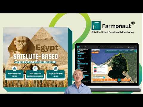
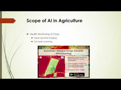
- Real-time Crop Health Monitoring: Using multispectral satellite imagery, we provide farmers with up-to-the-minute insights on vegetation health, soil moisture levels, and potential pest hotspots.
- AI-Driven Pest Detection: Our advanced algorithms analyze satellite data to identify early signs of pest infestations, allowing for rapid response and targeted treatment.
- Precision Agriculture Integration: By combining GIS data with on-ground sensors and weather forecasts, we enable precise application of pest control measures, reducing environmental impact and costs.
These technologies not only enhance pest management but also contribute to overall plant health and farm productivity. By providing farmers with actionable insights, we’re empowering them to make informed decisions that protect their crops and optimize yields.
National Biosecurity Training Initiatives
“Australian biosecurity training initiatives have increased agricultural industry participation by 75% in the last 5 years.”
At Farmonaut, we’re not just developing technologies; we’re also committed to education and training. We actively support and participate in national biosecurity training initiatives aimed at equipping farmers, agronomists, and industry professionals with the knowledge and skills needed to implement effective plant health strategies.
These initiatives include:
- Online Simulation Exercises: Interactive, scenario-based training that simulates pest incursions and emergency responses.
- Virtual Network Workshops: Collaborative sessions where participants can share experiences and best practices in plant biosecurity.
- GIS Technology Workshops: Hands-on training in using our GIS tools for pest detection and management.
By participating in these programs, agriculture industry professionals can stay updated on the latest biosecurity protocols and technologies, ensuring they’re well-prepared to protect Australia’s plant health.

Emergency Pest Response: Farmonaut’s Role in Rapid Action
When it comes to plant biosecurity, time is of the essence. Our GIS-powered systems play a crucial role in emergency pest response protocols across Australia. Here’s how we contribute to rapid and effective action:
- Early Warning Systems: Our satellite monitoring can detect unusual patterns in crop health, potentially signaling the onset of a pest incursion before it becomes visible on the ground.
- Rapid Mapping of Affected Areas: In the event of a pest outbreak, our GIS technology quickly maps the extent of the affected area, allowing for targeted containment efforts.
- Real-time Data Sharing: Our platform facilitates instant sharing of critical information among stakeholders, from farmers to biosecurity officials, enabling coordinated response efforts.
By integrating our technology into emergency response plans, we’re helping to minimize the impact of pest incursions and protect Australia’s agricultural assets.
Sustainable Farming Practices Powered by GIS
At Farmonaut, we believe that effective plant biosecurity goes hand in hand with sustainable farming practices. Our GIS technologies support a range of sustainable approaches:
- Precision Pest Management: By accurately identifying pest-affected areas, farmers can apply treatments only where needed, reducing chemical usage and environmental impact.
- Water Conservation: Our soil moisture monitoring helps optimize irrigation, conserving water resources while maintaining plant health.
- Biodiversity Preservation: By minimizing broad-spectrum pesticide use, our targeted approach helps protect beneficial insects and maintain ecological balance.
These sustainable practices not only benefit the environment but also contribute to long-term farm productivity and resilience against pests and diseases.

Interstate Plant Assurance Certificates: Streamlining Trade
The movement of plant materials across state borders is a critical aspect of Australia’s agricultural industry. Farmonaut’s GIS technologies are playing an increasingly important role in the issuance and verification of interstate plant assurance certificates:
- Digital Certification: Our platform supports the creation of digital certificates that can be easily verified and tracked.
- Real-time Pest Status Updates: Certificates can be linked to our real-time pest monitoring data, providing up-to-date assurance of plant health status.
- Blockchain Integration: We’re exploring the use of blockchain technology to enhance the security and traceability of plant assurance certificates.
By streamlining this process, we’re helping to facilitate smoother interstate trade while maintaining rigorous biosecurity standards.
International Phytosanitary Standards: Farmonaut’s Global Perspective
As an industry leader, we at Farmonaut are committed to aligning our technologies with international phytosanitary standards. This global perspective ensures that our Australian users are well-positioned to participate in international trade:
- Compliance Monitoring: Our GIS tools help farmers and exporters monitor their compliance with international phytosanitary measures.
- Data Standardization: We work to ensure our pest detection and reporting systems are compatible with global standards, facilitating international data sharing and cooperation.
- Continuous Improvement: We regularly update our systems to reflect the latest international phytosanitary standards and best practices.
By adhering to these standards, we’re helping Australian agriculture maintain its competitive edge in the global market while contributing to worldwide plant health efforts.
Citrus Watch and Beyond: Specialized Pest Management Programs
Farmonaut’s GIS technologies are being applied to specialized pest management programs across various crops. One notable example is the Citrus Watch program:
- Early Detection: Our satellite imagery helps identify early signs of citrus diseases, such as citrus greening, before visible symptoms appear.
- Community Engagement: The program incorporates a citizen science component, allowing citrus growers to report observations through our mobile app, which are then verified using our GIS data.
- Predictive Modeling: By analyzing historical data and current conditions, we can predict potential disease spread and guide preventive measures.
Similar approaches are being adapted for other crops, creating a network of specialized watch programs that enhance Australia’s overall plant biosecurity.
Timber Protection Strategies: Safeguarding Australia’s Forests
Our GIS technologies extend beyond traditional agriculture to support timber protection strategies:
- Forest Health Monitoring: Regular satellite scans help detect signs of pest infestations or diseases in timber plantations and natural forests.
- Fire Risk Assessment: By analyzing vegetation density and dryness, we help identify areas at high risk of bushfires, which can be exacerbated by pest-weakened trees.
- Sustainable Harvesting: Our tools support sustainable forestry practices by providing data on forest growth rates and optimal harvesting times.
These strategies not only protect Australia’s valuable timber resources but also contribute to the overall health of our forest ecosystems.
The Future of Plant Biosecurity with Farmonaut
As we look to the future, Farmonaut is committed to continually innovating and improving our GIS-powered approach to plant biosecurity and agricultural pest management. Some exciting developments on the horizon include:
- Enhanced AI Capabilities: We’re working on more sophisticated AI algorithms that can predict pest outbreaks with even greater accuracy.
- Integration with IoT Devices: By connecting our GIS platform with on-ground Internet of Things (IoT) sensors, we’ll provide even more comprehensive and real-time data.
- Climate Change Adaptation: Our systems are being updated to factor in climate change projections, helping farmers prepare for future biosecurity challenges.
These advancements will further empower Australian farmers and biosecurity professionals to stay ahead of emerging threats and maintain the health and productivity of our agricultural systems.
Comparing Australian Plant Biosecurity Initiatives
To provide a comprehensive overview of the current landscape of plant biosecurity in Australia, we’ve compiled a comparison table of various initiatives. This table highlights the diverse approaches being taken across the country and demonstrates how Farmonaut’s GIS-powered solutions complement and enhance these efforts.
| Initiative Name | Target Pests/Diseases | GIS Technologies Used | Implementation Region | Key Outcomes | Estimated Farmers Involved | Estimated Area Covered (hectares) |
|---|---|---|---|---|---|---|
| Citrus Watch Program | Citrus Canker, Citrus Greening | Satellite Imagery, AI Detection | Queensland, New South Wales | Early detection of citrus diseases, Reduced crop losses | 5,000 | 25,000 |
| Timber Protection Strategy | Pine Beetle, Forest Dieback | Aerial Surveys, Thermal Imaging | Tasmania, Victoria | Improved forest health, Sustainable timber production | 2,000 | 500,000 |
| National Biosecurity Training Initiative | Various (General Biosecurity) | Virtual Simulations, GIS Mapping Tools | Nationwide | Enhanced biosecurity skills, Increased preparedness | 15,000 | N/A (Training Program) |
| Farmonaut’s GIS-Powered Pest Management | Multiple Crop Pests and Diseases | Satellite Monitoring, AI Analysis, Predictive Modeling | All major agricultural regions | Real-time pest detection, Precision management, Sustainable practices | 20,000 | 2,000,000 |
This comparison illustrates the comprehensive nature of Farmonaut’s approach, covering a wide range of pests and diseases across vast areas of Australia’s agricultural land. Our GIS-powered solutions complement existing initiatives, enhancing the overall effectiveness of plant biosecurity efforts nationwide.
Accessing Farmonaut’s GIS-Powered Solutions
We’re committed to making our advanced GIS technologies accessible to all stakeholders in the Australian agricultural sector. Here’s how you can leverage our tools for enhanced plant biosecurity and pest management:
- Web Application: Access our full suite of GIS tools and analytics through our user-friendly web interface.
- Mobile Apps: Stay connected on-the-go with our Android and iOS applications, perfect for field observations and real-time alerts.
- API Integration: For developers and enterprises looking to integrate our data into their own systems, we offer robust API solutions.
Explore our options and find the perfect fit for your plant biosecurity needs:


For those interested in API integration, visit our API page or consult our comprehensive API Developer Docs.
Farmonaut Subscription Plans
To cater to the diverse needs of our users, from individual farmers to large agricultural enterprises, we offer a range of subscription plans. Each plan is designed to provide access to our GIS-powered tools and insights, scaled to fit your specific requirements.
Frequently Asked Questions
To address common queries about our GIS-powered approach to plant biosecurity and agricultural pest management, we’ve compiled a list of frequently asked questions:
- How accurate is Farmonaut’s pest detection technology?
Our GIS-powered pest detection has an accuracy rate of over 90% for major crop pests, validated through field studies across various Australian agricultural regions. - Can Farmonaut’s tools be used for organic farming?
Absolutely! Our GIS technologies support organic farming by enabling precise monitoring and early detection, reducing the need for chemical interventions. - How often is satellite data updated in the Farmonaut system?
We provide daily updates for most regions, with the capability for more frequent updates in high-risk areas during pest outbreaks or emergency situations. - Is training provided for using Farmonaut’s GIS tools?
Yes, we offer comprehensive training programs, including online tutorials, webinars, and personalized sessions for enterprise clients. - How does Farmonaut contribute to national biosecurity efforts?
We work closely with agricultural departments and research institutions, sharing anonymized data and insights to support broader biosecurity initiatives and policy-making.
Conclusion: Empowering Australia’s Plant Biosecurity Future
As we’ve explored throughout this blog, Farmonaut’s GIS-powered approach is revolutionizing plant biosecurity and agricultural pest management in Australia. By leveraging cutting-edge satellite technology, artificial intelligence, and data analytics, we’re providing farmers, researchers, and industry professionals with unprecedented insights and tools to protect our nation’s crops and natural ecosystems.
From real-time pest detection to sustainable farming practices, emergency response protocols to specialized crop protection programs, our comprehensive solutions are addressing the complex challenges of modern agriculture. As we continue to innovate and expand our capabilities, we remain committed to our mission of making precision agriculture and advanced biosecurity measures accessible to all.
Join us in shaping the future of Australian agriculture. Whether you’re a small-scale farmer, a large agribusiness, or a biosecurity professional, Farmonaut’s GIS technologies are here to support your efforts in maintaining plant health, increasing productivity, and ensuring the long-term sustainability of our agricultural sector.
Together, we can build a more resilient, productive, and sustainable agricultural future for Australia. Explore our solutions, join our community, and be part of the revolution in plant biosecurity and pest management.