Analyzing Water Levels of Lakes of Udaipur (India)
With the threats of climate change on the horizon, every year hundreds of lakes get dried up and get extinct due to ever changing and harsh climatic conditions. In response to this, and understand how the condition of lakes change over a course of a year, we shifted our focus to some of the famous lakes in India. Udaipur is known for its beautiful lakes, so we decided to analyze four famous lakes of udaipur, namely:
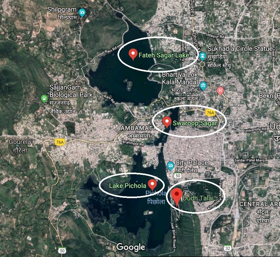
- Dudh Talai
- Lake Pichola
- Swaroop Sagar, and
- Fateh Sagar Lake
For this analysis, we accessed three different types of images through our system, namely:
ETCI (Enhanced True Color Image): These images are used to observe a satellite captured true color image (RGB) enhanced using our system with no further processing.
NDWI (Normalized Differential Water Index): These images are used to observe a color map image of the lake and the surrounding suburban area, providing a much better outlook of the current condition of water index which may not be easily observable by naked eye.
MNDWI (Masked Normalized Differential Water Index): These images are used so that we can see the water index masking of the lake on a true color satellite image.
The time period selected for this observation was a complete year, starting from January 2018 to December 2018.
ETCI Imagery
The enhanced true color images show us the lakes and the suburban region surrounding them. With these images even though we can figure out the regions where the lakes exist, but it is almost impossible to figure out how water in those lakes change with time. To better understand the imagery, let’s look at the Water index imagery of the same location for the same months.
NDWI Imagery
The NDWI images completely eliminate suburban area (dark maroon region) and the lakes are visible as dark orange regions in the images. More the saturation level of the orange color, the better the health of the lake. As we can see from the images, during the month of January, the lakes were completely healthy and the water index of all the four regions was pretty high. When we check the same region for the month of July, we see a sharp dimness in the same region, with Lake Pichola and Dudh Talai (The bottom orange region) taking the hardest hit, since these lakes show more dimness in the month of July. What this indicates is that the water level in these lakes went down sharply as compared to the water levels of January. This can be taken as an alarming condition since a few years back in the year of 2010, the same region faced extreme dryness in the lakes.
https://udaipurtimes.com/our-lakes-are-drying-what-are-you-doing/
During the month of December we can see that the water level is coming back up to the level of January and the cycle of lake water index level decreasing and increasing will continue again.
MNDWI Imagery
The MNDWI images give us a super-imposed image of ETCI and NDWI image. With these images, not only can we observes the water level index of the lakes/water bodies, but also how the suburban region surrounding them responded and changed during abrupt and abnormal decrease/increase in water levels.
We are still exploring different applications of the satellite imagery which anyone can access through our website: https://farmonaut.com/satellite-imagery or through our android app. We will keep posting every interesting findings which we come across.
Do you have an awesome idea for a landscape you think is worth exploring? Or are you looking for better resolution images for your work at affordable prices? Simply click on the link below and get a free trial. https://farmonaut.com/satellite-imagery
Famonaut aims to provide the best service and satisfy your needs. Not sure what to do? Contact us at [email protected].
We have some more interesting articles coming up soon. Stay tuned!
Wait!!
Before that…
Follow us at:
Facebook: https://facebook.com/farmonaut
Instagram: https://instagram.com/farmonaut
Twitter: https://twitter.com/farmonaut
LinkedIn: https://www.linkedin.com/company/farmonaut/
Pinterest: https://in.pinterest.com/farmonaut/
Tumblr: https://farmonaut.tumblr.com/
Youtube: https://www.youtube.com/channel/UCYWOOPPKATLgh4L6YRlYFOQ
AppLink: https://play.google.com/store/apps/details?id=com.farmonaut.android
Website: https://farmonaut.com
Satellite Imagery: https://farmonaut.com/satellite-imagery
Satellite Imagery Samples: https://farmonaut.com/satellite-imagery-samples