Revolutionize Farming with Farmonaut’s Precision Agriculture API: Harness Satellite Data for Optimal Crop Management

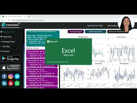
“Farmonaut’s Precision Agriculture API can provide historical rainfall data and weather forecasts for any given geographic coordinates.”
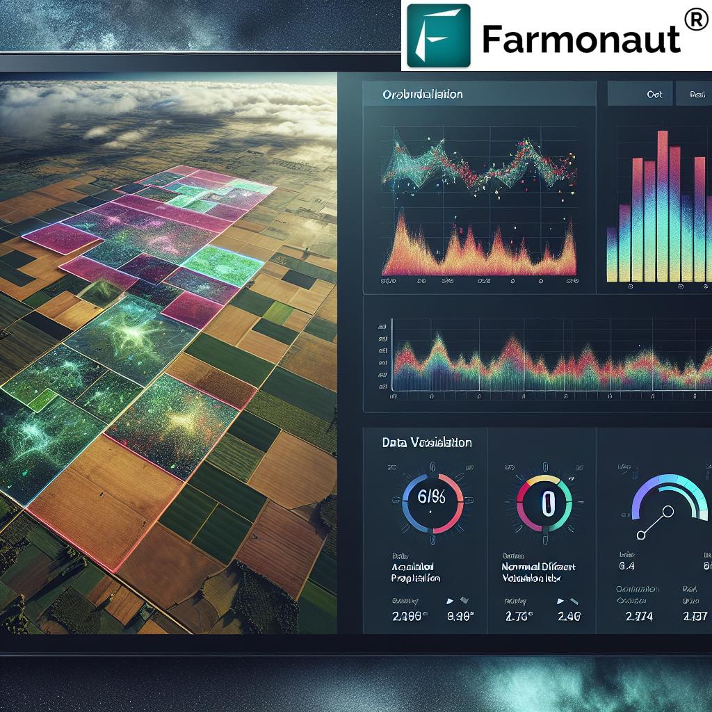
In the ever-evolving landscape of modern agriculture, precision and data-driven decision-making have become paramount. We at Farmonaut are at the forefront of this agricultural revolution, offering cutting-edge solutions that harness the power of satellite technology and advanced data analytics. Our Precision Agriculture API is designed to transform the way farmers manage their crops, providing unprecedented access to crucial agricultural weather data and empowering them with the tools needed for optimal crop management.
In this comprehensive guide, we’ll explore how Farmonaut’s innovative Accumulated Precipitation API and other precision agriculture technologies are revolutionizing farming practices. We’ll delve into the intricacies of leveraging satellite imagery for agriculture, the importance of historical rainfall data, and the game-changing potential of advanced weather forecasting for farmers. Whether you’re a small-scale farmer looking to optimize your yields or a large agribusiness seeking to enhance your operations, this article will provide valuable insights into the world of data-driven agriculture.
The Power of Precision Agriculture Technology
Precision agriculture is transforming the farming industry by enabling more efficient use of resources, improving crop yields, and reducing environmental impact. At the heart of this transformation lies the ability to collect, analyze, and act upon detailed, location-specific data. This is where Farmonaut’s Precision Agriculture API comes into play, offering a suite of tools that bring the power of satellite-based monitoring and advanced analytics to farms of all sizes.
Key Components of Farmonaut’s Precision Agriculture API
- Accumulated Precipitation Data
- Historical Rainfall Analysis
- Advanced Weather Forecasting
- Soil Moisture Monitoring
- UV Index Information
- NDVI (Normalized Difference Vegetation Index) Analysis
- Polygon Mapping for Field Management
Each of these components plays a crucial role in providing farmers with the insights they need to make informed decisions about their crops. Let’s explore how these features work together to create a comprehensive agricultural decision support system.
Harnessing Satellite Data for Agricultural Insights
Satellite imagery has revolutionized many industries, and agriculture is no exception. By leveraging remote sensing technology, we can now gather vast amounts of data about crop health, soil conditions, and weather patterns without setting foot in the field. This capability is at the core of Farmonaut’s offerings.
The Role of Satellite Imagery in Modern Farming
Satellite-based monitoring offers several advantages over traditional on-ground methods:
- Wide Coverage: Satellites can capture data over large areas quickly and efficiently.
- Frequent Updates: Regular satellite passes provide up-to-date information.
- Non-Invasive: Data collection doesn’t disturb crops or soil.
- Consistent Methodology: Standardized data collection ensures comparability over time and across regions.
Our API harnesses this power, providing farmers with access to a wealth of satellite-derived data that can inform critical farming decisions.
The Accumulated Precipitation API: A Game-Changer for Crop Management
One of the most crucial aspects of successful farming is understanding and managing water resources. Farmonaut’s Accumulated Precipitation API is designed to provide farmers with detailed insights into rainfall patterns, both historical and forecasted.
How the Accumulated Precipitation API Works
The API allows users to retrieve precipitation data for specific locations and time periods by simply inputting geographic coordinates and date ranges. The response includes:
- Total accumulated precipitation for the specified period
- Daily breakdown of precipitation levels
- Statistical analysis of rainfall patterns
This information is invaluable for various aspects of crop management, from planning irrigation schedules to making decisions about planting and harvesting times.
Benefits of Historical Rainfall Data
Access to historical rainfall data allows farmers to:
- Identify long-term trends in precipitation patterns
- Make informed decisions about crop selection based on typical rainfall in their area
- Plan water management strategies more effectively
- Assess the potential impact of climate change on their operations
By combining historical data with real-time monitoring and forecasts, farmers can develop a comprehensive understanding of their local climate conditions.
Advanced Weather Forecasting for Farmers
While historical data provides valuable context, accurate weather forecasts are essential for day-to-day decision-making on the farm. Farmonaut’s API integrates advanced weather forecasting capabilities to help farmers prepare for upcoming conditions.
Key Features of Our Weather Forecasting System
- Short-term and long-term precipitation forecasts
- Temperature predictions
- Wind speed and direction forecasts
- Humidity level estimates
These forecasts enable farmers to plan activities such as planting, fertilizer application, and harvesting with greater precision, minimizing waste and maximizing efficiency.
Soil Moisture Monitoring: The Key to Optimal Irrigation
Proper irrigation is critical for crop health and yield optimization. Our API provides valuable soil moisture data derived from satellite observations, helping farmers maintain ideal soil conditions for their crops.
Benefits of Satellite-Based Soil Moisture Monitoring
- Reduce water waste through more efficient irrigation
- Prevent over-watering and associated issues like root rot
- Optimize fertilizer application based on soil moisture levels
- Improve crop resilience to drought conditions
By integrating soil moisture data with precipitation information and weather forecasts, farmers can develop highly efficient irrigation strategies tailored to their specific crops and local conditions.
“The API offers accumulated precipitation measurements, soil moisture data, and UV index information for specific locations and date ranges.”
UV Index Monitoring for Crop Protection
Excessive UV radiation can be harmful to many crops, potentially causing sunburn, reduced photosynthesis, and other issues. Farmonaut’s API includes UV index monitoring to help farmers protect their crops from these risks.
Applications of UV Index Data in Agriculture
- Timing the application of protective sprays or films
- Planning shade provision for sensitive crops
- Adjusting harvesting schedules to minimize UV exposure
- Selecting UV-resistant crop varieties for high-risk areas
By incorporating UV index data into their decision-making processes, farmers can better protect their crops and maintain optimal growing conditions.
NDVI Analysis: A Window into Crop Health
The Normalized Difference Vegetation Index (NDVI) is a powerful tool for assessing crop health and vigor. Farmonaut’s API provides NDVI data derived from satellite imagery, offering farmers a bird’s-eye view of their fields’ condition.
Understanding NDVI in Agriculture
NDVI is calculated based on the reflectance of near-infrared and red light from vegetation. Healthy plants reflect more near-infrared light and less visible light compared to stressed plants. This difference allows us to quantify vegetation health and density.
Applications of NDVI in Crop Management
- Early detection of crop stress or disease outbreaks
- Monitoring crop growth stages
- Identifying areas of poor plant establishment
- Assessing the effectiveness of different management practices
By regularly analyzing NDVI data, farmers can quickly identify and address issues in their fields, leading to improved crop health and yields.
Polygon Mapping: Precision Field Management
Farmonaut’s API includes powerful polygon mapping capabilities, allowing farmers to define and analyze specific areas within their fields with high precision.
Benefits of Polygon Mapping in Agriculture
- Create custom management zones within fields
- Analyze crop performance in different areas
- Plan variable rate applications of inputs
- Track changes in field boundaries or crop rotations
This feature enables highly targeted management practices, optimizing resource use and potentially increasing overall farm profitability.
Integrating Farmonaut’s API into Agricultural Decision Support Systems
The true power of Farmonaut’s Precision Agriculture API lies in its ability to be integrated into broader agricultural decision support systems. By combining our satellite-derived data with on-ground sensors, farm management software, and other tools, farmers can create comprehensive systems for optimizing their operations.
Potential Applications
- Automated irrigation systems that adjust based on soil moisture, weather forecasts, and crop needs
- Precision fertilizer application systems that consider soil conditions, crop health, and weather patterns
- Pest and disease management tools that use NDVI and weather data to predict and prevent outbreaks
- Yield prediction models that incorporate historical data, current conditions, and forecasts
The possibilities for innovation in this space are vast, and we’re excited to see how farmers and agricultural technology developers leverage our API to create new solutions.

Comparison of Farmonaut’s Precision Agriculture API Features
| Feature | Description | Benefits | Applications in Farming |
|---|---|---|---|
| Accumulated Precipitation Data | Historical and current rainfall measurements | Improved water management | Irrigation planning, flood risk assessment |
| Historical Rainfall Analysis | Long-term precipitation trends and patterns | Better long-term planning | Crop selection, infrastructure development |
| Weather Forecasting | Short and long-term weather predictions | Proactive farm management | Timing of planting, harvesting, and other activities |
| Soil Moisture Information | Satellite-derived soil moisture levels | Optimized irrigation | Precision watering, drought mitigation |
| UV Index Monitoring | Measurement of UV radiation levels | Enhanced crop protection | Timing of protective measures, variety selection |
| NDVI Analysis | Vegetation health and density assessment | Early problem detection | Crop health monitoring, yield prediction |
| Polygon Mapping | Custom field boundary and zone definition | Precise field management | Variable rate applications, targeted interventions |
Getting Started with Farmonaut’s Precision Agriculture API
Integrating our API into your agricultural operations or software solutions is straightforward. Here’s a quick guide to get you started:
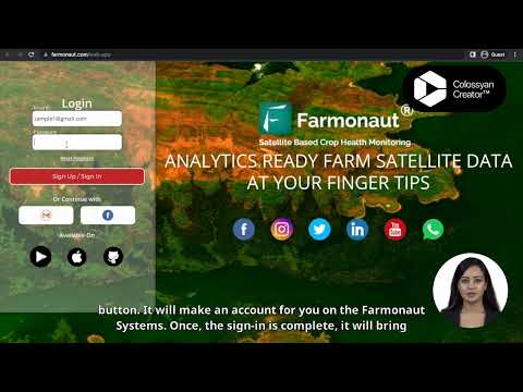
- Sign up for an API key at our API portal
- Review our comprehensive API documentation
- Test the API endpoints using our sandbox environment
- Integrate the API calls into your applications or systems
- Monitor your usage and scale your subscription as needed
Our team is always available to provide support and guidance as you implement our API into your solutions.
The Future of Precision Agriculture
As technology continues to advance, the potential for precision agriculture to transform farming practices is immense. We at Farmonaut are committed to staying at the forefront of these developments, continuously improving our API and expanding our offerings to meet the evolving needs of farmers worldwide.
Emerging Trends in Agtech
- Integration of AI and machine learning for predictive analytics
- Increased use of IoT devices for real-time data collection
- Development of autonomous farm equipment guided by satellite data
- Enhanced data visualization tools for easier interpretation of complex datasets
As these technologies mature, they will open up new possibilities for precision agriculture, further enhancing the value of satellite-derived data in farm management.
Conclusion: Embracing Data-Driven Agriculture
The agricultural industry stands on the brink of a data-driven revolution, and Farmonaut’s Precision Agriculture API is at the forefront of this transformation. By harnessing the power of satellite imagery, advanced weather forecasting, and sophisticated data analytics, we’re empowering farmers to make more informed decisions, optimize their resource use, and ultimately increase their yields and profitability.
From small family farms to large agricultural enterprises, the benefits of precision agriculture are accessible to all through our API. As we continue to innovate and expand our offerings, we invite you to join us in shaping the future of farming – a future where data-driven insights lead to more sustainable, efficient, and productive agricultural practices worldwide.
Ready to revolutionize your farming practices? Explore Farmonaut’s Precision Agriculture API today and take the first step towards a more data-driven approach to crop management.
Frequently Asked Questions (FAQ)
1. What is Farmonaut’s Precision Agriculture API?
Farmonaut’s Precision Agriculture API is a comprehensive set of tools that provide satellite-derived agricultural data, including accumulated precipitation, weather forecasts, soil moisture information, UV index, NDVI analysis, and polygon mapping capabilities. It’s designed to help farmers make data-driven decisions for optimal crop management.
2. How accurate is the satellite data provided by Farmonaut?
Our satellite data is highly accurate, derived from advanced remote sensing technologies. However, like all satellite-based systems, accuracy can vary slightly depending on factors such as cloud cover and satellite pass frequency. We continuously work to improve our data processing algorithms to ensure the highest possible accuracy.
3. Can Farmonaut’s API be integrated with existing farm management software?
Yes, our API is designed to be easily integrated with a wide range of farm management software and systems. We provide comprehensive documentation and support to assist with integration efforts.
4. How often is the data updated?
Data update frequency varies depending on the specific dataset. Weather forecasts are typically updated multiple times daily, while satellite imagery-based data like NDVI may be updated every few days, depending on satellite pass frequency and cloud cover.
5. Is Farmonaut’s API suitable for small-scale farmers?
Absolutely! Our API is designed to be scalable and accessible to farms of all sizes. We offer various subscription tiers to meet the needs of different users, from small family farms to large agricultural enterprises.
6. How can I get started with Farmonaut’s Precision Agriculture API?
To get started, visit our API portal at https://sat.farmonaut.com/api to sign up for an API key. You can then review our documentation and begin integrating our data into your systems.
7. Does Farmonaut offer customer support for API users?
Yes, we provide comprehensive customer support to all our API users. This includes technical documentation, integration assistance, and ongoing support to help you make the most of our precision agriculture tools.


