Revolutionizing Banana Farm Mapping in West Bengal: A Deep Dive into Crop Area Estimation Using Advanced GIS and Remote Sensing Technologies

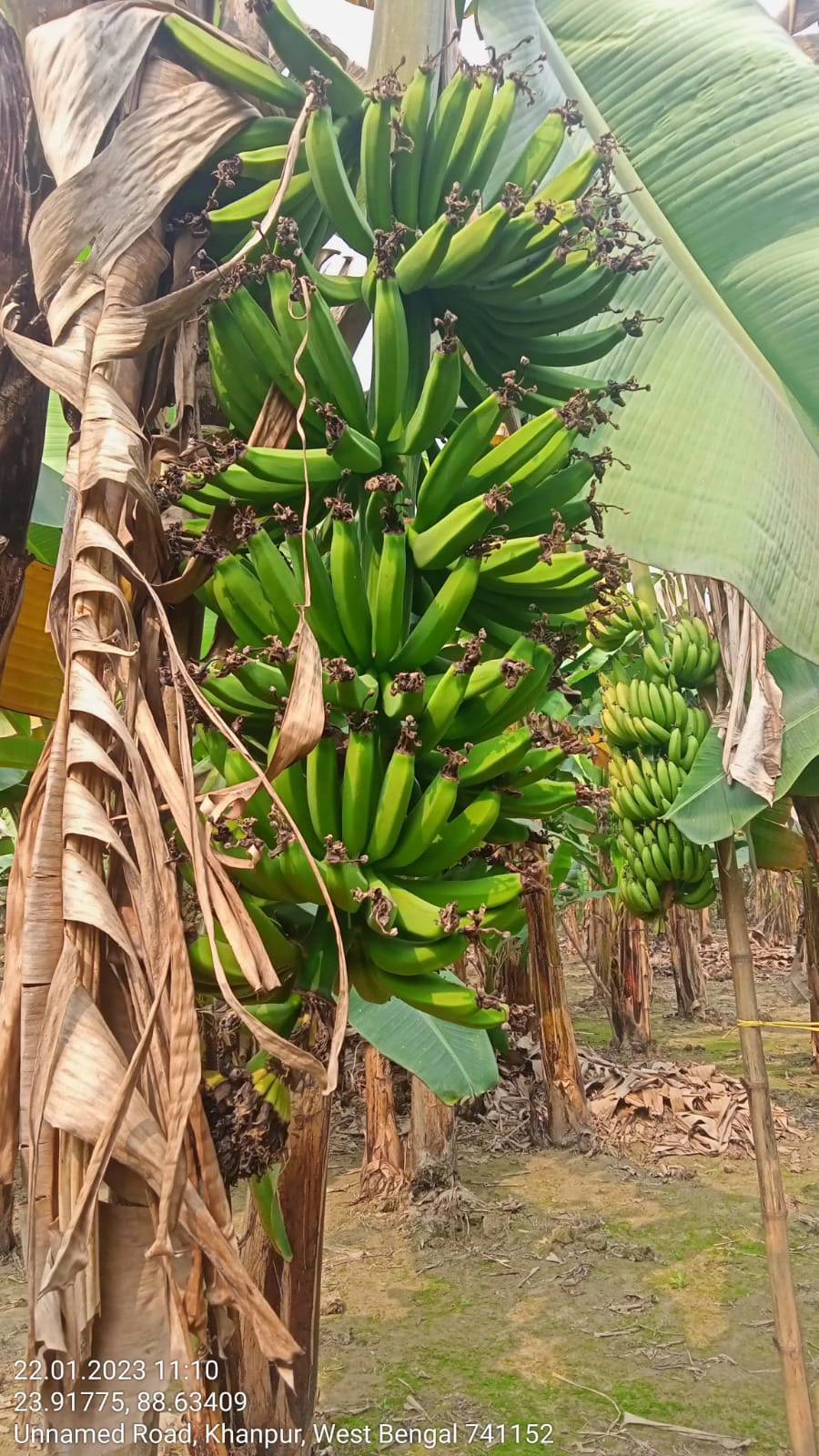
At Farmonaut, we’re excited to share our latest endeavor in the realm of precision agriculture. We’re currently engaged in an extensive banana farm mapping project in West Bengal, leveraging cutting-edge GIS and remote sensing technologies. This initiative is not just about mapping; it’s about revolutionizing how we estimate crop areas and ultimately, how we approach farming in the 21st century.
The Importance of Banana Farming in West Bengal
Banana cultivation plays a crucial role in West Bengal’s agricultural landscape. As one of the state’s primary fruit crops, bananas contribute significantly to both the local economy and food security. Understanding the extent and health of banana plantations is vital for:
- Accurate crop yield predictions
- Efficient resource allocation
- Targeted agricultural interventions
- Informed policy-making
This is where our advanced mapping and estimation techniques come into play.
Crop Mapping Using Remote Sensing: A Game-Changer
Remote sensing has revolutionized the way we approach crop mapping. At Farmonaut, we utilize state-of-the-art satellite imagery and advanced algorithms to create detailed, accurate maps of banana plantations across West Bengal. Here’s how our process works:
- Data Acquisition: We collect high-resolution satellite images of the target areas.
- Image Processing: Our team applies sophisticated image processing techniques to enhance the quality and usability of the satellite data.
- Spectral Analysis: We analyze the spectral signatures of different land cover types to identify banana plantations accurately.
- Machine Learning Classification: Employing machine learning algorithms, we classify the images to distinguish banana crops from other vegetation.
- Ground Truth Verification: We conduct field visits to verify the accuracy of our remote sensing data.
This comprehensive approach allows us to create highly accurate maps of banana plantations, providing invaluable insights for farmers, agricultural planners, and policymakers.
The Role of GIS in Agricultural Mapping
Geographic Information Systems (GIS) play a pivotal role in our banana farm mapping project. GIS allows us to:
- Integrate various data sources, including satellite imagery, soil maps, and topographic data
- Perform spatial analysis to identify patterns and trends in banana cultivation
- Create interactive maps that stakeholders can easily use and understand
- Track changes in banana plantation areas over time
By leveraging GIS technology, we’re able to provide a comprehensive view of banana farming in West Bengal, enabling better decision-making at all levels.
Crop Area Estimation: Precision Through Technology
One of the primary objectives of our banana farm mapping project is accurate crop area estimation. This is crucial for various reasons:
- Yield Forecasting: Accurate area estimates lead to more precise yield predictions.
- Resource Planning: Knowing the exact area under cultivation helps in planning irrigation, fertilizer, and pesticide requirements.
- Policy Formulation: Government agencies can use this data to formulate targeted agricultural policies.
- Market Analysis: Traders and exporters can make informed decisions based on reliable production estimates.
Our crop area estimation process involves:
- Satellite Data Analysis: We use multi-temporal satellite imagery to track the growth and extent of banana plantations.
- Advanced Algorithms: Our proprietary algorithms process the satellite data to calculate precise area measurements.
- Machine Learning Models: We employ machine learning models trained on historical data to improve estimation accuracy.
- Field Validation: Regular ground surveys ensure the reliability of our satellite-based estimates.
This multi-faceted approach allows us to achieve unprecedented accuracy in crop area estimation, often surpassing traditional survey methods.
The Power of Satellite Imagery in Farming
Satellite imagery has become an indispensable tool in modern agriculture, and our banana farm mapping project in West Bengal is a prime example of its potential. Here’s how satellite imagery is transforming farming:
- Wide Coverage: Satellites can cover vast areas quickly, making them ideal for large-scale mapping projects.
- Regular Monitoring: Frequent revisit times of satellites allow for continuous monitoring of crop growth and health.
- Multispectral Insights: Satellites capture data across various spectral bands, revealing information invisible to the naked eye.
- Cost-Effective: Compared to traditional surveying methods, satellite imagery provides a more cost-effective solution for large-area mapping.
- Historical Data: Access to historical satellite imagery allows for trend analysis and change detection over time.
At Farmonaut, we harness the full potential of satellite imagery to provide our clients with actionable insights for improved agricultural management.
Farmonaut’s Approach to GIS and Remote Sensing Services for Agriculture
Our banana farm mapping project in West Bengal showcases Farmonaut’s comprehensive approach to providing GIS and remote sensing services for agriculture. Here’s what sets us apart:
- Cutting-Edge Technology: We utilize the latest advancements in satellite technology, machine learning, and GIS to deliver accurate and timely results.
- Customized Solutions: Our services are tailored to meet the specific needs of each client, whether it’s a small-scale farmer or a large agricultural corporation.
- User-Friendly Interfaces: We present complex data in easily understandable formats through our intuitive web and mobile applications.
- Real-Time Updates: Our systems provide near-real-time updates on crop health and growth, enabling timely interventions.
- Integration Capabilities: Our solutions can be seamlessly integrated with existing farm management systems for enhanced functionality.
To experience the power of our GIS and remote sensing services, visit our Farmonaut app or explore our API services.
Comparing Farmonaut’s Satellite System with Drone and IoT-Based Farm Monitoring
| Feature | Farmonaut Satellite System | Drone-Based Monitoring | IoT-Based Monitoring |
|---|---|---|---|
| Coverage Area | Large (Thousands of hectares) | Medium (Hundreds of hectares) | Small (Tens of hectares) |
| Frequency of Data Collection | Daily to weekly | On-demand | Continuous |
| Initial Setup Cost | Low | High | Medium |
| Operational Complexity | Low | High | Medium |
| Data Processing Time | Fast | Medium | Fast |
| Weather Dependency | Low | High | Low |
| Scalability | High | Medium | Low |
As evident from the comparison, Farmonaut’s satellite-based system offers unparalleled advantages in terms of coverage, cost-effectiveness, and scalability, making it the ideal choice for large-scale agricultural monitoring and mapping projects like our banana farm mapping initiative in West Bengal.
The Future of Banana Farming in West Bengal
Our banana farm mapping project is just the beginning of a new era in West Bengal’s agricultural sector. By providing accurate, up-to-date information on banana plantations, we’re enabling:
- More efficient resource allocation
- Targeted interventions for pest and disease control
- Improved yield predictions
- Better market planning for banana producers
- Enhanced policy-making for agricultural development
As we continue to refine our techniques and expand our coverage, we envision a future where every banana farmer in West Bengal has access to the benefits of precision agriculture, regardless of the size of their operation.
Expanding Beyond Banana Farming
While our current focus is on banana farm mapping in West Bengal, the techniques and technologies we’re employing have wide-ranging applications across various crops and regions. In the future, we plan to expand our mapping and estimation services to cover:
- Other fruit crops like mangoes, litchis, and pineapples
- Staple crops such as rice, wheat, and maize
- Cash crops including tea, jute, and oilseeds
This expansion will contribute to a more comprehensive understanding of West Bengal’s agricultural landscape, facilitating better planning and management at both the farm and policy levels.
Empowering Farmers with Technology
At Farmonaut, we believe that technology should empower farmers, not complicate their lives. That’s why we’ve designed our solutions to be user-friendly and accessible. Here’s how farmers can benefit from our technology:
- Mobile App Access: Our Android and iOS apps provide easy access to farm mapping and monitoring tools.
- Real-Time Alerts: Farmers receive timely notifications about crop health issues, weather risks, and optimal harvesting times.
- Decision Support: Our AI-powered system offers personalized recommendations for crop management.
- Historical Analysis: Farmers can track their farm’s performance over time, enabling data-driven decision-making.
By putting powerful tools in the hands of farmers, we’re democratizing access to precision agriculture and helping to create a more sustainable and productive agricultural sector.
Collaboration and Partnerships
Our banana farm mapping project in West Bengal is not just about technology; it’s about collaboration. We’re working closely with:
- Local agricultural universities and research institutions
- Government agricultural departments
- Farmer cooperatives and associations
- Agri-tech startups and established agricultural companies
These partnerships ensure that our technology addresses real-world needs and contributes to the overall development of the agricultural sector in West Bengal.
The Road Ahead
As we continue our banana farm mapping project in West Bengal, we’re excited about the possibilities that lie ahead. Our vision extends beyond just mapping; we aim to create a comprehensive agricultural intelligence platform that will:
- Provide real-time insights into crop health and yield potential
- Offer predictive analytics for pest and disease outbreaks
- Facilitate better market linkages for farmers
- Support sustainable farming practices through targeted recommendations
- Enable precision agriculture at scale, even for small and marginal farmers
We invite farmers, agricultural experts, policymakers, and technology enthusiasts to join us on this exciting journey. Together, we can transform agriculture in West Bengal and beyond, ensuring food security, improving farmer livelihoods, and promoting sustainable farming practices.
Get Involved with Farmonaut
Are you interested in leveraging our advanced GIS and remote sensing technologies for your agricultural projects? Here’s how you can get started:
- Download our mobile app: Android | iOS
- Explore our API services: Farmonaut API
- Check out our developer documentation: API Documentation
For those ready to take their farming to the next level, we offer various subscription plans tailored to different needs and farm sizes:
Conclusion
Our banana farm mapping project in West Bengal represents a significant step forward in the application of GIS and remote sensing technologies in agriculture. By providing accurate, timely, and actionable insights, we’re not just mapping farms; we’re paving the way for a more efficient, productive, and sustainable agricultural future.
As we continue to refine our techniques and expand our coverage, we remain committed to our mission of making precision agriculture accessible to farmers of all scales. The future of farming is here, and it’s powered by data, driven by technology, and focused on sustainability.
Join us in this agricultural revolution. Together, we can cultivate a brighter future for farmers in West Bengal and beyond.
FAQs
Q: How accurate is satellite-based crop mapping compared to traditional methods?
A: Satellite-based crop mapping can achieve accuracy levels of up to 95% or higher, often surpassing traditional ground-based survey methods, especially for large areas.
Q: Can small-scale farmers benefit from Farmonaut’s technology?
A: Absolutely! Our solutions are scalable and designed to be accessible to farmers of all sizes, from small holdings to large plantations.
Q: How often is the satellite data updated?
A: Depending on the specific satellite and service plan, data can be updated daily to weekly, ensuring timely insights for farmers.
Q: Is internet connectivity required to use Farmonaut’s services?
A: While an internet connection enhances the real-time capabilities of our services, we also offer offline functionalities to ensure farmers can access critical information even in areas with limited connectivity.
Q: How does Farmonaut ensure the privacy and security of farm data?
A: We employ state-of-the-art encryption and data protection measures to ensure the confidentiality and security of all user data. Our systems comply with international data protection standards.
Q: Can Farmonaut’s technology be used for crops other than bananas?
A: Yes, our technology is adaptable and can be applied to a wide range of crops, including grains, fruits, vegetables, and cash crops.
We hope this comprehensive overview has provided valuable insights into our banana farm mapping project in West Bengal and the transformative potential of GIS and remote sensing technologies in agriculture. For more information or to start your journey with Farmonaut, visit our website or contact our team today. Let’s cultivate a smarter, more sustainable future together!
