Revolutionizing Crop Area Estimation: Farmonaut’s Breakthrough Technology

In the ever-evolving landscape of agricultural technology, we at Farmonaut were thrilled to announce a groundbreaking advancement in crop area estimation. Our innovative system has redefined the way farmers, agronomists, and policymakers approach this crucial aspect of agricultural planning and management. In this comprehensive blog post, we’ll delve into the intricacies of our new technology, its wide-ranging applications, and the transformative impact it’s having on the agricultural sector.
The Challenge of Crop Area Estimation
Accurate crop area estimation has long been a challenge in agriculture. Traditional methods often involve time-consuming field surveys, which can be labor-intensive, costly, and prone to human error. Moreover, these methods struggle to keep pace with the rapid changes in cropping patterns and the vast scale of modern agriculture.
The need for a more efficient, accurate, and scalable solution has been apparent for years. This is where Farmonaut’s breakthrough technology comes into play, leveraging the power of satellite imagery and advanced algorithms to revolutionize the field of crop area estimation.
Farmonaut’s Innovative Approach
At Farmonaut, we’ve developed a cutting-edge system that makes crop area estimation super easy, quick, automated, and highly scalable. Our technology utilizes state-of-the-art satellite images of agricultural land combined with sophisticated machine learning algorithms to provide accurate and timely crop area estimates.
Key Features of Our Crop Area Estimation Technology:
- Global Coverage: Our system can estimate crops and their sown area from anywhere around the world.
- Web-Based Platform: Users can access our crop area estimation tools directly through our web platform, eliminating the need for specialized software or hardware.
- High Accuracy: Our algorithms have been fine-tuned to provide highly accurate estimates across various crop types and geographies.
- Rapid Results: Unlike traditional methods that can take weeks or months, our system provides results in a matter of days or even hours.
- Scalability: Whether you’re looking at a single field or an entire region, our technology scales effortlessly to meet your needs.
Real-World Applications and Success Stories
Our crop area estimation technology has already been put to the test in various real-world scenarios, demonstrating its effectiveness and versatility. Here are some of our recent success stories:
Cotton Area Estimation in Maharashtra
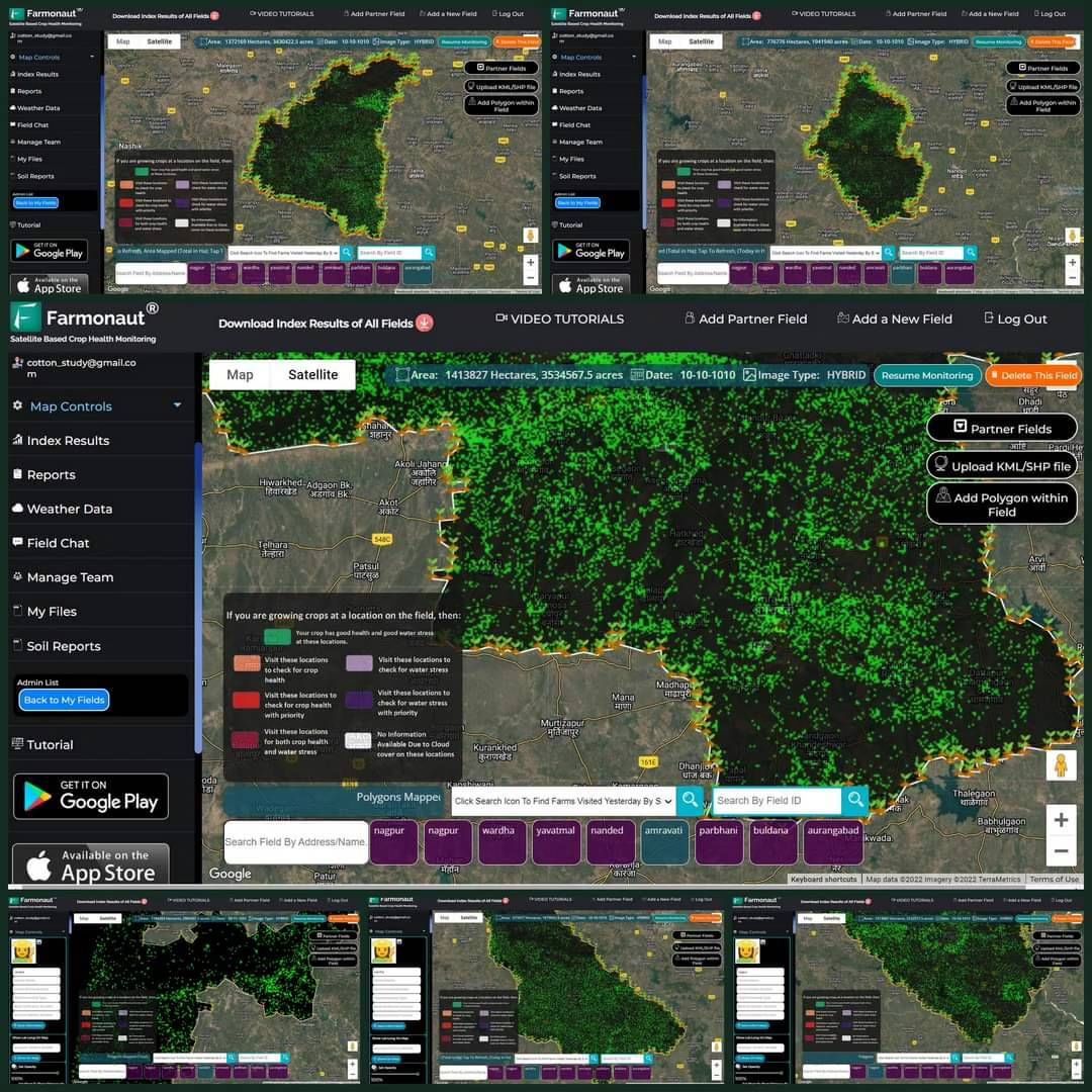
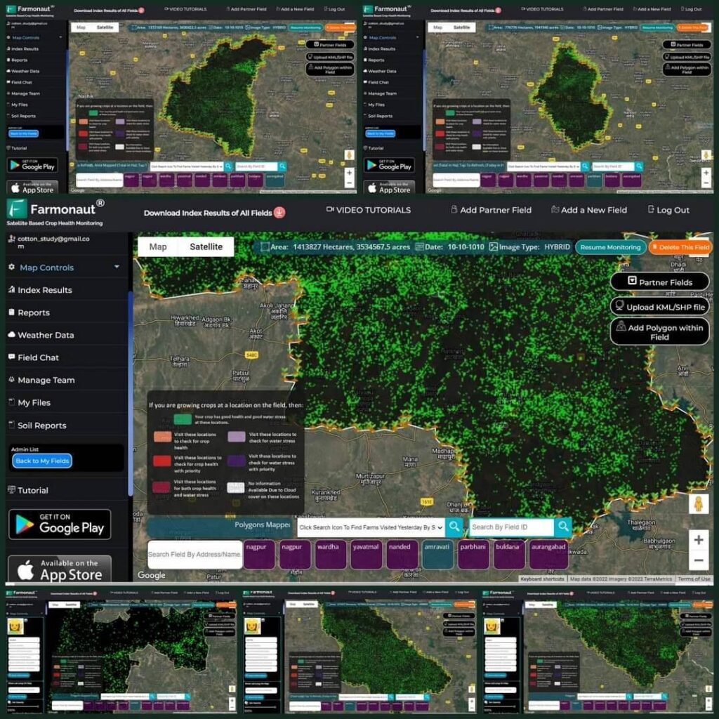
We’ve successfully estimated Cotton Area in multiple districts of Maharashtra during the ongoing season, including:
- Aurangabad
- Wardha
- Amravati
- Parbhani
- Nanded
- Nagpur
Our estimates have shown remarkably high accuracy, providing valuable insights into the cotton cultivation patterns across these regions.
Paddy Area Estimation in Madhya Pradesh and Bihar
Our system has also been employed to estimate paddy areas in several districts of Madhya Pradesh and Bihar. This application demonstrates the versatility of our technology across different crop types and geographical regions.
International Recognition
The effectiveness of our crop area estimation technology has not gone unnoticed. We’ve already received numerous requests for crop area estimation from various international locations, highlighting the global demand for such advanced agricultural solutions.
The Technology Behind the Breakthrough
Our crop area estimation technology is built on a foundation of advanced remote crop monitoring solutions and sophisticated data analysis techniques. Here’s a closer look at the key components that make our system so effective:
1. High-Resolution Satellite Imagery
We utilize the latest satellite images of agricultural land from multiple sources, including:
- Sentinel-2
- Landsat-8
- Planet Labs
These satellites provide us with high-resolution, multispectral imagery that allows for detailed analysis of crop patterns and land use.
2. Advanced Machine Learning Algorithms
Our proprietary algorithms leverage the power of machine learning and artificial intelligence to analyze the satellite imagery. These algorithms are trained on vast datasets of known crop patterns, allowing them to accurately identify and classify different crop types across diverse landscapes.
3. Temporal Analysis
By analyzing satellite images taken over time, our system can track changes in vegetation patterns throughout the growing season. This temporal analysis is crucial for accurately distinguishing between different crop types and estimating their respective areas.
4. Integration of Auxiliary Data
To further enhance accuracy, our system integrates various auxiliary data sources, including:
- Historical crop data
- Weather patterns
- Soil types
- Topographical information
This holistic approach allows for more nuanced and accurate crop area estimations.
Advantages Over Traditional Methods
Our satellite-based crop area estimation technology offers several significant advantages over traditional methods:
| Feature | Farmonaut Satellite System | Drone-based Monitoring | IoT-based Monitoring |
|---|---|---|---|
| Coverage Area | Global | Limited by flight range | Limited to sensor placement |
| Data Collection Frequency | Daily to weekly | As per flight schedule | Continuous |
| Initial Setup Cost | Low | High | Medium to High |
| Operational Complexity | Low | High | Medium |
| Data Processing Time | Fast | Medium | Fast |
| Scalability | Highly Scalable | Limited Scalability | Moderate Scalability |
| Weather Dependency | Low | High | Low |
| Regulatory Compliance | Simple | Complex | Moderate |
Applications Across the Agricultural Sector
The implications of our crop area estimation technology extend far beyond mere acreage calculations. Here are some of the key applications and benefits for various stakeholders in the agricultural sector:
For Farmers and Agribusinesses
- Crop Planning: Accurate area estimates help in better planning for inputs, labor, and machinery.
- Yield Forecasting: When combined with other data, area estimates improve yield predictions..
- Market Intelligence: Helps in understanding supply trends and potential market prices.
For Government and Policymakers
- Agricultural Policy Formulation: Accurate crop area data informs better policy decisions.
- Subsidy Distribution: Ensures fair and efficient distribution of agricultural subsidies.
- Food Security Planning: Helps in assessing food production capabilities and needs.
- Environmental Monitoring: Tracks changes in land use and crop patterns over time.
For Researchers and Academics
- Agricultural Studies: Provides valuable data for various agricultural research projects.
- Climate Change Impact Assessment: Helps in studying the effects of climate change on crop patterns.
- Land Use Analysis: Facilitates studies on changing land use patterns over time.
For Agri-tech Companies
- Product Development: Informs the development of tailored agricultural solutions.
- Market Analysis: Helps in identifying potential markets for agri-tech products and services.
- Integration with Other Technologies: Can be combined with other agri-tech solutions for comprehensive farm management.
The Future of Crop Area Estimation with Farmonaut
As we continue to refine and expand our crop area estimation technology, we envision a future where accurate, real-time crop data is available at the fingertips of every stakeholder in the agricultural sector. Here’s a glimpse into what we’re working on:
1. Enhanced Crop Identification
We’re continuously improving our crop identification using satellite images capabilities. Our goal is to be able to distinguish between an even wider variety of crop types with even greater accuracy.
2. Integration with Climate Models
By integrating our crop area estimates with advanced climate models, we aim to provide more accurate predictions of how changing weather patterns might affect crop distributions in the future.
3. Real-time Monitoring
We’re working towards providing near real-time updates on crop area changes, allowing for more dynamic and responsive agricultural planning.
4. Expansion of Global Coverage
While our system already offers global coverage, we’re continually expanding our database and refining our algorithms to provide even more accurate results across diverse agricultural landscapes worldwide.
5. Integration with Other Farmonaut Services
We’re working on seamlessly integrating our crop area estimation technology with our other services, such as our AI-powered advisory system and blockchain-based traceability solutions, to provide a comprehensive suite of agricultural management tools.
How to Access Farmonaut’s Crop Area Estimation Technology
We’ve made it easy for various stakeholders to access and benefit from our crop area estimation technology. Here are the primary ways you can leverage our innovative solution:
1. Farmonaut Web Platform
Our web-based platform provides a user-friendly interface for accessing our crop area estimation tools. Simply visit our platform to get started.
2. Mobile Applications
For on-the-go access, download our mobile applications:
3. API Integration
For developers and businesses looking to integrate our crop area estimation capabilities into their own systems, we offer robust API solutions. Check out our API documentation for more information.
4. Custom Solutions
For large-scale projects or specialized requirements, we offer custom solutions tailored to your specific needs. Contact our team to discuss your requirements.
Pricing and Subscription Options
We offer flexible pricing tiers to suit various needs and scales of operation. Here’s our current pricing table:
Frequently Asked Questions (FAQ)
Q: How accurate is Farmonaut’s crop area estimation technology?
A: Our technology has demonstrated high accuracy rates across various crop types and regions. While exact accuracy can vary depending on factors such as crop type and local conditions, we consistently achieve accuracy levels above 90% in most scenarios.
Q: How often is the crop area data updated?
A: The frequency of updates depends on the satellite revisit times and cloud cover conditions. Typically, we can provide updates every 5-10 days, but this can vary based on specific location and weather conditions.
Q: Can your system distinguish between different crop types?
A: Yes, our advanced algorithms are capable of distinguishing between various crop types. We continuously expand and refine our crop identification capabilities.
Q: Is your technology suitable for small-scale farmers?
A: Absolutely! Our technology is scalable and can be used for farms of all sizes, from small holdings to large agricultural operations.
Q: How does your system handle cloud cover?
A: We use a combination of techniques to mitigate the impact of cloud cover, including using imagery from multiple dates and employing advanced cloud-masking algorithms.
Q: How does your system compare to drone-based crop monitoring?
A: While drones can provide very high-resolution imagery, our satellite-based system offers advantages in terms of coverage area, cost-effectiveness, and ease of use, especially for large-scale applications.
Q: Is training required to use your crop area estimation tools?
A: Our tools are designed to be user-friendly, but we do offer training and support to ensure you can make the most of our technology. Detailed documentation and tutorials are also available.
Q: Can your system be integrated with other farm management software?
A: Yes, we offer API access that allows for integration with various farm management systems. Check our API documentation for more details.
Q: How do you ensure the privacy and security of farm data?
A: We take data privacy and security very seriously. All data is encrypted and stored securely, and we adhere to strict privacy policies to protect our users’ information.
Conclusion: Empowering Agriculture Through Innovation
At Farmonaut, we’re committed to pushing the boundaries of what’s possible in agricultural technology. Our breakthrough in crop area estimation is just one example of how we’re working to make precision agriculture more accessible, efficient, and effective for farmers and agricultural stakeholders worldwide.
By leveraging the power of satellite imagery, advanced algorithms, and user-friendly platforms, we’re not just providing a tool – we’re offering a transformative solution that has the potential to revolutionize agricultural planning and management on a global scale.
As we continue to innovate and expand our services, we invite you to join us on this exciting journey. Whether you’re a small-scale farmer, a large agribusiness, a government agency, or a researcher, our crop area estimation technology has something to offer you.
Ready to experience the future of crop area estimation? Visit our platform to get started, or contact us at [email protected] or +91-6366026267 for more information.
Together, let’s cultivate a smarter, more sustainable future for agriculture.
Happy Farming!
