Revolutionizing Pipeline Safety: How Satellite Imagery Detects Brine Leaks in Houston Before They Become Visible
“Satellite imagery can detect pipeline brine leaks within days, significantly faster than traditional ground-based monitoring methods.”
In the ever-evolving landscape of environmental protection and infrastructure management, we at Farmonaut are proud to be at the forefront of innovation. Our recent project with Boardwalk Pipelines in Houston has demonstrated the immense potential of satellite leak detection and pipeline monitoring technology in revolutionizing how we approach pipeline safety and environmental conservation.

In this comprehensive blog post, we’ll delve into the groundbreaking application of satellite technology in detecting brine leaks, explore the implications for pipeline safety, and discuss how this innovative approach is setting new standards in environmental protection and operational efficiency.
The Challenge: Detecting Invisible Threats
Brine leaks from pipelines pose a significant threat to both the environment and pipeline operations. Traditional monitoring methods often fall short in detecting these leaks early, leading to extensive damage before the issue is even identified. This is where our cutting-edge satellite leak detection technology comes into play.
- Brine leaks can cause severe environmental damage
- Traditional methods are slow to detect invisible leaks
- Early detection is crucial for minimizing impact
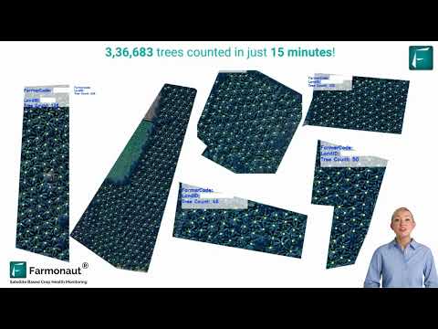
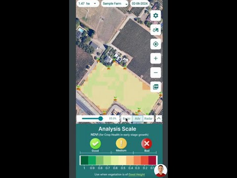
Our high-resolution satellite imagery, combined with advanced NDVI (Normalized Difference Vegetation Index) and ETCI (Enhanced Thermal Clustering Index) analysis, provides a revolutionary solution to this pressing challenge. By harnessing the power of space technology, we’re able to spot potential issues within days, dramatically reducing the time it takes to identify and address leaks.
The Power of Satellite Innovation
At the heart of our solution lies the innovative use of satellite technology. By analyzing high-resolution imagery from space, we’re able to detect subtle changes in plant health and soil conditions that are often invisible to the naked eye. This early warning system for pipelines allows us to identify potential leaks long before they become visible on the ground.

Key advantages of our satellite-based monitoring include:
- Rapid detection of potential leaks within days
- Comprehensive coverage of large areas
- Non-invasive monitoring that doesn’t disrupt operations
- Ability to detect issues before visible damage occurs
By leveraging these capabilities, we’re able to provide a level of precision monitoring that was previously unattainable. This not only enhances pipeline safety but also offers a sustainable solution for long-term infrastructure management.
NDVI and ETCI Analysis: The Science Behind Early Detection
Our approach utilizes two powerful analytical tools: NDVI (Normalized Difference Vegetation Index) and ETCI (Enhanced Thermal Clustering Index). These advanced techniques allow us to extract crucial information from satellite imagery, providing insights that go far beyond what the human eye can see.

NDVI Analysis: This index measures the health and density of vegetation by analyzing the difference between near-infrared and red light reflectance. Healthy vegetation absorbs red light and reflects near-infrared light, while stressed vegetation shows different patterns. By tracking changes in NDVI over time, we can identify areas where plant health is declining, potentially indicating a brine leak.
ETCI Analysis: This advanced technique combines thermal imaging with clustering algorithms to detect anomalies in surface temperature. Brine leaks can alter the temperature of the surrounding soil and vegetation, creating thermal signatures that our ETCI analysis can identify.
By combining these analytical methods with our high-resolution satellite imagery, we create a powerful tool for early leak detection. This approach allows us to:
- Detect subtle changes in vegetation health
- Identify temperature anomalies indicative of leaks
- Track changes over time for more accurate predictions
- Provide actionable insights for pipeline operators
For those interested in leveraging similar technology for agricultural applications, our crop plantation and forest advisory services utilize similar principles to optimize crop health and forest management.
Environmental Impact: Protecting Ecosystems and Resources
The environmental benefits of early leak detection cannot be overstated. Brine leaks can have devastating effects on local ecosystems, contaminating soil and water resources. By identifying these leaks early, we can significantly reduce the environmental impact and protect vulnerable habitats.
“High-resolution satellite technology analyzes plant health and soil conditions from space, providing early warnings for potential pipeline issues.”
Our satellite monitoring technology contributes to environmental protection in several ways:
- Minimizing soil and water contamination
- Protecting local flora and fauna from harmful brine exposure
- Reducing the carbon footprint associated with extensive ground surveys
- Supporting sustainable resource management practices
For companies looking to monitor and reduce their environmental impact, our carbon footprinting services provide valuable insights and tools for sustainability management.
Operational Efficiency: Transforming Pipeline Management
Beyond environmental protection, our satellite leak detection technology significantly enhances operational efficiency for pipeline operators. By providing early warnings and precise location data, we enable operators to address potential issues proactively, minimizing downtime and reducing maintenance costs.
Key operational benefits include:
- Reduced need for frequent ground inspections
- Faster response times to potential leaks
- More efficient allocation of maintenance resources
- Improved overall pipeline reliability and safety
For companies managing large-scale operations, our large-scale farm management solutions offer similar efficiency gains in the agricultural sector.
The Future of Pipeline Monitoring: Integrated Satellite Solutions
As we look to the future, the integration of satellite technology with other advanced monitoring systems promises even greater improvements in pipeline safety and environmental protection. We envision a comprehensive monitoring ecosystem that combines:
- Satellite imagery and analysis
- IoT sensors for real-time data collection
- AI and machine learning for predictive maintenance
- Blockchain technology for secure data management
This integrated approach will provide unprecedented visibility into pipeline operations, enabling operators to manage their infrastructure more effectively and sustainably than ever before.

For those interested in exploring the potential of satellite data for their own applications, our API services and developer documentation provide the tools and resources needed to integrate this powerful technology into custom solutions.
Comparative Analysis: Traditional vs. Satellite-Based Leak Detection
To fully appreciate the advantages of satellite-based leak detection, it’s helpful to compare it with traditional monitoring methods. The following table provides a comprehensive overview of how our technology stacks up against conventional approaches:
| Detection Method | Time to Detect Leaks | Area Coverage | Environmental Impact | Cost-Effectiveness | Accuracy |
|---|---|---|---|---|---|
| Traditional Ground Surveys | Weeks to months | Limited | High (vehicle emissions) | Low | Moderate |
| Aerial Inspections | Days to weeks | Moderate | Moderate (aircraft emissions) | Moderate | Good |
| Pressure Monitoring Systems | Hours to days | Pipeline-specific | Low | High | Good |
| Farmonaut’s Satellite Imagery and NDVI Analysis | Within days | Extensive | Very Low | Very High | Excellent |
As the table illustrates, our satellite-based technology offers significant advantages in terms of detection speed, area coverage, environmental impact, cost-effectiveness, and accuracy. This comprehensive approach to leak detection represents a major leap forward in pipeline safety and environmental protection.
Implementing Satellite-Based Monitoring: Best Practices
For pipeline operators considering the adoption of satellite-based monitoring, we recommend the following best practices:
- Establish baseline data: Conduct initial scans to establish normal vegetation and soil conditions along pipeline routes.
- Integrate with existing systems: Combine satellite data with current monitoring tools for a comprehensive approach.
- Develop response protocols: Create clear procedures for addressing potential leaks identified by satellite analysis.
- Invest in training: Ensure that staff are properly trained to interpret and act on satellite-derived insights.
- Regular updates: Schedule frequent satellite scans to maintain up-to-date monitoring of pipeline conditions.
By following these guidelines, pipeline operators can maximize the benefits of satellite-based leak detection and enhance their overall safety and environmental protection efforts.
Beyond Pipelines: Broader Applications of Satellite Monitoring
While our focus in this article has been on pipeline safety, it’s worth noting that the same satellite technology has numerous applications across various industries. Some potential areas of application include:
- Agricultural crop monitoring and yield prediction
- Forest management and deforestation tracking
- Urban planning and infrastructure development
- Disaster response and damage assessment
- Water resource management
For those interested in exploring these applications, our traceability solutions offer insights into how satellite data can be leveraged for supply chain management and product authentication.

The Road Ahead: Continuous Innovation in Satellite Technology
As we continue to push the boundaries of what’s possible with satellite technology, we’re excited about the potential for even greater advancements in leak detection and environmental monitoring. Some areas of ongoing research and development include:
- Higher resolution imagery for more detailed analysis
- Advanced AI algorithms for automated leak detection
- Integration with 5G networks for real-time data transmission
- Hyperspectral imaging for enhanced chemical detection
These innovations promise to further enhance our ability to protect critical infrastructure and the environment, setting new standards for safety and sustainability in pipeline operations and beyond.
Conclusion: A New Era of Pipeline Safety and Environmental Protection
Our project with Boardwalk Pipelines in Houston represents more than just a technological achievement; it marks the beginning of a new era in pipeline safety and environmental protection. By harnessing the power of satellite imagery and advanced analysis techniques, we’re able to detect potential issues faster, more accurately, and more cost-effectively than ever before.
This innovative approach not only enhances operational efficiency for pipeline operators but also significantly reduces the risk of environmental damage from brine leaks. As we continue to refine and expand our technology, we look forward to contributing to a safer, more sustainable future for pipeline operations and beyond.
The future of infrastructure monitoring is here, and it’s watching from above. With satellite innovation leading the way, we’re excited to be at the forefront of this revolution, solving real-world challenges and protecting our planet’s precious resources.
FAQ Section
Q: How accurate is satellite-based leak detection compared to traditional methods?
A: Satellite-based leak detection offers superior accuracy compared to traditional methods. Our technology can detect subtle changes in vegetation health and soil conditions that are often missed by ground surveys or aerial inspections. The combination of high-resolution imagery and advanced NDVI and ETCI analysis allows for early detection of potential leaks, often days or weeks before they would be visible to the naked eye.
Q: Is satellite monitoring a replacement for ground-based inspections?
A: While satellite monitoring significantly reduces the need for frequent ground inspections, it’s best used as a complementary tool rather than a complete replacement. Satellite technology excels at providing broad coverage and early detection, allowing ground teams to focus their efforts on areas of concern identified by satellite analysis. This integrated approach maximizes efficiency and effectiveness in pipeline monitoring.
Q: How often should satellite scans be conducted for effective monitoring?
A: The frequency of satellite scans can vary depending on the specific needs of the pipeline and the surrounding environment. However, we typically recommend scans every 1-2 weeks for optimal monitoring. This frequency allows for the detection of gradual changes over time while still providing timely alerts for potential issues.
Q: Can satellite monitoring detect all types of pipeline leaks?
A: Satellite monitoring is particularly effective at detecting brine leaks and other issues that affect vegetation health or soil conditions. While it may not directly detect all types of leaks (e.g., small gas leaks), it can often identify secondary signs of these issues. For comprehensive leak detection, we recommend combining satellite monitoring with other technologies such as pressure sensors and regular maintenance checks.
Q: What are the cost implications of implementing satellite-based monitoring?
A: While there is an initial investment in implementing satellite-based monitoring, the long-term cost savings can be significant. By reducing the need for frequent ground inspections, minimizing environmental damage through early detection, and preventing costly operational disruptions, satellite monitoring often proves to be a highly cost-effective solution for pipeline operators.
Explore Farmonaut’s Solutions
Interested in leveraging the power of satellite technology for your operations? Explore our range of solutions:


Earn With Farmonaut
Join our affiliate program and earn while helping farmers save!
Earn 20% recurring commission with Farmonaut’s affiliate program by sharing your promo code and helping farmers save 10%. Onboard 10 Elite farmers monthly to earn a minimum of $148,000 annually—start now and grow your income!
Learn More About Our Affiliate Program

Farmonaut Subscriptions