Revolutionize Your Farm: How Satellite Imagery and Precision Agriculture Boost Crop Yields and Sustainability
“Satellite-based NDVI monitoring can detect plant stress up to 2 weeks earlier than visual inspection, enabling timely interventions.”
In the ever-evolving world of agriculture, we find ourselves at the cusp of a technological revolution that promises to transform the way we grow food and manage our farms. At the heart of this revolution lies the powerful combination of satellite imagery and precision agriculture. These cutting-edge technologies are not just changing the game; they’re redefining it entirely. In this comprehensive exploration, we’ll delve into how these innovations are boosting crop yields, enhancing sustainability, and shaping the future of farming.
The Dawn of Precision Agriculture
Precision agriculture, also known as precision farming, is an approach that leverages technology to optimize crop production. It’s about doing the right thing, in the right place, at the right time, and in the right way. This method allows farmers to:
- Maximize crop yields
- Minimize environmental impact
- Reduce costs
- Improve overall farm efficiency
At the core of precision agriculture is data – lots of it. This is where satellite imagery comes into play, providing a bird’s-eye view of vast agricultural lands and delivering invaluable insights.
Satellite Imagery: The Eye in the Sky
Satellite imagery in farming has revolutionized the way we monitor and manage crops. These space-based sensors capture high-resolution images of agricultural lands, providing farmers with a wealth of information about their fields. Here’s how satellite imagery is changing the game:
- Real-time crop monitoring: Farmers can track crop health and growth patterns without setting foot in the field.
- Early stress detection: Vegetation health analysis allows for the early identification of plant stress, diseases, or pest infestations.
- Resource optimization: By analyzing soil moisture and nutrient levels, farmers can make informed decisions about irrigation and fertilizer application.
- Yield prediction: Advanced algorithms can predict crop yields based on historical data and current field conditions.

NDVI: The Pulse of Plant Health
One of the most powerful tools in the precision agriculture toolkit is the Normalized Difference Vegetation Index (NDVI). This index uses satellite imagery to measure and map the health and vigor of vegetation. NDVI crop monitoring allows farmers to:
- Assess crop health across large areas
- Identify areas of stress or poor growth
- Monitor crop development throughout the growing season
- Make data-driven decisions about irrigation, fertilization, and pest management
By leveraging NDVI data, farmers can take proactive measures to address issues before they become serious problems, ultimately leading to healthier crops and higher yields.
Smart Irrigation Systems: Quenching Thirst Efficiently
Water is a precious resource, and efficient irrigation is crucial for sustainable farming. Smart irrigation systems, powered by satellite data and soil moisture sensors, are transforming how we manage water in agriculture. These systems:
- Provide real-time data on soil moisture levels
- Automatically adjust water application based on crop needs and weather conditions
- Reduce water waste and improve crop water use efficiency
- Help prevent issues like waterlogging and drought stress
By optimizing water usage, smart irrigation not only conserves resources but also promotes healthier plant growth and improved yields.
Soil Moisture Management: The Foundation of Healthy Crops
Effective soil moisture management is critical for optimal crop growth. Satellite-based soil moisture monitoring allows farmers to:
- Track soil moisture levels across their fields
- Identify areas prone to drought or excess water
- Make informed decisions about irrigation scheduling
- Prevent crop stress due to water imbalances
By maintaining ideal soil moisture levels, farmers can ensure that their crops have access to the water they need, when they need it, leading to improved plant health and higher yields.
Vegetation Health Analysis: Spotting Trouble Early
Vegetation health analysis using satellite imagery enables farmers to detect plant stress early, often before it’s visible to the naked eye. This early warning system allows for timely interventions, such as:
- Targeted pest and disease management
- Precision application of nutrients
- Adjustments to irrigation strategies
- Mitigation of environmental stressors like heat or cold damage
By addressing issues promptly, farmers can prevent crop losses and maintain optimal plant health throughout the growing season.
Farm Data Analytics: Turning Information into Action
The true power of precision agriculture lies in the ability to analyze and interpret vast amounts of data. Farm data analytics platforms integrate information from various sources, including:
- Satellite imagery
- Weather data
- Soil sensors
- Historical yield data
- Equipment performance metrics
By synthesizing this data, these platforms provide farmers with actionable insights to optimize their operations, improve decision-making, and boost overall farm productivity.
“Advanced agricultural weather forecasting can improve crop yield predictions by up to 30%, enhancing farm management decisions.”
Agricultural Weather Forecasting: Planning for Nature’s Whims
Accurate weather forecasting is crucial for successful farming. Advanced agricultural weather forecasting systems use satellite data and sophisticated models to provide:
- Hyperlocal weather predictions
- Frost and heat wave warnings
- Precipitation forecasts
- Growing degree day calculations
This information helps farmers plan their activities, from planting and harvesting to pest management and irrigation, with greater precision and confidence.

Nutrient Management in Crops: Feeding Plants Precisely
Efficient nutrient management is essential for maximizing crop yields while minimizing environmental impact. Precision agriculture techniques enable farmers to:
- Map soil nutrient levels across their fields
- Identify areas of nutrient deficiency or excess
- Apply fertilizers with variable-rate technology
- Monitor crop nutrient uptake throughout the growing season
By providing crops with the right nutrients at the right time and in the right amounts, farmers can optimize plant growth, reduce fertilizer waste, and protect water quality.
Drone Mapping for Agriculture: A Closer Look
While satellite imagery provides a broad view of agricultural lands, drone mapping offers a more detailed, on-demand perspective. Drones equipped with high-resolution cameras and multispectral sensors can:
- Create detailed field maps
- Perform crop scouting missions
- Identify pest hotspots or disease outbreaks
- Assess crop damage after extreme weather events
The combination of satellite and drone imagery provides farmers with a comprehensive view of their fields, from the macro to the micro level.
Sustainable Farming Practices: Balancing Productivity and Environmental Stewardship
Precision agriculture and satellite imagery are powerful tools for promoting sustainable farming practices. By optimizing resource use and minimizing environmental impact, these technologies help farmers:
- Reduce chemical inputs
- Conserve water resources
- Minimize soil erosion
- Enhance biodiversity
- Reduce greenhouse gas emissions
These sustainable practices not only benefit the environment but also contribute to long-term farm profitability and food security.
Crop Yield Prediction: Planning for the Future
Accurate crop yield prediction is crucial for farm planning, resource allocation, and market decisions. Advanced yield prediction models use a combination of:
- Historical yield data
- Current crop health information from satellite imagery
- Weather forecasts
- Soil condition data
These models provide farmers with early estimates of expected yields, allowing them to make informed decisions about harvesting, storage, and marketing.
Remote Sensing in Agriculture: Beyond the Visible Spectrum
Remote sensing technologies, including satellite and drone-based sensors, can capture information beyond what’s visible to the human eye. These advanced sensors can detect:
- Plant stress before visible symptoms appear
- Variations in crop canopy temperature
- Soil moisture levels
- Nutrient deficiencies
By providing this wealth of information, remote sensing enables farmers to make more precise and timely management decisions.
Farm Management Software: Bringing It All Together
Farm management software platforms integrate data from various sources, including satellite imagery, weather stations, and field sensors, to provide a comprehensive view of farm operations. These platforms offer:
- Real-time monitoring of crop health and field conditions
- Task management and scheduling tools
- Record-keeping and reporting functions
- Decision support systems for various farm activities
By centralizing farm data and providing user-friendly interfaces, these software solutions make it easier for farmers to implement precision agriculture techniques and manage their operations efficiently.
Crop Disease Detection: Safeguarding Plant Health
Early detection of crop diseases is crucial for preventing widespread outbreaks and minimizing yield losses. Satellite and drone-based imaging technologies, combined with machine learning algorithms, can:
- Identify disease symptoms before they’re visible to the naked eye
- Map the spread of diseases across fields
- Assist in targeted treatment application
- Monitor the effectiveness of disease control measures
By enabling early intervention, these technologies help farmers protect their crops and reduce reliance on chemical treatments.
Climate-Smart Agriculture: Adapting to a Changing World
As climate change poses new challenges to agriculture, precision farming technologies are helping farmers adapt. Climate-smart agriculture practices, supported by satellite data and advanced analytics, include:
- Drought-resistant crop selection
- Improved water management strategies
- Soil conservation techniques
- Adaptive pest management
By implementing these practices, farmers can build resilience to climate-related challenges and ensure sustainable food production for the future.
Digital Farming Solutions: The Future is Now
The integration of satellite imagery, precision agriculture, and digital technologies is ushering in a new era of farming. Digital farming solutions offer:
- Automated decision support systems
- Predictive maintenance for agricultural equipment
- Blockchain-based traceability for food safety
- AI-powered crop management recommendations
These advanced solutions are making farming more efficient, sustainable, and responsive to global challenges.
Agricultural Sustainability: A Holistic Approach
The ultimate goal of precision agriculture and satellite-based farming technologies is to promote agricultural sustainability. This holistic approach encompasses:
- Environmental stewardship
- Economic viability
- Social responsibility
By optimizing resource use, reducing waste, and improving productivity, these technologies are helping create a more sustainable and resilient food system for generations to come.
Comparing Traditional Farming vs. Farmonaut Satellite System
| Farming Aspect | Traditional Method | Farmonaut Method | Estimated Improvement |
|---|---|---|---|
| Crop Monitoring Frequency | Monthly | Daily | 30x increase |
| Early Stress Detection Time | 14 days | 2-3 days | 80% reduction |
| Irrigation Efficiency | Manual scheduling | Data-driven, automated | 30% increase |
| Fertilizer Usage Optimization | Uniform application | Variable-rate, targeted | 25% reduction in use |
| Yield Prediction Accuracy | +/- 20% | +/- 5% | 75% improvement |
| Sustainability Impact | Limited data-driven decisions | Comprehensive sustainability metrics | 40% reduction in environmental impact |
Frequently Asked Questions
- What is precision agriculture?
Precision agriculture is a farming management concept that uses technology to optimize crop production by tailoring inputs and practices to the specific needs of each area within a field. - How does satellite imagery benefit farmers?
Satellite imagery provides farmers with real-time data on crop health, soil moisture, and field conditions, enabling them to make informed decisions about irrigation, fertilization, and pest management. - What is NDVI and why is it important?
NDVI (Normalized Difference Vegetation Index) is a measure of plant health derived from satellite imagery. It helps farmers assess crop vigor, detect stress, and monitor growth patterns across their fields. - How can precision agriculture improve sustainability?
By optimizing resource use, reducing chemical inputs, and improving overall farm efficiency, precision agriculture helps minimize environmental impact while maintaining or improving crop yields. - What role do drones play in precision agriculture?
Drones provide high-resolution, on-demand imagery and data collection capabilities, complementing satellite-based monitoring and enabling detailed crop scouting and mapping.
As we’ve explored throughout this article, the combination of satellite imagery and precision agriculture is truly revolutionizing farming practices. From boosting crop yields to enhancing sustainability, these technologies are paving the way for a more efficient, productive, and environmentally friendly agricultural future.
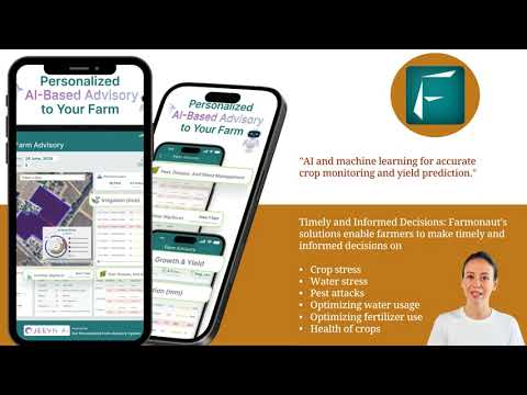
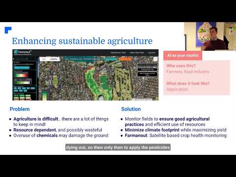
To experience the power of satellite-based crop monitoring firsthand, consider exploring Farmonaut’s innovative solutions:
For developers interested in integrating satellite and weather data into their own applications, check out the Farmonaut API and the comprehensive API Developer Docs.
By embracing these cutting-edge technologies, farmers can not only improve their yields and profitability but also contribute to a more sustainable and resilient global food system. The future of farming is here, and it’s powered by the eyes in the sky and the precision of data-driven agriculture.


