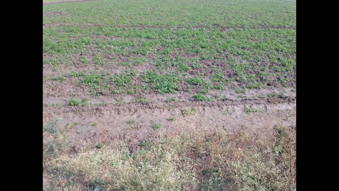
Coriander Farm Mapping in Rajasthan: Leveraging Remote Sensing for Precision Agriculture

At Farmonaut, we’re excited to share our latest project: mapping coriander farms in the vibrant state of Rajasthan, India. This initiative showcases the power of remote sensing and precision agriculture in revolutionizing traditional farming practices. Join us as we delve into the world of satellite-based farm management and explore how it’s transforming the cultivation of this aromatic herb.
The Importance of Coriander in Rajasthan’s Agriculture
Coriander, known locally as “dhania,” is a crucial crop in Rajasthan’s agricultural landscape. This versatile herb is not only a staple in Indian cuisine but also a significant export commodity. Rajasthan’s climate and soil conditions make it an ideal region for coriander cultivation, contributing substantially to India’s position as the world’s largest producer and exporter of coriander.
However, coriander farming faces several challenges, including:
- Water scarcity in the arid regions of Rajasthan
- Pest and disease management
- Optimizing fertilizer usage
- Ensuring consistent quality for export markets
These challenges underscore the need for innovative solutions in coriander cultivation, which is where our expertise at Farmonaut comes into play.
Remote Sensing: A Game-Changer for Coriander Farming
Remote sensing technology has emerged as a powerful tool in modern agriculture, offering farmers unprecedented insights into their crops’ health and growth patterns. At Farmonaut, we leverage advanced satellite imagery to provide farmers with real-time data on their coriander fields.
How Remote Sensing Works for Coriander Farms
- Satellite Imagery Acquisition: We use high-resolution multispectral satellite images to capture detailed views of coriander fields across Rajasthan.
- Data Processing: Our advanced algorithms process these images to extract valuable information about crop health, soil moisture, and potential stress factors.
- Analysis and Interpretation: Our team of experts, including agronomists and data scientists, analyze the processed data to generate actionable insights for farmers.
- Delivery of Insights: Farmers receive easy-to-understand reports and recommendations through our user-friendly Android and iOS apps.
Key Benefits of Remote Sensing for Coriander Farmers
- Early Detection of Crop Stress: Identify potential issues before they become visible to the naked eye, allowing for timely interventions.
- Optimized Resource Management: Precise data on soil moisture helps farmers make informed decisions about irrigation, reducing water waste.
- Targeted Fertilizer Application: Identify areas that need more or less fertilizer, leading to cost savings and environmental benefits.
- Improved Yield Prediction: Accurate forecasts help farmers and buyers plan better for harvest and market demands.
- Enhanced Quality Control: Monitor crop uniformity and maturity to ensure consistent quality, crucial for meeting export standards.
Precision Agriculture: Tailoring Farming Practices for Coriander
Precision agriculture goes hand in hand with remote sensing, allowing farmers to apply site-specific management practices based on the data collected. For coriander farms in Rajasthan, this approach is particularly beneficial due to the region’s varied soil conditions and microclimates.
Implementing Precision Agriculture in Coriander Farming
- Variable Rate Irrigation: Adjust water application based on soil moisture data, ensuring optimal hydration while conserving water.
- Targeted Pest Management: Identify pest-prone areas early and apply treatments only where needed, reducing pesticide use.
- Customized Fertilizer Plans: Develop nutrient management strategies tailored to different zones within the field.
- Harvest Timing Optimization: Use vegetation indices to determine the ideal harvest time for maximum yield and quality.
The Role of EVI Vegetation Index
The Enhanced Vegetation Index (EVI) is a critical tool in our remote sensing arsenal. EVI provides valuable information about coriander crop health and vigor, offering several advantages over other vegetation indices:
- Better sensitivity in high biomass regions
- Reduced atmospheric influences
- Improved canopy background signal decoupling
By incorporating EVI data into our analysis, we provide coriander farmers with more accurate and nuanced insights into their crop’s condition.
Farmonaut’s Approach to Coriander Farm Mapping in Rajasthan
Our coriander farm mapping project in Rajasthan exemplifies our commitment to revolutionizing agriculture through technology. Here’s how we’re making a difference:
1. Comprehensive Field Scouting
We begin by conducting thorough field scouting using our satellite-based monitoring system. This allows us to create detailed maps of coriander farms across Rajasthan, identifying:
- Field boundaries and size
- Crop growth stages
- Areas of potential concern
2. Advanced Data Analysis
Our team utilizes cutting-edge algorithms to analyze the satellite data, generating insights such as:
- NDVI (Normalized Difference Vegetation Index) maps for assessing crop health
- Soil moisture maps to guide irrigation decisions
- Yield prediction models based on historical and current data
3. Customized Recommendations
We provide coriander farmers with tailored advice through our Farmonaut app, including:
- Optimal irrigation schedules
- Fertilizer application recommendations
- Pest and disease alerts
- Harvest timing suggestions
4. Continuous Monitoring and Support
Our commitment doesn’t end with initial mapping. We offer ongoing support through:
- Regular updates on crop health and field conditions
- Real-time alerts for potential issues
- Access to our team of agricultural experts for personalized advice
Case Study: Transforming Coriander Cultivation in Jodhpur District
To illustrate the impact of our technology, let’s look at a recent success story from the Jodhpur district of Rajasthan.
Background
A group of coriander farmers in Jodhpur were facing challenges with water scarcity and inconsistent crop quality. They partnered with Farmonaut to implement our satellite-based farm management solutions.
Implementation
- We mapped 500 hectares of coriander fields using high-resolution satellite imagery.
- Our AI-powered Jeevn advisory system provided weekly updates on crop health and irrigation needs.
- Farmers received personalized recommendations through the Farmonaut app.
Results
- 25% reduction in water usage through optimized irrigation
- 15% increase in overall yield
- 20% decrease in pesticide application
- Improved crop quality, leading to better market prices
This case study demonstrates the tangible benefits of integrating remote sensing and precision agriculture in coriander farming.
The Future of Coriander Farming in Rajasthan
As we continue our mapping project across Rajasthan, we envision a future where all coriander farmers in the region can benefit from these advanced technologies. Our goals include:
- Expanding coverage to all major coriander-growing districts in Rajasthan
- Integrating blockchain technology for improved traceability in the coriander supply chain
- Developing AI models specific to coriander cultivation for even more accurate predictions and recommendations
- Collaborating with local agricultural universities and research institutions to further refine our solutions
Farmonaut’s Commitment to Sustainable Agriculture
Our work in mapping coriander farms is part of our broader mission to promote sustainable agriculture. By helping farmers optimize their resources and reduce environmental impact, we’re contributing to a more sustainable future for agriculture in Rajasthan and beyond.
Environmental Benefits
- Reduced water consumption in a water-scarce region
- Decreased use of chemical inputs, leading to healthier soils
- Lower carbon footprint through optimized farm operations
Economic Benefits
- Increased profitability for farmers through higher yields and lower input costs
- Enhanced competitiveness in the global coriander market
- Potential for premium pricing through improved quality and traceability
Social Benefits
- Empowerment of farmers through access to advanced technologies
- Preservation of traditional coriander farming communities
- Contribution to food security and rural development
How Farmonaut’s Satellite System Compares to Drone and IoT-Based Farm Monitoring
| Feature | Farmonaut Satellite System | Drone-Based Monitoring | IoT-Based Monitoring |
|---|---|---|---|
| Coverage Area | Large scale (thousands of hectares) | Limited (typically under 100 hectares per flight) | Limited to sensor placement |
| Frequency of Data Collection | Regular (every few days) | On-demand (requires manual flight) | Continuous |
| Initial Setup Cost | Low | High (drone purchase, training) | Medium to High (sensor network installation) |
| Operational Complexity | Low (automated) | High (requires skilled operator) | Medium (maintenance of sensor network) |
| Data Processing | Automated, AI-powered | Often requires manual processing | Automated, but limited to sensor data |
| Scalability | Highly scalable | Limited by flight time and regulations | Requires additional hardware for expansion |
| Weather Dependency | Low (can penetrate clouds) | High (affected by wind, rain) | Low to Medium (depending on sensor type) |
Get Started with Farmonaut
Are you a coriander farmer in Rajasthan looking to revolutionize your farming practices? Or perhaps you’re an agribusiness interested in implementing precision agriculture at scale? Farmonaut offers solutions tailored to your needs.
- Download our app: Android | iOS
- Explore our API for developers: Farmonaut API
- Learn more about our weather API: Farmonaut Weather API Docs
Ready to take your farming to the next level? Subscribe to Farmonaut today:
FAQs
Q: How often are satellite images updated for my coriander farm?
A: We typically provide updates every 3-5 days, depending on satellite availability and weather conditions.
Q: Can Farmonaut’s technology work for small coriander farms?
A: Absolutely! Our solutions are scalable and can benefit farms of all sizes, from small holdings to large plantations.
Q: How accurate are the crop health assessments?
A: Our assessments have an accuracy rate of over 90%, validated through ground-truthing and comparison with traditional scouting methods.
Q: Is internet connectivity required to use Farmonaut’s services?
A: While internet connectivity enhances the real-time aspects of our service, we also offer offline capabilities for areas with limited connectivity.
Q: How does Farmonaut ensure data privacy and security?
A: We employ industry-standard encryption and security protocols to protect all farmer data. Your information is never shared without your explicit consent.
Conclusion
Our coriander farm mapping project in Rajasthan is just the beginning of a new era in precision agriculture. By harnessing the power of remote sensing, AI, and data analytics, we’re empowering farmers to make smarter decisions, optimize their resources, and produce higher quality crops. As we continue to innovate and expand our services, we remain committed to our vision of making advanced agricultural technologies accessible to all farmers, regardless of the scale of their operations.
Join us in this agricultural revolution. Together, we can cultivate a more sustainable, productive, and prosperous future for coriander farming in Rajasthan and beyond.
