Precision Agriculture 101: Unlocking the Power of Satellite Data for Smart Farming

At Farmonaut, we’re excited to embark on a journey to educate farmers about the fundamentals of precision agriculture and the interpretation of satellite data. Today, we’re kicking off a series of informative posts that will revolutionize the way you approach farming. Let’s dive into the world of smart farming and explore how satellite technology is transforming agriculture.
Understanding NDVI: The Key to Crop Health Monitoring
One of the most powerful tools in precision agriculture is the Normalized Difference Vegetation Index (NDVI). NDVI is a simple but effective index used to quantify vegetation health and density. Let’s break down what NDVI means and how it can benefit your farming practices.
What is NDVI?
NDVI is a standardized index that allows us to generate an image displaying vegetation greenness, also known as relative biomass. This index capitalizes on the contrast between red and near-infrared reflection of solar radiation by vegetation. Healthy vegetation absorbs most of the visible light that hits it and reflects a large portion of near-infrared light. Unhealthy or sparse vegetation reflects more visible light and less near-infrared light.
The NDVI is calculated using the following formula:
NDVI = (NIR – RED) / (NIR + RED)
Where NIR is the near-infrared reflection and RED is the red reflection.
Interpreting NDVI Images
NDVI values range from -1 to 1, with higher values indicating healthier vegetation. In the color-coded NDVI images provided by Farmonaut, the interpretation is straightforward:
- Dark Green/Green: Very healthy crop
- Yellow: Crop needs attention
- Red: Barren land or severely stressed vegetation
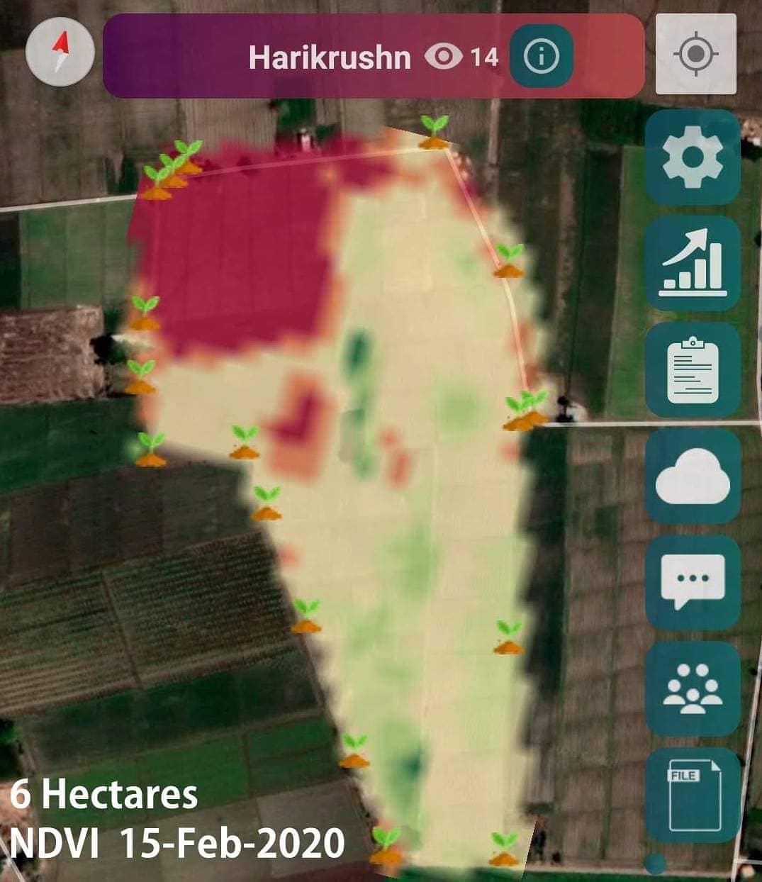
Case Study: Harikrushn’s Field in Surendranagar, Gujarat
Let’s analyze a real-world example to understand how NDVI can be applied in practice. We’ll look at the field of farmer Harikrushn from Surendranagar, Gujarat, with a total area of 6 hectares.
NDVI Analysis
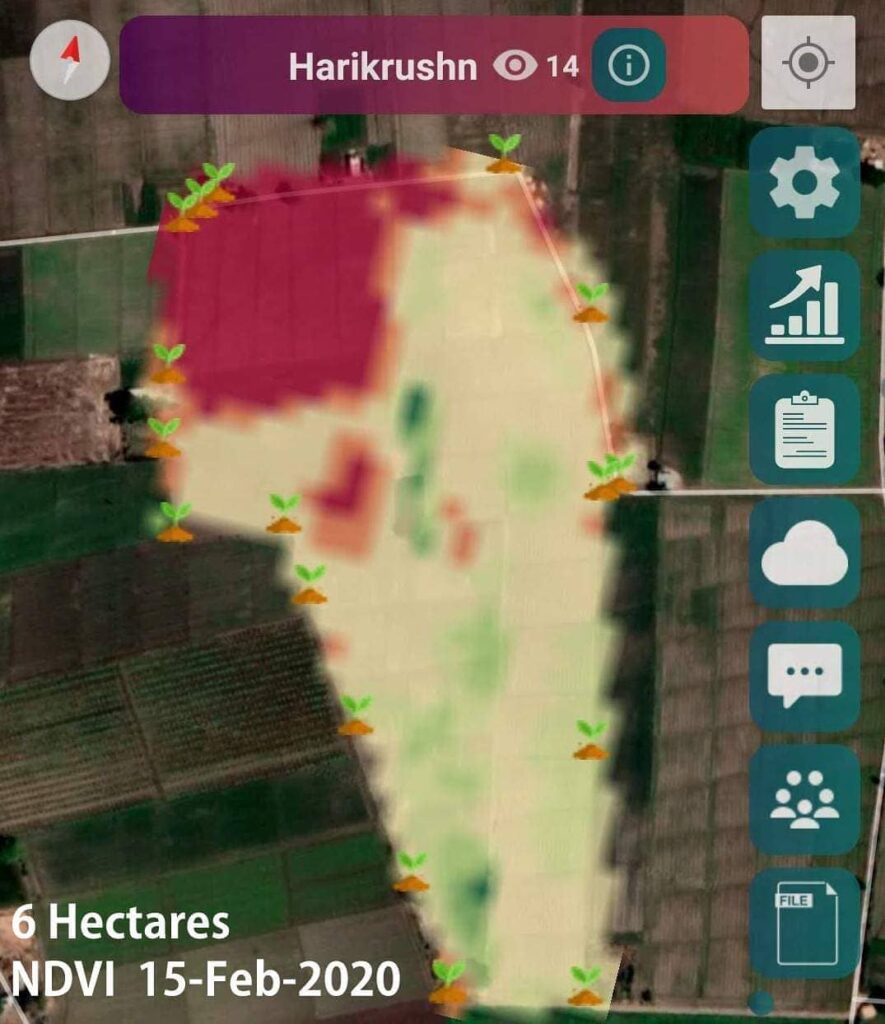
The NDVI image captured by satellite on February 15, 2020, reveals valuable information about the field’s crop health:
- The top left portion of the field appears red, indicating barren land or extremely stressed vegetation.
- The majority of the field shows yellowish-green to green coloration, suggesting that the overall crop health is good but may benefit from some attention in certain areas.
Practical Application
Farmers can easily verify these results by using the GPS on their smartphones and navigating through the field with the NDVI image as a guide. This ground-truthing process helps farmers understand the correlation between the satellite data and the actual field conditions.
Benefits of Satellite-Based Precision Agriculture
By leveraging satellite data provided by Farmonaut, farmers can achieve significant improvements in their agricultural practices:
- Reduced Chemical and Fertilizer Consumption: By identifying specific areas where crop health is suboptimal, farmers can apply chemicals and fertilizers precisely where they’re needed most, reducing overall usage and environmental impact.
- Lower Labor Costs: Direct labor resources to critical areas of the field, optimizing workforce efficiency and reducing unnecessary labor expenses.
- Water Conservation: Implement targeted irrigation strategies by focusing on areas with low plant water stress, minimizing water waste and promoting sustainable water management.
- Increased Overall Yield: By addressing issues promptly and optimizing resource allocation, farmers can significantly boost their crop yields.
Farmonaut: Your Partner in Precision Agriculture
At Farmonaut, we’re committed to making precision agriculture accessible to farmers worldwide. Our platform is designed to be user-friendly and compatible with various devices:
- Android App: Download from Google Play Store
- iOS App: Download from App Store
- Web Platform: Access via Browser
The Power of Satellite Data in Agriculture
Satellite-based farm monitoring offers numerous advantages over traditional methods and even other modern approaches like drone and IoT-based systems. Let’s compare these technologies to understand why Farmonaut’s satellite system stands out:
| Feature | Farmonaut Satellite System | Drone-based Monitoring | IoT-based Monitoring |
|---|---|---|---|
| Coverage Area | Large scale (Global) | Limited (Local) | Limited (Local) |
| Frequency of Data Collection | Regular (Every few days) | On-demand | Continuous |
| Initial Setup Cost | Low | High | Medium to High |
| Maintenance Required | Minimal | Regular | Regular |
| Scalability | Highly Scalable | Limited Scalability | Moderate Scalability |
| Weather Dependency | Low | High | Low |
| Data Processing | Automated | Manual/Semi-automated | Automated |
| Historical Data Analysis | Extensive | Limited | Moderate |
Advanced Features of Farmonaut’s Platform
While NDVI is a powerful tool, it’s just one aspect of Farmonaut’s comprehensive precision agriculture solution. Let’s explore some of the advanced features that make our platform stand out:
1. Jeevn AI Advisory System
Our AI-powered farm advisory tool, Jeevn, takes precision agriculture to the next level. By analyzing satellite data, weather patterns, and historical farm information, Jeevn provides personalized recommendations for:
- Optimal planting dates
- Irrigation scheduling
- Fertilizer application
- Pest and disease management
- Harvest timing
This AI-driven approach ensures that farmers receive tailored advice specific to their fields and crops, maximizing efficiency and yield potential.
2. Blockchain-Based Traceability
In an era where consumers are increasingly concerned about the origin and journey of their food, Farmonaut offers a blockchain-based traceability solution. This feature allows:
- End-to-end tracking of agricultural products
- Verification of organic and sustainable farming practices
- Enhanced trust between producers and consumers
- Streamlined supply chain management
By implementing blockchain technology, we’re helping farmers and agribusinesses build transparency and trust in their operations.
3. Weather Forecasting and Historical Analysis
Accurate weather information is crucial for successful farming. Farmonaut provides:
- Hyperlocal weather forecasts
- Historical weather data analysis
- Climate trend predictions
- Severe weather alerts
This comprehensive weather intelligence allows farmers to make informed decisions about planting, irrigation, and harvesting, reducing weather-related risks.
4. Crop Yield Estimation
Using advanced machine learning algorithms and historical data, Farmonaut offers crop yield estimation capabilities. This feature helps farmers and agribusinesses:
- Project harvest volumes
- Plan logistics and storage
- Make informed marketing decisions
- Secure financing based on projected yields
Accurate yield estimations are invaluable for financial planning and resource allocation throughout the growing season.
5. Integration with Farm Management Software
Farmonaut’s API allows seamless integration with other farm management tools and software. This interoperability enables:
- Centralized data management
- Automated record-keeping
- Enhanced decision-making through comprehensive data analysis
- Streamlined operations across multiple software platforms
For developers and businesses interested in integrating Farmonaut’s powerful satellite and weather data into their own systems, we offer comprehensive API documentation: Farmonaut API Documentation
The Future of Farming: Precision, Sustainability, and Profitability
As we continue to face global challenges such as climate change, population growth, and resource scarcity, the role of precision agriculture becomes increasingly crucial. Farmonaut is at the forefront of this agricultural revolution, providing tools and insights that enable farmers to:
- Optimize Resource Use: By precisely targeting inputs like water, fertilizers, and pesticides, farmers can reduce waste and environmental impact while maintaining or improving yields.
- Adapt to Climate Change: With access to detailed climate data and AI-driven recommendations, farmers can better adapt their practices to changing weather patterns and extreme events.
- Improve Soil Health: Precision agriculture allows for more sustainable soil management practices, promoting long-term soil health and fertility.
- Increase Profitability: By reducing input costs and maximizing yields, farmers can improve their bottom line and ensure the long-term viability of their operations.
- Enhance Food Security: More efficient and productive farming practices contribute to global food security, helping to meet the nutritional needs of a growing world population.
Getting Started with Farmonaut
Ready to revolutionize your farming practices with satellite-based precision agriculture? Here’s how you can get started with Farmonaut:
- Sign Up: Create your account on the Farmonaut platform.
- Map Your Fields: Use our intuitive tools to outline your farm fields.
- Access Satellite Data: Start receiving regular satellite imagery and analysis of your fields.
- Explore Features: Familiarize yourself with NDVI maps, weather forecasts, and AI recommendations.
- Implement Insights: Use data-driven insights to make informed decisions about your farming practices.
- Track Progress: Monitor improvements in crop health, resource efficiency, and yields over time.
To get started with Farmonaut and unlock the power of precision agriculture for your farm, choose a subscription plan that fits your needs:
Frequently Asked Questions (FAQ)
To help you better understand Farmonaut and precision agriculture, we’ve compiled a list of frequently asked questions:
Q: How often are satellite images updated?
A: Farmonaut provides satellite imagery updates every 3-5 days, depending on weather conditions and satellite availability.
Q: Can Farmonaut be used for all types of crops?
A: Yes, our system is designed to work with a wide variety of crops, including grains, fruits, vegetables, and cash crops.
Q: Do I need special equipment to use Farmonaut?
A: No special equipment is required. You can access Farmonaut’s features using your smartphone, tablet, or computer.
Q: How accurate is the NDVI data?
A: NDVI data from Farmonaut is highly accurate, with a resolution of up to 3 meters per pixel. However, we always recommend ground-truthing for the best results.
Q: Can Farmonaut help with organic farming?
A: Absolutely! Our precision agriculture tools are particularly useful for organic farmers, helping to optimize natural resource use and pest management without synthetic inputs.
Q: Is my farm data secure with Farmonaut?
A: Yes, we take data security very seriously. All farm data is encrypted and stored securely, and we never share your information without your explicit permission.
Q: Can Farmonaut integrate with my existing farm management software?
A: Yes, Farmonaut offers API access for integration with other farm management tools. Contact our support team for more information on integration options.
Q: What support does Farmonaut offer if I need help?
A: We provide comprehensive customer support, including online documentation, video tutorials, email support, and in some cases, direct phone support for our premium users.
Conclusion: Embrace the Future of Farming with Farmonaut
As we’ve explored in this comprehensive guide, precision agriculture powered by satellite technology is revolutionizing the way we approach farming. From NDVI analysis to AI-driven recommendations, Farmonaut provides a suite of tools designed to help farmers optimize their operations, increase yields, and promote sustainability.
By embracing these advanced technologies, farmers can not only improve their own bottom line but also contribute to global food security and environmental conservation. The future of agriculture is here, and it’s more precise, efficient, and sustainable than ever before.
We invite you to join the precision agriculture revolution with Farmonaut. Whether you’re a small-scale farmer or managing large agricultural operations, our platform is designed to meet your needs and help you achieve your farming goals.
Ready to take your farming to the next level? Sign up for Farmonaut today and discover the power of satellite-based precision agriculture for yourself!
Happy Farming!
