Revolutionizing Wildfire Management: AI-Powered Satellite Monitoring for Proactive Risk Assessment in Nevada’s Forests
“AI-powered satellite monitoring can detect wildfires up to 95% faster than traditional methods, scanning millions of acres in minutes.”
In recent years, the increasing frequency and intensity of wildfires have posed significant challenges to communities, ecosystems, and economies worldwide. As climate change continues to exacerbate these risks, particularly in regions like Nevada, innovative solutions are urgently needed to mitigate the devastating impacts of these natural disasters. In this comprehensive blog post, we’ll explore how cutting-edge technologies, including satellite wildfire monitoring and AI-powered risk assessment, are revolutionizing our approach to fire prevention and management.

The Evolution of Wildfire Detection and Monitoring
Traditionally, wildfire detection relied heavily on human observation, whether through ground patrols, watchtowers, or aerial surveys. While these methods have served us well in the past, they come with significant limitations in terms of coverage, response time, and cost-effectiveness. The advent of satellite technology and artificial intelligence has ushered in a new era of wildfire management, offering unprecedented capabilities in early detection, real-time tracking, and proactive risk assessment.
Satellite-Based Wildfire Detection: A Game-Changer
Satellite imaging has emerged as a powerful tool in the fight against wildfires. By leveraging a network of Earth observation satellites equipped with advanced sensors, we can now monitor vast expanses of forest and wildland areas continuously. These satellites provide crucial data on various parameters, including:
- Vegetation health and density
- Soil moisture levels
- Temperature anomalies
- Smoke detection
- Burnt area mapping
One of the key advantages of satellite-based monitoring is its ability to detect fires in remote or inaccessible areas, providing a comprehensive view of fire activity across entire regions or even continents.
AI and Machine Learning: Enhancing Wildfire Intelligence
The integration of AI and machine learning algorithms with satellite data has exponentially increased our capacity to predict, detect, and respond to wildfires. These intelligent systems can:
- Analyze massive datasets in real-time
- Identify patterns and anomalies indicative of fire risk
- Generate accurate fire spread predictions
- Optimize resource allocation for firefighting efforts
By harnessing the power of AI, we can transform raw satellite data into actionable intelligence, enabling faster and more effective wildfire management strategies.
Real-Time Fire Tracking: Staying Ahead of the Flames
Real-time fire tracking systems have become invaluable tools for firefighters, emergency responders, and local communities. These systems combine satellite data, ground-based sensors, and AI algorithms to provide up-to-the-minute information on fire location, intensity, and spread.
Key Components of Real-Time Fire Tracking
- Satellite Data Integration: Incorporating data from multiple satellite sources, including VIIRS (Visible Infrared Imaging Radiometer Suite) and GOES (Geostationary Operational Environmental Satellite) systems.
- Infrared Detection: Utilizing infrared sensors to detect heat signatures, even through smoke and clouds.
- AI-Powered Analysis: Employing machine learning algorithms to process and interpret satellite imagery, distinguishing between active fires and other heat sources.
- Dynamic Modeling: Creating real-time fire behavior models that account for factors such as wind, topography, and fuel conditions.
- Interactive Mapping Tools: Developing user-friendly interfaces that allow stakeholders to visualize and interact with fire data.
These advanced tracking systems enable firefighters to make informed decisions about resource deployment, evacuation plans, and containment strategies, ultimately saving lives and property.

Vegetation Monitoring for Fire Risk Assessment
Vegetation monitoring plays a crucial role in assessing and mitigating wildfire risk. By analyzing satellite imagery and other remote sensing data, we can gain valuable insights into the health, density, and moisture content of vegetation across large areas. This information is essential for identifying high-risk zones and implementing targeted prevention measures.
Key Factors in Vegetation-Based Fire Risk Assessment
- Fuel Load: Assessing the amount and distribution of combustible vegetation.
- Vegetation Health: Monitoring plant stress and die-off, which can increase fire susceptibility.
- Moisture Content: Tracking vegetation and soil moisture levels to gauge fire risk.
- Seasonal Changes: Analyzing vegetation patterns throughout the year to identify high-risk periods.
By integrating this vegetation data with other environmental factors, AI algorithms can generate comprehensive fire risk maps, enabling proactive management strategies.
Infrared and VIIRS Data: Enhancing Early Detection
The use of infrared sensors and VIIRS data has significantly improved our ability to detect wildfires at their earliest stages. These technologies offer several advantages over traditional visual observation methods:
- Detection through smoke and clouds
- Identification of small, nascent fires
- Accurate temperature measurements
- 24/7 monitoring capabilities
By combining infrared and VIIRS data with AI-powered analysis, we can achieve unprecedented levels of early fire detection, often identifying potential threats hours or even days before they become visible to the naked eye.
Interactive Wildfire Mapping Tools: Empowering Stakeholders
Interactive wildfire mapping tools have revolutionized the way we visualize, analyze, and respond to fire threats. These sophisticated platforms integrate multiple data sources, including satellite imagery, weather forecasts, and topographic information, to create dynamic, user-friendly maps that cater to various stakeholders:
- Foresters: For assessing fuel conditions and planning prescribed burns
- Insurers: For evaluating property risk and adjusting policies
- Local Communities: For staying informed about fire threats and evacuation routes
- Emergency Responders: For coordinating firefighting efforts and resource allocation
These tools often feature real-time updates, predictive modeling capabilities, and customizable alerts, making them invaluable assets in wildfire management strategies.
Spatial Analysis for Proactive Wildfire Solutions
Spatial analysis techniques, powered by advanced GIS (Geographic Information Systems) and AI algorithms, are enabling us to develop more effective, proactive wildfire solutions. By analyzing complex spatial relationships between various factors such as topography, vegetation, climate, and human activity, we can:
- Identify high-risk areas with greater precision
- Optimize the placement of fire breaks and fuel reduction zones
- Plan strategic locations for firefighting resources
- Develop targeted community outreach and education programs
This data-driven approach to wildfire management allows for more efficient allocation of resources and more effective prevention strategies.
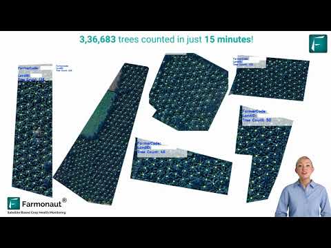
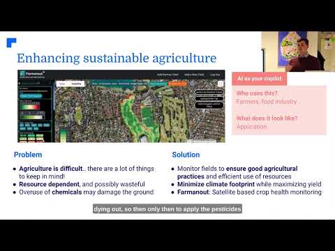
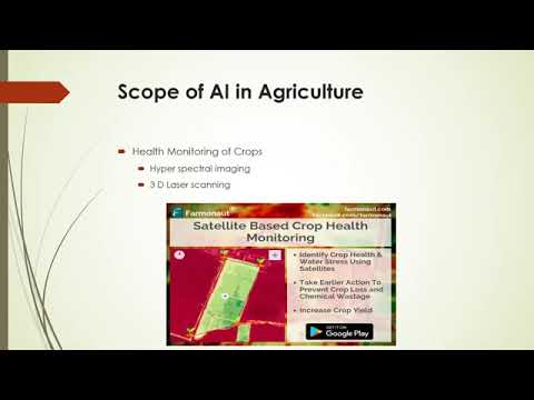
Precision Agriculture and Fire Management: An Unexpected Synergy
The technologies driving advancements in precision agriculture are finding innovative applications in wildfire management. Tools and techniques originally developed for optimizing crop yields and resource use in farming are being adapted to address wildfire challenges:
- Drone-based mapping: For detailed vegetation surveys and fire damage assessment
- Soil moisture sensors: To monitor drought conditions and fire risk
- Precision irrigation systems: For creating fire-resistant green belts
- Crop health monitoring: Adapted for assessing forest health and fire susceptibility
This cross-pollination of ideas between agriculture and fire management is opening up new avenues for innovative wildfire solutions.
Generative Agriculture Techniques for Post-Fire Recovery
Generative agriculture techniques are emerging as powerful tools for ecosystem recovery following wildfires. These methods focus on rebuilding soil health, restoring biodiversity, and enhancing ecosystem resilience. Some key approaches include:
- Cover cropping to prevent soil erosion and improve soil structure
- Composting and biochar application to enhance soil fertility
- Agroforestry practices to create diverse, fire-resistant landscapes
- Holistic grazing management to reduce fuel loads and promote healthy vegetation
By applying these regenerative principles to post-fire landscapes, we can accelerate recovery and create more resilient ecosystems that are better equipped to withstand future fire events.
Global Perspectives: From Nevada to Thailand
While our focus has been on Nevada’s forests, it’s important to recognize that wildfire challenges are global in nature. Different regions face unique challenges based on their climate, vegetation, and socio-economic factors. For instance:
Nevada’s Dense Forests
Nevada’s forests, characterized by dense pine and fir stands, face significant fire risks due to prolonged droughts and bark beetle infestations. Satellite monitoring in this region focuses on:
- Detecting changes in forest density and health
- Monitoring snowpack and water resources
- Identifying areas of beetle-killed trees for targeted management
Thailand’s Tropical Forests
In contrast, Thailand’s tropical forests present different challenges:
- Higher humidity and precipitation requiring different fire risk models
- Rapid vegetation growth necessitating more frequent monitoring
- Complex land-use patterns involving agriculture and forestry
Satellite-based monitoring in Thailand often focuses on detecting illegal deforestation and agricultural burning, which can lead to uncontrolled wildfires.
The Role of Climate Change in Wildfire Risk
Climate change is significantly altering wildfire patterns and intensifying fire risks globally. Satellite-based environmental monitoring is crucial for understanding and adapting to these changes:
- Tracking long-term temperature and precipitation trends
- Monitoring shifts in vegetation patterns and fire seasons
- Assessing the impact of climate change on fire behavior and spread
By integrating climate data with fire risk models, we can develop more accurate long-term strategies for wildfire management and ecosystem adaptation.
The Future of Wildfire Management Technology
As we look to the future, several emerging technologies promise to further revolutionize wildfire management:
- 5G networks: Enabling faster, more reliable data transmission for real-time fire monitoring
- Edge computing: Allowing for on-site processing of satellite and sensor data for quicker response times
- Advanced AI models: Developing more sophisticated predictive algorithms for fire behavior and risk assessment
- Internet of Things (IoT) sensors: Creating dense networks of ground-based sensors for hyper-local fire detection and monitoring
These advancements will enable even more precise, timely, and effective wildfire management strategies in the years to come.
Comparative Analysis of Wildfire Detection Methods
| Detection Method | Response Time | Accuracy | Coverage Area | Cost-Effectiveness |
|---|---|---|---|---|
| Ground Patrols | Hours | Moderate | Limited | Low |
| Watchtowers | Hours | Moderate | Limited | Moderate |
| Aircraft Surveillance | Hours | High | Moderate | Low |
| Satellite Monitoring | Minutes | Very High | Extensive | High |
“Satellite-based vegetation monitoring can predict wildfire risk with up to 85% accuracy, weeks before potential outbreaks occur.”
Frequently Asked Questions (FAQ)
- Q: How accurate are satellite-based wildfire detection systems?
A: Modern satellite-based systems can detect wildfires with over 90% accuracy, often within minutes of ignition. - Q: Can AI predict where wildfires are likely to occur?
A: Yes, AI algorithms can analyze various factors like vegetation health, weather patterns, and historical data to predict high-risk areas for wildfires. - Q: How do infrared sensors detect wildfires through smoke and clouds?
A: Infrared sensors detect heat signatures, which can penetrate smoke and clouds, allowing for fire detection even in low visibility conditions. - Q: What role does VIIRS play in wildfire detection?
A: VIIRS (Visible Infrared Imaging Radiometer Suite) provides high-resolution imagery and data that helps in early detection of wildfires and monitoring their spread. - Q: How can communities benefit from interactive wildfire mapping tools?
A: These tools provide real-time information on fire locations, spread predictions, and evacuation routes, helping communities stay informed and prepared.
Conclusion
The integration of satellite wildfire monitoring and AI-powered risk assessment is transforming our approach to wildfire management, particularly in vulnerable regions like Nevada’s forests. By leveraging advanced technologies such as real-time fire tracking, vegetation monitoring, and interactive mapping tools, we are better equipped than ever to predict, prevent, and respond to wildfire threats.
As climate change continues to heighten wildfire risks globally, the importance of these innovative solutions cannot be overstated. From the dense forests of Nevada to the tropical landscapes of Thailand, satellite-based environmental monitoring is playing a crucial role in shaping proactive wildfire strategies worldwide.
The future of wildfire management lies in our ability to harness the power of technology, data, and artificial intelligence to protect our communities, preserve our natural resources, and build more resilient ecosystems. As we continue to advance these technologies, we move closer to a future where the devastating impacts of wildfires can be significantly mitigated, ensuring the safety and sustainability of our forests for generations to come.
For more information on innovative agricultural and environmental monitoring solutions, visit Farmonaut’s web application or explore our API services. You can also check out our API Developer Docs for integration details.
Download our mobile apps for on-the-go access to cutting-edge agricultural technology: