Mapping Banana Farms in West Bengal: A Deep Dive into Remote Sensing and Agricultural Innovation

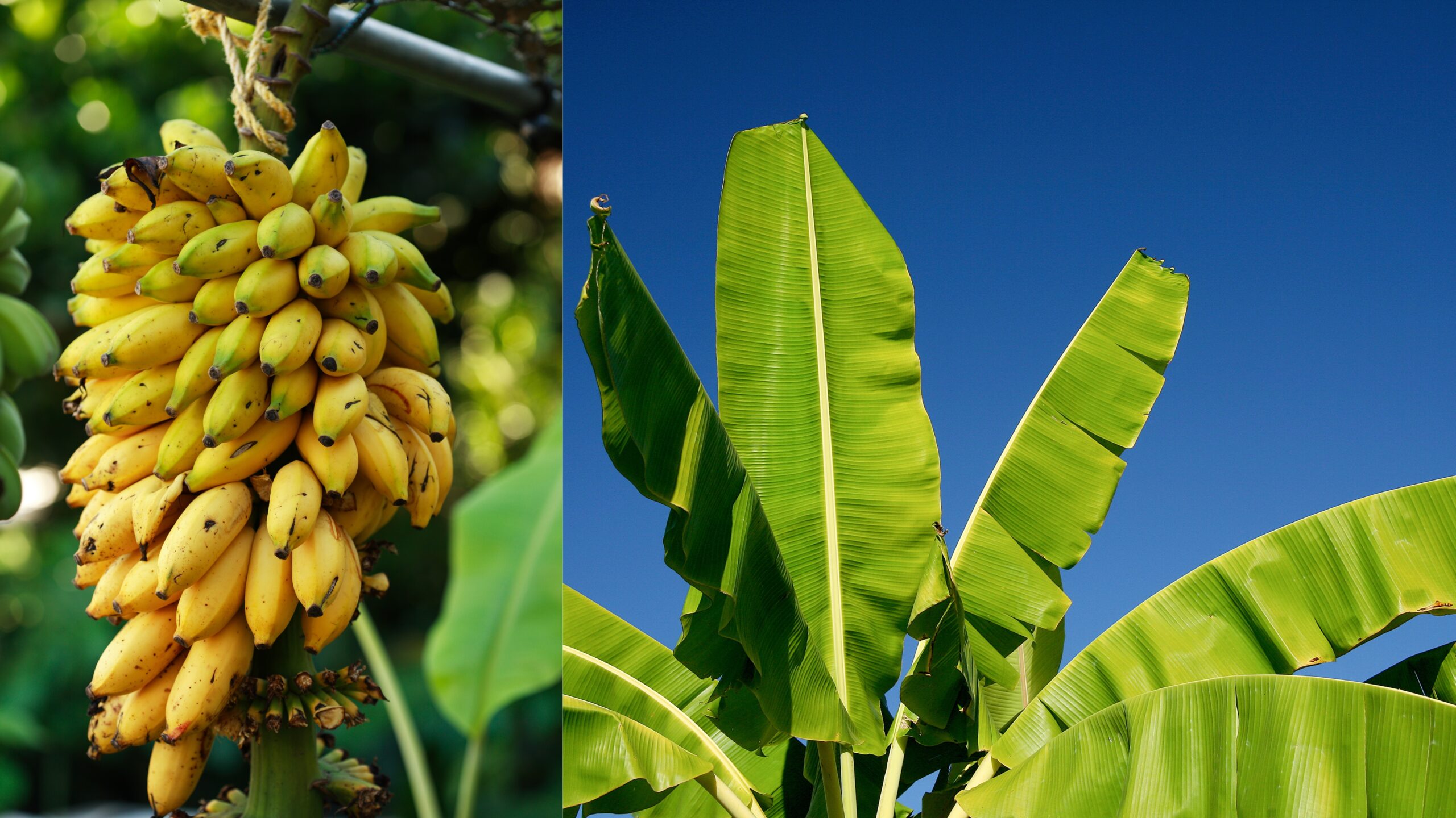
At Farmonaut, we’re excited to share our latest project: mapping more banana farms in West Bengal using cutting-edge remote sensing technology. This initiative not only showcases the power of satellite imagery in agriculture but also highlights the immense potential of banana cultivation in the region. Join us as we explore the intricacies of this project and its implications for farmers, researchers, and the agricultural sector at large.
The Importance of Banana Cultivation in West Bengal
West Bengal, known for its diverse agricultural landscape, has been a significant contributor to India’s banana production. The state’s climate and soil conditions make it ideal for banana cultivation, supporting the livelihoods of thousands of farmers. By mapping these farms, we at Farmonaut are taking a crucial step towards optimizing banana production and supporting sustainable farming practices in the region.
Remote Sensing: A Game-Changer in Agricultural Mapping
Remote sensing technology has revolutionized the way we monitor and manage agricultural lands. At Farmonaut, we leverage advanced satellite imagery and data analysis techniques to provide accurate, real-time information about crop health, land use, and environmental conditions. Here’s how we’re applying this technology to banana farms in West Bengal:
- Multispectral Imaging: We use multispectral satellite images to capture data across various electromagnetic spectrum bands. This allows us to analyze vegetation health, soil moisture, and other critical factors affecting banana cultivation.
- NDVI (Normalized Difference Vegetation Index): This index helps us assess the health and density of vegetation in banana plantations, providing valuable insights into crop vigor and potential yield.
- NDWI (Normalized Difference Water Index) in Remote Sensing: NDWI is crucial for monitoring water content in banana plants and soil moisture levels, helping farmers optimize irrigation practices.
- IR Satellite Data: Infrared (IR) satellite imagery allows us to detect temperature variations across banana plantations, which can indicate stress levels or disease outbreaks.
The Process of Mapping Banana Farms
Our mapping process involves several steps, each crucial for generating accurate and actionable data:
- Data Acquisition: We collect high-resolution satellite imagery of West Bengal’s agricultural areas.
- Image Processing: Advanced algorithms process the raw data, enhancing image quality and extracting relevant information.
- Spectral Analysis: We analyze spectral signatures to identify banana plantations and assess their health.
- Ground Truthing: Our team verifies satellite data with on-ground observations to ensure accuracy.
- Map Generation: We create detailed, interactive maps of banana farms across West Bengal.
Benefits for Banana Farmers in West Bengal
By mapping banana farms using remote sensing technology, we’re providing numerous benefits to farmers:
- Improved Crop Management: Farmers can make data-driven decisions about irrigation, fertilization, and pest control.
- Early Disease Detection: Spectral analysis can reveal signs of diseases like banana wilt before they become visible to the naked eye.
- Yield Prediction: Accurate estimation of crop yields helps farmers plan harvesting and marketing strategies.
- Resource Optimization: By identifying areas of stress or low productivity, farmers can allocate resources more efficiently.
Addressing Challenges: Banana Aphids and Other Pests
One of the significant challenges in banana cultivation is pest management, particularly
banana aphids. These tiny insects can cause substantial damage to banana plants by transmitting viral diseases and reducing crop yields. Our remote sensing technology can help detect early signs of aphid infestation by identifying changes in plant health indicators.
Here’s how we’re helping farmers combat
banana aphids and other pests:
- Early Detection: Spectral analysis can reveal subtle changes in plant health that may indicate pest presence.
- Targeted Treatment: By precisely locating affected areas, farmers can apply pest control measures more effectively.
- Monitoring Effectiveness: Post-treatment imagery allows farmers to assess the effectiveness of their pest management strategies.
Farmonaut’s Satellite System vs. Drone and IoT-based Farm Monitoring
While drones and IoT devices have their place in agriculture, Farmonaut’s satellite-based system offers unique advantages for large-scale farm monitoring. Here’s a comparison:
| Feature |
Farmonaut Satellite System |
Drone-based Monitoring |
IoT-based Monitoring |
| Coverage Area |
Large scale (entire regions) |
Limited (local areas) |
Limited (specific points) |
| Frequency of Data Collection |
Regular (as per satellite pass) |
On-demand (requires manual operation) |
Continuous (limited by battery life) |
| Initial Setup Cost |
Low (no hardware required) |
High (drone purchase and training) |
Medium to High (sensors and network setup) |
| Maintenance |
Minimal (software updates) |
High (hardware maintenance and repairs) |
Medium (sensor replacement and calibration) |
| Data Processing |
Automated (AI and machine learning) |
Semi-automated (requires human interpretation) |
Automated (limited to sensor capabilities) |
| Scalability |
Highly scalable (regional to global) |
Limited scalability (local operations) |
Moderate scalability (network-dependent) |
The Future of Banana Farming in West Bengal
As we continue to map and monitor banana farms in West Bengal, we’re excited about the potential for innovation and growth in the sector. Here are some future possibilities we’re exploring:
- AI-Powered Predictive Analytics: Developing models to predict banana yields and market trends based on historical and real-time data.
- Blockchain Integration: Implementing blockchain technology to enhance traceability and transparency in the banana supply chain.
- Climate Resilience Strategies: Using long-term satellite data to develop climate-resilient banana varieties and cultivation practices.
- Precision Agriculture Techniques: Refining our technology to enable ultra-precise application of inputs, reducing waste and environmental impact.
How Farmers Can Access Farmonaut’s Technology
We’re committed to making our technology accessible to farmers of all scales. Here’s how you can get started with Farmonaut:
- Mobile App: Download our app for Android (Google Play Store) or iOS (App Store) to access farm monitoring tools on the go.
- Web Platform: Visit our web application for comprehensive farm management and analysis tools.
- API Access: Developers and agribusinesses can integrate our data into their systems using our API. Check out our API documentation for more details.
Conclusion
The mapping of banana farms in West Bengal using remote sensing technology represents a significant step forward in agricultural innovation. At Farmonaut, we’re proud to be at the forefront of this revolution, providing farmers with the tools and insights they need to thrive in an ever-changing agricultural landscape.
By leveraging satellite imagery, advanced analytics, and our deep understanding of agricultural processes, we’re not just mapping farms – we’re paving the way for a more sustainable, efficient, and productive future for banana cultivation in West Bengal and beyond.
FAQ Section
Q1: How accurate is satellite-based mapping for identifying banana farms?
A1: Our satellite-based mapping is highly accurate, with success rates typically exceeding 90%. We use a combination of high-resolution multispectral imagery and advanced machine learning algorithms to identify banana plantations. Additionally, we perform regular ground-truthing exercises to validate and improve our models continuously.
Q2: Can Farmonaut’s technology detect specific banana varieties?
A2: While our current technology primarily focuses on identifying banana plantations in general, we are working on refining our spectral analysis capabilities to differentiate between various banana varieties. This advancement will provide even more targeted insights for farmers and researchers.
Q3: How often is the satellite imagery updated?
A3: The frequency of updates depends on the satellite constellation we use and the specific subscription plan. Generally, we provide updates every 5-7 days, but this can be more frequent for premium users or in areas of high agricultural importance.
Q4: Can Farmonaut’s technology help in managing banana aphids?
A4: Yes, our technology can aid in managing banana aphids by detecting early signs of infestation through changes in plant health indicators. While we can’t directly visualize the aphids from satellite imagery, we can identify stress patterns in banana plants that often correlate with aphid presence, allowing for timely intervention.
Q5: Is Farmonaut’s technology suitable for small-scale banana farmers?
A5: Absolutely! We’ve designed our platform to be accessible and valuable for farmers of all scales. Small-scale farmers can benefit from our basic subscription plans, which provide essential insights into crop health, weather patterns, and potential issues, all at an affordable price point.
Q6: How does Farmonaut integrate weather data into its analysis?
A6: We incorporate real-time and historical weather data into our analysis, correlating it with satellite imagery to provide comprehensive insights. This integration allows us to offer more accurate predictions about crop health, potential risks, and optimal times for various farming activities.
Q7: Can Farmonaut’s technology help in estimating banana yields?
A7: Yes, our technology can provide yield estimations based on various factors such as plant health, historical data, and environmental conditions. While these estimations are not exact, they offer valuable insights for harvest planning and market predictions.
Q8: How does Farmonaut ensure data privacy and security?
A8: We take data privacy and security very seriously. All user data is encrypted and stored securely on our servers. We adhere to strict data protection regulations and never share individual farm data without explicit consent from the farmer.
Q9: Can Farmonaut’s technology be used for organic banana farming?
A9: Absolutely! Our technology is equally beneficial for organic farmers. It can help in monitoring crop health, identifying potential issues early, and optimizing resource use – all crucial aspects of successful organic farming.
Q10: How does Farmonaut support sustainable farming practices?
A10: Sustainability is at the core of our mission. By providing precise data on crop health and resource needs, we help farmers optimize their use of water, fertilizers, and pesticides. This not only reduces environmental impact but also improves farm profitability. Additionally, our long-term data analysis supports the development of more sustainable and climate-resilient farming practices.
We hope this comprehensive overview has provided valuable insights into our banana farm mapping project in West Bengal and the broader applications of our technology. At Farmonaut, we’re committed to advancing agricultural practices through innovative technology, supporting farmers, and promoting sustainable food production. Join us in this exciting journey towards a smarter, more efficient agricultural future!
 At Farmonaut, we’re excited to share our latest project: mapping more banana farms in West Bengal using cutting-edge remote sensing technology. This initiative not only showcases the power of satellite imagery in agriculture but also highlights the immense potential of banana cultivation in the region. Join us as we explore the intricacies of this project and its implications for farmers, researchers, and the agricultural sector at large.
